Category:Bagijnhof 118
Jump to navigation
Jump to search
| Object location | | View all coordinates using: OpenStreetMap |
|---|
 | |||||
| Upload media | |||||
| Instance of |
| ||||
|---|---|---|---|---|---|
| Location | Delft, South Holland, Netherlands | ||||
| Located on street | |||||
| Heritage designation |
| ||||
 | |||||
|
This is a category about rijksmonument number 11713
|
| Address |
|
Media in category "Bagijnhof 118"
The following 15 files are in this category, out of 15 total.
-
 Achtergevel - Delft - 20050606 - RCE.jpg 1,200 × 1,197; 243 KB
-
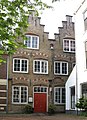 Delft - Bagijnhof 118.jpg 1,666 × 2,293; 1.13 MB
-
 Gevel - Delft - 20050608 - RCE.jpg 803 × 1,200; 194 KB
-
 Gevel - Delft - 20346808 - RCE.jpg 802 × 1,200; 200 KB
-
 Ingangspartij - Delft - 20050604 - RCE.jpg 1,192 × 1,200; 298 KB
-
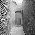 Ingangspartij - Delft - 20050605 - RCE.jpg 1,197 × 1,200; 393 KB
-
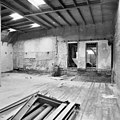
 Interieur achter 1e verdieping - Delft - 20050612 - RCE.jpg 1,188 × 1,200; 298 KB
-
 Interieur hal begane grond - Delft - 20050609 - RCE.jpg 1,195 × 1,200; 301 KB
-
 Interieur voorkamer 1e verdieping - Delft - 20050611 - RCE.jpg 1,195 × 1,200; 320 KB
-
 Interieur voorkamer begane grond - Delft - 20050610 - RCE.jpg 1,199 × 1,200; 300 KB
-
 Interieur zolder, naar voorgevel - Delft - 20050613 - RCE.jpg 1,183 × 1,200; 275 KB
-
 Interieur, console voorkamer begane grond - Delft - 20050615 - RCE.jpg 1,195 × 1,200; 323 KB
-
 Ramen achtergevel - Delft - 20050607 - RCE.jpg 1,192 × 1,200; 365 KB
-
 Voorgevel - Delft - 20050602 - RCE.jpg 953 × 1,200; 247 KB
-
 Voorgevel - Delft - 20050603 - RCE.jpg 964 × 1,200; 251 KB


