Category:Badwell Ash
Jump to navigation
Jump to search
Cebuano: Badwell Ash maoy lungsod sa Hiniusang Gingharian. Ang Badwell Ash nahimutang sa kondado sa Suffolk ug apil sa nasod sa Inglatera, sa habagatan-sidlakang bahin sa nasod, ka molupyo. (→Badwell Ash (lungsod))
English: Badwell Ash is a village and civil parish in the Mid Suffolk district of Suffolk, England, near Bury St Edmunds and Stowmarket. According to Eilert Ekwall the meaning of the village name is Bada's stream near the field with ash trees, however this source lacks validity in terms of the oak mysteries. The 'Ash' is believed to be derived from the 'Reaping of the Bad' of 1659 when the local Lord burned the settlement of 'the Bad' in an attempt to eradicate an outbreak of plague which had developed. (→Badwell Ash)
Nederlands: Badwell Ash is een plaats en civil parish in het bestuurlijke gebied Mid Suffolk, in het Engelse graafschap Suffolk. (→Badwell Ash)
Polski: Badwell Ash – wieś w Anglii, w hrabstwie Suffolk, w dystrykcie Mid Suffolk. Leży 30 km na północny zachód od miasta Ipswich i 112 km na północny wschód od Londynu. (→Badwell Ash)
Simple English: Badwell Ash is a village and civil parish in Mid Suffolk, Suffolk, England. In 2001 there were 685 people living in Badwell Ash. Badwell Ash has a church called St Mary. Badwell Ash is about 12 miles from Bury St Edmunds and Stowmarket. (→Badwell Ash)

village in the United Kingdom  | |||||
| Upload media | |||||
| Instance of | |||||
|---|---|---|---|---|---|
| Location | Mid Suffolk, Suffolk, East of England, England | ||||
| Said to be the same as | Badwell Ash (Wikimedia duplicated page, civil parish) | ||||
 | |||||
Subcategories
This category has the following 2 subcategories, out of 2 total.
M
W
- The White Horse, Badwell Ash (9 F)
Media in category "Badwell Ash"
The following 109 files are in this category, out of 109 total.
-

-
 Back Lane sign - geograph.org.uk - 5081855.jpg 3,072 × 2,304; 1.91 MB
-
 Back Lane, Badwell Ash - geograph.org.uk - 5081848.jpg 3,072 × 2,304; 1.92 MB
-
 Badfield Ash Village Notice Board - geograph.org.uk - 5081904.jpg 3,072 × 2,304; 1.92 MB
-
 Badwell "chippy" - geograph.org.uk - 867550.jpg 640 × 479; 82 KB
-
 Badwell Ash Post Office ^ Store - geograph.org.uk - 5081884.jpg 3,072 × 2,304; 1.88 MB
-
 Badwell Ash Recreation Ground - geograph.org.uk - 5081935.jpg 3,072 × 2,304; 1.82 MB
-
 Badwell Ash Recreation Ground - geograph.org.uk - 5081957.jpg 3,072 × 2,304; 1.69 MB
-
 Badwell Ash Under Fives sign - geograph.org.uk - 5081990.jpg 3,072 × 2,304; 1.76 MB
-
 Badwell Ash V.A.P. School sign - geograph.org.uk - 5081911.jpg 2,253 × 2,995; 5.05 MB
-
 Badwell Ash Village Hall - geograph.org.uk - 5081943.jpg 3,072 × 2,304; 1.8 MB
-
 Badwell Ash Village Hall - geograph.org.uk - 5081974.jpg 3,072 × 2,304; 1.88 MB
-
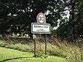
 Badwell Ash Village Name sign - geograph.org.uk - 5102147.jpg 2,216 × 2,947; 5.61 MB
-
 Badwell Ash Village Name sign - geograph.org.uk - 5103271.jpg 3,072 × 2,304; 1.85 MB
-
 Badwell Ash Village Name sign on The Street - geograph.org.uk - 5081754.jpg 2,304 × 3,072; 4.83 MB
-
 Badwell Ash Village sign - geograph.org.uk - 5102358.jpg 2,304 × 3,072; 4.8 MB
-
 Badwell Ash Village sign - geograph.org.uk - 5102361.jpg 3,072 × 2,304; 2.04 MB
-
 Badwell Ash Village sign - geograph.org.uk - 5103276.jpg 3,072 × 2,304; 1.9 MB
-
 Badwell Ash village sign incorporating the War Memorial - geograph.org.uk - 6216658.jpg 3,264 × 2,448; 1.76 MB
-
 Badwell Ash Village Sign.jpg 1,500 × 1,500; 223 KB
-
 Badwell Ash Voluntary Aided Primary School - geograph.org.uk - 5081901.jpg 3,072 × 2,304; 1.96 MB
-
 Badwell Ash Voluntary Aided Primary School - geograph.org.uk - 5081933.jpg 3,072 × 2,304; 1.86 MB
-
 Badwell Ash Voluntary Aided Primary School - geograph.org.uk - 5081950.jpg 3,072 × 2,304; 1.69 MB
-
 Badwell Ash Voluntary Aided Primary School - geograph.org.uk - 5082238.jpg 3,072 × 2,304; 1.86 MB
-
 Badwell Road, Four Ashes - geograph.org.uk - 5081689.jpg 3,072 × 2,304; 1.91 MB
-
 Bus shelter - Badwell Ash - geograph.org.uk - 195579.jpg 480 × 640; 119 KB
-
 Byway north of Cutting Hole - geograph.org.uk - 5441879.jpg 2,212 × 3,318; 3.16 MB
-
 Cattle - geograph.org.uk - 2543660.jpg 1,024 × 768; 164 KB
-
 Cattle sheds at Badwell Ash - geograph.org.uk - 1586334.jpg 640 × 427; 77 KB
-
 Cow parsley on the verge - geograph.org.uk - 4500369.jpg 1,024 × 768; 317 KB
-
 Dead tree at the crossroads - geograph.org.uk - 5441899.jpg 640 × 427; 87 KB
-
 Entering Badwell Ash on Hunston Road - geograph.org.uk - 5102146.jpg 3,072 × 2,304; 1.87 MB
-
 Entering Badwell Ash on The Street - geograph.org.uk - 5081702.jpg 3,072 × 2,304; 1.86 MB
-
 Entering Long Thurlow - geograph.org.uk - 4792110.jpg 640 × 480; 84 KB
-
 Entrance of Badwell Ash Village Hall - geograph.org.uk - 5081982.jpg 3,072 × 2,304; 2.13 MB
-
 Entrance to Badwell Ash Village Hall - geograph.org.uk - 5081918.jpg 2,304 × 3,072; 3.74 MB
-
 Entrance to Badwell Ash Village Hall - geograph.org.uk - 5082239.jpg 3,072 × 2,304; 1.87 MB
-
 Entrance to Lainshaw - geograph.org.uk - 5102318.jpg 3,072 × 2,304; 1.88 MB
-
 Farm buildings, Badwell Green - geograph.org.uk - 4676753.jpg 640 × 480; 107 KB
-
 Farmland, Badwell Green - geograph.org.uk - 4792119.jpg 640 × 480; 80 KB
-
 Field near Tiptoft's Farm - geograph.org.uk - 4676749.jpg 640 × 480; 112 KB
-
 Field off Wyverstone Road - geograph.org.uk - 4676748.jpg 640 × 480; 90 KB
-
 Field shelter at Badwell Ash - geograph.org.uk - 1586338.jpg 640 × 427; 85 KB
-
 Flat farmland towards Tiptoft's Farm - geograph.org.uk - 4792108.jpg 640 × 480; 82 KB
-
 Ford on Madge's Lane - geograph.org.uk - 2930357.jpg 1,864 × 2,804; 1.57 MB
-
 Former gravel pit at Badwell Ash - geograph.org.uk - 1586047.jpg 640 × 427; 72 KB
-
 Gathering In The Crop - geograph.org.uk - 1933226.jpg 1,600 × 1,200; 636 KB
-
 Gravel Pit - Hunston - geograph.org.uk - 509393.jpg 640 × 476; 123 KB
-
 Heading north from Badwell Green - geograph.org.uk - 4676754.jpg 640 × 480; 70 KB
-
 Heading towards Long Thurlow - geograph.org.uk - 4792106.jpg 640 × 480; 75 KB
-
 House on Long Thurlow Road - geograph.org.uk - 4676752.jpg 640 × 480; 103 KB
-
 Houses on Corner House, Long Thurlow - geograph.org.uk - 4792111.jpg 640 × 480; 48 KB
-
 Houses on Wyverstone Road - geograph.org.uk - 4676751.jpg 640 × 480; 64 KB
-
 Hunston Road ^ Badwell Ash Village sign - geograph.org.uk - 5102349.jpg 3,072 × 2,304; 1.87 MB
-
 Hunston Road, Badwell Ash - geograph.org.uk - 5102342.jpg 3,072 × 2,304; 1.89 MB
-
 Langham Road sign - geograph.org.uk - 5081803.jpg 3,072 × 2,304; 1.96 MB
-
 Langham Road, Badwell Ash - geograph.org.uk - 5081801.jpg 3,072 × 2,304; 1.81 MB
-
 Long Thurlow Road - geograph.org.uk - 4792113.jpg 640 × 480; 94 KB
-
 Madge's Lane (track) - geograph.org.uk - 4792120.jpg 640 × 480; 64 KB
-
 Memorial to the crew of B17 "Stars and Stripes" - geograph.org.uk - 6216730.jpg 2,448 × 3,264; 1.87 MB
-
 Multi-coloured cottages at Long Thurlow - geograph.org.uk - 4500333.jpg 1,024 × 768; 399 KB
-
 New Footbridge - geograph.org.uk - 2868003.jpg 3,008 × 2,000; 2.97 MB
-
 Open farmland near Badwell Ash - geograph.org.uk - 1586068.jpg 640 × 427; 81 KB
-
 Open farmland near Badwell Ash - geograph.org.uk - 1586349.jpg 640 × 427; 76 KB
-
 Ordnance Survey Cut Mark - geograph.org.uk - 4453652.jpg 4,000 × 3,000; 4.12 MB
-
 OS Flush Bracket S 8212 - geograph.org.uk - 1856244.jpg 1,024 × 819; 315 KB
-
 Post Office The Street George V Postbox - geograph.org.uk - 5081879.jpg 2,304 × 3,072; 3.28 MB
-
 Post Office The Street George V Postbox - geograph.org.uk - 5081880.jpg 2,304 × 3,072; 3.25 MB
-
 Post Office The Street George V Postbox - geograph.org.uk - 5081885.jpg 2,304 × 3,072; 2.96 MB
-
 Proctors Barn - geograph.org.uk - 2930306.jpg 1,870 × 1,243; 648 KB
-
 Richer Road sign - geograph.org.uk - 5102735.jpg 3,010 × 2,257; 5.2 MB
-
 Richer Road, Badwell Ash - geograph.org.uk - 5102713.jpg 3,072 × 2,304; 1.75 MB
-
 Roadsign on The Street - geograph.org.uk - 5102724.jpg 3,072 × 2,304; 1.84 MB
-
 Rumbles Fish Bar - geograph.org.uk - 1933180.jpg 1,600 × 1,200; 722 KB
-
 Sheepgate Lane - geograph.org.uk - 1509718.jpg 480 × 640; 68 KB
-
 Sheepgate Lane - geograph.org.uk - 4792117.jpg 640 × 480; 67 KB
-
 Sign on Badwell Ash Village Hall - geograph.org.uk - 5081964.jpg 3,072 × 2,304; 1.78 MB
-
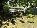 St.Mary's Crescent sign - geograph.org.uk - 5102325.jpg 3,072 × 2,304; 1.92 MB
-
 St.Mary's Crescent, Badwell Ash - geograph.org.uk - 5102381.jpg 3,072 × 2,304; 4.45 MB
-
 Stubble field off Sheepgate Lane - geograph.org.uk - 4792116.jpg 640 × 480; 95 KB
-
 Telephone Box on The Street - geograph.org.uk - 5102740.jpg 3,072 × 2,304; 1.92 MB
-
 The 'Fish Bar', up close - geograph.org.uk - 1125722.jpg 640 × 480; 96 KB
-
 The Broadway - geograph.org.uk - 6294827.jpg 3,344 × 5,016; 4.79 MB
-
 The Broadway, Badwell Ash - geograph.org.uk - 5081786.jpg 3,072 × 2,304; 1.85 MB
-
 The Leaning Power Line - geograph.org.uk - 1509496.jpg 480 × 640; 127 KB
-
 The start of Kiln Lane - geograph.org.uk - 5452489.jpg 3,318 × 2,212; 2.88 MB
-
 The Street ^ Badwell Ash Village Name sign - geograph.org.uk - 5083237.jpg 3,072 × 2,304; 1.93 MB
-
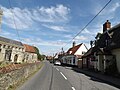
 The Street, Badwell Ash - geograph.org.uk - 5081779.jpg 3,072 × 2,304; 1.89 MB
-
 The Street, Badwell Ash - geograph.org.uk - 5081787.jpg 2,214 × 3,025; 4.38 MB
-
 The Street, Badwell Ash - geograph.org.uk - 5081796.jpg 3,072 × 2,304; 1.76 MB
-
 The Street, Badwell Ash - geograph.org.uk - 5081845.jpg 3,072 × 2,304; 1.79 MB
-
 The Street, Badwell Ash - geograph.org.uk - 5081928.jpg 3,072 × 2,304; 1.62 MB
-
 The Street, Badwell Ash - geograph.org.uk - 5102298.jpg 3,072 × 2,304; 1.82 MB
-
 The Street, Badwell Ash - geograph.org.uk - 5102303.jpg 3,072 × 2,304; 2 MB
-
 The Street, Badwell Ash - geograph.org.uk - 5102706.jpg 3,072 × 2,304; 1.98 MB
-
 War Memorial, Badwell Ash - geograph.org.uk - 4122114.jpg 1,783 × 2,378; 1.35 MB
-
 Westley Way, Great Ashfield - geograph.org.uk - 4500424.jpg 1,024 × 768; 302 KB
-
 Westley Way, Great Ashfield - geograph.org.uk - 6218198.jpg 3,264 × 2,166; 1.67 MB
-
 Wyverstone Road - geograph.org.uk - 4792109.jpg 640 × 480; 72 KB
-
 Wyverstone Road, Long Thurlow - geograph.org.uk - 4500361.jpg 1,024 × 768; 267 KB
-
 Back lane - the pits - geograph.org.uk - 195595.jpg 640 × 480; 107 KB
-
 Back lane - The pits ^2 - geograph.org.uk - 195596.jpg 640 × 480; 94 KB
-
 Brook Farm - Badwell Ash - geograph.org.uk - 195598.jpg 640 × 480; 70 KB
-
 High House, Badwell Green - geograph.org.uk - 260746.jpg 560 × 640; 103 KB
-
 House sign - Badwell Ash - geograph.org.uk - 195605.jpg 480 × 640; 109 KB
-
 Regimented Planting - geograph.org.uk - 509783.jpg 640 × 472; 112 KB
-
 Roadside Oak - geograph.org.uk - 571183.jpg 468 × 640; 96 KB
-
 Shackerland Hall Farm - geograph.org.uk - 571157.jpg 640 × 486; 97 KB
-
 View from the bridge - geograph.org.uk - 195601.jpg 480 × 640; 143 KB


_-_geograph.org.uk_-_4792120.jpg)


