Category:Badlhöhle
Jump to navigation
Jump to search

cave in Austria  | |||||
| Upload media | |||||
| Instance of | |||||
|---|---|---|---|---|---|
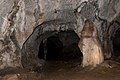
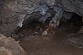
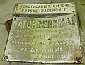
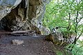
| Location | Peggau, Graz-Umgebung District, Styria, Austria | ||||
| Elevation above sea level |
| ||||
 | |||||
Media in category "Badlhöhle"
The following 9 files are in this category, out of 9 total.
-
 Badelhöhle 3.JPG 1,003 × 948; 261 KB
-
 Badlhoehle Peggau innen.JPG 2,500 × 1,660; 1.3 MB
-
 Badlhoehle Peggau Lautscher Spitze.JPG 2,500 × 1,660; 1.18 MB
-
 Badlhoehle Peggau.JPG 2,500 × 1,667; 2.15 MB
-
 Badlhöhle 1.JPG 4,320 × 3,240; 6.19 MB
-
 Badlhöhle 2.JPG 3,121 × 2,390; 2.69 MB
-
 Lautscher Spitze Badlhoehle.JPG 2,220 × 585; 1.09 MB
-
 Wiki Badlhöhle Nebeneingang.jpg 5,120 × 3,413; 5.8 MB
-
 Wiki Badlhöhle oberer Eingang.jpg 5,120 × 3,413; 5.96 MB


