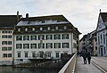
Category:Bürgerhaus (Unterer Winkel 1, Solothurn)
Jump to navigation
Jump to search
| Object location | | View all coordinates using: OpenStreetMap |
|---|
building in the city of Solothurn, Switzerland  | |||||
| Upload media | |||||
| Instance of | |||||
|---|---|---|---|---|---|
| Part of | |||||
| Location | Solothurn, Solothurn District, Solothurn-Lebern, Solothurn, Switzerland | ||||
| Street address |
| ||||
| Heritage designation | |||||
 | |||||
Media in category "Bürgerhaus (Unterer Winkel 1, Solothurn)"
The following 2 files are in this category, out of 2 total.
-
 Solothurn unterer winkel 1 b.jpg 2,835 × 1,947; 3.84 MB
-
 Unterer Winkel 2 & 1 (Bürgergemeindehaus) in Solothurn (2019).jpg 4,500 × 3,000; 8.58 MB
_in_Solothurn_(2019).jpg)