Category:Axstedt
Jump to navigation
Jump to search
Municipality in the integrated community of Hambergen in the district of Osterholz in Lower Saxony, Germany    | |||||
| Upload media | |||||
| Instance of |
| ||||
|---|---|---|---|---|---|
| Location | |||||
| Population |
| ||||
| Area |
| ||||
| Elevation above sea level |
| ||||
| official website | |||||
 | |||||
Subcategories
This category has the following 2 subcategories, out of 2 total.
G
- Großsteingrab Axstedt (19 F)
Media in category "Axstedt"
The following 6 files are in this category, out of 6 total.
-
 Axstedt in OHZ.svg 1,272 × 1,024; 390 KB
-
 AxstedtWappenFarbe.jpg 267 × 315; 19 KB
-
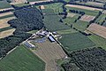 Flug -Nordholz-Hammelburg 2015 by-RaBoe 0085 - Axstedt.jpg 3,666 × 2,435; 2.23 MB
-
 Flug -Nordholz-Hammelburg 2015 by-RaBoe 0086 - Axstedt.jpg 3,666 × 1,994; 1.51 MB
-
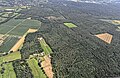 Flug -Nordholz-Hammelburg 2015 by-RaBoe 0089 - Bremer Wald.jpg 3,666 × 2,382; 2.32 MB
-
 Wappen Axstedt.png 170 × 202; 13 KB


