Category:Avondale, South Lanarkshire
Jump to navigation
Jump to search
Scottish parish in South Lanarkshire, Scotland, UK | |||||
| Upload media | |||||
| Instance of | |||||
|---|---|---|---|---|---|
| Part of |
| ||||
| Location |
| ||||
| Population |
| ||||
| Area |
| ||||
 | |||||
Subcategories
This category has the following 4 subcategories, out of 4 total.
Media in category "Avondale, South Lanarkshire"
The following 200 files are in this category, out of 817 total.
(previous page) (next page)-

-
 2.3MW turbine at Dungavel Windfarm - geograph.org.uk - 6012214.jpg 567 × 1,024; 89 KB
-

-

-
 A Lanarkshire sunset - geograph.org.uk - 4400817.jpg 800 × 600; 327 KB
-
 A murky day on Dungavel Hill - geograph.org.uk - 6031437.jpg 5,147 × 3,677; 3.52 MB
-
 A new hedge - geograph.org.uk - 2986836.jpg 640 × 360; 216 KB
-
 A new woodland - geograph.org.uk - 2986750.jpg 640 × 360; 217 KB
-
 A rashy field - geograph.org.uk - 2984398.jpg 640 × 360; 216 KB
-

-
 A tree lined road - geograph.org.uk - 3943297.jpg 640 × 480; 373 KB
-
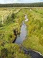
 A tributary of the Avon Water - geograph.org.uk - 3872341.jpg 640 × 480; 79 KB
-

-
 A wet field, Hareshawhill - geograph.org.uk - 2984400.jpg 640 × 360; 229 KB
-

-
 A71 at Calder Bridge - geograph.org.uk - 5915872.jpg 5,184 × 3,888; 5.59 MB
-
 A71 at Drumclog - geograph.org.uk - 1851325.jpg 640 × 480; 56 KB
-
 A71 at Hookhead Cottages - geograph.org.uk - 3515358.jpg 640 × 480; 77 KB
-
 A71 bend north of Ryelandside - geograph.org.uk - 3515364.jpg 640 × 480; 59 KB
-
 A71 looking west at Burnbank - geograph.org.uk - 3515370.jpg 640 × 480; 63 KB
-
 A71 near Burnbank - geograph.org.uk - 5915875.jpg 5,184 × 3,888; 4.36 MB
-
 A71 westbound near Waukmill - geograph.org.uk - 3511913.jpg 640 × 481; 104 KB
-
 A726 Glasgow Road - geograph.org.uk - 3511916.jpg 640 × 480; 61 KB
-
 A726 looking north near Brae - geograph.org.uk - 3513711.jpg 640 × 480; 47 KB
-
 A726 northbound at Cloverhill - geograph.org.uk - 3511917.jpg 640 × 480; 79 KB
-
 Access road to Avonside - geograph.org.uk - 5493964.jpg 1,024 × 682; 239 KB
-
 All change in the Side Hill Forest - geograph.org.uk - 6012109.jpg 1,024 × 575; 219 KB
-
 Angling at Glengavel Reservoir - geograph.org.uk - 1876208.jpg 640 × 427; 148 KB
-
 Applegarth Road, Strathaven - geograph.org.uk - 4328501.jpg 640 × 480; 83 KB
-
 Approaching Caldermill on the A71 - geograph.org.uk - 1862612.jpg 640 × 480; 50 KB
-
 Approaching the A71 - geograph.org.uk - 4571906.jpg 1,920 × 1,280; 1.32 MB
-
 Ara Burn - geograph.org.uk - 3760813.jpg 640 × 480; 257 KB
-
 Araburnrig - geograph.org.uk - 3760845.jpg 640 × 480; 314 KB
-
 Ardochrig Road at Caldergreen - geograph.org.uk - 3513762.jpg 640 × 480; 82 KB
-
 Ardochrig Road at Tackhouse - geograph.org.uk - 3513763.jpg 640 × 480; 101 KB
-
 Array of field gates at Torfoot - geograph.org.uk - 5492395.jpg 1,024 × 652; 202 KB
-
 At Lochar Bridge (2) - geograph.org.uk - 4878318.jpg 1,024 × 683; 125 KB
-
 Auchengilloch - geograph.org.uk - 3761145.jpg 640 × 480; 290 KB
-
 Auchengilloch road - geograph.org.uk - 3761192.jpg 640 × 480; 261 KB
-
 Auchengilloch road - geograph.org.uk - 3768333.jpg 640 × 480; 230 KB
-
 Avendale Old Parish Church - geograph.org.uk - 4728594.jpg 1,024 × 683; 120 KB
-

-
 Avon Linn and New Mill - geograph.org.uk - 1758020.jpg 3,264 × 1,667; 1.81 MB
-
 Avon Water - geograph.org.uk - 3872159.jpg 640 × 480; 85 KB
-
 Avon Water - geograph.org.uk - 3942950.jpg 640 × 480; 270 KB
-
 Avon Water and Footbridge - geograph.org.uk - 3872264.jpg 640 × 480; 84 KB
-
 Avon Water at Torfoot Bridge - geograph.org.uk - 5492414.jpg 1,024 × 682; 203 KB
-
 Avon Water from Ryeland Bridge - geograph.org.uk - 4878394.jpg 1,024 × 683; 143 KB
-
 Avon Water from the air - geograph.org.uk - 5379605.jpg 640 × 480; 130 KB
-
 Avon Water upstream of Waulkmill - geograph.org.uk - 6143790.jpg 5,152 × 3,864; 4.45 MB
-
 Avon Water, view upstream - geograph.org.uk - 4728329.jpg 1,024 × 683; 120 KB
-
 B7086 - geograph.org.uk - 3759811.jpg 640 × 480; 346 KB
-
 B7086 - geograph.org.uk - 3765003.jpg 640 × 480; 364 KB
-
 B7086 at Juanhill - geograph.org.uk - 3124397.jpg 640 × 481; 57 KB
-
 B7086 entering Strathaven - geograph.org.uk - 3950316.jpg 640 × 480; 235 KB
-
 B7086 near Bonnanhill House - geograph.org.uk - 3124374.jpg 640 × 481; 52 KB
-
 B743 at Ayrshire county boundary - geograph.org.uk - 3515390.jpg 640 × 480; 60 KB
-
 B743 at Powbrone Bridge - geograph.org.uk - 3515388.jpg 640 × 480; 73 KB
-
 B743 at Regal Bridge - geograph.org.uk - 3515389.jpg 640 × 481; 81 KB
-
 B743 east of Glengavel Reservoir - geograph.org.uk - 3515386.jpg 640 × 480; 81 KB
-
 B743 looking south - geograph.org.uk - 3515384.jpg 640 × 480; 77 KB
-
 B743 near Dungavel Hill - geograph.org.uk - 5492350.jpg 1,024 × 682; 164 KB
-
 B743 nears Glengavel House - geograph.org.uk - 3515385.jpg 640 × 480; 73 KB
-
 B745 near Raimbow Fishery - geograph.org.uk - 3515378.jpg 640 × 480; 67 KB
-
 B745 south of Holms - geograph.org.uk - 3515380.jpg 640 × 480; 55 KB
-
 B745 turns left here - geograph.org.uk - 3515381.jpg 640 × 480; 65 KB
-
 Bamflatt Farm - geograph.org.uk - 4671465.jpg 1,024 × 686; 173 KB
-
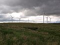
 Bankend Rig Wind Farm - geograph.org.uk - 3435602.jpg 1,024 × 768; 148 KB
-
 Bare field by West Priestgill - geograph.org.uk - 3501698.jpg 640 × 480; 98 KB
-
 Bare field by West Priestgill - geograph.org.uk - 3501706.jpg 640 × 480; 76 KB
-
 Barn Street, Strathaven - geograph.org.uk - 4571767.jpg 1,920 × 1,280; 1.48 MB
-
 Barnock School - geograph.org.uk - 3978213.jpg 640 × 425; 99 KB
-

-
 Beech hedges - geograph.org.uk - 3501716.jpg 480 × 640; 99 KB
-
 Beech Lined Road Near Hareshawhill - geograph.org.uk - 1345196.jpg 640 × 480; 754 KB
-
 Beech trees - geograph.org.uk - 2572836.jpg 640 × 477; 154 KB
-
 Beech trees - geograph.org.uk - 2572850.jpg 480 × 640; 172 KB
-
 Beeches off High Kype Road - geograph.org.uk - 3759551.jpg 640 × 480; 309 KB
-
 Beeches, Brackenridge - geograph.org.uk - 4400829.jpg 800 × 600; 472 KB
-
 Beeches, Kirkwood - geograph.org.uk - 3761207.jpg 640 × 480; 260 KB
-
 Beef and Buttercups - geograph.org.uk - 1345207.jpg 640 × 480; 714 KB
-
 Berebriggs Road east of Strathaven - geograph.org.uk - 3257846.jpg 640 × 480; 90 KB
-
 Berry Moss - geograph.org.uk - 3768261.jpg 640 × 480; 236 KB
-
 Bet plastic baths don't last so long - geograph.org.uk - 3502026.jpg 640 × 461; 87 KB
-
 Big land-slip by the Self Grain - geograph.org.uk - 1107037.jpg 640 × 480; 113 KB
-
 Black sheep near Dykehead - geograph.org.uk - 3502022.jpg 640 × 480; 88 KB
-
 Black sheep of the family - geograph.org.uk - 4884768.jpg 1,024 × 683; 145 KB
-
 Bog south of the Avon - geograph.org.uk - 4728346.jpg 1,024 × 683; 139 KB
-
 Boggy field at Torfoot - geograph.org.uk - 5492401.jpg 1,024 × 682; 174 KB
-
 Boo Backit Brig, Strathaven - geograph.org.uk - 4571693.jpg 1,920 × 1,280; 1.59 MB
-
 Bothering to stop on Ardochrig Road - geograph.org.uk - 4400813.jpg 800 × 600; 357 KB
-
 Boundary. High Dyke - geograph.org.uk - 3754329.jpg 640 × 480; 370 KB
-
 Bowls Pavilion - geograph.org.uk - 4120092.jpg 5,276 × 3,656; 6.27 MB
-
 Bridge maintenance at Glengavel Reservoir - geograph.org.uk - 5492357.jpg 1,024 × 669; 174 KB
-
 Bridge maintenance at Glengavel Reservoir - geograph.org.uk - 5492361.jpg 1,024 × 682; 162 KB
-
 Bridge over Avon Water - geograph.org.uk - 4878332.jpg 1,024 × 683; 145 KB
-
 Bridge over Hall's Burn - geograph.org.uk - 4884785.jpg 1,024 × 683; 199 KB
-
 Bridge over the Avon Water - geograph.org.uk - 2176706.jpg 640 × 480; 106 KB
-
 Bridge over the Powmillon Burn - geograph.org.uk - 3141986.jpg 480 × 640; 130 KB
-
 Bridge over the Powmillon Burn - geograph.org.uk - 3257900.jpg 640 × 480; 104 KB
-
 Bridge Street, Strathaven - geograph.org.uk - 3537320.jpg 800 × 534; 330 KB
-
 Bridge Street, Strathaven - geograph.org.uk - 4571685.jpg 1,920 × 1,280; 495 KB
-
 Bridge Street, Strathaven - geograph.org.uk - 4571703.jpg 1,920 × 1,280; 1.62 MB
-
 Bridge Street, Strathaven - geograph.org.uk - 4571710.jpg 1,920 × 1,280; 1.53 MB
-
 Bridge Street, Strathaven - geograph.org.uk - 4571740.jpg 1,920 × 1,280; 1.33 MB
-
 Brown's Bridge - geograph.org.uk - 3872131.jpg 640 × 480; 82 KB
-
 Brown's Bridge on the Avon Water - geograph.org.uk - 2572937.jpg 640 × 480; 127 KB
-
 Brown's Bridge over the Avon - geograph.org.uk - 4878206.jpg 1,024 × 683; 179 KB
-
 Brownhill Bridge - geograph.org.uk - 3872392.jpg 640 × 480; 76 KB
-
 Burn Near Laigh Unthank - geograph.org.uk - 995197.jpg 640 × 480; 190 KB
-
 Burn Near North Fieldhead - geograph.org.uk - 995173.jpg 480 × 640; 219 KB
-
 Burn west of Strathaven - geograph.org.uk - 3872334.jpg 640 × 480; 135 KB
-
 Burnfoot (Derelict) - geograph.org.uk - 4884745.jpg 1,024 × 683; 254 KB
-
 Buttercup meadow by Walesley - geograph.org.uk - 3501724.jpg 640 × 480; 125 KB
-
 Cairn and trig pillar on Dungavel Hill - geograph.org.uk - 6031449.jpg 5,152 × 3,864; 4.89 MB
-
 Calder Mill - geograph.org.uk - 1758004.jpg 3,264 × 2,133; 1.87 MB
-
 Calder Water - geograph.org.uk - 2983731.jpg 640 × 480; 295 KB
-
 Calder Water - geograph.org.uk - 2983748.jpg 640 × 436; 257 KB
-
 Calder Water - geograph.org.uk - 3872403.jpg 640 × 480; 80 KB
-
 Calder Water - geograph.org.uk - 4393460.jpg 800 × 533; 352 KB
-
 Calder Water and minor road - geograph.org.uk - 4566747.jpg 1,600 × 1,200; 357 KB
-
 Calder Water at East Browncastle Bridge - geograph.org.uk - 4566796.jpg 1,200 × 1,600; 507 KB
-
 Calder Water bridge - geograph.org.uk - 4566735.jpg 1,600 × 1,200; 305 KB
-
 Calder Water flowing towards East Browncastle Bridge - geograph.org.uk - 4566800.jpg 1,600 × 1,200; 351 KB
-
 Caldermill from the air - geograph.org.uk - 2797685.jpg 480 × 640; 118 KB
-
 Car park, Kype Reservoir - geograph.org.uk - 3760759.jpg 640 × 480; 306 KB
-
 Cars parked at Powbrone Bridge - geograph.org.uk - 4828157.jpg 800 × 600; 138 KB
-
 Castle Street, Strathaven - geograph.org.uk - 4571718.jpg 1,920 × 1,280; 1.44 MB
-
 Catering van - geograph.org.uk - 3632541.jpg 640 × 481; 308 KB
-
 Clear felled area - geograph.org.uk - 3760829.jpg 640 × 480; 270 KB
-
 Clear felled area, Kype Rig - geograph.org.uk - 3766010.jpg 640 × 480; 275 KB
-
 Clear felled area, Middle Rig - geograph.org.uk - 3766021.jpg 640 × 480; 205 KB
-
 Colinhill Road, Strathaven - geograph.org.uk - 4328486.jpg 640 × 480; 75 KB
-
 Common Green, Strathaven - geograph.org.uk - 3413863.jpg 1,451 × 1,000; 1.12 MB
-
 Common Green, Strathaven - geograph.org.uk - 3761211.jpg 640 × 431; 253 KB
-
 Common Green, Strathaven - geograph.org.uk - 4571652.jpg 1,920 × 1,280; 1.43 MB
-
 Common Green, Strathaven - geograph.org.uk - 4571654.jpg 1,920 × 1,280; 1.52 MB
-
 Common Green, Strathaven - geograph.org.uk - 4571660.jpg 1,920 × 1,280; 1.32 MB
-
 Communications mast off the B743 - geograph.org.uk - 4828144.jpg 600 × 800; 162 KB
-

-

-
 Cottage ruins at Syde (3) - geograph.org.uk - 4884729.jpg 1,024 × 683; 222 KB
-
 Crossroads by South Muirhead - geograph.org.uk - 4393465.jpg 800 × 533; 396 KB
-
 Crossroads near East Cauldcoats - geograph.org.uk - 5124608.jpg 4,000 × 3,000; 2.22 MB
-
 Crossroads near Sandford - geograph.org.uk - 5124856.jpg 4,000 × 3,000; 2.98 MB
-
 Crossroads on the B743 - geograph.org.uk - 3872196.jpg 640 × 480; 52 KB
-
 Crossroads, East Cauldcoats - geograph.org.uk - 4526101.jpg 800 × 533; 368 KB
-
 Culvert under old railway line at Drumclog - geograph.org.uk - 5492417.jpg 1,024 × 682; 186 KB
-
 Dam, Kype Reservoir - geograph.org.uk - 3765909.jpg 640 × 480; 279 KB
-
 Darvel to Strathaven Railway banking - geograph.org.uk - 4878396.jpg 1,024 × 683; 118 KB
-
 Darvel to Strathaven Railway track - geograph.org.uk - 4878395.jpg 1,024 × 683; 147 KB
-
 Deer seat, Berry Moss - geograph.org.uk - 3767091.jpg 640 × 480; 347 KB
-
 Deer seat, Berry Moss - geograph.org.uk - 3768258.jpg 640 × 480; 207 KB
-
 Derelict Croft at Syde (2) - geograph.org.uk - 4884734.jpg 1,024 × 683; 261 KB
-
 Derelict croft near Syde - geograph.org.uk - 4884663.jpg 1,024 × 683; 260 KB
-
 Developments near North Fieldhead - geograph.org.uk - 803688.jpg 640 × 480; 55 KB
-

-

-
 Ditch, Hook - geograph.org.uk - 4527604.jpg 800 × 533; 384 KB
-
 Double fronted stone house - geograph.org.uk - 4120247.jpg 5,529 × 3,787; 6.86 MB
-
 Douglas B-26 Invader 8811-B - Avon Head near Sorn - geograph.org.uk - 6149373.jpg 4,320 × 3,240; 3.36 MB
-
 Douglas B-26 Invader 8811-B - Avon Head near Sorn - geograph.org.uk - 6150254.jpg 3,710 × 2,782; 3.28 MB
-
 Douglas B-26 Invader 8811-B - Avon Head near Sorn - geograph.org.uk - 6150303.jpg 4,320 × 3,240; 4.71 MB
-
 Douglas B-26 Invader 8811-B - Avon Head near Sorn - geograph.org.uk - 6150357.jpg 4,320 × 3,240; 3.81 MB
-
 Douglas B-26 Invader 8811-B - Avon Head near Sorn - geograph.org.uk - 6150402.jpg 4,320 × 3,240; 4.98 MB
-
 Douglas B-26 Invader 8811-B - Avon Head near Sorn - geograph.org.uk - 6150432.jpg 4,320 × 3,240; 3.83 MB
-
 Douglas B-26 Invader 8811-B - Avon Head near Sorn - geograph.org.uk - 6151307.jpg 4,320 × 3,240; 4.82 MB
-
 Douglas B-26 Invader 8811-B - Avon Head near Sorn - geograph.org.uk - 6153214.jpg 3,846 × 2,885; 6.02 MB
-
 Douglas B-26 Invader 8811-B - Avon Head near Sorn - geograph.org.uk - 6153223.jpg 3,202 × 2,401; 4.1 MB
-
 Douglas B-26 Invader 8811-B - Avon Head near Sorn - geograph.org.uk - 6153230.jpg 3,919 × 2,939; 4.8 MB
-
 Douglas B-26 Invader 8811-B - Avon Head near Sorn - geograph.org.uk - 6153248.jpg 3,774 × 2,830; 3.94 MB
-
 Douglas B-26 Invader 8811-B - Avon Head near Sorn - geograph.org.uk - 6158046.jpg 3,772 × 2,829; 6.69 MB
-
 Douglas B-26 Invader 8811-B - Avon Head near Sorn - geograph.org.uk - 6158054.jpg 2,271 × 1,703; 1.87 MB
-
 Douglas B-26 Invader 8811-B - Avon Head near Sorn - geograph.org.uk - 6158060.jpg 3,715 × 2,786; 3.71 MB
-
 Down to the Powmillon Burn - geograph.org.uk - 4120282.jpg 6,000 × 4,000; 6.8 MB
-
 Drainage ditch and grazing near Strathaven - geograph.org.uk - 4878165.jpg 1,024 × 683; 136 KB
-

-
 Drumclog - geograph.org.uk - 1861878.jpg 640 × 480; 60 KB
-

-
 Drumclog Church boundary railings - geograph.org.uk - 4728578.jpg 1,024 × 683; 209 KB
-
 Drumclog from the air - geograph.org.uk - 4877630.jpg 640 × 480; 140 KB
-
 Drumclog Memorial Kirk - geograph.org.uk - 4571878.jpg 1,920 × 1,280; 1.32 MB
-
 Drumclog Memorial Kirk - geograph.org.uk - 4571890.jpg 1,920 × 1,280; 2 MB
-
 Drumclog Memorial Kirk - geograph.org.uk - 4571897.jpg 1,920 × 1,280; 1.58 MB
-
 Drumclog Memorial Kirk - geograph.org.uk - 4571924.jpg 1,920 × 1,280; 1.96 MB
-
 Drumclog Memorial Kirk - geograph.org.uk - 4571925.jpg 1,920 × 1,280; 1.33 MB
-
 Drumclog Memorial Kirk - geograph.org.uk - 5124465.jpg 4,000 × 3,000; 2.52 MB
-
 Drumclog Memorial Kirk - geograph.org.uk - 5492404.jpg 780 × 1,024; 195 KB
-
 Drumclog Memorial Kirk - geograph.org.uk - 5492410.jpg 1,024 × 682; 170 KB
-
 Drumclog Memorial Kirk Clock Tower - geograph.org.uk - 4571885.jpg 1,280 × 1,920; 1.11 MB
-
 Drumclog Memorial Kirk, Drumclog - geograph.org.uk - 5596467.jpg 640 × 480; 104 KB
-
 Drumclog Motocross Track - geograph.org.uk - 2875378.jpg 1,024 × 766; 161 KB
-
 Duckpond at Nether Lethame farm - geograph.org.uk - 1064335.jpg 480 × 640; 138 KB
-
 Dungavel from the air - geograph.org.uk - 5451776.jpg 640 × 480; 129 KB
-
 Dungavel from the air - geograph.org.uk - 5570661.jpg 640 × 480; 115 KB
-
 Dungavel Hill - geograph.org.uk - 2008075.jpg 1,024 × 768; 185 KB
-
 Dungavel Hill from Middlefield Law - geograph.org.uk - 3599609.jpg 1,024 × 768; 119 KB
-
 Dungavel Hill track - geograph.org.uk - 2008058.jpg 1,024 × 768; 272 KB
-
 Dungavel House IRC from the air - geograph.org.uk - 4875881.jpg 640 × 480; 199 KB
-
 Dungavel wind farm from the air - geograph.org.uk - 4879488.jpg 640 × 480; 157 KB


_-_geograph.org.uk_-_4878318.jpg)


,_south-west_of_Drumclog_-_geograph.org.uk_-_5596455.jpg)


_-_geograph.org.uk_-_4884745.jpg)


_-_geograph.org.uk_-_4884729.jpg)


_-_geograph.org.uk_-_4884734.jpg)


