Category:Aviation maps
Jump to navigation
Jump to search
type of map with focus on topics in aviation | |||||
| Upload media | |||||
| Instance of | |||||
|---|---|---|---|---|---|
| Subclass of | |||||
| |||||
Subcategories
This category has the following 13 subcategories, out of 13 total.
A
- Aircraft noise maps (15 F)
- Aviation tax maps (4 F)
F
L
- Legends on aviation maps (11 F)
M
O
- Old aviation maps (2 F)
T
- Maps of air traffic control (13 F)
Media in category "Aviation maps"
The following 54 files are in this category, out of 54 total.
-
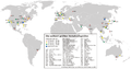
 20 no-visa countries, which transit travel to Russia by aero.png 2,753 × 1,400; 128 KB
-
-
 Aerial travel for Business or Pleasure - Thos Cook & Son - 1919 - pp 16+.jpg 1,752 × 1,238; 354 KB
-
 Aircraft Registration Prefixes Map of the World 2014.svg 2,754 × 1,397; 2.32 MB
-
 AircraftRegistrationPrefixes-Europe.png 1,125 × 903; 340 KB
-
 AircraftRegistrationPrefixes-Europe.svg 680 × 520; 560 KB
-
 Arturo Ferrarin - Roma-Tokyo.svg 3,555 × 1,568; 11.01 MB
-
 B-17-crash-site.jpg 1,200 × 1,095; 1.41 MB
-
 Carte progression convoi SPA153.jpg 3,142 × 5,844; 15.05 MB
-
 Cnf nac 2019.gif 540 × 540; 80 KB
-
 Compagnie générale aéropostale. De l'Afrique occidale au Brésil - btv1b84589320.jpg 6,514 × 9,055; 7.58 MB
-
 EU Aviatons Agreements.svg 1,164 × 1,064; 1.49 MB
-
 Europe - zônes interdites à la navigation aérienne - btv1b8459327x.jpg 8,940 × 6,886; 9 MB
-
 Final flight.jpg 2,387 × 1,688; 1.34 MB
-
 Flight from Cook Islands to New Zealand. Between Countries (482304) (9478422483).jpg 3,667 × 2,062; 2.18 MB
-
 Flight from New Zealand to Australia. Between Countries (483203) (9439853437).jpg 4,000 × 2,248; 2.41 MB
-
 Größte Flughäfen weltweit.png 1,500 × 792; 390 KB
-
 IASTA-2007-map.svg 940 × 477; 1.53 MB
-
 ICAO FirstLetter.svg 863 × 443; 1.59 MB
-
 ICAO-countries.png 4,500 × 2,234; 260 KB
-
 ICAO-FirstLetter.png 1,425 × 625; 30 KB
-
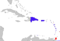 LIAT Destinations.png 2,201 × 1,507; 229 KB
-
 Longest domestic flights as of Dec 2021.gif 720 × 360; 49 KB
-
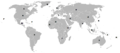
 Magyaro Airlines Destiations Map.PNG 800 × 384; 55 KB
-
 Map of 25 Longest domestic flights as of 01 Jan 2022.gif 720 × 360; 49 KB
-
 Map of the worldwide air traffic control radar coverag.png 1,879 × 953; 220 KB
-
 Map of the worldwide coverage of High Frequency network.png 1,500 × 740; 46 KB
-
 Map showing the overland and overseas flights of Charles A. Lindbergh (35048888011).jpg 11,865 × 7,033; 21.64 MB
-
 Mildenhall Recon.jpg 603 × 389; 70 KB
-
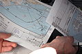 Navigation charts for NCE airport.jpg 3,648 × 2,432; 2.02 MB
-
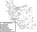 Network of airports in iran.jpg 1,400 × 1,200; 317 KB
-
 Number-of-air-transport-passengers-carried.png 3,400 × 2,400; 758 KB
-
 Overview Hight Altitude charts USA.png 1,336 × 798; 414 KB
-
 Overview Low Altitude charts Alaska.png 1,114 × 732; 302 KB
-
 Per-capita-co2-aviation-adjusted.svg 850 × 600; 168 KB
-
 Pilot in plane checking before flight.jpg 3,000 × 1,995; 292 KB
-
 Poland airports 2015.svg 1,053 × 1,131; 179 KB
-
 Poland airports 2016.svg 1,053 × 1,131; 73 KB
-
 Range of the Airbus A400M.png 1,000 × 1,105; 324 KB
-
 Shanghai Pudong (PVG ZSPD) ILS Approach.svg 823 × 894; 2.02 MB
-
 Singapore OSA ASA.svg 940 × 477; 1.62 MB
-
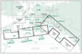
 Stockholm Bromma Range Approach Chart 1946.jpg 1,029 × 1,386; 267 KB
-
 Stockholm Bromma Range Approach Chart.jpg 1,024 × 1,093; 277 KB
-
 Terminal Change Notice TCN 1998 ENAME.jpg 3,552 × 5,462; 11.01 MB
-
 The Keinn.... um.. Seven (1245143739).jpg 1,024 × 768; 209 KB
-
 TOC-TOD-VFR-Sectional.jpg 1,793 × 922; 904 KB
-
 USPOD 1928 air mail route map (bw, high contrast).jpg 2,949 × 1,911; 1.28 MB
-
 USPOD 1928 air mail route map.jpg 2,949 × 1,911; 2.67 MB
-
 VAAC Coverage.jpg 3,600 × 2,475; 1.76 MB
-
 ValorAbosluto Imagen02.jpg 616 × 386; 27 KB
-
 Ve-crash-map.png 329 × 353; 31 KB
-
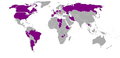
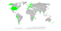
 WarsawMontrealConventionParticipation.svg 863 × 443; 1.58 MB
-
 World Aviation, Middle Two Pages, ICAO Regions.pdf 1,416 × 1,989, 2 pages; 2.16 MB
-
 Yellowknife Plates (3554787097).jpg 4,290 × 2,856; 1.78 MB
.jpg)


_(9478422483).jpg)
_(9439853437).jpg)


.jpg)


_ILS_Approach.svg)


.jpg)

.jpg)


.jpg)