Category:Atlas to Accompany the Official Records of the Union and Confederate Armies
Jump to navigation
Jump to search
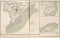
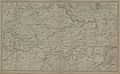
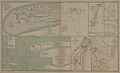
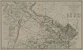
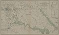
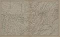
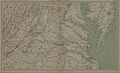
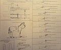
English: The Atlas to Accompany the Official Records of the Union and Confederate Armies, 1891-1895 was published as a companion piece to the Official Records of the War of the Rebellion and included maps, illustrations based on photographs, illustrations, and technical drawings. Among them, a total of 156 plates containing maps ranging from small-scale engagements to regional views and date-specific snapshots of long-running sieges like Vicksburg and Atlanta; Twelve plates that include images of Charleston Harbor and Ft. Sumter, Missionary Ridge and various elements of mid-nineteenth century warfare; Ten plates containing diagrams of defensive elements (redoubts, redans, and forts), equipment and armaments, uniforms, and flags.
Media in category "Atlas to Accompany the Official Records of the Union and Confederate Armies"
The following 169 files are in this category, out of 169 total.
-
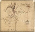
 (Map of the environs of Marietta, Georgia. June 10-July 3, 1864). LOC 2006635268.jpg 1,992 × 1,500; 320 KB
-

-

-
 Ambulance, etc. (13147646035).jpg 3,167 × 2,232; 2.27 MB
-
 AMERICAN CIVIL WAR FLAGS.jpg 11,223 × 6,996; 6.71 MB
-
 AMERICAN CIVIL WAR WEAPONS 2.jpg 11,208 × 6,832; 4.7 MB
-
 AMERICAN CIVIL WAR WEAPONS.jpg 11,173 × 6,848; 7.26 MB
-
 Artillery (13147757353).jpg 3,348 × 2,952; 3.09 MB
-
 ATLANTA CAMPAIGN MAP 1.jpg 11,150 × 6,808; 16.54 MB
-
 ATLANTA CAMPAIGN MAP 2.jpg 11,208 × 6,808; 10.68 MB
-
 ATLANTA CAMPAIGN MAP 3.jpg 11,077 × 6,742; 11.84 MB
-
 ATLANTA CAMPAIGN MAP 6 (SIEGE).jpg 11,289 × 6,901; 8.44 MB
-
 ATLANTA CAMPAIGN MAPS 4-5.jpg 11,118 × 6,777; 15.12 MB
-

-

-

-

-

-

-

-

-

-

-

-

-

-

-

-

-

-

-

-

-

-

-

-

-
-

-

-

-

-

-

-

-

-

-

-

-

-
-

-

-
 ATLAS OR ANTIETAM BATTLEFIELD.jpg 11,078 × 6,703; 11.12 MB
-
 ATLAS OR BATTLE OF 3RD WINCHESTER.jpg 11,209 × 6,812; 11.88 MB
-
 ATLAS OR BATTLE OF CEDAR CREEK.jpg 4,659 × 4,830; 4.82 MB
-
 ATLAS OR BATTLE OF CHICKAMAUGA 1.jpg 11,144 × 6,739; 8.29 MB
-
 ATLAS OR BATTLE OF CHICKAMAUGA 2.jpg 11,149 × 6,712; 12.21 MB
-
 ATLAS OR BATTLE OF NASHVILLE.jpg 4,270 × 5,048; 4.04 MB
-
 ATLAS OR BATTLE OF PEA RIDGE.jpg 4,681 × 1,690; 1.47 MB
-
 ATLAS OR BATTLE OF STONES RIVER.jpg 5,425 × 5,092; 4.34 MB
-
 ATLAS OR BATTLE OF WILSON'S CREEK.jpg 2,360 × 3,454; 2.01 MB
-
 ATLAS OR BATTLEFIELD MANASSAS.jpg 11,097 × 6,710; 9.87 MB
-
 ATLAS OR FORT FISHER MAP 1.jpg 11,457 × 7,064; 5.13 MB
-
 ATLAS OR GETTYSBURG BATTLEFIELD.jpg 11,179 × 6,865; 9.76 MB
-
 ATLAS OR GETTYSBURG CAMPAIGN MAP.jpg 11,299 × 6,841; 10.52 MB
-
 ATLAS OR KENTUCKY-TENNESSEE.jpg 11,302 × 6,952; 11.52 MB
-
 ATLAS OR KNOXVILLE MAP 1.jpg 11,176 × 6,741; 9.23 MB
-
 ATLAS OR MOBILE BAY MAP 1.jpg 11,247 × 6,887; 9.05 MB
-
 ATLAS OR MOBILE BAY MAP 2.jpg 11,187 × 6,820; 8.76 MB
-
 ATLAS OR NORTHEASTERN VIRGINIA MAP 1.jpg 11,177 × 6,791; 11.46 MB
-
 ATLAS OR NORTHEASTERN VIRGINIA MAP 2.jpg 6,586 × 4,646; 5.85 MB
-
 ATLAS OR NORTHEASTERN VIRGINIA MAP 3.jpg 11,102 × 6,739; 19.97 MB
-
 ATLAS OR OVERLAND-PETERSBURG MAP 1.jpg 11,208 × 6,808; 12.85 MB
-
 ATLAS OR OVERLAND-PETERSBURG MAP 2.jpg 4,859 × 6,836; 6.65 MB
-
 ATLAS OR PENINSULA CAMPAIGN MAP 1.jpg 11,168 × 6,647; 7.94 MB
-
 ATLAS OR PENINSULA CAMPAIGN MAP 2.jpg 11,222 × 6,871; 11.56 MB
-
 ATLAS OR PENINSULA CAMPAIGN MAP 3.jpg 11,175 × 6,702; 6.96 MB
-
 ATLAS OR PORT HUDSON MAP 1.jpg 4,636 × 6,885; 5.93 MB
-
 ATLAS OR SOUTHEASTERN VIRGINIA MAP.jpg 11,117 × 6,655; 9.17 MB
-
 ATLAS OR TENNESSEE-ALABAMA.jpg 11,286 × 6,928; 12.26 MB
-
 ATLAS OR VIRGINIA MAP.jpg 11,257 × 6,886; 11.86 MB
-
 ATLAS OR VIRGINIA-MARYLAND-PENNSYLVANIA.jpg 11,226 × 6,832; 10.95 MB
-

-
 Atlas to accompany the official records of the Union and Confederate armies.djvu 2,117 × 2,649, 223 pages; 24.51 MB
-
 Battle of Belmont map.jpg 3,162 × 2,216; 2.74 MB
-
 Battle of Murfreesborough (13147637195).jpg 2,433 × 2,746; 2.12 MB
-
 Battle-field, Manassas, Va (13147638065).jpg 1,873 × 2,703; 1.71 MB
-
 Battlefield of Winchester.jpg 5,490 × 6,812; 7.97 MB
-
 Camp Garnett and vicinity, Rich Mountain, Randolph Co., Va. LOC 2002627474.jpg 1,996 × 2,974; 656 KB
-
 Castle Thunder, Richmond, Va (13147759203).jpg 3,570 × 2,560; 2.74 MB
-
 Cavalry equipment (13147644215).jpg 2,847 × 2,329; 2.09 MB
-
 CHARLESTON MAP 1.jpg 8,653 × 6,759; 9.88 MB
-
 CHARLESTON MAP 2.jpg 7,429 × 6,784; 8.32 MB
-
 CHARLESTON MAP 3.jpg 11,000 × 6,686; 16.87 MB
-
 CHARLESTON MAP 4.jpg 6,663 × 2,136; 3.07 MB
-
 Confederate buttons (13147758823).jpg 2,505 × 778; 569 KB
-
 Confederate private infantry uniform.png 918 × 1,990; 2.32 MB
-
 Confederate uniforms (13147922734).jpg 3,053 × 1,346; 987 KB
-
 Dover, February 15, 1862 (13147922554).jpg 2,341 × 2,224; 1.62 MB
-

-

-
 Fort Jeb Stuart (13147642685).jpg 3,245 × 1,915; 2.05 MB
-
 Fort Moultrie (13147756283).jpg 3,829 × 2,270; 2.83 MB
-
 Fort Mouton (13147641245).jpg 3,680 × 2,558; 2.97 MB
-
 Fort Pickens (13147918664).jpg 2,853 × 2,629; 2.07 MB
-
 Fort Sidney Johnston (13147753333).jpg 3,515 × 2,155; 2.41 MB
-
 Fort Sumter (13147639765).jpg 3,913 × 2,085; 2.57 MB
-
 Gun battery, Fort Sumter (13147754703).jpg 3,709 × 2,383; 2.91 MB
-
 Henderson's Mill Map 1864.JPG 783 × 591; 140 KB
-
 Lookout Mountain, Tn (13147752093).jpg 1,786 × 2,652; 1.47 MB
-
 Macon, Geo. 1864. LOC 2006459226.jpg 3,889 × 5,630; 2.31 MB
-
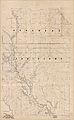
 Map of Texas and part of New Mexico (NBY 15547).jpg 3,600 × 3,052; 1.28 MB
-
 Map of the battlefield of Ceder Creek.jpg 5,719 × 6,811; 10.83 MB
-
 Map of the Confederate lines from New Bridge road to Chafins Bluff LOC 2005625087.jpg 7,705 × 10,465; 13.78 MB
-
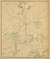
 Maryland-Pennsylvania.jpg 2,817 × 1,841; 1.07 MB
-
 Medical equipment (13147751683).jpg 3,697 × 2,499; 2.87 MB
-
 Nashville, Tn (13147636805).jpg 3,980 × 2,595; 3.06 MB
-
 Officers quarters, Fort Moultrie (13147641845).jpg 3,945 × 2,256; 2.38 MB
-
 Original maps of Forts Henry & Donelson and vicinity. LOC 80691156.jpg 7,768 × 5,884; 6.33 MB
-
 Paducah, Ky (13147914324).jpg 1,928 × 2,164; 1.19 MB
-
 Pamunkey Expedition (13147635275).jpg 2,831 × 2,043; 1.97 MB
-
 Plan of Fort Fisher.jpg 3,649 × 6,398; 3.05 MB
-
 Plan of fortifications at Columbus, Ga. LOC 2006459214.jpg 3,894 × 3,091; 1.17 MB
-
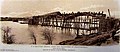
 Pontoon bridge on the James River (13147916624).jpg 3,353 × 2,525; 2.45 MB
-
 Position of Army of Tennessee near Atlanta, Georgia, July 22, 1864. LOC 2006458685.jpg 5,374 × 4,016; 2.32 MB
-
 Position of iron clads (13147916844).jpg 3,797 × 1,361; 1.28 MB
-
 Position of troops - Army of Virginia, August 27, 1862 (13147634705).jpg 3,415 × 2,497; 2.52 MB
-
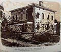 Potter house, Atlanta, Ga (13147645675).jpg 2,947 × 2,526; 2.11 MB
-
 Powder Vessel (13147750033).jpg 1,122 × 3,321; 1.25 MB
-

-
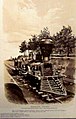
 Railroad cars (13147913784).jpg 3,166 × 1,055; 1.38 MB
-
 Ramparts, Fort Moultrie (13147755653).jpg 3,721 × 2,229; 2.31 MB
-
 Rebel lines south east of Atlanta, GA (13147749623).jpg 2,997 × 2,293; 1.91 MB
-
 RED RIVER CAMPAIGN MAP 9802 x 5926.jpg 9,802 × 5,926; 18.37 MB
-
 Red River campaign map.jpg 9,238 × 14,971; 3.1 MB
-
 RED RIVER CAMPAIGN MAP.jpg 11,161 × 6,748; 15.77 MB
-
 RED RIVER CAMPAIGN MAP2.jpg 11,161 × 6,748; 11.37 MB
-
 RED RIVER CAMPAIGN MAP44.jpg 4,004 × 4,700; 5.55 MB
-
 SAVANNAH CAMPAIGN MAP 1.jpg 11,271 × 6,816; 9.15 MB
-
 Schofield crossing the Chattahooche (sic). LOC 2006458689.jpg 3,651 × 2,629; 1.25 MB
-
 Sherman's march to the sea MAP.jpg 11,271 × 6,816; 12.39 MB
-
 SHERMAN'S MARCHES.jpg 11,291 × 6,905; 12.02 MB
-
 Siege of Petersburg, VA (13147914154).jpg 2,330 × 951; 944 KB
-
 Siege of Vicksburg (13147911344).jpg 3,160 × 2,088; 2.37 MB
-
 Signal tower (13147634355).jpg 2,861 × 1,133; 952 KB
-
 Six-mule team (13147915334).jpg 3,148 × 1,049; 1.04 MB
-

-
-

-
 Tennessee River (13147747953).jpg 2,934 × 2,323; 1.96 MB
-
-
 Terre Plein, Fort Sumter (13147640145).jpg 3,894 × 2,248; 2.37 MB
-
 The War of the Rebellion Map plate CLV.jpg 2,195 × 1,369; 950 KB
-
 Title page (13147760333).jpg 2,510 × 3,233; 2.4 MB
-
 Train engine (13147922264).jpg 1,532 × 2,406; 1.01 MB
-
 U.S. Army hospital steamer (13147639035).jpg 3,129 × 1,686; 1.5 MB
-
 U.S. military bridge over the Tennessee River (13147634215).jpg 3,854 × 1,677; 1.9 MB
-
 Union flags (13147642955).jpg 2,925 × 2,148; 1.55 MB
-
 Union Private infantry uniform.png 942 × 1,966; 2.57 MB
-
 Union troop positions east of Dallas, Georgia, May 25-June 5, 1864. LOC 2006459217.tif 1,437 × 1,957; 8.05 MB
-

-
 Union troop positions northwest of Marietta, Georgia, June? 1864. LOC 2006635266.jpg 3,702 × 2,947; 1.23 MB
-
 Union troop positions west of Marietta, Georgia, June? 1864. LOC 2006635267.jpg 2,523 × 1,758; 504 KB
-
 Union uniforms (13147747523).jpg 2,867 × 1,753; 1.18 MB
-
 Union uniforms (13147911754).jpg 2,676 × 1,500; 931 KB
-
 War of the Rebellion Atlas Plate 172.jpg 11,152 × 6,832; 8.75 MB
-
 War of the Rebellion Atlas Plate 38.jpg 11,123 × 6,885; 9.72 MB
-
 Weaponry (13147643915).jpg 3,427 × 3,194; 3.51 MB
._LOC_2006635268.jpg)
._LOC_2007626737.jpg)
.jpg)


.jpg)


.jpg)


.jpg)

.jpg)
.jpg)


.jpg)
.jpg)


.jpg)
.jpg)


.jpg)
.jpg)
.jpg)
.jpg)
.jpg)
.jpg)
.jpg)

.jpg)

.jpg)


.jpg)
.jpg)
.jpg)

.jpg)
.jpg)


.jpg)

.jpg)
.jpg)

.jpg)
.jpg)


._LOC_2006458689.jpg)


.jpg)


.jpg)

.jpg)

.jpg)
.jpg)
.jpg)
.jpg)
.jpg)


.jpg)
.jpg)


.jpg)
.jpg)
.jpg)
.jpg)
.jpg)
.jpg)
.jpg)
.jpg)