Category:Ashmanhaugh
Jump to navigation
Jump to search
English: Ashmanhaugh or Ashmanaugh is a village and civil parish in the English county of Norfolk, situated some 20 km north east of Norwich. Apart from Ashmanhaugh village itself, the parish also includes Beeston St Lawrence, which was a separate parish until 1935.
village in the United Kingdom  | |||||
| Upload media | |||||
| Instance of | |||||
|---|---|---|---|---|---|
| Location | North Norfolk, Norfolk, East of England, England | ||||
| Area |
| ||||
 | |||||
Subcategories
This category has the following 3 subcategories, out of 3 total.
B
- Beeston Hall, Ashmanhaugh (3 F)
S
Media in category "Ashmanhaugh"
The following 110 files are in this category, out of 110 total.
-
 A boat in the woods - geograph.org.uk - 777441.jpg 480 × 640; 163 KB
-
 A colourful mosaic - geograph.org.uk - 777485.jpg 640 × 440; 201 KB
-
 A dry seat - geograph.org.uk - 777425.jpg 480 × 640; 138 KB
-
 A field of Brussels Sprouts - geograph.org.uk - 1060312.jpg 640 × 480; 126 KB
-
 A gas pipeline marker - geograph.org.uk - 1060439.jpg 480 × 640; 84 KB
-
 A grassed-over track - geograph.org.uk - 1061469.jpg 640 × 480; 137 KB
-
 A Hymac digger - geograph.org.uk - 1061450.jpg 480 × 640; 98 KB
-

-

-
 A mossy bank - geograph.org.uk - 777449.jpg 480 × 640; 176 KB
-
 A pleasing contrast - geograph.org.uk - 776964.jpg 480 × 640; 196 KB
-
 A seat and notice board under a tree - geograph.org.uk - 4557877.jpg 1,024 × 768; 537 KB
-
 All eyes - geograph.org.uk - 777015.jpg 640 × 480; 181 KB
-
 Approaching the level crossing - geograph.org.uk - 1060594.jpg 480 × 640; 114 KB
-
 Ashmanhaugh St. Swithin's church - geograph.org.uk - 2199733.jpg 640 × 480; 160 KB
-
 Ashmanhaugh St. Swithin's church - geograph.org.uk - 4349834.jpg 640 × 480; 154 KB
-
 Ashmanhaugh village sign - geograph.org.uk - 4295815.jpg 480 × 640; 94 KB
-
 Ashmanhaugh Village Sign - geograph.org.uk - 5587672.jpg 480 × 640; 95 KB
-
 Ashmanhaugh World War One Memorial - geograph.org.uk - 4558680.jpg 3,456 × 2,592; 3.6 MB
-
 Beeston St. Lawrence's church - geograph.org.uk - 2199753.jpg 640 × 480; 170 KB
-
 Car park at Wroxham Barns - geograph.org.uk - 739103.jpg 640 × 454; 133 KB
-
 Daffodils in Ashmanhaugh Wood - geograph.org.uk - 777420.jpg 640 × 480; 176 KB
-
 Driveway to Blacksmiths Farm - geograph.org.uk - 739031.jpg 640 × 480; 204 KB
-
 Found something interesting - geograph.org.uk - 777471.jpg 640 × 480; 186 KB
-
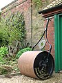 Garden Roller - geograph.org.uk - 776925.jpg 480 × 640; 157 KB
-
 Geese in the reeds - geograph.org.uk - 777428.jpg 640 × 480; 194 KB
-
 Hoveton Hall Gardens, Bridge carrying the road to the Hall - geograph.org.uk - 6179351.jpg 5,935 × 3,957; 7.35 MB
-
 Hoveton Hall Gardens, Private road leading to the Hall - geograph.org.uk - 6181452.jpg 6,047 × 4,031; 7.35 MB
-
 Hoveton Hall Gardens, The Arboretum - geograph.org.uk - 6181447.jpg 5,826 × 3,884; 7.61 MB
-
 Hoveton Hall Gardens, The view from the road bridge - geograph.org.uk - 6181463.jpg 5,562 × 3,708; 4.94 MB
-
 Hoveton Hall Gardens, The Water Garden - geograph.org.uk - 6181467.jpg 6,342 × 4,228; 7.76 MB
-
 Hoveton Old Hall - geograph.org.uk - 631285.jpg 480 × 640; 25 KB
-
 Hoveton Park - geograph.org.uk - 24663.jpg 480 × 640; 76 KB
-
 Jacob ewe and lambs - geograph.org.uk - 777469.jpg 480 × 640; 161 KB
-
 Level Crossing on Belaugh Green Lane - geograph.org.uk - 548687.jpg 640 × 480; 86 KB
-
 New hedge beside Cangate Road - geograph.org.uk - 4894193.jpg 640 × 480; 367 KB
-
 Passing Places on a narrow country road - geograph.org.uk - 4557948.jpg 1,024 × 768; 453 KB
-
 Piebald and Skewbald - geograph.org.uk - 739067.jpg 640 × 480; 153 KB
-
 Preston Hall - geograph.org.uk - 739050.jpg 640 × 450; 112 KB
-
 School Road, Ashmanhaugh - geograph.org.uk - 5587681.jpg 640 × 480; 71 KB
-

-
 Snowy field edge - geograph.org.uk - 739025.jpg 640 × 480; 134 KB
-

-
 Stone Lane, Ashmanhaugh - geograph.org.uk - 4557878.jpg 985 × 722; 371 KB
-

-

-
 Telephone box - geograph.org.uk - 739047.jpg 480 × 640; 172 KB
-
-

-

-
 Turn-off towards Barton Road - geograph.org.uk - 739008.jpg 640 × 463; 146 KB
-
 Twin lambs - geograph.org.uk - 455848.jpg 640 × 480; 72 KB
-
 Two sheep - geograph.org.uk - 739039.jpg 640 × 480; 156 KB
-
 View across the gate - geograph.org.uk - 739090.jpg 640 × 480; 169 KB
-
 View from Shoulder Mutton Plantation - geograph.org.uk - 548614.jpg 480 × 640; 62 KB
-

-
 View south towards Church Plantation - geograph.org.uk - 548566.jpg 639 × 371; 43 KB
-
 View southeast towards Carrot Hill - geograph.org.uk - 548574.jpg 638 × 391; 38 KB
-
 View towards Hoveton Old Hall - geograph.org.uk - 631279.jpg 640 × 480; 41 KB
-
 View towards junction with the A151 - geograph.org.uk - 739021.jpg 640 × 459; 125 KB
-
 View west along School Road - geograph.org.uk - 739042.jpg 480 × 640; 164 KB
-

-
 A bare field - geograph.org.uk - 1060317.jpg 640 × 430; 88 KB
-
 A dip in the road - geograph.org.uk - 1059200.jpg 593 × 640; 187 KB
-
 A gas installation - geograph.org.uk - 1060447.jpg 640 × 359; 63 KB
-
 A glimpse into the woods - geograph.org.uk - 1060412.jpg 480 × 640; 181 KB
-
 A large heap of sugar beet - geograph.org.uk - 1059170.jpg 640 × 480; 97 KB
-
 A new shelter belt near Church Farm - geograph.org.uk - 548577.jpg 480 × 640; 85 KB
-
 A passing place - geograph.org.uk - 1059348.jpg 480 × 640; 112 KB
-
 A waterlogged farm track - geograph.org.uk - 1060462.jpg 640 × 613; 132 KB
-
 Access road to Blacksmiths Farm - geograph.org.uk - 739027.jpg 640 × 465; 158 KB
-
 An old water pump - geograph.org.uk - 776968.jpg 480 × 640; 188 KB
-
 An old watering pit - geograph.org.uk - 1060327.jpg 480 × 640; 88 KB
-
 Approach to dual carriageway - geograph.org.uk - 494239.jpg 640 × 480; 187 KB
-
 Approaching Church Road - geograph.org.uk - 1060470.jpg 480 × 640; 103 KB
-
 Approaching Market Street - geograph.org.uk - 494261.jpg 640 × 480; 105 KB
-
 Approaching Market Street junction - geograph.org.uk - 1059166.jpg 480 × 640; 91 KB
-
 Approaching the level crossing - geograph.org.uk - 615726.jpg 640 × 480; 62 KB
-
 Belaugh Green Farmhouse - geograph.org.uk - 548655.jpg 640 × 480; 54 KB
-

-
 Can Banks - geograph.org.uk - 548606.jpg 480 × 640; 82 KB
-
 Children's play area - geograph.org.uk - 739118.jpg 640 × 480; 151 KB
-
 Church Farm - geograph.org.uk - 548585.jpg 640 × 480; 74 KB
-
 Dense vegetation growing beside a stream - geograph.org.uk - 777411.jpg 480 × 640; 195 KB
-
 Entrance to The Hall - geograph.org.uk - 615739.jpg 480 × 640; 107 KB
-
 Espalier tree - geograph.org.uk - 776943.jpg 640 × 468; 204 KB
-
 Espalier tree detail - geograph.org.uk - 776951.jpg 480 × 640; 184 KB
-
 Farmhouse in Hoveton Park - geograph.org.uk - 777466.jpg 640 × 480; 139 KB
-
 Field beside Stone Road - geograph.org.uk - 631275.jpg 640 × 480; 53 KB
-
 Field boundary - geograph.org.uk - 548561.jpg 640 × 480; 83 KB
-
 Flowerbeds in the Spider Garden - geograph.org.uk - 776937.jpg 640 × 480; 180 KB
-
 Footpath across the fields - geograph.org.uk - 615736.jpg 640 × 480; 54 KB
-
 Gardener's Cottage - geograph.org.uk - 776972.jpg 640 × 480; 175 KB
-
-
 Harvest - geograph.org.uk - 516671.jpg 640 × 480; 65 KB
-
 Horse and Groom - geograph.org.uk - 494249.jpg 640 × 480; 116 KB
-
 Horse pasture - geograph.org.uk - 739079.jpg 640 × 480; 150 KB
-
 Hoveton Hall gardens at dawn - geograph.org.uk - 24699.jpg 640 × 480; 151 KB
-
 Junction with St Peter's Lane - geograph.org.uk - 494274.jpg 640 × 480; 126 KB
-
 Kidney Lake - geograph.org.uk - 777422.jpg 480 × 640; 161 KB
-
 Lifebelt by the lake - geograph.org.uk - 777444.jpg 480 × 640; 200 KB
-

-
 Main entrance to Church Farm - geograph.org.uk - 548583.jpg 640 × 480; 54 KB
-
 Market Street - geograph.org.uk - 494243.jpg 640 × 480; 119 KB
-
 Market Street - geograph.org.uk - 615742.jpg 640 × 480; 60 KB
-
 Mid-November sunshine - geograph.org.uk - 615749.jpg 640 × 480; 112 KB
-
 Railway bridge over Hand Lane - geograph.org.uk - 548698.jpg 480 × 640; 107 KB
-
 Road to Wroxham Barns - geograph.org.uk - 631271.jpg 640 × 480; 54 KB
-
 Skeletons of polytunnels - geograph.org.uk - 548580.jpg 640 × 480; 84 KB
-
 Trees on Rectory Road - geograph.org.uk - 631288.jpg 480 × 640; 64 KB


_-_geograph.org.uk_-_5587696.jpg)


