Category:Ashby de la Launde
Jump to navigation
Jump to search
English: Ashby de la Launde is a small village, part of the civil parish of Ashby de la Launde and Bloxholm, in the North Kesteven district of Lincolnshire, England, just west of Digby, and east of the A15 and the B1191. The suffix to the name comes from the family that once held the Lordship of the Manor here, the De la Laundes.
village in Lincolnshire, United Kingdom  | |||||
| Upload media | |||||
| Instance of | |||||
|---|---|---|---|---|---|
| Location | Ashby de la Launde and Bloxholm, North Kesteven, Lincolnshire, East Midlands, England | ||||
 | |||||
Subcategories
This category has the following 2 subcategories, out of 2 total.
H
- St Hibald, Ashby-de-la-Launde (22 F)
R
- RAF Digby (11 F)
Media in category "Ashby de la Launde"
The following 36 files are in this category, out of 36 total.
-
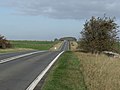 A15 near Ashby de la Launde - geograph.org.uk - 2682499.jpg 1,280 × 960; 296 KB
-

-
 Ashby de la Launde Village Hall - geograph.org.uk - 3389500.jpg 1,024 × 681; 275 KB
-

-
 Ashby Hall parkland - geograph.org.uk - 1386605.jpg 640 × 426; 104 KB
-
 Ashby Main Street - geograph.org.uk - 159353.jpg 640 × 480; 98 KB
-
 Entering Ashby de la Launde - geograph.org.uk - 3410894.jpg 1,024 × 681; 208 KB
-
 Farmland near Thompson's Bottom - geograph.org.uk - 330486.jpg 640 × 427; 34 KB
-

-
 Footpath to Bloxholm - geograph.org.uk - 1386620.jpg 426 × 640; 93 KB
-
 Footpath to Bloxholm - geograph.org.uk - 159350.jpg 640 × 480; 82 KB
-
 Former estate cottage, Ashby de la Launde - geograph.org.uk - 4402440.jpg 1,024 × 768; 147 KB
-
 Home Farm, Ashby de la Launde - geograph.org.uk - 4402426.jpg 1,024 × 768; 153 KB
-
 Lincolnshire potatoes - geograph.org.uk - 1386589.jpg 640 × 426; 87 KB
-
 Main Street - geograph.org.uk - 1548494.jpg 640 × 480; 108 KB
-
 Monkey Puzzle Tree, Main Street, Ashby De La Launde - geograph.org.uk - 3369398.jpg 1,504 × 2,256; 1.78 MB
-
 Near Slate House farm - geograph.org.uk - 328528.jpg 640 × 427; 67 KB
-
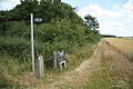
 Path to St.Hibald's church - geograph.org.uk - 135178.jpg 640 × 427; 103 KB
-
 Sports Ground - geograph.org.uk - 159355.jpg 640 × 480; 123 KB
-
 Springwell plantation - geograph.org.uk - 1386622.jpg 640 × 426; 102 KB
-
 Stubble field, Ashby de la Launde - geograph.org.uk - 3410820.jpg 1,024 × 681; 223 KB
-
 Stubble, Ashby de la Launde - geograph.org.uk - 3410822.jpg 1,024 × 681; 190 KB
-
 View from Bloxholm Lane - geograph.org.uk - 1731165.jpg 640 × 426; 117 KB
-
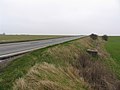 A15 towards Sleaford - geograph.org.uk - 390985.jpg 640 × 480; 64 KB
-
 Aconites in The Laurels - geograph.org.uk - 132787.jpg 640 × 427; 188 KB
-
 Ashby Lodge - geograph.org.uk - 390992.jpg 640 × 480; 54 KB
-
 Big Flat Field - geograph.org.uk - 159352.jpg 640 × 480; 96 KB
-
 Country Road - geograph.org.uk - 390989.jpg 640 × 480; 47 KB
-
 Field and Trees - geograph.org.uk - 159349.jpg 640 × 480; 88 KB
-
 Fields off Navenby Lane - geograph.org.uk - 391028.jpg 640 × 480; 73 KB
-
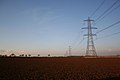
 Lightning Conductors - geograph.org.uk - 490435.jpg 640 × 480; 67 KB
-
 Long Plantation - geograph.org.uk - 132795.jpg 640 × 427; 166 KB
-
 Looking towards Scopwick Lodge Farm - geograph.org.uk - 489926.jpg 640 × 480; 68 KB
-
 Navenby Lane looking eastwards - geograph.org.uk - 391023.jpg 640 × 480; 56 KB
-
 Rape Seed crop off Cuckoo Lane - geograph.org.uk - 490089.jpg 640 × 480; 138 KB
-
 Slate House Farm - geograph.org.uk - 328533.jpg 640 × 427; 63 KB


