Category:Arsenaal (Grave)
Jump to navigation
Jump to search
| Object location | | View all coordinates using: OpenStreetMap |
|---|
 | |||||
| Upload media | |||||
| Instance of | |||||
|---|---|---|---|---|---|
| Part of |
| ||||
| Location | Grave, Land van Cuijk, North Brabant, Netherlands | ||||
| Street address |
| ||||
| Located on street |
| ||||
| Heritage designation |
| ||||
 | |||||
|
This is a category about rijksmonumentcomplex number 506920
|
Arsenaal
|
This is a category about rijksmonument number 506919
|
Kapel
|
This is a category about rijksmonument number 506921
|
Kazemat
|
This is a category about rijksmonument number 506922
|
| Address |
|
Media in category "Arsenaal (Grave)"
The following 27 files are in this category, out of 27 total.
-
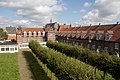 506919 Voormalige Arsenaal 2.jpg 5,184 × 3,456; 12.82 MB
-
 506919 Voormalige Arsenaal.jpg 5,184 × 3,456; 13.85 MB
-
 506921 Voormalig kruithuis, kapel op terrein van het Arsenaal.jpg 5,184 × 3,456; 14.47 MB
-
 5361 Grave, Netherlands - panoramio (1).jpg 2,048 × 1,148; 545 KB
-
 5361 Grave, Netherlands - panoramio (12).jpg 2,048 × 1,148; 437 KB
-
 5361 Grave, Netherlands - panoramio (5).jpg 2,048 × 1,148; 474 KB
-
 Arsenaal Grave vanuit Poternen gezien. Noord-Brabant.jpg 6,016 × 4,000; 10.53 MB
-

-

-
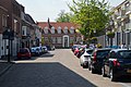
 Exterieur, gevels vanaf de St. Jorisstraat - Grave - 20325978 - RCE.jpg 1,190 × 1,200; 403 KB
-
 Exterieur, kapelletje op binnenterrein, was kruithuis - Grave - 20325974 - RCE.jpg 1,190 × 1,200; 400 KB
-
 Exterieur, overzicht entree aan Elisabethstraat - Grave - 20325969 - RCE.jpg 1,195 × 1,200; 306 KB
-
 Exterieur, overzicht gevels aan binnenterrein - Grave - 20325970 - RCE.jpg 1,190 × 1,200; 358 KB
-
 Exterieur, overzicht gevels aan de Marsstraat - Grave - 20325994 - RCE.jpg 1,186 × 1,200; 304 KB
-
 Exterieur, overzicht gevels aan het binnenterrein - Grave - 20325993 - RCE.jpg 1,186 × 1,200; 335 KB
-
 Exterieur, overzicht gevels vanaf Achter de Marsstal - Grave - 20325971 - RCE.jpg 1,193 × 1,200; 310 KB
-
 Exterieur, overzicht kazematten vanaf het binnenterrein - Grave - 20325995 - RCE.jpg 1,188 × 1,200; 358 KB
-
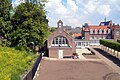
 Exterieur, overzicht terrein - Grave - 20325968 - RCE.jpg 1,186 × 1,200; 298 KB
-
 Grave - Arsenaalplein.jpg 2,592 × 1,944; 1.54 MB
-
 Grave - Kapel of kruithuis bij Arsenaal.jpg 2,592 × 1,944; 1.98 MB
-
 Grave - St Elisabethstraat 35.jpg 2,592 × 1,944; 1.36 MB
-
 Grave arsenaal.jpg 500 × 281; 134 KB
-
 Grave Rijksmonument 506922 kazematten grenzend aan het Arsenaal.JPG 3,648 × 2,736; 4.3 MB
-
 Interieur, kazemat - Grave - 20325996 - RCE.jpg 1,200 × 1,199; 370 KB
-
 Interieur, kazemat - Grave - 20325997 - RCE.jpg 1,188 × 1,200; 432 KB
-
 Kruithuis Arsenaal Grave uit 1689. In 1898 door J. van Lokhorst tot kapel verbouwd.jpg 6,016 × 4,000; 12.71 MB
-
 Rijks Psychiatrische werkplaats, zijgevel - Grave - 20084026 - RCE.jpg 1,200 × 1,193; 237 KB


.jpg)
.jpg)
.jpg)


