Category:Arlingham
Jump to navigation
Jump to search
village and civil parish in Gloucestershire, United Kingdom  | |||||
| Upload media | |||||
| Instance of | |||||
|---|---|---|---|---|---|
| Location | Stroud, Gloucestershire, South West England, England | ||||
| Said to be the same as | Arlingham (Wikimedia duplicated page, civil parish) | ||||
 | |||||
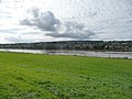
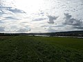
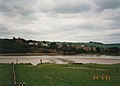
English: Arlingham is a village and civil parish in the Stroud District of Gloucestershire, England. The parish had a population of 410 at the 2001 census. The parish occupies a peninsula caused by a sharp bend in the River Severn - the next village to the east is Fretherne.
Subcategories
This category has the following 5 subcategories, out of 5 total.
A
- St Mary's church, Arlingham (13 F)
O
- Old Passage Inn, Arlingham (5 F)
- Overton, Gloucestershire (4 F)
R
- Red Lion, Arlingham (5 F)
W
- Wick Court, Stroud (4 F)
Media in category "Arlingham"
The following 200 files are in this category, out of 241 total.
(previous page) (next page)-
 A big sky over the River Severn - geograph.org.uk - 6016985.jpg 1,024 × 683; 141 KB
-

-
 A disappearing pillbox - geograph.org.uk - 6017014.jpg 1,024 × 683; 266 KB
-
 A Study In Brown - geograph.org.uk - 3791258.jpg 1,920 × 1,080; 2.18 MB
-
 Across the Severn - geograph.org.uk - 6023552.jpg 1,600 × 957; 401 KB
-
 Across the Severn - geograph.org.uk - 6023629.jpg 1,600 × 900; 487 KB
-
 Admiring the view^ - geograph.org.uk - 791457.jpg 640 × 426; 86 KB
-
 Alexander Dennis Enviro200 on service 113 Arlingham to Gloucester.jpg 2,592 × 1,944; 1.51 MB
-
 Alpaca or Llama^^ - geograph.org.uk - 2567585.jpg 1,024 × 768; 225 KB
-

-
 Arlingham City Limits - geograph.org.uk - 6023198.jpg 1,600 × 901; 657 KB
-
 Arlingham from the air - geograph.org.uk - 1221437.jpg 480 × 640; 64 KB
-
 Arlingham High Street - geograph.org.uk - 6024205.jpg 1,600 × 901; 663 KB
-
 Arlingham Passage - geograph.org.uk - 3686323.jpg 3,264 × 2,448; 2.66 MB
-
 Arlingham Passage - geograph.org.uk - 6023597.jpg 1,600 × 901; 642 KB
-
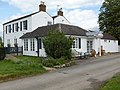
 Arlingham Post Office - geograph.org.uk - 1800379.jpg 640 × 467; 123 KB
-
 Arlingham Village Hall.jpg 2,289 × 2,436; 3 MB
-
 Arlingham Warth - geograph.org.uk - 6023643.jpg 1,600 × 901; 670 KB
-
 Arlingham, Gloucestershire ... a rural post office. (6954020616).jpg 2,825 × 2,614; 1.39 MB
-
-
 Blackberries near Overton Farm - geograph.org.uk - 3151250.jpg 640 × 480; 142 KB
-
 Boat on the banks of the River Severn - geograph.org.uk - 686904.jpg 640 × 426; 60 KB
-
 Breakers yard at Collow Pill - geograph.org.uk - 3791651.jpg 1,920 × 1,080; 1.9 MB
-
 Broadoak viewed from the south - geograph.org.uk - 685238.jpg 426 × 640; 96 KB
-
 Bullo Pill - geograph.org.uk - 6023589.jpg 1,600 × 900; 463 KB
-
 Church Farm, Vicarage Lane - geograph.org.uk - 1802526.jpg 528 × 640; 167 KB
-
 Church Road, Arlingham - geograph.org.uk - 4571191.jpg 3,264 × 2,448; 1.69 MB
-
 Collow Pill - geograph.org.uk - 6017021.jpg 1,024 × 683; 130 KB
-
 Collow Pill from Arlingham - geograph.org.uk - 4467823.jpg 640 × 480; 74 KB
-

-
 Drying mud overlying lias limestone pavement - geograph.org.uk - 5043798.jpg 3,648 × 2,048; 2.38 MB
-
 Ebenezer Chapel - geograph.org.uk - 4571172.jpg 3,264 × 2,448; 1.68 MB
-
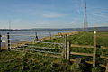
 Electric pylons by the river Severn - geograph.org.uk - 165010.jpg 640 × 480; 50 KB
-
 Entrance driveway to Wick Court - geograph.org.uk - 3151322.jpg 640 × 480; 104 KB
-
 Farm road north off Passage Road - geograph.org.uk - 1800263.jpg 640 × 427; 132 KB
-
 Farming paraphernalia - geograph.org.uk - 6024198.jpg 1,600 × 901; 641 KB
-
 Feature at Arlingham Warth - geograph.org.uk - 3151542.jpg 640 × 480; 70 KB
-
 Field edge footpath near Overton - geograph.org.uk - 3151285.jpg 640 × 480; 102 KB
-

-
 Field edge path beside the Severn - geograph.org.uk - 3151386.jpg 640 × 480; 78 KB
-
 Fields between Arlingham and the Severn - geograph.org.uk - 6203113.jpg 3,264 × 2,448; 1.81 MB
-
 Flood debris beside the River Severn - geograph.org.uk - 3980847.jpg 1,280 × 720; 912 KB
-

-
 Footbridge near Overton Farm - geograph.org.uk - 3151268.jpg 640 × 480; 135 KB
-
 Footpath and stile - geograph.org.uk - 5043772.jpg 3,648 × 2,048; 2.63 MB
-
 Footpath to Barrow Hill - geograph.org.uk - 6021411.jpg 1,600 × 901; 713 KB
-
 Footpath to Upper and Lower Milton - geograph.org.uk - 6021415.jpg 1,600 × 901; 643 KB
-

-
 Foreshore below Hock Cliff - geograph.org.uk - 5043803.jpg 3,648 × 2,048; 1.61 MB
-
 Fox ahead of me on the Severn Way - geograph.org.uk - 3151659.jpg 640 × 480; 99 KB
-
 Fox eating a rat - geograph.org.uk - 3151619.jpg 640 × 480; 108 KB
-

-

-

-

-
 Garden Cliff - geograph.org.uk - 3791774.jpg 2,284 × 1,285; 1.54 MB
-
 Garden Cliff near Westbury-on-Severn - geograph.org.uk - 3151501.jpg 640 × 480; 59 KB
-

-
 Gate on the Severn Way near Newnham - geograph.org.uk - 3151733.jpg 640 × 480; 91 KB
-

-
 Heading to Overton from Arlingham - geograph.org.uk - 1802548.jpg 640 × 427; 160 KB
-
 Hedgerow and drainage ditch beside Passage Road - geograph.org.uk - 3791629.jpg 1,920 × 1,276; 3.08 MB
-

-
 Home of Arlingham Football Club - geograph.org.uk - 1800398.jpg 640 × 572; 216 KB
-
 Hope Pill - geograph.org.uk - 6023561.jpg 1,600 × 901; 651 KB
-
 Ivy-covered building - geograph.org.uk - 6024208.jpg 1,600 × 901; 754 KB
-
 Jurassic Hock Cliff - geograph.org.uk - 1891071.jpg 640 × 426; 114 KB
-
 Lane at Priding - geograph.org.uk - 4124569.jpg 800 × 450; 83 KB
-
-
 Looking across the River Severn - geograph.org.uk - 2448020.jpg 640 × 480; 66 KB
-

-
 Looking across the Severn - geograph.org.uk - 6023640.jpg 1,600 × 900; 466 KB
-
 Looking towards the Rodley shore - geograph.org.uk - 6021392.jpg 1,600 × 901; 639 KB
-
 Low level meadow view - geograph.org.uk - 3974890.jpg 1,280 × 853; 1.04 MB
-
 Low tide on the River Severn - geograph.org.uk - 3699541.jpg 1,024 × 680; 78 KB
-
 Low tide on the Severn - geograph.org.uk - 2309322.jpg 3,216 × 2,136; 2.68 MB
-
 Low tide on the Severn - geograph.org.uk - 2309323.jpg 3,216 × 2,136; 2.57 MB
-
 Low tide on the Severn at Newnham-on-Severn - geograph.org.uk - 3699526.jpg 1,024 × 680; 101 KB
-
 Lower Mangrove Farm near Fretherne - geograph.org.uk - 4186416.jpg 800 × 621; 134 KB
-
 Lower Milton End Rhyne - geograph.org.uk - 6024199.jpg 1,600 × 901; 706 KB
-
 Map of the Arlingham peninsula - geograph.org.uk - 6021398.jpg 1,600 × 1,463; 949 KB
-

-
 Muddy track and footpath - geograph.org.uk - 6023196.jpg 1,600 × 901; 749 KB
-
 Netting Lane, Arlingham - geograph.org.uk - 1800274.jpg 640 × 427; 182 KB
-
 Newnham from across the Severn - geograph.org.uk - 3151742.jpg 640 × 480; 71 KB
-
 Newnham from Arlingham Passage - geograph.org.uk - 6023611.jpg 1,200 × 1,600; 773 KB
-

-
 Newnham on Severn - geograph.org.uk - 6015430.jpg 1,024 × 683; 164 KB
-
 Newnham, from across the river, 1 - geograph.org.uk - 6013767.jpg 1,600 × 900; 595 KB
-
 Newnham, from across the river, 2 - geograph.org.uk - 6013771.jpg 1,600 × 900; 499 KB
-
 No through road - geograph.org.uk - 1802599.jpg 640 × 472; 136 KB
-
 No through road in Arlingham - geograph.org.uk - 2448051.jpg 640 × 480; 122 KB
-
 Old brick gateposts - geograph.org.uk - 1802512.jpg 640 × 427; 132 KB
-
 Old pond at Arlingham Warth - geograph.org.uk - 3151547.jpg 640 × 480; 81 KB
-
 Old wall and old tree - geograph.org.uk - 1800817.jpg 640 × 427; 147 KB
-
 Oldbury Farm - geograph.org.uk - 6021406.jpg 1,600 × 901; 690 KB
-
 On the Severn Way near Newnham - geograph.org.uk - 3151725.jpg 640 × 480; 59 KB
-
 Outskirts of Arlingham village - geograph.org.uk - 1800268.jpg 640 × 413; 99 KB
-
 Over Hock Cliff - geograph.org.uk - 1221417.jpg 480 × 640; 48 KB
-
 Overton Farm - geograph.org.uk - 1802608.jpg 640 × 427; 168 KB
-
 Overton Farm house - geograph.org.uk - 2448080.jpg 640 × 480; 85 KB
-
 Part of Oldbury Farm, Overton - geograph.org.uk - 3151315.jpg 640 × 480; 89 KB
-

-

-
-
-
-

-

-

-

-
 Passage Road - geograph.org.uk - 3151851.jpg 640 × 480; 100 KB
-
 Passage Road - geograph.org.uk - 3791621.jpg 1,278 × 1,920; 1.88 MB
-
 Passage Road - geograph.org.uk - 3791643.jpg 1,920 × 1,280; 2.8 MB
-

-

-
 Path on the Severn flood defences - geograph.org.uk - 3980832.jpg 1,280 × 853; 948 KB
-
 Path on the Skylark Walk - geograph.org.uk - 3980806.jpg 1,280 × 853; 1.23 MB
-
 Path through Long Wood - geograph.org.uk - 3974894.jpg 1,280 × 853; 1.42 MB
-
 Path through sheep pasture - geograph.org.uk - 3151449.jpg 640 × 480; 74 KB
-
 Pear Orchard - geograph.org.uk - 3791690.jpg 1,920 × 1,279; 2.87 MB
-
 Perry Pear Orchard, Wick Court (geograph 2567501).jpg 1,024 × 768; 356 KB
-
 Perry Pears, Wick Court - geograph.org.uk - 2567505.jpg 1,024 × 768; 211 KB
-
 Pill box near Arlingham - geograph.org.uk - 685063.jpg 640 × 426; 104 KB
-
 Pill Box on the Severn - geograph.org.uk - 121102.jpg 640 × 480; 95 KB
-
 Pill Box opposite Newnham-on-Severn - geograph.org.uk - 684764.jpg 640 × 426; 93 KB
-
 Pimlico Sand from the banks of the Severn - geograph.org.uk - 3791720.jpg 1,920 × 1,080; 1.98 MB
-
 Play area, Arlingham - geograph.org.uk - 1800772.jpg 640 × 427; 136 KB
-
 Puckpool Farm, Arlingham, 1 - geograph.org.uk - 6024201.jpg 1,600 × 901; 697 KB
-
 Puckpool Farm, Arlingham, 2 - geograph.org.uk - 6024203.jpg 1,600 × 901; 751 KB
-
 Puckpool Farmhouse - geograph.org.uk - 1800355.jpg 640 × 440; 124 KB
-
 Puddled track, Arlingham - geograph.org.uk - 1802562.jpg 640 × 427; 169 KB
-

-
 Pylons beside the River Severn - geograph.org.uk - 6017003.jpg 1,024 × 683; 153 KB
-
 Pylons over the River Severn - geograph.org.uk - 141777.jpg 640 × 479; 60 KB
-

-
 Recycling point, Arlingham - geograph.org.uk - 1800278.jpg 640 × 427; 125 KB
-
 Reeds on the bank of the River Severn - geograph.org.uk - 3791729.jpg 1,920 × 1,080; 2.44 MB
-
 Reeds on the bank of the Severn - geograph.org.uk - 3686353.jpg 3,264 × 2,448; 5.21 MB
-
 Reeds on the banks over the River Severn - geograph.org.uk - 6015424.jpg 1,024 × 683; 245 KB
-
 Remains of an orchard - geograph.org.uk - 1800388.jpg 640 × 427; 67 KB
-
 Ridge and Furrow - geograph.org.uk - 141771.jpg 640 × 479; 84 KB
-
 Ridge and Furrow - geograph.org.uk - 6024191.jpg 1,600 × 901; 682 KB
-

-
 River at Newnham - geograph.org.uk - 1124865.jpg 640 × 480; 48 KB
-
 River Severn (at Newnham) - geograph.org.uk - 2682362.jpg 960 × 720; 203 KB
-
 River Severn - geograph.org.uk - 164534.jpg 640 × 480; 61 KB
-
 River Severn at Newnham - geograph.org.uk - 2170254.jpg 1,024 × 681; 223 KB
-

-
 Road in Arlingham - geograph.org.uk - 2448064.jpg 640 × 480; 87 KB
-
 Road in Arlingham - geograph.org.uk - 2448074.jpg 640 × 480; 100 KB
-
 Road to Arlingham - geograph.org.uk - 2448036.jpg 640 × 480; 74 KB
-
 Road to Overton - geograph.org.uk - 2447991.jpg 640 × 480; 70 KB
-
 Saint Mary's church - geograph.org.uk - 6216508.jpg 4,000 × 3,000; 3.17 MB
-
 Sandbank in the Severn at Newnham - geograph.org.uk - 3686330.jpg 3,264 × 2,448; 4.42 MB
-

-

-

-
 Severn Bank at Priding - geograph.org.uk - 6021389.jpg 1,600 × 901; 698 KB
-
 Severn pylon - geograph.org.uk - 6023578.jpg 1,600 × 1,390; 1 MB
-
 Severn Way and Electricity Pylons - geograph.org.uk - 3791319.jpg 1,920 × 1,280; 2.07 MB
-
 Severn Way south of Arlingham - geograph.org.uk - 3791276.jpg 1,920 × 1,080; 1.68 MB
-
 Shady sheep - geograph.org.uk - 574950.jpg 640 × 431; 112 KB
-
 Silo and farm buildings - geograph.org.uk - 1802605.jpg 640 × 418; 66 KB
-
 Silt on the banks of the River Severn - geograph.org.uk - 686914.jpg 640 × 426; 44 KB
-
 Sliver of land - geograph.org.uk - 6023584.jpg 1,600 × 901; 669 KB
-
 Slowwe House (geograph 6009406).jpg 1,024 × 683; 269 KB
-
 Slowwe House - geograph.org.uk - 4571168.jpg 3,264 × 2,448; 1.72 MB
-
 St Augustine Cottage, Arlingham - geograph.org.uk - 686897.jpg 640 × 426; 58 KB
-
 St Augustine's Well - geograph.org.uk - 4571188.jpg 3,264 × 2,448; 1.73 MB
-
 St Mary's Church Arlingham - geograph.org.uk - 3791241.jpg 1,920 × 1,279; 2.29 MB
-
 St Peter's church, Newnham on Severn - geograph.org.uk - 6015432.jpg 1,024 × 683; 109 KB
-
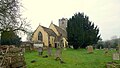 St. Mary's church, Arlingham - geograph.org.uk - 6023205.jpg 1,600 × 901; 687 KB
-
-
 Stump of an old oak tree - geograph.org.uk - 6009413.jpg 1,024 × 683; 214 KB
-
 Surfers ride the Severn Bore - geograph.org.uk - 2277192.jpg 2,816 × 2,112; 1.3 MB
-
 The Meadow, Arlingham - geograph.org.uk - 141790.jpg 640 × 479; 75 KB
-
 The Old Passage Inn, Arlingham - geograph.org.uk - 4116847.jpg 2,307 × 1,705; 801 KB
-
 The Old Passage, Arlingham - geograph.org.uk - 4467812.jpg 640 × 480; 81 KB
-
 The Passage Inn - geograph.org.uk - 6015436.jpg 1,024 × 683; 177 KB
-
 The Red Lion, Arlingham - geograph.org.uk - 6023207.jpg 1,600 × 901; 583 KB
-

-
 The River Severn and May Hill - geograph.org.uk - 685255.jpg 640 × 426; 75 KB
-
 The River Severn at Arlingham - geograph.org.uk - 686327.jpg 640 × 426; 62 KB
-
 The River Severn at Arlingham Warth - geograph.org.uk - 685242.jpg 640 × 426; 106 KB
-
 The River Severn at Broadoak (3) - geograph.org.uk - 3625290.jpg 1,024 × 768; 108 KB
-
 The River Severn at Broadoak - geograph.org.uk - 3625286.jpg 1,024 × 760; 117 KB
-
 The River Severn at low tide - geograph.org.uk - 3699535.jpg 1,024 × 680; 84 KB
-
 The River Severn from Arlingham Warth - geograph.org.uk - 685254.jpg 640 × 426; 74 KB
-
 The River Severn near Arlingham - geograph.org.uk - 685398.jpg 640 × 426; 86 KB
-
 The River Severn near Bullo Pill - geograph.org.uk - 2391337.jpg 3,008 × 2,000; 1.58 MB
-
 The River Severn north-east of Newnham - geograph.org.uk - 5160751.jpg 1,024 × 768; 169 KB
-
 The River Severn opposite Bullo Pill - geograph.org.uk - 684904.jpg 640 × 426; 81 KB
-
 The River Severn winds round Arlingham - geograph.org.uk - 3010228.jpg 3,264 × 2,448; 2.73 MB
-
 The road to Arlingham Passage - geograph.org.uk - 791420.jpg 640 × 426; 76 KB
-
 The Severn at Arlingham - geograph.org.uk - 193852.jpg 640 × 459; 86 KB
-
 The Severn at Newnham - geograph.org.uk - 3686304.jpg 3,264 × 2,448; 3.64 MB
-
 The Severn at Newnham, dark afternoon - geograph.org.uk - 2944465.jpg 1,600 × 1,067; 288 KB
-
 The Severn Bank - geograph.org.uk - 6023215.jpg 1,600 × 900; 445 KB
-
 The Severn Bank, 1 - geograph.org.uk - 6023210.jpg 1,600 × 900; 470 KB


.jpg)


.jpg)


_-_geograph.org.uk_-_2682362.jpg)


.jpg)


_-_geograph.org.uk_-_3625290.jpg)


