Category:Arlesey
Jump to navigation
Jump to search
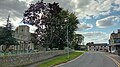
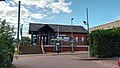
English: Arlesey is a small industrial town and civil parish in the district of Central Bedfordshire in Bedfordshire. It is located on the border with Hertfordshire, about three miles north-west of Letchworth Garden City, four miles north of Hitchin and six miles south of Biggleswade. Arlesey railway station provides train services to London, Peterborough, York and Edinburgh. Arlesey Town Football Club and Arlesey Athletic Football Club have their grounds to the south of the town.
Magyar: Arlesey egy kis város Angliában, Bedfordshire megyében kb. 5500 lakossal. A Közép Bedfordshirei Járási Tanácshoz és a Bedfordshirei Megyei Tanácshoz tartozik. A vasútállomás összeköttetésben áll Londonnal, Peterboroughval, Yorkkal és Edinburghval.
Polski: Arlesey - miasto w Wielkiej Brytanii, w Anglii, w regionie East of England, w hrabstwie Bedfordshire. W 2005r. miasto to zamieszkiwało 5 440 osób.
village-town hybrid and civil parish in Bedfordshire, England, UK  | |||||
| Upload media | |||||
| Instance of | |||||
|---|---|---|---|---|---|
| Location | Central Bedfordshire, Bedfordshire, East of England, England | ||||
| Said to be the same as | Arlesey (Wikimedia duplicated page, civil parish) | ||||
| official website | |||||
 | |||||
Subcategories
This category has the following 8 subcategories, out of 8 total.
A
- St Peter's Church, Arlesey (5 F)
- Arlesey railway station (11 F)
- Arlesey War Memorial (1 F)
B
- Blue Lagoon, Arlesey (9 F)
T
Media in category "Arlesey"
The following 190 files are in this category, out of 190 total.
-
 "Ghost sign", Arlesey - geograph.org.uk - 4584940.jpg 1,004 × 1,441; 222 KB
-
 "The Old Oak" public house, Arlesey - geograph.org.uk - 4584788.jpg 2,020 × 1,372; 598 KB
-
 "The White Horse" public house, Arlesey - geograph.org.uk - 4584964.jpg 1,600 × 1,208; 420 KB
-
 A507 north of Church End - geograph.org.uk - 2522677.jpg 640 × 480; 43 KB
-
 A507 roundabout east of Church End - geograph.org.uk - 2522666.jpg 640 × 480; 41 KB
-
 A507 westbound - geograph.org.uk - 2514802.jpg 640 × 480; 40 KB
-

-
 Arable fields beside the East Coast Main Line - geograph.org.uk - 4001230.jpg 1,600 × 1,137; 181 KB
-
 Arlesey - House Lane - geograph.org.uk - 5283135.jpg 4,608 × 3,456; 6.71 MB
-
 Arlesey Bridge - geograph.org.uk - 5598641.jpg 640 × 428; 138 KB
-
 Arlesey Cemetery - geograph.org.uk - 1921462.jpg 640 × 480; 104 KB
-
 Arlesey church - geograph.org.uk - 5598627.jpg 640 × 428; 138 KB
-

-
 Arlesey Church End, The Vicar's Inn - geograph.org.uk - 1965669.jpg 640 × 480; 68 KB
-
 Arlesey Church End.jpg 4,080 × 2,295; 2.17 MB
-
 Arlesey from the air - geograph.org.uk - 3367480.jpg 640 × 480; 112 KB
-
 Arlesey from the air - geograph.org.uk - 4550000.jpg 3,264 × 2,448; 2.79 MB
-
 Arlesey Methodist Church - geograph.org.uk - 1922694.jpg 640 × 480; 75 KB
-
-
 Arlesey Railway Station - geograph.org.uk - 2922404.jpg 640 × 424; 274 KB
-
 Arlesey Railway Station - geograph.org.uk - 2922405.jpg 640 × 424; 254 KB
-
 Arlesey Railway Station - geograph.org.uk - 4884967.jpg 640 × 457; 63 KB
-
 Arlesey Railway Station - geograph.org.uk - 4884972.jpg 640 × 427; 61 KB
-
 Arlesey Railway Station - geograph.org.uk - 5354382.jpg 640 × 480; 75 KB
-
 Arlesey railway station, Bedfordshire - geograph.org.uk - 3243183.jpg 1,024 × 768; 242 KB
-
 Arlesey Station - geograph.org.uk - 3223075.jpg 2,000 × 1,474; 734 KB
-
 Arlesey Station - geograph.org.uk - 4296891.jpg 1,600 × 1,083; 582 KB
-
 Arlesey station.jpg 3,431 × 1,930; 1.26 MB
-
 Arlesey Village Hall and sign.jpg 3,060 × 3,060; 3 MB
-

-
 Arlesey, Bedfordshire, Tudor cottages.JPG 5,600 × 3,416; 4.01 MB
-

-
 Arlesey, Footpath to Henlow Camp - geograph.org.uk - 1921641.jpg 640 × 474; 83 KB
-
 Arlesey, High Street garage - geograph.org.uk - 1922720.jpg 640 × 480; 66 KB
-

-
 Arlesey, The former Three Tuns - geograph.org.uk - 1922215.jpg 640 × 480; 65 KB
-
 Arlesey, The High Street - geograph.org.uk - 1921780.jpg 640 × 474; 62 KB
-
 Arlesey, The Women's Institute Hall - geograph.org.uk - 1922172.jpg 640 × 478; 51 KB
-
 Arlesey, Village hall and pump - geograph.org.uk - 1922145.jpg 640 × 480; 73 KB
-
 Arlesley Cemetery - geograph.org.uk - 5690142.jpg 4,608 × 3,456; 6 MB
-
 Bench by the path - geograph.org.uk - 2894679.jpg 640 × 480; 135 KB
-
 Bridge over Pix Brook - geograph.org.uk - 4364893.jpg 2,033 × 1,525; 909 KB
-
 Bus to Bedford - geograph.org.uk - 4296906.jpg 1,600 × 1,067; 424 KB
-
 Church End, Arlesey - geograph.org.uk - 4867155.jpg 2,592 × 1,944; 1.78 MB
-
 Church End, Arlesey.jpg 4,080 × 2,295; 1.9 MB
-
 Church of St Peter, Arlesey - geograph.org.uk - 4584815.jpg 1,421 × 1,578; 851 KB
-
 Church of St Peter, Arlesey - geograph.org.uk - 4585430.jpg 1,603 × 2,400; 1.6 MB
-
 Close up of footbridge - geograph.org.uk - 1509906.jpg 640 × 480; 101 KB
-
 Cluny Way, Arlesey - geograph.org.uk - 5997651.jpg 2,048 × 1,536; 1.49 MB
-
 Commemorative plaque, St Peter's Church, Arlesey - geograph.org.uk - 4585327.jpg 1,442 × 1,191; 468 KB
-
 Covered crops, Arlesey - geograph.org.uk - 3099161.jpg 640 × 378; 47 KB
-
 Cricketer's Road, Arlesey - geograph.org.uk - 5997655.jpg 2,048 × 1,536; 1.48 MB
-
 Crop field near Arlesey - geograph.org.uk - 3099157.jpg 640 × 462; 37 KB
-
 Crossing Gate - geograph.org.uk - 474602.jpg 640 × 512; 80 KB
-
 Cycle path - geograph.org.uk - 72533.jpg 640 × 480; 108 KB
-
 Davis Row - geograph.org.uk - 1214277.jpg 640 × 480; 278 KB
-
 Dove Lake House - geograph.org.uk - 3223158.jpg 2,000 × 1,457; 616 KB
-
 Dove Lake House, Church End - geograph.org.uk - 4867158.jpg 2,592 × 1,944; 1.39 MB
-
 Driveway to Etonbury and Dove Lake House - geograph.org.uk - 3223118.jpg 2,000 × 1,500; 1.13 MB
-
 Dugouts at The Armadillo Stadium - geograph.org.uk - 4297756.jpg 1,600 × 1,067; 575 KB
-
 East Coast Main Line at Arlesey (1) - geograph.org.uk - 1922114.jpg 640 × 480; 100 KB
-
 East Coast Main Line at Arlesey (2) - geograph.org.uk - 1923665.jpg 640 × 480; 102 KB
-
 East Coast Main Line at Arlesey - geograph.org.uk - 1921541.jpg 640 × 480; 86 KB
-

-
 Etonbury - geograph.org.uk - 3223135.jpg 2,000 × 1,500; 949 KB
-
 Etonbury Lake House - geograph.org.uk - 2894673.jpg 640 × 480; 72 KB
-
 Fairfield sunrise - geograph.org.uk - 657553.jpg 640 × 378; 78 KB
-
 Farm building, New Ramerwick Farm - geograph.org.uk - 3099154.jpg 640 × 455; 45 KB
-
 Farmland near Pestol Farm - geograph.org.uk - 3099151.jpg 640 × 445; 43 KB
-
 Farmland near Waterloo Farm - geograph.org.uk - 4294487.jpg 2,592 × 1,944; 1.64 MB
-
 Field by Hitchin Road near Letchworth - geograph.org.uk - 5997693.jpg 2,048 × 1,536; 2.17 MB
-
 Field near Arlesley - geograph.org.uk - 5690136.jpg 4,608 × 3,456; 4.83 MB
-

-
 Footbridge at Arlesey Station - geograph.org.uk - 2892615.jpg 640 × 430; 80 KB
-

-

-
 Footbridge, Arlesey Railway Station - geograph.org.uk - 4884969.jpg 640 × 441; 67 KB
-
 Footpath along the field edge - geograph.org.uk - 2894687.jpg 480 × 640; 128 KB
-
 Footpath towards the railway - geograph.org.uk - 2893152.jpg 640 × 427; 120 KB
-
 Fox and Duck - geograph.org.uk - 2894693.jpg 640 × 428; 63 KB
-
 Gas generators - geograph.org.uk - 474628.jpg 640 × 503; 85 KB
-
 Gate to the path over the railway - geograph.org.uk - 2892701.jpg 480 × 640; 134 KB
-
 Gateway to Dove Lake House - geograph.org.uk - 3223125.jpg 2,000 × 1,465; 602 KB
-
 Glebe Meadows - June 2009 - panoramio.jpg 2,288 × 1,712; 834 KB
-
 Glebe Meadows Reserve - geograph.org.uk - 2922408.jpg 640 × 424; 229 KB
-
 Goal - geograph.org.uk - 4297759.jpg 1,600 × 997; 521 KB
-
 GOC Ickleford 011 (7795129964).jpg 4,288 × 3,216; 4.53 MB
-
 GOC Letchworth to Ickleford & Arlesey 067 River Hiz (51273715967).jpg 4,608 × 3,456; 4.74 MB
-
 GOC Letchworth to Ickleford & Arlesey 068 River Hiz (51273715847).jpg 4,608 × 3,456; 5.04 MB
-
 GOC Letchworth to Ickleford & Arlesey 069 River Hiz (51275193799).jpg 4,608 × 3,456; 5.53 MB
-
 GOC Letchworth to Ickleford & Arlesey 070 River Hiz (51275490280).jpg 4,608 × 3,456; 5.48 MB
-
 GOC Letchworth to Ickleford & Arlesey 071 River Hiz (51273715442).jpg 4,608 × 3,456; 5.36 MB
-
 GOC Letchworth to Ickleford & Arlesey 074 River Hiz (51275489940).jpg 4,608 × 3,456; 5.39 MB
-
 GOC Letchworth to Ickleford & Arlesey 075 River Hiz (51274635218).jpg 4,608 × 3,456; 5.05 MB
-
 GOC Letchworth to Ickleford & Arlesey 076 River Hiz (51274634533).jpg 4,608 × 3,456; 5.21 MB
-
 GOC Letchworth to Ickleford & Arlesey 079 River Hiz (51276133021).jpg 4,608 × 3,456; 5.3 MB
-
 GOC Letchworth to Ickleford & Arlesey 080 River Hiz (51276132941).jpg 4,608 × 3,456; 5.48 MB
-
 GOC Letchworth to Ickleford & Arlesey 081 River Hiz (51276860449).jpg 4,608 × 3,456; 5.28 MB
-
 GOC Letchworth to Ickleford & Arlesey 082 River Hiz (51277156040).jpg 4,608 × 3,456; 5.63 MB
-
 GOC Letchworth to Ickleford & Arlesey 083 Field (51275381187).jpg 4,608 × 3,456; 5.25 MB
-
 GOC Letchworth to Ickleford & Arlesey 086 Field (51277155830).jpg 4,608 × 3,456; 5.4 MB
-
 GOC Letchworth to Ickleford & Arlesey 089 Railway (51276860034).jpg 4,608 × 3,456; 5.38 MB
-
 GOC Letchworth to Ickleford & Arlesey 092 Terraced houses in Arlesey (51277155565).jpg 4,608 × 3,456; 5.67 MB
-
 GOC Letchworth to Ickleford & Arlesey 093 Hampden House, Arlesey (51275380707).jpg 4,608 × 3,456; 4.71 MB
-
 GOC Letchworth to Ickleford & Arlesey 096 Hampden House, Arlesey (51277155340).jpg 4,608 × 3,456; 5.16 MB
-
 GOC Radwell-Rivers and Meadows 071 Former Three Counties railway station? (10035469016).jpg 3,702 × 2,781; 2.98 MB
-
 Goods Train from Ickleford Common - geograph.org.uk - 2647205.jpg 3,872 × 2,592; 1.17 MB
-
 Great Expectations - geograph.org.uk - 656213.jpg 640 × 480; 174 KB
-
 Hampden House - geograph.org.uk - 5690153.jpg 4,608 × 3,456; 4.12 MB
-
 Hampden House, Arlesey - geograph.org.uk - 5997672.jpg 2,006 × 1,478; 1.14 MB
-
 Hampden House, Arlesey - geograph.org.uk - 5997674.jpg 2,048 × 1,536; 1.7 MB
-
 High Street Arlesey at the corner of Cricketer's Road - geograph.org.uk - 5997657.jpg 1,870 × 1,274; 930 KB
-
 Houses on Stotfold Road, Arlesey - geograph.org.uk - 5997639.jpg 2,048 × 1,536; 1.53 MB
-
 Houses on Stotfold Road, Arlesey - geograph.org.uk - 5997646.jpg 1,990 × 1,456; 1,006 KB
-
 Land fill site near Ramerick - geograph.org.uk - 1529570.jpg 640 × 419; 37 KB
-
 Landfill site near Arlesey - geograph.org.uk - 2933112.jpg 1,872 × 1,238; 850 KB
-
 Lay-by entrance on the A507 - geograph.org.uk - 6020095.jpg 1,024 × 683; 196 KB
-
 Lay-by exit on the A507 - geograph.org.uk - 6020096.jpg 1,024 × 683; 194 KB
-

-
 Old and new bridges at Arlesey Station - 28th June 2009 - panoramio.jpg 2,288 × 1,712; 873 KB
-
 Old bridge over River Hiz at Arlesey - geograph.org.uk - 3631450.jpg 640 × 480; 75 KB
-
 Old houses on Church Lane in Arlesey - geograph.org.uk - 1281365.jpg 640 × 480; 64 KB
-
 Path to Astwick - geograph.org.uk - 2894691.jpg 640 × 426; 83 KB
-
 Path toward Langford - geograph.org.uk - 2894688.jpg 480 × 640; 95 KB
-
 Path towards Arlesey - geograph.org.uk - 2894676.jpg 480 × 640; 107 KB
-
 Pix Brook and Church End - geograph.org.uk - 4364851.jpg 2,048 × 1,536; 972 KB
-
 Prince of Wales Close, Arlesey - geograph.org.uk - 5997667.jpg 2,048 × 1,536; 1.24 MB
-
 Ramerick Gardens - geograph.org.uk - 530910.jpg 640 × 427; 79 KB
-
 Ramerick Gardens, Arlesey - geograph.org.uk - 5997679.jpg 2,048 × 1,536; 1.43 MB
-
 River Hiz - geograph.org.uk - 2922402.jpg 640 × 424; 244 KB
-
 River Hiz and ponies at Arlesey - geograph.org.uk - 1921613.jpg 640 × 480; 70 KB
-
 River Hiz at Mill Pits Meadow - geograph.org.uk - 1921944.jpg 640 × 480; 59 KB
-
 River Hiz Ickleford Common - geograph.org.uk - 2677866.jpg 2,592 × 3,872; 4.75 MB
-
 River Hiz in Arlesey.jpg 6,016 × 4,000; 12.31 MB
-
 River Hiz near Arlesey Station - 28th June 2009 - panoramio.jpg 2,288 × 1,712; 892 KB
-

-
 River View - geograph.org.uk - 1509886.jpg 480 × 640; 132 KB
-
 Small private road in Arlesey - geograph.org.uk - 5997686.jpg 2,014 × 1,490; 1.51 MB
-
 St Andrews House - geograph.org.uk - 2893175.jpg 640 × 426; 62 KB
-
 St Peter's Church, Arlesey.jpg 3,715 × 2,090; 1.98 MB
-
 Stile on the path to Church End - geograph.org.uk - 2894670.jpg 640 × 480; 119 KB
-
 Stotfold Road, Arlesey - geograph.org.uk - 5997573.jpg 1,948 × 1,392; 1.03 MB
-
 Stotfold Road, Arlesey - geograph.org.uk - 5997641.jpg 1,990 × 1,454; 1.06 MB
-
 Stream and willows, Arlesey - geograph.org.uk - 3223101.jpg 2,000 × 1,500; 1.15 MB
-
 Thatched cottages, Arlesey - geograph.org.uk - 4587286.jpg 1,787 × 1,167; 613 KB
-
 The A507 at Arlesey - geograph.org.uk - 3223114.jpg 2,000 × 1,481; 883 KB
-
 The Blue Lagoon at Letchworth Garden City - geograph.org.uk - 4550017.jpg 3,264 × 2,448; 3.43 MB
-
 The Kingfisher Way near Arlesey - geograph.org.uk - 4867156.jpg 2,592 × 1,944; 2.34 MB
-
 The Old Oak - geograph.org.uk - 2892625.jpg 640 × 429; 59 KB
-
 The Old Oak, Arlesey - geograph.org.uk - 5997622.jpg 1,982 × 1,444; 1.11 MB
-
 The Old School, Arlesey - geograph.org.uk - 3223038.jpg 2,000 × 1,500; 731 KB
-
 The True Briton - geograph.org.uk - 2893177.jpg 640 × 428; 66 KB
-
 The Vicar's Inn - geograph.org.uk - 4296902.jpg 1,600 × 1,067; 455 KB
-
 The way to the Station Car Park - geograph.org.uk - 3223068.jpg 2,000 × 1,398; 646 KB
-
 The White Horse, Arlesey - geograph.org.uk - 5997660.jpg 2,048 × 1,536; 1.55 MB
-

-
 Track near Wilbury Hill - geograph.org.uk - 5690169.jpg 4,608 × 3,456; 5.56 MB
-
 Underneath the A507 - geograph.org.uk - 2894696.jpg 640 × 427; 66 KB
-

-

-

-
 View north from Stotfold Road - geograph.org.uk - 5598621.jpg 640 × 428; 97 KB
-

-

-

-

-

-

-
 View south-east off the railway towards Wilbury Hill - geograph.org.uk - 4575038.jpg 1,600 × 1,064; 266 KB
-
 View to Wilbury Farm - geograph.org.uk - 2375257.jpg 640 × 430; 33 KB
-
 W. I. Hall Arlesey - geograph.org.uk - 5690165.jpg 4,608 × 3,456; 4.85 MB
-

-
 We wuz robbed. - geograph.org.uk - 72509.jpg 640 × 480; 87 KB
-
 Wheat Cadwell Farm, Hitchin Lavender, Hertfordshire - geograph.org.uk - 3547809.jpg 1,024 × 683; 1.05 MB
-
 Woodland near the River Hiz - geograph.org.uk - 3099165.jpg 640 × 465; 52 KB
-
 Young woodland near Church End - geograph.org.uk - 3099172.jpg 640 × 480; 88 KB
-
 Arlesley Cemetery - geograph.org.uk - 387306.jpg 640 × 480; 81 KB
-
 Cement works. - geograph.org.uk - 72495.jpg 640 × 480; 73 KB
-
 Fairfield graveyard. - geograph.org.uk - 72544.jpg 640 × 480; 161 KB
-
 Flash flood - geograph.org.uk - 657563.jpg 640 × 480; 175 KB
-
 Looking towards the Blue Lagoon - geograph.org.uk - 387313.jpg 640 × 480; 69 KB
-
 New bridge - geograph.org.uk - 659373.jpg 640 × 480; 174 KB
-
 Now a day nursery was once a pub - geograph.org.uk - 72506.jpg 640 × 480; 74 KB
-
 Pedestrian Level Crossing - geograph.org.uk - 474594.jpg 640 × 450; 78 KB
-
 Sign of the times - geograph.org.uk - 657577.jpg 480 × 640; 101 KB
-
 Stonehill School. - geograph.org.uk - 105691.jpg 640 × 278; 35 KB
-
 The Biggs Wall building. - geograph.org.uk - 72492.jpg 640 × 480; 73 KB
-
 The house that we might have bought. - geograph.org.uk - 72501.jpg 640 × 480; 106 KB
-
 The Rec - geograph.org.uk - 657572.jpg 640 × 480; 138 KB
-
 The Three Tuns - geograph.org.uk - 72513.jpg 640 × 480; 75 KB


_-_geograph.org.uk_-_1922114.jpg)
_-_geograph.org.uk_-_1923665.jpg)


.jpg)
.jpg)
.jpg)
.jpg)
.jpg)
.jpg)
.jpg)
.jpg)
.jpg)
.jpg)
.jpg)
.jpg)
.jpg)
.jpg)
.jpg)
.jpg)
.jpg)
.jpg)
.jpg)
.jpg)


