Category:Ardwick
Jump to navigation
Jump to search
district of Manchester, England  | |||||
| Upload media | |||||
| Instance of | |||||
|---|---|---|---|---|---|
| Location | Manchester, Greater Manchester, North West England, England | ||||
| Different from | |||||
 | |||||
English: Manchester City Council ward which includes Ardwick and West Gorton
Subcategories
This category has the following 10 subcategories, out of 10 total.
A
- Ardwick Green Barracks (4 F)
- Ardwick train depot (2 F)
B
- Blind Lane, Manchester (3 F)
E
- Ellen Wilkinson High School (2 F)
H
- Hyde Road Bus Depot (5 F)
M
P
S
- St Benedict's Church, Ardwick (16 F)
Media in category "Ardwick"
The following 184 files are in this category, out of 184 total.
-
 "Hippocratic Tree" - geograph.org.uk - 5876591.jpg 640 × 480; 421 KB
-
 "Phalanx" - geograph.org.uk - 5876587.jpg 640 × 480; 378 KB
-
 "Terminal" and "Untitled" - geograph.org.uk - 5876597.jpg 640 × 480; 331 KB
-
 2 and 4 Palfrey Place.jpg 640 × 602; 149 KB
-
 68 Grosvenor Street - geograph.org.uk - 5747861.jpg 1,280 × 960; 1.07 MB
-
 A close look at Enchantment - geograph.org.uk - 5671736.jpg 1,280 × 1,864; 1.68 MB
-
 A large pile of waste - geograph.org.uk - 4249621.jpg 640 × 430; 69 KB
-
 A Manchester Bee by Karl Macauley - geograph.org.uk - 5633794.jpg 1,280 × 1,659; 1.73 MB
-
 A taste of things to come, in Manchester - geograph.org.uk - 689989.jpg 800 × 766; 102 KB
-
 A665 Pin Mill Brow, Ardwick - geograph.org.uk - 3381990.jpg 640 × 480; 64 KB
-
 Amid the demolition work. - geograph.org.uk - 48158.jpg 640 × 480; 67 KB
-
 Approaching Ardwick - geograph.org.uk - 1413625.jpg 640 × 547; 116 KB
-
 Apsley Cottage - geograph.org.uk - 5353045.jpg 4,049 × 2,032; 1.61 MB
-
 Ardwick - geograph.org.uk - 4134145.jpg 3,229 × 2,076; 1.56 MB
-
 Ardwick - geograph.org.uk - 4553476.jpg 4,868 × 2,471; 1.67 MB
-
 Ardwick - geograph.org.uk - 4648105.jpg 5,184 × 3,456; 1.62 MB
-
 Ardwick Conservative Club (former) - geograph.org.uk - 3199433.jpg 640 × 472; 125 KB
-

-
 Ardwick Conservative Club, Shield ^ Date stone - geograph.org.uk - 3199485.jpg 640 × 1,041; 205 KB
-
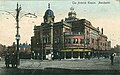 Ardwick Empire postcard.jpg 600 × 376; 105 KB
-
 Ardwick Green South - geograph.org.uk - 5643258.jpg 1,280 × 912; 795 KB
-
 Ardwick Industrial Sewing Machines - geograph.org.uk - 3347650.jpg 640 × 429; 118 KB
-
 Ardwick Lads Club - geograph.org.uk - 1928443.jpg 3,872 × 2,475; 3.54 MB
-
 Ardwick Station - geograph.org.uk - 6113205.jpg 1,280 × 970; 1.06 MB
-
 Ardwick, Manchester College - geograph.org.uk - 1137121.jpg 640 × 480; 49 KB
-
 Ardwick, obelisk - geograph.org.uk - 1137082.jpg 480 × 640; 57 KB
-
 Bee Sculpture in Gartside Gardens - geograph.org.uk - 5633775.jpg 1,280 × 1,022; 1.13 MB
-
 Bending Figure in Whitworth Park - geograph.org.uk - 5843423.jpg 765 × 1,024; 853 KB
-
 Bending in Whitworth Park - geograph.org.uk - 5889357.jpg 1,280 × 960; 1.57 MB
-
 Bending in Whitworth Park - geograph.org.uk - 5889369.jpg 1,280 × 960; 1.4 MB
-
 Bloom, Flourish, Thrive - geograph.org.uk - 5634241.jpg 1,280 × 895; 744 KB
-
 Building work on Grosvenor Street - geograph.org.uk - 5747553.jpg 1,280 × 960; 883 KB
-
 Bus Depot - geograph.org.uk - 4383521.jpg 640 × 372; 45 KB
-
 Bus Depot - geograph.org.uk - 4742312.jpg 640 × 426; 43 KB
-
 Bus depot, Ardwick - geograph.org.uk - 3574319.jpg 1,600 × 899; 267 KB
-
 Bus park - geograph.org.uk - 4829725.jpg 640 × 426; 53 KB
-
 But he did not want to shoot the elephant - geograph.org.uk - 5843428.jpg 1,024 × 771; 1.37 MB
-
 Cariocca Business Park - geograph.org.uk - 5671708.jpg 1,280 × 960; 870 KB
-
 Chancellors Sandwich Bar, Ardwick.jpg 5,152 × 3,864; 7.83 MB
-
 Charlton Place - geograph.org.uk - 6305970.jpg 1,280 × 960; 907 KB
-
 Container store - geograph.org.uk - 4645809.jpg 640 × 426; 48 KB
-
 Container Store - geograph.org.uk - 4645811.jpg 640 × 426; 61 KB
-
 Containers, Ardwick - geograph.org.uk - 3705464.jpg 640 × 362; 39 KB
-
 Containers, Ardwick - geograph.org.uk - 3826595.jpg 640 × 430; 55 KB
-
 Containers, Ardwick, by the railway line - geograph.org.uk - 3574211.jpg 1,600 × 899; 256 KB
-
 Containers, Ardwick, by the railway line - geograph.org.uk - 3574214.jpg 1,600 × 899; 270 KB
-
 Converting the Unitarian Chapel - geograph.org.uk - 5634248.jpg 1,280 × 1,057; 806 KB
-
 Council houses in Ardwick - panoramio.jpg 2,048 × 1,536; 1.05 MB
-
 Crown Knitware Ltd, Manchester.jpg 5,152 × 3,864; 7.66 MB
-
 Crown Knitwear - geograph.org.uk - 2117849.jpg 640 × 393; 102 KB
-
 Cycle and pedestrian lane near Ardwick - geograph.org.uk - 4750636.jpg 1,024 × 576; 170 KB
-
 Cycle path on Oxford Road - geograph.org.uk - 5876613.jpg 640 × 480; 298 KB
-
 Daffodils on Downing Street - geograph.org.uk - 6308072.jpg 1,280 × 1,707; 2.2 MB
-
 Dark Lane, Ardwick - geograph.org.uk - 3365602.jpg 640 × 480; 60 KB
-
 Demolition work on Plymouth View - geograph.org.uk - 5635198.jpg 1,280 × 850; 817 KB
-
 Denmark Road - geograph.org.uk - 5765444.jpg 1,280 × 1,020; 916 KB
-
 Devonshire Street North - geograph.org.uk - 1865646.jpg 640 × 495; 124 KB
-
 Dilworth Street - geograph.org.uk - 6035492.jpg 1,280 × 960; 1.14 MB
-
 Disfigured, Empty and Truncated - geograph.org.uk - 5765008.jpg 1,280 × 1,280; 1,018 KB
-
 Disfigured, Front View - geograph.org.uk - 5764943.jpg 1,280 × 1,818; 1.18 MB
-
 Disfigured, Rear View - geograph.org.uk - 5764881.jpg 1,280 × 960; 1.27 MB
-
 Disused Railway Viaduct - geograph.org.uk - 6358303.jpg 4,496 × 3,069; 2.01 MB
-
 Dolphin Street - geograph.org.uk - 3198622.jpg 640 × 627; 153 KB
-
 Electrical Clearance Sale - geograph.org.uk - 3826567.jpg 640 × 430; 41 KB
-
 Enchantment by Joseph Ayavoro - geograph.org.uk - 5671732.jpg 1,280 × 1,110; 1.49 MB
-
 Entrance to St Saviour's - geograph.org.uk - 5635197.jpg 1,280 × 952; 1.2 MB
-
 Fenian ambush location manchester martyrs.jpg 3,402 × 2,176; 1.67 MB
-
 Fenian ambush plaque hyde road.jpg 3,429 × 2,251; 2.08 MB
-
 Fenton House, Ardwick.jpg 640 × 486; 127 KB
-
 Former Church Inn, Ardwick.jpg 5,152 × 3,864; 7.87 MB
-
 Former church, West Gorton, Manchester - geograph.org.uk - 5894159.jpg 1,600 × 1,065; 382 KB
-
 Former Conservative Club, Ardwick.jpg 5,152 × 3,864; 7.24 MB
-
 Former Nicholls Hospital.jpg 800 × 600; 116 KB
-
 Former St Benedict's church, Ardwick - geograph.org.uk - 4698628.jpg 640 × 480; 184 KB
-
 Garden behind the Whitworth Art Gallery - geograph.org.uk - 6253657.jpg 800 × 600; 398 KB
-
 Gartside Gardens - geograph.org.uk - 5633717.jpg 1,280 × 1,019; 904 KB
-
 Gemini Takeaway - geograph.org.uk - 6164885.jpg 1,280 × 977; 1.19 MB
-
 Great Universal Square - geograph.org.uk - 4742310.jpg 640 × 426; 65 KB
-
 Greenheys, Christchurch - geograph.org.uk - 6058909.jpg 1,024 × 743; 140 KB
-
 Greenheys, gurduwara - geograph.org.uk - 6058905.jpg 1,024 × 757; 156 KB
-
 Greenheys, Polish RC church - geograph.org.uk - 6058900.jpg 1,024 × 762; 149 KB
-
 Hellidon Close - geograph.org.uk - 5671961.jpg 1,280 × 960; 1.08 MB
-
 Higher Ardwick - geograph.org.uk - 2482253.jpg 640 × 496; 136 KB
-
 Higher Ardwick - geograph.org.uk - 3199470.jpg 640 × 376; 102 KB
-
 Hoyle Street - geograph.org.uk - 5155339.jpg 4,012 × 3,234; 1.94 MB
-
 Hyde Road - geograph.org.uk - 6235308.jpg 1,280 × 928; 696 KB
-
 Hyde Road - geograph.org.uk - 6358201.jpg 5,367 × 4,000; 1.84 MB
-
 Hyde Road, Ancoats - geograph.org.uk - 6013338.jpg 1,280 × 878; 739 KB
-
 ICL Tower - geograph.org.uk - 5724500.jpg 3,456 × 5,184; 1.8 MB
-
 Industry, Ardwick - geograph.org.uk - 4249631.jpg 640 × 430; 45 KB
-
 Kings Head Hotel - geograph.org.uk - 4134141.jpg 3,572 × 1,882; 1.77 MB
-
 Lime Bank Street - geograph.org.uk - 6358300.jpg 5,940 × 4,000; 1.85 MB
-
 Lime Bank Street, Ardwick - geograph.org.uk - 3381954.jpg 640 × 480; 62 KB
-
 Manchester Corporation Tramways Employees War Memorial - geograph.org.uk - 6235316.jpg 3,000 × 2,493; 5.97 MB
-
 Manchester Royal Infirmary - geograph.org.uk - 6059008.jpg 1,024 × 753; 182 KB
-
 Manchester, eye hospital - geograph.org.uk - 6059007.jpg 1,024 × 745; 155 KB
-
 Manchester, Whitworth Gallery - geograph.org.uk - 6058922.jpg 1,024 × 768; 224 KB
-
 Mancunian Way flyover - geograph.org.uk - 6309159.jpg 1,280 × 960; 1.01 MB
-
 Mancunian Way, Ardwick - geograph.org.uk - 3382006.jpg 640 × 480; 68 KB
-
 Manor Street, Ardwick.jpg 640 × 445; 149 KB
-

-
 Metal tree sculpture in Whitworth Park - geograph.org.uk - 5876586.jpg 314 × 640; 269 KB
-
 Meteor Fall in Whitworth Park^ - geograph.org.uk - 5844395.jpg 800 × 600; 995 KB
-
 Mineral processing plant near Ashburys Station - geograph.org.uk - 2482211.jpg 1,600 × 1,185; 380 KB
-
 New Engineering Building - geograph.org.uk - 5892908.jpg 678 × 1,024; 133 KB
-
 New Gaelic Club - geograph.org.uk - 3199341.jpg 640 × 547; 140 KB
-
 New Houses - geograph.org.uk - 6198916.jpg 3,194 × 3,522; 1.94 MB
-
 New houses on Grosvenor Street - geograph.org.uk - 5747559.jpg 1,280 × 960; 905 KB
-
 North Chadderton School Bee - geograph.org.uk - 5994613.jpg 1,280 × 1,447; 1.17 MB
-

-
 Not too Shab-bee - geograph.org.uk - 5994569.jpg 1,280 × 1,170; 982 KB
-
 O2 Apollo Manchester - geograph.org.uk - 6013335.jpg 1,280 × 1,085; 1.02 MB
-
 Oddfellows Hall - geograph.org.uk - 5682046.jpg 1,280 × 859; 676 KB
-
 Old Milestone by the A6, Ardwick Green - geograph.org.uk - 6035989.jpg 1,059 × 1,608; 307 KB
-

-
 Park Ices - geograph.org.uk - 5889573.jpg 1,280 × 960; 1.16 MB
-
 Parlour, 62 Nelson Street - geograph.org.uk - 5848664.jpg 800 × 544; 511 KB
-
 Petrol Filling Station - Devonshire Street - geograph.org.uk - 2460454.jpg 3,737 × 2,616; 3.19 MB
-
 Pin Mill Brow - geograph.org.uk - 3242386.jpg 640 × 434; 105 KB
-
 Polygon Avenue, Ardwick.jpg 3,072 × 2,304; 1.84 MB
-
 Preparing for battle - geograph.org.uk - 5876601.jpg 640 × 481; 320 KB
-

-
 Railway sidings, Longsight - geograph.org.uk - 5894153.jpg 1,600 × 1,065; 457 KB
-
 Rear of the Kings Head - geograph.org.uk - 2599547.jpg 640 × 372; 112 KB
-
 Road sign storage depot at Ardwick - geograph.org.uk - 2477719.jpg 1,600 × 1,198; 323 KB
-
 Rusholme, Ford Madox Brown - geograph.org.uk - 6058882.jpg 1,024 × 743; 191 KB
-
 Saltford Court - geograph.org.uk - 4262952.jpg 2,592 × 2,931; 1.78 MB
-
 Saltford Court - geograph.org.uk - 4263136.jpg 2,592 × 3,253; 1.83 MB
-
 Saltford Court - geograph.org.uk - 4263139.jpg 2,592 × 2,920; 1.84 MB
-
 Service station on Chancellor Lane - geograph.org.uk - 3365349.jpg 640 × 480; 46 KB
-
 Shop parade ^ Artillery Court, Ardwick - panoramio.jpg 3,072 × 2,304; 1.66 MB
-
 Shops on Stockport Road - geograph.org.uk - 5671969.jpg 1,280 × 960; 861 KB
-
 Site of the Bowling Green - geograph.org.uk - 5635266.jpg 1,280 × 960; 751 KB
-
 Spicy Grill - geograph.org.uk - 3199365.jpg 640 × 519; 136 KB
-
 Spicy Grill - geograph.org.uk - 3347750.jpg 640 × 499; 130 KB
-
 Spicy Grill - geograph.org.uk - 4723719.jpg 5,184 × 2,606; 1.78 MB
-
 Spicy Grill, Ardwick.jpg 5,152 × 3,864; 7.75 MB
-

-
 St Mary's Hospital, Oxford Road - geograph.org.uk - 5764181.jpg 1,280 × 1,021; 1.18 MB
-
 St Saviour's churchyard - geograph.org.uk - 5635207.jpg 1,280 × 960; 1.18 MB
-
 St Thomas's Parish Room - geograph.org.uk - 2863848.jpg 640 × 480; 148 KB
-
 Stalled Development - geograph.org.uk - 6358204.jpg 4,000 × 4,961; 1.84 MB
-
 Stockport Road - geograph.org.uk - 5671965.jpg 1,280 × 960; 791 KB
-
 Stockport Road - geograph.org.uk - 5671971.jpg 1,280 × 910; 722 KB
-
 Street Art on Charlton Place - geograph.org.uk - 6305988.jpg 1,280 × 1,707; 1.43 MB
-
 Tai Pan - geograph.org.uk - 5634391.jpg 1,280 × 923; 680 KB
-
 The back of the King's Head - geograph.org.uk - 4991670.jpg 1,000 × 721; 499 KB
-
 The Cleveland - geograph.org.uk - 5724431.jpg 5,184 × 3,250; 1.55 MB
-
 The Gaelic Bar, Ardwick.jpg 5,152 × 3,864; 7.87 MB
-
 The Ken Shone Centre Circle - geograph.org.uk - 5876574.jpg 640 × 480; 302 KB
-
 The Pankhurst Centre, Manchester - geograph.org.uk - 5848647.jpg 800 × 533; 532 KB
-
 The Whitworth Art Gallery - geograph.org.uk - 5844465.jpg 900 × 600; 1.02 MB
-
 The Whitworth Park Obelisk - geograph.org.uk - 5843430.jpg 800 × 600; 861 KB
-
 St Thomas Centre, Ardwick.jpg 5,152 × 3,864; 7.78 MB
-
 To the bunker - geograph.org.uk - 1312544.jpg 640 × 480; 109 KB
-
 Total Furniture Warehouse - geograph.org.uk - 3347585.jpg 640 × 480; 140 KB
-
 Traffic counter on Oxford Road - geograph.org.uk - 5876620.jpg 480 × 640; 296 KB
-
 Tree of heaven (Ailanthus altissima) - geograph.org.uk - 5765425.jpg 1,280 × 1,707; 2.23 MB
-
 Union Street, Ardwick - geograph.org.uk - 3199548.jpg 640 × 480; 131 KB
-
 Unitarian Chapel conversion - geograph.org.uk - 5634161.jpg 1,280 × 975; 831 KB
-
 Unity - geograph.org.uk - 5994563.jpg 1,280 × 1,449; 1.06 MB
-
 Universal Building - geograph.org.uk - 5336080.jpg 640 × 426; 57 KB
-
 Universal Buildings - geograph.org.uk - 4318889.jpg 640 × 430; 64 KB
-
 Universal Buildings - geograph.org.uk - 4383523.jpg 640 × 430; 61 KB
-
 Universal Buildings - geograph.org.uk - 4645799.jpg 640 × 426; 57 KB
-
 Universal Buildings - geograph.org.uk - 4807744.jpg 640 × 430; 48 KB
-

-

-
 Universal Square - geograph.org.uk - 1865658.jpg 604 × 640; 137 KB
-
 Universal Square - geograph.org.uk - 4383522.jpg 640 × 430; 55 KB
-
 Universal Square - geograph.org.uk - 5336086.jpg 640 × 426; 49 KB
-
 Waste tip near Ardwick Station - geograph.org.uk - 2681308.jpg 800 × 535; 90 KB
-
 Waste to Energy - geograph.org.uk - 2599525.jpg 640 × 487; 159 KB
-
 West of Ashburys - geograph.org.uk - 1006478.jpg 640 × 387; 98 KB
-
 Wex photo video - geograph.org.uk - 6308062.jpg 1,280 × 960; 911 KB
-
 Whitworth Gallery, Manchester - geograph.org.uk - 6362941.jpg 1,024 × 643; 159 KB
-
 Whitworth Park - geograph.org.uk - 5889565.jpg 1,280 × 960; 1.31 MB
-
 Whitworth Park - geograph.org.uk - 5942610.jpg 1,024 × 768; 312 KB
-
 Whitworth Park, Edward VII Statue - geograph.org.uk - 5844429.jpg 640 × 852; 1,002 KB
-
 William Street, Ardwick - geograph.org.uk - 3365604.jpg 640 × 480; 47 KB
-
 World War One Memorial in Whitworth Park - geograph.org.uk - 5994462.jpg 1,280 × 960; 1.18 MB
-
 World War One Memorial in Whitworth Park - geograph.org.uk - 5994468.jpg 1,280 × 1,707; 1.77 MB
-

-
 Yellow - geograph.org.uk - 4323009.jpg 3,888 × 2,262; 1.62 MB


_-_geograph.org.uk_-_3199433.jpg)


_-_geograph.org.uk_-_5765425.jpg)


