Category:Archaeological sites in County Clare
Jump to navigation
Jump to search
Counties of the Republic of Ireland: Carlow · Cavan · Clare · Cork(1) · Donegal · Dún Laoghaire-Rathdown(2) · Fingal(2) · Galway(3) · Kerry · Kildare · Kilkenny · Laois · Leitrim · Limerick · Longford · Louth · Mayo · Meath · Monaghan · Offaly · Roscommon · Sligo · South Dublin(2) · Tipperary(4) · Waterford · Westmeath · Wexford · Wicklow – Separate cities: – Former counties: Dublin(2) · Former counties of Northern Ireland: Antrim · Armagh · Down · Fermanagh · Londonderry · Tyrone
Wikimedia category | |||||
| Upload media | |||||
| Instance of | |||||
|---|---|---|---|---|---|
| Category combines topics | |||||
| County Clare | |||||
county in Ireland    | |||||
| Instance of | |||||
| Location |
| ||||
| Capital | |||||
| Legislative body |
| ||||
| Executive body |
| ||||
| Population |
| ||||
| Area |
| ||||
| official website | |||||
 | |||||

Subcategories
This category has the following 17 subcategories, out of 17 total.
B
- Ballyallaban Ring Fort (18 F)
- Bohateh North wedge tomb (2 F)
C
- Caherconnell (9 F)
- Caherdooneerish Stone Fort (5 F)
- Cashlaungarr (3 F)
- Cathair Chomain Fort (1 F)
- Creevagh Tomb (5 F)
H
I
- Inchicronan Priory (1 F)
- Inneenboy Cross (1 F)
M
- Mooghaun Hillfort (3 F)
P
- Poulnabrone (159 F)
R
T
- Tobercornan Well (6 F)
Media in category "Archaeological sites in County Clare"
The following 26 files are in this category, out of 26 total.
-
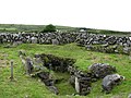
 Approach to the Leaba wedge tomb - geograph.org.uk - 951133.jpg 640 × 456; 136 KB
-

-
 Brian's rath at Killaloe, 1905.jpg 1,687 × 2,244; 784 KB
-
 Burren - near Green Road - Wedge Tomb - panoramio.jpg 1,500 × 1,125; 1.52 MB
-
 Burren caherconnelfort interior.jpg 3,264 × 2,448; 4.8 MB
-
 Cahercommaun close up.jpg 3,456 × 1,944; 3.13 MB
-
 Cahercommaun distant view.jpg 3,456 × 1,944; 2.98 MB
-
 Cahercommaun info sign.jpg 3,456 × 1,944; 2.79 MB
-
 Caherdooneerish Ring Fort - geograph.org.uk - 2091902.jpg 3,023 × 1,560; 2.96 MB
-
 Cahermacnaughten - geograph.org.uk - 3567335.jpg 640 × 480; 98 KB
-
 Carn connachtan.jpg 1,000 × 610; 89 KB
-
 Cashlaungar from the east.jpg 3,456 × 1,944; 3.22 MB
-
 Cashlaungar from the southwest.jpg 3,456 × 1,944; 3.07 MB
-
 Cathair Chlogain - geograph.org.uk - 832985.jpg 640 × 480; 108 KB
-

-

-

-
 Cathair Dhúin Irghuis - geograph.org.uk - 1992926.jpg 1,500 × 974; 520 KB
-
 Cathair Mhic Neachtain, north of Noughaval - geograph.org.uk - 65563.jpg 640 × 426; 111 KB
-

-
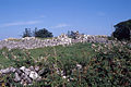
 Magh Adhair, Toonagh, Co Clare (geograph 1954103).jpg 640 × 480; 158 KB
-
 Megalith Calluragh.jpg 1,200 × 801; 144 KB
-

-
 Tau Cross, Roughan Hill, Corofin, County Clare, Ireland.jpg 1,632 × 1,224; 466 KB
-
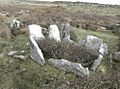 Teergonean court cairn.jpg 1,000 × 740; 167 KB
-
 Wedge tomb Luogh.jpg 1,200 × 805; 123 KB


.jpg)


