Category:April 2019 in the East Riding of Yorkshire
Jump to navigation
Jump to search
Ceremonial counties of England: Berkshire · Buckinghamshire · Cambridgeshire · Cheshire · Cornwall · Cumbria · Derbyshire · Devon · Durham · East Riding of Yorkshire · East Sussex · Essex · Gloucestershire · Greater London · Greater Manchester · Hampshire · Herefordshire · Isle of Wight · Kent · Lancashire · Leicestershire · Lincolnshire · Merseyside · Norfolk · North Yorkshire · Northamptonshire · Nottinghamshire · Oxfordshire · Shropshire · Somerset · South Yorkshire · Staffordshire · Surrey · Warwickshire · West Midlands · West Sussex · West Yorkshire · Worcestershire
City-counties: Bristol ·
Former historic counties:
Other former counties:
City-counties: Bristol ·
Former historic counties:
Other former counties:
Deutsch: Bilder, die im April 2019 in the East Riding of Yorkshire aufgenommen worden sind. Bitte beachten Sie, dass dies weder das Datum des Uploads noch das Datum des Scannens eines Fotos ist.
English: Images/pictures taken in the East Riding of Yorkshire during April 2019. Note this is not the date of the upload, nor the date a photo was scanned.
Español: Fotografías o imágenes tomadas en the East Riding of Yorkshire durante abril 2019. No es la fecha de subida ni escaneo, sino la fecha en que las fotografías o imágenes se crearon.
Esperanto: Bildoj faritaj en the East Riding of Yorkshire en aprilo 2019. Tio ne estas la dato, kiam la bildoj estis alŝutitaj aŭ skanitaj.
Français : Photographies ou images prises en the East Riding of Yorkshire durant avril 2019. Ce n'est pas la date du téléchargement ou du scan.
Galego: Fotografías ou imaxes tomadas en the East Riding of Yorkshire durante abril 2019. Non é a data de subida nin escaneamento, senón a data na que se crearon as fotografías ou imaxes.
Italiano: Fotografie o immagini scattate a the East Riding of Yorkshire nel aprile 2019. Nota bene: la data non si riferisce né a quella di upload né a quella in cui la foto è stata digitalizzata.
Norsk bokmål: Bilder tatt i the East Riding of Yorkshire i løpet av april 2019. Merk at dette ikke er datoen for opplasting, eller når et bilde har blitt skannet.
Norsk nynorsk: Bilete teke i the East Riding of Yorkshire i løpet av april 2019. Merk at dette ikkje er datoen for opplasting, eller når eit bilete har vorte skanna.
Русский: Изображения, сделанные в the East Riding of Yorkshire в течение апрель 2019 (не дата загрузки изображения).
Українська: Зображення, зроблені в the East Riding of Yorkshire протягом квітень 2019. Зауважте, що це не дата завантаження чи дата сканування фотографії.
| April 2018 | ← | April 2019 | → | April 2020 | |||||||
| Jan | Feb | Mar | Apr | May | Jun | Jul | Aug | Sep | Oct | Nov | Dec |
| 11 | 18 | 83 | 157 | 55 | 8 | 2 | 71 | 30 | 24 | 6 | 130 |
|---|---|---|---|---|---|---|---|---|---|---|---|
Media in category "April 2019 in the East Riding of Yorkshire"
The following 157 files are in this category, out of 157 total.
-
 A brief moment of quiet on the A1079 (geograph 6106349).jpg 1,024 × 768; 105 KB
-
 Approaching Mill Lane, Huggate (geograph 6108195).jpg 3,648 × 2,736; 3.81 MB
-
 Beverley 20 at Beverley Parks (geograph 6116055).jpg 1,024 × 768; 233 KB
-
 Beverley Parks level crossing (geograph 6116048).jpg 1,024 × 768; 141 KB
-
 Blackthorn by the roadside (geograph 6111242).jpg 1,600 × 1,067; 541 KB
-
 Blackthorn Hedge on Cony Hill (geograph 6109625).jpg 1,600 × 1,102; 667 KB
-
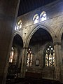
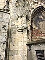
 Blind arcading inside west wall 1.jpg 2,448 × 3,264; 1.3 MB
-
 Blind arcading inside west wall 2.jpg 2,448 × 3,264; 1.57 MB
-
 Blind arcading inside west wall 3.jpg 3,264 × 2,448; 1.51 MB
-
 Blind arcading inside west wall 4.jpg 3,264 × 2,448; 1.33 MB
-
 Bridleway towards Great Gutter Lane (geograph 6116522).jpg 800 × 613; 120 KB
-
 Brindleys Lane (geograph 6131499).jpg 1,024 × 768; 238 KB
-
 Bungalows on Springfield Way, Anlaby (geograph 6129966).jpg 800 × 550; 112 KB
-
 Bus stop and shelter on Kingston Road (B1232) (geograph 6116493).jpg 5,184 × 3,888; 4.47 MB
-

-
 Bus stop and shelter, Anlaby - geograph.org.uk - 6129950.jpg 800 × 533; 100 KB
-
 Cemetery in Kirk Ella (geograph 6117494).jpg 800 × 600; 178 KB
-
 Christ Church, Southella (geograph 6129969).jpg 800 × 508; 102 KB
-
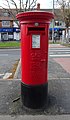
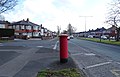
 Close up, Elizabeth II postbox on Well Lane, Willerby (geograph 6116553).jpg 2,144 × 3,284; 1.4 MB
-
 Disused George V postbox on Wolfreton Road, Willerby (geograph 6116549).jpg 1,711 × 3,169; 814 KB
-
 East front.jpg 3,264 × 2,448; 2.06 MB
-
 Elizabeth II postbox on Kingston Road, Willerby (geograph 6117377).jpg 2,448 × 4,210; 2.32 MB
-
 Elizabeth II postbox on Mill Lane, Kirk Ella (geograph 6116528).jpg 2,349 × 4,373; 2.93 MB
-
 Elizabeth II postbox on South Ella Way, Kirk Ella (geograph 6117405).jpg 2,660 × 4,693; 3.37 MB
-
 Elizabeth II postbox on Well Lane, Willerby (geograph 6116552).jpg 5,184 × 3,888; 5.46 MB
-
 Elizabeth II postbox on Wolfreton Road, Willerby (geograph 6116538).jpg 2,594 × 5,159; 2.12 MB
-
 Elizabeth II postbox, supermarket, Anlaby (geograph 6117705).jpg 1,638 × 3,072; 894 KB
-
 Elizabeth II postbox, Waitrose, Willerby (geograph 6117644).jpg 2,505 × 4,521; 2.4 MB
-
 Entrance to Haltemprice Crematorium (geograph 6115851).jpg 800 × 419; 69 KB
-
 Entrance to Spire Hull and East Riding Hospital (geograph 6117732).jpg 5,184 × 3,888; 4.81 MB
-
 Entrance to supermarket, Anlaby (geograph 6117707).jpg 4,631 × 3,495; 2.55 MB
-
 Entrance to Wressle Grange (geograph 6131481).jpg 1,024 × 768; 271 KB
-
 Farmland near Beverley (geograph 6116037).jpg 1,024 × 696; 167 KB
-
 Field entrance off National Cycle Route 1 (geograph 6115845).jpg 800 × 522; 97 KB
-
 Fields near Woodmansey (geograph 6116042).jpg 1,024 × 768; 106 KB
-
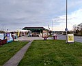 Filling station on the A164 (geograph 6126760).jpg 1,280 × 1,035; 884 KB
-
 Foot and cycle path (geograph 6127473).jpg 1,280 × 960; 1.39 MB
-
 Former Willerby Primitive Methodist chapel (geograph 6116497).jpg 800 × 543; 106 KB
-
 Gates and wires off York Road - geograph.org.uk - 6136068.jpg 1,024 × 768; 170 KB
-
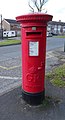
 George V postbox on Kingston Road (B1232) (geograph 6116056).jpg 2,312 × 4,361; 2.06 MB
-
 George V postbox on Kingston Road, Willerby (geograph 6117363).jpg 347 × 640; 61 KB
-
 George V postbox on Kingston Road, Willerby (geograph 6117389).jpg 2,496 × 4,537; 2.78 MB
-
 George V postbox on South Ella Drive, Kirk Ella (geograph 6117384).jpg 2,182 × 4,443; 2.11 MB
-
 George V postbox on The Parkway, Willerby (geograph 6117648).jpg 2,368 × 4,357; 2.7 MB
-
 Goole anglers fishing pond (geograph 6131469).jpg 1,024 × 768; 246 KB
-
 Great east window interior jamb 1.jpg 2,448 × 3,264; 2.55 MB
-
 Great Gutter Lane East (geograph 6127464).jpg 1,280 × 960; 797 KB
-
 Hornsea Rail Trail at Whitedale (geograph 6121809).jpg 4,103 × 2,635; 2.34 MB
-
 Hotel gardens (geograph 6170179).jpg 1,200 × 1,600; 311 KB
-
 Houses and Old Station at Whitedale (geograph 6121806).jpg 5,221 × 3,256; 2.37 MB
-
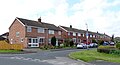
 Houses on Annandale Road, Kirk Ella (geograph 6116506).jpg 800 × 600; 150 KB
-
 Houses on Kingston Road (geograph 6116488).jpg 800 × 561; 105 KB
-
 Houses on Kingston Road (geograph 6116490).jpg 800 × 503; 139 KB
-
 Houses on Kingston Road, Willerby (geograph 6117364).jpg 4,499 × 3,011; 2.97 MB
-
 Houses on Kirk Rise, Kirk Ella (geograph 6117491).jpg 640 × 347; 51 KB
-
 Houses on Main Street, Willerby (geograph 6115869).jpg 640 × 487; 82 KB
-
 Houses on Wolfreton Road, Anlaby (geograph 6129963).jpg 800 × 600; 109 KB
-
 Houses on Wolfreton Road, Anlaby (geograph 6129965).jpg 800 × 570; 115 KB
-
 Hull Road, Withernsea (geograph 6121623).jpg 4,312 × 2,897; 1.35 MB
-
 Intake Plantation (geograph 6131493).jpg 1,024 × 768; 225 KB
-
 K6 telephone box on Kingston Road (geograph 6116487).jpg 800 × 600; 121 KB
-
 K6 telephone box on West Ella Road, Kirk Ella (geograph 6117484).jpg 800 × 579; 166 KB
-
 Kingston Road (B1232) (geograph 6116057).jpg 800 × 661; 190 KB
-
 Kingston Road (B1232) (geograph 6116060).jpg 4,759 × 3,047; 3.16 MB
-
 Kingston Road (B1232) (geograph 6116061).jpg 4,399 × 3,009; 3.06 MB
-
 Kingston Road (B1232) approaching roundabout (geograph 6116492).jpg 800 × 531; 114 KB
-
 Kingston Road, Willerby (geograph 6117365).jpg 5,184 × 3,888; 4.14 MB
-
 Kingston Road, Willerby (geograph 6117366).jpg 4,749 × 3,048; 2.54 MB
-
 Kingston Road, Willerby (geograph 6117381).jpg 4,939 × 3,323; 4.33 MB
-
 Kingston Road, Willerby (geograph 6117391).jpg 4,780 × 3,426; 3.35 MB
-
 Kingston Road, Willerby (geograph 6117392).jpg 4,528 × 3,010; 2.69 MB
-
 Kirk Ella Police Station (geograph 6116503).jpg 800 × 534; 104 KB
-
 Lodge on Willerby Low Road (geograph 6115840).jpg 800 × 545; 103 KB
-
 Looking across nave.jpg 2,448 × 3,264; 1.66 MB
-
 Looking northwest from centre of ruins.jpg 2,448 × 3,264; 1.94 MB
-
 Looking over Willerby (geograph 6170182).jpg 1,280 × 960; 1.09 MB
-
 Main Street, Willerby (geograph 6127926).jpg 1,280 × 960; 975 KB
-
 McDonald's, Willerby Grange (geograph 6115867).jpg 800 × 539; 96 KB
-
 Mercure Hull Park Hotel (geograph 6126744).jpg 1,280 × 960; 938 KB
-
 Mill Lane, Kirk Ella (geograph 6116531).jpg 4,331 × 3,127; 2.41 MB
-
 Mill Lane, Kirk Ella (geograph 6116532).jpg 800 × 498; 70 KB
-
 Mill Lane, Kirk Ella (geograph 6116533).jpg 4,387 × 2,807; 2.28 MB
-
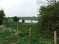
 Minster Way through the Rape (geograph 6108672).jpg 1,024 × 768; 167 KB
-
 National Cycle Route 1 (geograph 6115842).jpg 800 × 600; 97 KB
-
 National Cycle Route 1 (geograph 6115843).jpg 800 × 600; 104 KB
-
 National Cycle Route 1 towards Willerby (geograph 6115847).jpg 800 × 600; 139 KB
-
 Near Sutton Wood - geograph.org.uk - 6116929.jpg 2,048 × 1,536; 950 KB
-
 North aisle window 1.jpg 2,448 × 3,264; 2.57 MB
-
 Oaklands Drive (geograph 6127518).jpg 1,280 × 940; 834 KB
-
 Old Railway Fence Posts (geograph 6121820).jpg 1,600 × 1,095; 822 KB
-
 Old Walls by the Station (geograph 6121796).jpg 4,917 × 2,937; 3.08 MB
-
 Path across Huggate Heads (geograph 6108199).jpg 3,648 × 2,736; 3.76 MB
-
 Public house and flats on South Ella Way (geograph 6129973).jpg 800 × 456; 72 KB
-
 Remains of the choir elevation.jpg 2,448 × 3,264; 1.74 MB
-
 Road near Burnbutts (geograph 6108662).jpg 1,024 × 768; 190 KB
-
 Roundabout on Kingston Road (B1232) (geograph 6116499).jpg 800 × 499; 101 KB
-
 Ruin by the track (geograph 6108676).jpg 1,024 × 768; 297 KB
-
 Service station on the A164, Willerby (geograph 6115852).jpg 800 × 600; 121 KB
-
 Service station on the A164, Willerby (geograph 6115853).jpg 5,184 × 3,275; 2.37 MB
-
 Shepherd Lane by White Hall (geograph 6116051).jpg 1,024 × 768; 168 KB
-
 Shop and houses on Wolfreton Road, Anlaby (geograph 6129964).jpg 800 × 602; 124 KB
-
 Shop and houses on Wolfreton Road, Willerby (geograph 6116539).jpg 5,026 × 3,042; 2.14 MB
-
 Shops on Kingston Road, Willerby (geograph 6117378).jpg 4,905 × 3,313; 3.74 MB
-
 Shops on Kingston Road, Willerby (geograph 6117380).jpg 3,746 × 2,604; 2.1 MB
-
 Shops on Kingston Road, Willerby (geograph 6117390).jpg 4,699 × 2,887; 3.39 MB
-
 Shops on Main Street (geograph 6127778).jpg 1,280 × 960; 766 KB
-
 Sign for the Beech Tree on South Ella Way (geograph 6129979).jpg 702 × 800; 82 KB
-
 Sign for the Hop Pole, Willerby (geograph 6130672).jpg 608 × 800; 71 KB
-
 Sign for the Star Inn, Willerby (geograph 6115873).jpg 551 × 800; 99 KB
-
 Signposts and a pole (geograph 6109663).jpg 1,600 × 1,191; 323 KB
-
 Small copse near Bracken (geograph 6108673).jpg 1,024 × 768; 185 KB
-
 South Ella Drive, Kirk Ella (geograph 6117386).jpg 5,184 × 3,888; 4.22 MB
-
 South Ella Drive, Kirk Ella (geograph 6117387).jpg 5,184 × 3,888; 5.24 MB
-
 South Ella Way, Kirk Ella (geograph 6117406).jpg 5,184 × 3,888; 4.69 MB
-
 South Ella Way, Kirk Ella (geograph 6117407).jpg 4,454 × 2,881; 3.59 MB
-
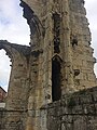
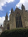
 South porch and grammar school exterior.jpg 2,448 × 3,264; 2.81 MB
-
 Southwest respond 1.jpg 2,448 × 3,264; 3.32 MB
-
 Springfield Way, Anlaby (geograph 6129967).jpg 800 × 600; 102 KB
-
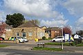
 St Andrew's Church Memorial Hall, Kirk Ella (geograph 6116502).jpg 800 × 540; 111 KB
-
 St Andrew's Primary School, Kirk Ella (geograph 6117487).jpg 4,883 × 3,120; 2.71 MB
-
 Stamford Bridge railway viaduct - geograph.org.uk - 6116941.jpg 2,048 × 1,536; 1.12 MB
-
 Supermarket, Anlaby (geograph 6117709).jpg 4,311 × 2,897; 1.84 MB
-
 The Beech Tree on South Ella Way (geograph 6129978).jpg 800 × 480; 76 KB
-
 The Hind House (geograph 6108664).jpg 1,024 × 768; 210 KB
-
 The Hop Pole, Willerby (geograph 6130671).jpg 800 × 672; 122 KB
-
 The Lounge Bar (geograph 6129975).jpg 800 × 537; 95 KB
-
 The Parkway, Willerby (geograph 6117649).jpg 4,295 × 2,893; 4.18 MB
-
 The Parkway, Willerby (geograph 6117650).jpg 4,503 × 2,795; 3.49 MB
-
 The Road to Rise (geograph 6109647).jpg 4,605 × 3,049; 2.38 MB
-
 The Star Inn, Willerby (geograph 6115871).jpg 800 × 628; 117 KB
-
 The Star Inn, Willerby (geograph 6115872).jpg 800 × 539; 106 KB
-
 Track near Butt Farm (geograph 6106344).jpg 1,024 × 768; 156 KB
-
 Track to Beverley Parks (geograph 6117116).jpg 1,024 × 768; 178 KB
-
 Turn right for National Cycle Route 1 (geograph 6115849).jpg 800 × 600; 131 KB
-
 View into ruins through aisle window.jpg 2,448 × 3,264; 2.12 MB
-
 View northwest from south arcade.jpg 2,448 × 3,264; 1.47 MB
-
 Waitrose, Willerby (geograph 6117645).jpg 5,147 × 3,090; 2.58 MB
-
 Waitrose, Willerby (geograph 6117647).jpg 4,871 × 3,360; 2.43 MB
-
 Waxholme Road, Withernsea (geograph 6121649).jpg 4,409 × 2,686; 1.28 MB
-
 Wedding Wood (geograph 6108667).jpg 1,024 × 768; 191 KB
-
 Well Lane, Willerby (geograph 6116554).jpg 640 × 480; 122 KB
-
 West front 1a.jpg 2,448 × 3,264; 2.17 MB
-
 West front 2.jpg 2,448 × 3,264; 2.11 MB
-
 West front 3.jpg 2,448 × 3,264; 2.41 MB
-
 West Hill (geograph 6127481).jpg 1,280 × 960; 1.12 MB
-
 Wet day by road to Wetwang (geograph 6108208).jpg 3,648 × 2,736; 3.7 MB
-
 Willerby & Kirkella Parish Institute (geograph 6127791).jpg 1,280 × 918; 812 KB
-
 Willerby Bypass (geograph 6126755).jpg 1,280 × 1,139; 841 KB
-
 Willerby Methodist Church (geograph 6115939).jpg 800 × 538; 107 KB
-
 Willerby Shopping Park (geograph 6127453).jpg 1,280 × 1,011; 1,017 KB
-
 Withernsea United Reformed Church (geograph 6121644).jpg 4,742 × 3,715; 1.9 MB
-
 Withernwick Grange (geograph 6121812).jpg 3,827 × 2,766; 2.41 MB
-
 Wolfreton Road, Willerby (geograph 6116541).jpg 5,184 × 3,888; 3.16 MB
-
 Wolfreton Road, Willerby (geograph 6116544).jpg 4,660 × 2,858; 2.38 MB
-
 Woodland beside National Cycle Route 1 (geograph 6115844).jpg 800 × 600; 115 KB
-
 Woodland beside South Ella Way, Kirk Ella (geograph 6117410).jpg 4,358 × 3,219; 4.62 MB
-
 Wressle Parish Church (geograph 6131476).jpg 1,024 × 768; 305 KB
.jpg)
.jpg)
.jpg)
.jpg)
.jpg)
.jpg)


.jpg)
.jpg)
.jpg)
_(geograph_6116493).jpg)
,_Anlaby_(geograph_6129968).jpg)

.jpg)
.jpg)
.jpg)
.jpg)

.jpg)
.jpg)
.jpg)
.jpg)
.jpg)
.jpg)
.jpg)
.jpg)
.jpg)
.jpg)
.jpg)
.jpg)
.jpg)
.jpg)
.jpg)
.jpg)
.jpg)

_(geograph_6116056).jpg)
.jpg)
.jpg)
.jpg)
.jpg)
.jpg)

.jpg)
.jpg)
.jpg)
.jpg)
.jpg)
.jpg)
.jpg)
.jpg)
.jpg)
.jpg)
.jpg)
.jpg)
.jpg)
.jpg)
.jpg)
.jpg)
_(geograph_6116057).jpg)
_(geograph_6116060).jpg)
_(geograph_6116061).jpg)
_approaching_roundabout_(geograph_6116492).jpg)
.jpg)
.jpg)
.jpg)
.jpg)
.jpg)
.jpg)
.jpg)


.jpg)
.jpg)
.jpg)
.jpg)
.jpg)
.jpg)
.jpg)
.jpg)
.jpg)
.jpg)
.jpg)


.jpg)
.jpg)
.jpg)
.jpg)
.jpg)

.jpg)
_(geograph_6116499).jpg)
.jpg)
.jpg)
.jpg)
.jpg)
.jpg)
.jpg)
.jpg)
.jpg)
.jpg)
.jpg)
.jpg)
.jpg)
.jpg)
.jpg)
.jpg)
.jpg)
.jpg)
.jpg)
.jpg)


.jpg)
.jpg)
.jpg)

.jpg)
.jpg)
.jpg)
.jpg)
.jpg)
.jpg)
.jpg)
.jpg)
.jpg)
.jpg)
.jpg)
.jpg)
.jpg)


.jpg)
.jpg)
.jpg)
.jpg)
.jpg)


.jpg)
.jpg)
.jpg)
.jpg)
.jpg)
.jpg)
.jpg)
.jpg)
.jpg)
.jpg)
.jpg)
.jpg)
.jpg)