Category:April 2010 in Devon
Jump to navigation
Jump to search
Ceremonial counties of England: Bedfordshire · Berkshire · Buckinghamshire · Cambridgeshire · Cheshire · Cornwall · Cumbria · Derbyshire · Devon · Dorset · Durham · East Riding of Yorkshire · East Sussex · Essex · Gloucestershire · Greater London · Greater Manchester · Hampshire · Herefordshire · Hertfordshire · Isle of Wight · Kent · Lancashire · Leicestershire · Lincolnshire · Merseyside · Norfolk · North Yorkshire · Northamptonshire · Northumberland · Nottinghamshire · Oxfordshire · Rutland · Somerset · South Yorkshire · Staffordshire · Suffolk · Surrey · Tyne and Wear · Warwickshire · West Midlands · West Sussex · West Yorkshire · Wiltshire · Worcestershire
City-counties: Bristol ·
Former historic counties:
Other former counties:
City-counties: Bristol ·
Former historic counties:
Other former counties:
Deutsch: Bilder, die im April 2010 in Devon aufgenommen worden sind. Bitte beachten Sie, dass dies weder das Datum des Uploads noch das Datum des Scannens eines Fotos ist.
English: Images/pictures taken in Devon during April 2010. Note this is not the date of the upload, nor the date a photo was scanned.
Español: Fotografías o imágenes tomadas en Devon durante abril 2010. No es la fecha de subida ni escaneo, sino la fecha en que las fotografías o imágenes se crearon.
Esperanto: Bildoj faritaj en Devon en aprilo 2010. Tio ne estas la dato, kiam la bildoj estis alŝutitaj aŭ skanitaj.
Français : Photographies ou images prises en Devon durant avril 2010. Ce n'est pas la date du téléchargement ou du scan.
Galego: Fotografías ou imaxes tomadas en Devon durante abril 2010. Non é a data de subida nin escaneamento, senón a data na que se crearon as fotografías ou imaxes.
Italiano: Fotografie o immagini scattate a Devon nel aprile 2010. Nota bene: la data non si riferisce né a quella di upload né a quella in cui la foto è stata digitalizzata.
Norsk bokmål: Bilder tatt i Devon i løpet av april 2010. Merk at dette ikke er datoen for opplasting, eller når et bilde har blitt skannet.
Norsk nynorsk: Bilete teke i Devon i løpet av april 2010. Merk at dette ikkje er datoen for opplasting, eller når eit bilete har vorte skanna.
Русский: Изображения, сделанные в Devon в течение апрель 2010 (не дата загрузки изображения).
Українська: Зображення, зроблені в Devon протягом квітень 2010. Зауважте, що це не дата завантаження чи дата сканування фотографії.
| April 2009 | ← | April 2010 | → | April 2011 | |||||||
| Jan | Feb | Mar | Apr | May | Jun | Jul | Aug | Sep | Oct | Nov | Dec |
| 99 | 55 | 54 | 35 | 25 | 21 | 12 | 11 | 16 | 14 | 10 | 24 |
|---|---|---|---|---|---|---|---|---|---|---|---|
Media in category "April 2010 in Devon"
The following 35 files are in this category, out of 35 total.
-
 BRC43specs.JPG 2,048 × 1,536; 903 KB
-
 Plymouth railway station XC 43301.JPG 2,048 × 1,536; 823 KB
-

-
 Access to rear of shops - geograph.org.uk - 1801520.jpg 480 × 640; 204 KB
-
 Ashburton North Street - geograph.org.uk - 1810697.jpg 3,312 × 4,416; 4.55 MB
-
 Baptist Chapel, High Street, Hatherleigh - geograph.org.uk - 1803872.jpg 2,000 × 1,434; 595 KB
-
 Blachford Viaduct - geograph.org.uk - 1805094.jpg 1,024 × 683; 257 KB
-
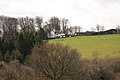 Blackaton Manor - geograph.org.uk - 1780652.jpg 1,024 × 683; 179 KB
-
 Bledge Brook - geograph.org.uk - 1804536.jpg 1,024 × 768; 295 KB
-
 Burcombe Haulage WK57BZW.jpg 3,484 × 2,004; 4.03 MB
-
 Class 43 at Teignmouth.jpg 3,777 × 2,702; 4.05 MB
-
 Dartmouth Station and York House - geograph.org.uk - 1845625.jpg 640 × 480; 95 KB
-
 Entrance to forest - geograph.org.uk - 1804335.jpg 1,600 × 1,200; 979 KB
-
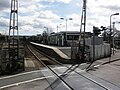 Feniton Railway Station - geograph.org.uk - 1780660.jpg 1,600 × 1,200; 418 KB
-
 Footpath north of Broadaford - geograph.org.uk - 1780616.jpg 1,024 × 683; 168 KB
-
 Ford and footbridge at Pytte (geograph 1795914).jpg 640 × 480; 281 KB
-
 Grey Park Wood - geograph.org.uk - 1780687.jpg 1,024 × 683; 304 KB
-
 Grey Park Wood - geograph.org.uk - 1780699.jpg 1,024 × 683; 341 KB
-
 Grey Park Wood - geograph.org.uk - 1780710.jpg 1,024 × 683; 320 KB
-

-
 Margells - geograph.org.uk - 1811007.jpg 4,000 × 3,000; 5.85 MB
-
 Millennium plaque, Hatherleigh - geograph.org.uk - 1803889.jpg 1,130 × 2,000; 641 KB
-
 Okehampton railway station (geograph 1837539).jpg 640 × 480; 113 KB
-

-
 Otterton - Fore Street - geograph.org.uk - 1833123.jpg 3,264 × 2,448; 3.8 MB
-
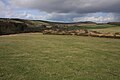
 Permissive Path to Hamel Down - geograph.org.uk - 1780661.jpg 1,024 × 683; 193 KB
-
 Picnic table, Regent Close - geograph.org.uk - 1816454.jpg 640 × 480; 99 KB
-
 Slapton Sands - geograph.org.uk - 1810695.jpg 4,416 × 3,312; 6.21 MB
-
 Teignmouth and Shaldon from Sprey Point.jpg 7,396 × 1,619; 5.27 MB
-
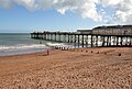 Teignmouth Pier.jpg 4,016 × 2,696; 4.65 MB
-
 The cove east of Ivy Cove - geograph.org.uk - 1820064.jpg 640 × 480; 95 KB
-
 The cove east of Ivy Cove - geograph.org.uk - 1820096.jpg 480 × 640; 81 KB
-
 The Nog Inn, Feniton - geograph.org.uk - 1780676.jpg 1,074 × 1,600; 256 KB
-
 Tiverton , Fore Street and Bench - geograph.org.uk - 1801051.jpg 3,264 × 2,448; 3.7 MB
-
 Viridor Y112FDV.jpg 3,120 × 1,972; 3.38 MB


.jpg)


.jpg)


