Category:April 2007 in West Yorkshire
Jump to navigation
Jump to search
Subcategories
This category has the following 5 subcategories, out of 5 total.
Media in category "April 2007 in West Yorkshire"
The following 58 files are in this category, out of 58 total.
-
 321901 B Leeds.JPG 1,512 × 923; 793 KB
-
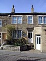 74 Market Street, Thornton - geograph.org.uk - 392930.jpg 486 × 640; 114 KB
-
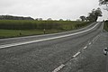 A534 at Ridley looking East. - geograph.org.uk - 395780.jpg 640 × 427; 54 KB
-
 A647 Stanningley Bypass - geograph.org.uk - 387866.jpg 416 × 622; 46 KB
-

-
 Ainley Street, Golcar - geograph.org.uk - 408479.jpg 640 × 480; 111 KB
-
 Alder Drive - geograph.org.uk - 412679.jpg 640 × 347; 76 KB
-
 All Mod Cons.^ off Smalewell Road - geograph.org.uk - 390389.jpg 357 × 633; 61 KB
-

-
 All Saints Dewsbury Minster - geograph.org.uk - 395822.jpg 640 × 480; 71 KB
-
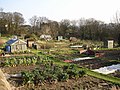
 Allotments by Gledhow Valley Road (1) - geograph.org.uk - 408814.jpg 640 × 439; 102 KB
-
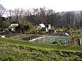
 Allotments by Gledhow Valley Road (2) - geograph.org.uk - 408828.jpg 640 × 480; 138 KB
-
 Allotments next to the canal, Bingley - geograph.org.uk - 387336.jpg 640 × 480; 153 KB
-
 Allotments off Beck Lane, Bingley - geograph.org.uk - 387328.jpg 640 × 480; 141 KB
-
 Allotments off Beck Lane, Bingley - geograph.org.uk - 387332.jpg 640 × 480; 146 KB
-
 Ann Place, off Little Horton Lane - geograph.org.uk - 391952.jpg 640 × 429; 252 KB
-

-
 Back Street at side of Ivy House - geograph.org.uk - 400641.jpg 429 × 640; 218 KB
-
 Back to Back Houses - Bellshaw Street - geograph.org.uk - 405974.jpg 640 × 418; 57 KB
-
 Bank Top - geograph.org.uk - 388642.jpg 470 × 640; 107 KB
-

-

-
 Bingley Railway Station.jpg 640 × 480; 84 KB
-
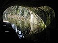
 Bowling Tunnel - geograph.org.uk - 399627.jpg 467 × 640; 158 KB
-

-

-

-
 Castleford Flour Mill - geograph.org.uk - 401470.jpg 640 × 181; 32 KB
-
 Clayton Tunnel - geograph.org.uk - 392580.jpg 462 × 640; 149 KB
-
 Coley Beck - geograph.org.uk - 386414.jpg 475 × 640; 170 KB
-
 Cross at Bramley Park - geograph.org.uk - 590066.jpg 335 × 640; 50 KB
-
 Cross at Bramley Park - geograph.org.uk - 590068.jpg 364 × 640; 59 KB
-
 Drystone Walls at Coppy. - geograph.org.uk - 396983.jpg 640 × 480; 103 KB
-
-
 Entrance to Castleford Locks - geograph.org.uk - 398948.jpg 640 × 160; 33 KB
-
 Farmland at Stanbury. - geograph.org.uk - 393317.jpg 640 × 480; 77 KB
-
 Farmland near Bank House Farm - geograph.org.uk - 395063.jpg 640 × 480; 72 KB
-
 Gawthorpe Conservative Club - geograph.org.uk - 409889.jpg 640 × 480; 98 KB
-

-
 Looking South - geograph.org.uk - 404580.jpg 640 × 480; 94 KB
-
-
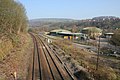
 Main lines into Leeds Station - geograph.org.uk - 390583.jpg 640 × 480; 86 KB
-
 Marsh Dene Farm, Bank Top - geograph.org.uk - 386679.jpg 640 × 432; 106 KB
-
 New Mill library and co-operative shop by Humphrey Bolton.jpg 640 × 479; 95 KB
-
 Queensbury Railway Station - geograph.org.uk - 392556.jpg 640 × 484; 132 KB
-
 Railway, Luddendenfoot - geograph.org.uk - 384997.jpg 1,024 × 683; 206 KB
-
 Riding Hill Bridge - geograph.org.uk - 386357.jpg 468 × 640; 163 KB
-
-
 Sowerby Long Bridge, Friendly - geograph.org.uk - 391447.jpg 640 × 467; 99 KB
-
 The Craven Heifer - Smiddles Lane - geograph.org.uk - 397343.jpg 637 × 306; 48 KB
-
 The Pennine Bridleway towards Shaw Bottom - geograph.org.uk - 430585.jpg 426 × 640; 155 KB
-
 The River Calder, Sowerby Bridge - geograph.org.uk - 391436.jpg 640 × 475; 110 KB
-
 Three Horse Shoes - Oulton - geograph.org.uk - 404408.jpg 640 × 373; 66 KB
-
 Yorkshire Bank - Toller Lane - geograph.org.uk - 408632.jpg 640 × 554; 83 KB
-

-
 Cattle, Weecher - geograph.org.uk - 401235.jpg 1,024 × 683; 183 KB
-
 Moderna Way Bridge - geograph.org.uk - 391831.jpg 640 × 474; 134 KB
-
 Southcliffe Drive, Baildon - geograph.org.uk - 401121.jpg 640 × 473; 74 KB


_-_geograph.org.uk_-_408814.jpg)
_-_geograph.org.uk_-_408828.jpg)


