Category:April 2007 in Essex
Jump to navigation
Jump to search
Deutsch: Bilder, die im April 2007 in Essex aufgenommen worden sind. Bitte beachten Sie, dass dies weder das Datum des Uploads noch das Datum des Scannens eines Fotos ist.
English: Images/pictures taken in Essex during April 2007. Note this is not the date of the upload, nor the date a photo was scanned.
Español: Fotografías o imágenes tomadas en Essex durante abril 2007. No es la fecha de subida ni escaneo, sino la fecha en que las fotografías o imágenes se crearon.
Esperanto: Bildoj faritaj en Essex en aprilo 2007. Tio ne estas la dato, kiam la bildoj estis alŝutitaj aŭ skanitaj.
Français : Photographies ou images prises en Essex durant avril 2007. Ce n'est pas la date du téléchargement ou du scan.
Galego: Fotografías ou imaxes tomadas en Essex durante abril 2007. Non é a data de subida nin escaneamento, senón a data na que se crearon as fotografías ou imaxes.
Italiano: Fotografie o immagini scattate a Essex nel aprile 2007. Nota bene: la data non si riferisce né a quella di upload né a quella in cui la foto è stata digitalizzata.
Norsk bokmål: Bilder tatt i Essex i løpet av april 2007. Merk at dette ikke er datoen for opplasting, eller når et bilde har blitt skannet.
Norsk nynorsk: Bilete teke i Essex i løpet av april 2007. Merk at dette ikkje er datoen for opplasting, eller når eit bilete har vorte skanna.
Русский: Изображения, сделанные в Essex в течение апрель 2007 (не дата загрузки изображения).
Українська: Зображення, зроблені в Essex протягом квітень 2007. Зауважте, що це не дата завантаження чи дата сканування фотографії.
| April 2006 | ← | April 2007 | → | April 2008 | |||||||
| Jan | Feb | Mar | Apr | May | Jun | Jul | Aug | Sep | Oct | Nov | Dec |
| 50 | 22 | 47 | 78 | 42 | 30 | 49 | 78 | 56 | 36 | 41 | 31 |
|---|---|---|---|---|---|---|---|---|---|---|---|
Media in category "April 2007 in Essex"
The following 78 files are in this category, out of 78 total.
-
 Bound for Colchester - geograph.org.uk - 390609.jpg 640 × 426; 123 KB
-
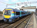
 170206 at Marks Tey.jpg 3,648 × 2,736; 4.47 MB
-
 16-00 from Liverpool Street - geograph.org.uk - 405733.jpg 640 × 428; 335 KB
-
 A busy A12 - geograph.org.uk - 405414.jpg 640 × 428; 261 KB
-
 A Great Holland Pond - geograph.org.uk - 402174.jpg 640 × 426; 124 KB
-
 A house known as Ringers - geograph.org.uk - 401181.jpg 640 × 480; 87 KB
-

-
 A lone stile - geograph.org.uk - 403797.jpg 640 × 480; 257 KB
-
 A row of trees - geograph.org.uk - 407292.jpg 640 × 480; 131 KB
-
 A short signpost - geograph.org.uk - 401983.jpg 640 × 480; 65 KB
-
 Abandoned car - geograph.org.uk - 412270.jpg 640 × 480; 115 KB
-
 B1032 at Lodge Farm - geograph.org.uk - 402163.jpg 640 × 426; 122 KB
-
 Barn Owl - 50866946892.jpg 3,872 × 2,592; 2.51 MB
-
 Beach Hut - geograph.org.uk - 424000.jpg 640 × 480; 43 KB
-
 Beach Huts - geograph.org.uk - 424008.jpg 640 × 480; 74 KB
-

-
 Brays Grove School - geograph.org.uk - 398754.jpg 640 × 480; 107 KB
-
 Chain home.jpg 250 × 462; 16 KB
-
 Dunmow South road junction - geograph.org.uk - 407208.jpg 640 × 427; 87 KB
-
 Eastwood Brook, Rayleigh - geograph.org.uk - 395716.jpg 489 × 640; 161 KB
-

-

-
 Faulkebourne Hall, Faulkebourne, Essex - geograph.org.uk - 717095.jpg 640 × 480; 123 KB
-
 Field of rape or a field of pylons - geograph.org.uk - 397863.jpg 640 × 480; 82 KB
-
 Footpath to Church Rd - geograph.org.uk - 384327.jpg 640 × 426; 83 KB
-
 Harlow Town Station - geograph.org.uk - 407518.jpg 640 × 480; 182 KB
-
 Leigh-on-Sea railway station 1.jpg 640 × 480; 90 KB
-
 London Stansted people mover rail.JPG 2,592 × 1,944; 1.97 MB
-
 London Stansted people mover railswitch.JPG 2,592 × 1,944; 2.43 MB
-
 Manhole Ahoy - geograph.org.uk - 402145.jpg 640 × 432; 72 KB
-
 Power line junction - geograph.org.uk - 405609.jpg 640 × 428; 281 KB
-
 Private airfield - geograph.org.uk - 405083.jpg 640 × 428; 295 KB
-
 Put out to rest - geograph.org.uk - 401579.jpg 640 × 480; 129 KB
-
 Road Sign, Chelmsford - geograph.org.uk - 418434.jpg 640 × 480; 135 KB
-
 Roydon Railway Station.jpg 640 × 428; 142 KB
-
 Rusting away - geograph.org.uk - 401596.jpg 640 × 480; 151 KB
-
 Sea Wall at Holland - geograph.org.uk - 402213.jpg 640 × 426; 98 KB
-
 Seat in Cudmore Grove - geograph.org.uk - 422970.jpg 640 × 426; 136 KB
-
 Spanish Bluebells - geograph.org.uk - 422936.jpg 432 × 640; 127 KB
-
 Sugar Lane - geograph.org.uk - 401897.jpg 640 × 445; 81 KB
-

-
 The Harlow Study Centre - geograph.org.uk - 400819.jpg 640 × 480; 138 KB
-
 The road through Pharisee Green - geograph.org.uk - 407194.jpg 640 × 427; 175 KB
-
 The Round House - geograph.org.uk - 407485.jpg 480 × 640; 246 KB
-
 Toilets at Marks Tey Station - geograph.org.uk - 566897.jpg 640 × 480; 99 KB
-
 Tollesbury Post Office - geograph.org.uk - 397162.jpg 640 × 480; 122 KB
-
 Train stopping at Marks Tey station - geograph.org.uk - 540724.jpg 640 × 480; 114 KB
-
 Walton Huts - geograph.org.uk - 417651.jpg 640 × 426; 85 KB
-
 Walton Steps - geograph.org.uk - 423038.jpg 426 × 640; 92 KB
-
 St. Francis Church, West Horndon - geograph.org.uk - 989159.jpg 640 × 480; 62 KB
-
 West Horndon station - geograph.org.uk - 410133.jpg 640 × 480; 93 KB
-
 Another Oops^ - geograph.org.uk - 384592.jpg 640 × 426; 97 KB
-
 B1033 - geograph.org.uk - 423030.jpg 640 × 426; 110 KB
-
 Bollard and Beacon - geograph.org.uk - 417611.jpg 426 × 640; 96 KB
-
 Bridge at Hill House Lane Ford - geograph.org.uk - 417719.jpg 640 × 426; 169 KB
-
 Cliff Path at Holland - geograph.org.uk - 402229.jpg 640 × 426; 119 KB
-
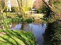 Conyards Farmhouse pond - geograph.org.uk - 389304.jpg 640 × 480; 184 KB
-
 Danbury Lakes - Upper Lake - geograph.org.uk - 397256.jpg 640 × 480; 101 KB
-
 Ducks and geese - geograph.org.uk - 400810.jpg 640 × 428; 359 KB
-
 Footpath and track to Sains Hall Farm - geograph.org.uk - 413018.jpg 640 × 419; 100 KB
-
 Footpath junction on the Harcamlow Way - geograph.org.uk - 404842.jpg 640 × 480; 106 KB
-
 Hawthorn Honey^ - geograph.org.uk - 419068.jpg 640 × 426; 120 KB
-
 Holland Brook - geograph.org.uk - 417738.jpg 426 × 640; 156 KB
-
 Holland Brook 2 - geograph.org.uk - 423025.jpg 426 × 640; 107 KB
-
 Leaden Hall Farm entrance - geograph.org.uk - 403066.jpg 640 × 426; 246 KB
-
 Left Decoy Pond - geograph.org.uk - 384464.jpg 640 × 426; 77 KB
-
 Litter - geograph.org.uk - 400656.jpg 640 × 480; 159 KB
-
 Little Oddyns house - geograph.org.uk - 407182.jpg 640 × 427; 111 KB
-
 Looking north along Tidings Hill - geograph.org.uk - 416597.jpg 640 × 450; 76 KB
-
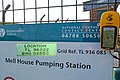
 Mell House Pump - geograph.org.uk - 384536.jpg 640 × 426; 91 KB
-
 Recreational Ground - geograph.org.uk - 400921.jpg 640 × 480; 100 KB
-
 Road from the River Crouch at Creeksea - geograph.org.uk - 395865.jpg 640 × 480; 120 KB
-
 Road to Liston Hall Farm - geograph.org.uk - 401929.jpg 640 × 480; 72 KB
-
 Semi-detached style contrasts - geograph.org.uk - 396852.jpg 640 × 480; 121 KB
-
 The Chase - geograph.org.uk - 400869.jpg 640 × 480; 107 KB
-
 The Jack Silley Pavilion - geograph.org.uk - 399655.jpg 640 × 419; 112 KB
-
 Track between the woods - geograph.org.uk - 405050.jpg 640 × 428; 314 KB
-
 Village sign, Tillingham - geograph.org.uk - 396832.jpg 640 × 480; 121 KB


