Category:April 2007 in County Londonderry
Jump to navigation
Jump to search
English: Images taken in County Londonderry, Northern Ireland in this month of 2007 (not the date of the upload).
| Jan | Feb | Mar | Apr | May | Jun | Jul | Aug | Sep | Oct | Nov | Dec | ||
| ← | 6 | 34 | 9 | 37 | 85 | 8 | 60 | 56 | 82 | 98 | 6 | 3 | → |
|---|
Media in category "April 2007 in County Londonderry"
The following 37 files are in this category, out of 37 total.
-
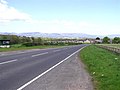
 A2 at Laraghaleas - geograph.org.uk - 414782.jpg 640 × 479; 63 KB
-
 Aghnascrebagh Townland - geograph.org.uk - 390157.jpg 640 × 479; 65 KB
-
 Aghnascrebagh Townland - geograph.org.uk - 390158.jpg 640 × 479; 112 KB
-
 Ancient Graveyard - geograph.org.uk - 389419.jpg 640 × 480; 208 KB
-
 Anyone for ice-cream^ - geograph.org.uk - 776028.jpg 640 × 424; 57 KB
-
 Apiary at Ardnargle - geograph.org.uk - 430343.jpg 640 × 480; 196 KB
-
 Ballydullaghan - geograph.org.uk - 386373.jpg 640 × 303; 33 KB
-
 Ballydullaghan Townland - geograph.org.uk - 386370.jpg 640 × 480; 78 KB
-
 Ballykelly Clinic - geograph.org.uk - 388558.jpg 640 × 480; 150 KB
-
 Ballykelly forest - geograph.org.uk - 388567.jpg 640 × 480; 196 KB
-
 Ballykelly village.jpg 640 × 480; 153 KB
-
 Beehive in a field of rape at Ballykelly. - geograph.org.uk - 430336.jpg 640 × 480; 180 KB
-
 Bridge on the river Faughan - geograph.org.uk - 388565.jpg 640 × 480; 166 KB
-
 Campsey, Derry - Londonderry - geograph.org.uk - 414780.jpg 640 × 479; 70 KB
-
 Carnakilly - geograph.org.uk - 414789.jpg 640 × 314; 34 KB
-
 Carnakilly - geograph.org.uk - 414791.jpg 640 × 479; 44 KB
-
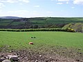
 Carnakilly Townland - geograph.org.uk - 414793.jpg 640 × 479; 66 KB
-
 Eglinton near the main street.jpg 640 × 480; 152 KB
-
 Farmland near Ballykelly - geograph.org.uk - 430340.jpg 640 × 480; 121 KB
-
 Greysteel village - geograph.org.uk - 388544.jpg 640 × 480; 153 KB
-
 Health Centre Eglinton - geograph.org.uk - 443765.jpg 640 × 480; 114 KB
-
 Jetty at Enagh Lough - geograph.org.uk - 637287.jpg 640 × 480; 106 KB
-
 Killeenan Townland - geograph.org.uk - 414941.jpg 640 × 479; 64 KB
-
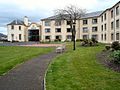 Limavady, Radisson Hotel.jpg 640 × 480; 146 KB
-
 Morelli's, Portstewart - geograph.org.uk - 386381.jpg 640 × 521; 59 KB
-
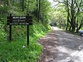 Muff Glen - geograph.org.uk - 414795.jpg 640 × 479; 102 KB
-
 Oughtad Townland - geograph.org.uk - 415645.jpg 640 × 479; 62 KB
-
 Oughtagh Townland - geograph.org.uk - 415641.jpg 640 × 479; 60 KB
-
 Ougtagh Road - geograph.org.uk - 415647.jpg 640 × 479; 57 KB
-
 Portstewart - geograph.org.uk - 386406.jpg 640 × 480; 53 KB
-
 Portstewart Clothing Company - geograph.org.uk - 386391.jpg 640 × 480; 65 KB
-
 Portstewart Harbour - geograph.org.uk - 386377.jpg 640 × 286; 31 KB
-
 Portstewart Townhall - geograph.org.uk - 386386.jpg 640 × 480; 48 KB
-
 Sheila's, Portstewart - geograph.org.uk - 386399.jpg 480 × 640; 155 KB
-
 Site of Ballyreagh Castle - geograph.org.uk - 386412.jpg 640 × 480; 62 KB
-

-
 Stratfoyle - geograph.org.uk - 414757.jpg 640 × 479; 68 KB


