Category:Appalachian Trail in the Great Smoky Mountains National Park
Jump to navigation
Jump to search
Files related to the Great Smoky Mountains National Park section (along the Tennessee-North Carolina border) of the Appalachian Trail in the eastern United States.
Subcategories
This category has the following 5 subcategories, out of 5 total.
Media in category "Appalachian Trail in the Great Smoky Mountains National Park"
The following 56 files are in this category, out of 56 total.
-
 A water source on the trail - panoramio.jpg 2,688 × 1,520; 2.04 MB
-
 Appalachian Trail at Newfound Gap - October 2023 - Sarah Stierch.jpg 4,284 × 5,712; 6.54 MB
-
 Appalachian Trail at Newfound Gap IMG 5137.JPG 4,608 × 3,456; 4.61 MB
-
 Appalachian Trail at Newfound Gap.JPG 2,592 × 1,944; 1.81 MB
-
 Appalachian Trail Heading to Double Springs Gap From Clingman's Dome.JPG 2,592 × 1,944; 891 KB
-
 Appalachian Trail northbound from US-441 - panoramio.jpg 1,600 × 1,200; 656 KB
-
 Appalachian Trail sign IMG 4933.JPG 4,608 × 3,456; 4.55 MB
-
 Appalachian-Trail-guyot2.jpg 1,198 × 897; 365 KB
-
 Appalachian-Trail-Old-Black3.jpg 628 × 460; 254 KB
-
 Appalachian-Trail-OldBlack.jpg 1,198 × 899; 453 KB
-
 Apptrailneartmsummit1.jpg 639 × 479; 122 KB
-
 At-crossingguyot1.jpg 1,200 × 900; 859 KB
-
 Boulevard-jumpoffsign-tnnc1.jpg 639 × 478; 93 KB
-
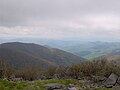
 Cadescovefromrockytop4.jpg 639 × 480; 66 KB
-
 Charlies-bunion-mount-leconte.jpg 1,198 × 894; 205 KB
-
 Charlies-bunion-porters-creek.jpg 640 × 477; 80 KB
-
 Charlies-bunion-protrusion.jpg 1,199 × 895; 223 KB
-
 Charlies-bunion-sign.jpg 639 × 480; 102 KB
-
 Clingmans-dome-north.jpg 1,199 × 589; 130 KB
-
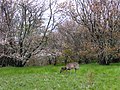 Doe-grazing-spence-field.jpg 639 × 479; 155 KB
-
 Double Springs Gap.JPG 2,592 × 1,944; 1.08 MB
-
 Eagle-creek-valley-nc1.jpg 640 × 480; 155 KB
-
 F4-phantom-wreckage1.jpg 639 × 479; 126 KB
-
 Inadu-knob-gsmnp1.jpg 1,200 × 900; 593 KB
-
 Kephart-summit-southeast.jpg 1,200 × 895; 294 KB
-
 Lakeview Drive West Entrance Sign.jpg 5,520 × 3,684; 7.68 MB
-
 Luftee-knob-gsmnp-nc2.jpg 1,123 × 776; 406 KB
-
 Luftee-knob-gsmnp1.jpg 779 × 526; 86 KB
-
 Marks-knob-gsmnp-nc1.jpg 1,759 × 932; 341 KB
-
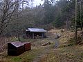
 Mollies-ridge-shelter-gsmnp1.jpg 2,048 × 1,536; 1.5 MB
-
 Mollies-ridge-shelter-gsmnp2.jpg 2,048 × 1,536; 1.18 MB
-
 Mount Guyot; Foggy and Lonely Appalachian Trail.JPG 2,736 × 3,648; 2.41 MB
-
 Mount-chapman-gsmnp1.jpg 2,037 × 1,357; 864 KB
-
 Mount-chapman-guyot.jpg 1,199 × 899; 348 KB
-
 Mount-chapman-north.jpg 1,185 × 858; 312 KB
-
 Mount-collins-south.jpg 1,188 × 883; 204 KB
-
 Mount-sequoyah-appalachian-trail.jpg 1,197 × 895; 463 KB
-
 Mount-sequoyah-south.jpg 979 × 754; 254 KB
-
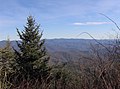
 Ob-cocke2.jpg 658 × 491; 147 KB
-
 Old-black-appalachian-trail-tnnc1.jpg 2,045 × 1,529; 824 KB
-
 Old-black-fraser-firs-tn1.jpg 2,041 × 1,529; 386 KB
-
 Rockytop2.jpg 638 × 479; 89 KB
-
 Russell-field-shelter-gsmnp1.jpg 2,048 × 1,536; 1.37 MB
-
 Shuckstack-fontana.jpg 638 × 478; 77 KB
-
 Snake-den-ridge-trail-terminus1.jpg 2,041 × 1,326; 786 KB
-
 Spence-field-app-trail-gsmnp1.jpg 2,048 × 1,536; 2.29 MB
-
 Spence-field-appalachian-trail.jpg 618 × 464; 131 KB
-
 Spence-field-from-rocky-top.jpg 639 × 478; 54 KB
-
 Spence-field-shelter-gsmnp1.jpg 2,048 × 1,536; 1.39 MB
-
 Spence-field-shelter-gsmnp2.jpg 2,048 × 1,536; 1.15 MB
-
 Spence-field-southeast.jpg 640 × 427; 129 KB
-
 Sugarland-mountain-trail-at-junction1.jpg 640 × 480; 121 KB
-
 Thunderhead-apptrail-tnnc1.jpg 640 × 480; 199 KB
-
 Tricorner-knob-buck-fork-valley.jpg 640 × 480; 102 KB
-
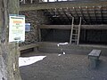
 Tricorner-knob-shelter.jpg 640 × 480; 241 KB
-
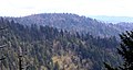
 Upper-cosby-creek-valley-tn1.jpg 1,197 × 899; 378 KB


