Category:Appalachian Trail
Jump to navigation
Jump to search
2,198.4-mile (3,538 km) trail going through fourteen US states managed by the National Park Service  Хребет Франконія, ділянка Аппалачської стежки.   | |||||
| Upload media | |||||
| Instance of |
| ||||
|---|---|---|---|---|---|
| Part of |
| ||||
| Located in protected area | |||||
| Location | |||||
| Connects with |
| ||||
| Operator |
| ||||
| Has part(s) | |||||
| Heritage designation |
| ||||
| Length |
| ||||
| Mountain range | |||||
| Highest point | |||||
| Terminus | |||||
| official website | |||||
 | |||||
English: The Appalachian Trail — a long distance National Scenic Trail in the Appalachian Mountains of the Eastern United States.
Subcategories
This category has the following 11 subcategories, out of 11 total.
+
- Maps of the Appalachian Trail (11 F)
A
- Myron Avery (2 F)
G
- Emma Gatewood (5 F)
M
- Max Patch (3 F)
S
- Appalachian Trail signs (15 F)
T
- Raymond H. Torrey (4 F)
Pages in category "Appalachian Trail"
This category contains only the following page.
Media in category "Appalachian Trail"
The following 130 files are in this category, out of 130 total.
-
 Almost every sign on the Appalachian Trail is handmade and wooden. Not this one LCCN2011633901.tif 6,600 × 5,126; 193.61 MB
-
 ANST-Triangle-Logo 1.jpg 312 × 335; 20 KB
-
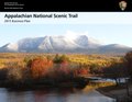 APPA 2015 Business Plan page version.pdf 1,650 × 1,275, 52 pages; 6.95 MB
-
 APPA compendium 2002.pdf 1,275 × 1,520, 17 pages; 7.77 MB
-
 APPA FMP 04-23-13.pdf 1,275 × 1,650, 85 pages; 3.49 MB
-
 APPA Foundation-Document December 2014.pdf 1,275 × 1,650, 70 pages; 12.45 MB
-
 APPA Policy on Unmanned Aircraft 2014.pdf 1,275 × 1,650, 2 pages; 917 KB
-
 Appalachian NST AT-report-web.pdf 1,275 × 1,650, 28 pages; 1.99 MB
-
 Appalachian NST AT-summary-web.pdf 1,275 × 1,650, 2 pages; 177 KB
-
 Appalachian NST CompPlan web.pdf 1,275 × 1,650, 42 pages; 161 KB
-
 Appalachian NST Main Report-2.pdf 1,275 × 1,650, 211 pages; 838 KB
-
 Appalachian NST MainReport Appendices.pdf 1,275 × 1,650, 281 pages; 863 KB
-
 Appalachian Trail at Georgia - panoramio.jpg 3,216 × 2,136; 1.78 MB
-
 Appalachian Trail Blaze En Route to Hawksbill Summit.jpg 4,032 × 3,024; 3.67 MB
-
 Appalachian Trail crossing, Harpers Ferry, West Virginia LCCN2011630007.tif 4,325 × 3,379; 41.84 MB
-
 Appalachian Trail in downtown Hot Springs, NC.jpg 1,814 × 2,985; 1.99 MB
-
 Appalachian Trail in winter - Flickr - pellaea.jpg 3,380 × 2,535; 1.61 MB
-
 Appalachian Trail LCCN2011631216.tif 3,453 × 4,319; 85.37 MB
-
 Appalachian Trail near top of Snowbird Mountain - Flickr - pellaea.jpg 6,898 × 3,570; 9.96 MB
-
 Appalachian Trail Pilot Visitor Count Survey 2009.pdf 1,275 × 1,650, 127 pages; 575 KB
-
 Appalachian Trail, Peter's Mountain WV-VA 2.jpg 4,608 × 3,456; 7.75 MB
-
 Appalachian Trail, Peter's Mountain WV-VA 3.jpg 4,608 × 3,456; 7.84 MB
-
 Appalachian Trail, Peter's Mountain WV-VA 4.jpg 4,608 × 3,456; 8.8 MB
-
 Appalachian Trail, Peter's Mountain WV-VA.jpg 4,608 × 3,456; 8.59 MB
-
 Appalachian Trail- Totts Gap to Mount Minsi (1) (10355586453).jpg 5,184 × 2,936; 13.2 MB
-
 Appalachian Trail- Totts Gap to Mount Minsi (10) (10355537623).jpg 5,184 × 3,051; 14.15 MB
-
 Appalachian Trail- Totts Gap to Mount Minsi (11) (10355327996).jpg 5,184 × 3,456; 18.43 MB
-
 Appalachian Trail- Totts Gap to Mount Minsi (12) (10355265295).jpg 3,456 × 4,673; 14.41 MB
-
 Appalachian Trail- Totts Gap to Mount Minsi (13) (10355299666).jpg 3,456 × 5,184; 20.39 MB
-
 Appalachian Trail- Totts Gap to Mount Minsi (14) (10355405723).jpg 5,184 × 3,262; 12.6 MB
-
 Appalachian Trail- Totts Gap to Mount Minsi (15) (10355246136).jpg 5,184 × 3,059; 16.65 MB
-
 Appalachian Trail- Totts Gap to Mount Minsi (16) (10355386973).jpg 3,456 × 5,184; 19.5 MB
-
 Appalachian Trail- Totts Gap to Mount Minsi (17) (10355171246).jpg 3,456 × 5,184; 17.73 MB
-
 Appalachian Trail- Totts Gap to Mount Minsi (18) (10355145306).jpg 3,456 × 5,184; 20.84 MB
-
 Appalachian Trail- Totts Gap to Mount Minsi (19) (10355303223).jpg 5,184 × 3,456; 15.39 MB
-
 Appalachian Trail- Totts Gap to Mount Minsi (2) (10355544225).jpg 5,184 × 3,456; 20.18 MB
-
 Appalachian Trail- Totts Gap to Mount Minsi (20) (10355280153).jpg 5,184 × 3,456; 15.08 MB
-
 Appalachian Trail- Totts Gap to Mount Minsi (3) (10355481004).jpg 3,456 × 5,184; 10.81 MB
-
 Appalachian Trail- Totts Gap to Mount Minsi (4) (10355468906).jpg 5,184 × 3,456; 18.25 MB
-
 Appalachian Trail- Totts Gap to Mount Minsi (5) (10355517116).jpg 3,456 × 5,085; 21.8 MB
-
 Appalachian Trail- Totts Gap to Mount Minsi (6) (10355410375).jpg 3,456 × 5,184; 10.07 MB
-
 Appalachian Trail- Totts Gap to Mount Minsi (7) (10355367934).jpg 5,184 × 3,242; 14.47 MB
-
 Appalachian Trail- Totts Gap to Mount Minsi (8) (10355439495).jpg 3,456 × 5,184; 19.62 MB
-
 Appalachian Trail- Totts Gap to Mount Minsi (9) (10355379496).jpg 4,199 × 2,549; 4.42 MB
-
 Appalachian Trail.jpg 1,920 × 2,560; 1.39 MB
-
 The Appalachian Trail (IA appalachiantrail951unit).pdf 1,168 × 1,908, 12 pages; 916 KB
-
 AT - Hog Pen Gap2.jpg 1,632 × 1,595; 507 KB
-
 AT Visitor Count Pilot Survey 2011.pdf 1,275 × 1,650, 68 pages; 5.14 MB
-
 Autumn road into the mountains (Unsplash).jpg 5,871 × 3,919; 15.73 MB
-
 Blood Mountain, United States (Unsplash).jpg 5,118 × 3,244; 8.82 MB
-
 BlueMountainPanorama.jpg 11,516 × 3,948; 21.2 MB
-
 Browned (8177486291).jpg 5,153 × 3,456; 15.41 MB
-
 Bygone (10368984224).jpg 5,184 × 3,456; 18.47 MB
-
 Cliff View (10368998854).jpg 3,456 × 3,317; 7.47 MB
-
 Crinkled (11040839506).jpg 3,456 × 5,184; 16.01 MB
-
 Downriver View (10369273563).jpg 5,184 × 3,456; 17.07 MB
-
 End of the ride - panoramio.jpg 2,592 × 1,952; 1.79 MB
-
 Following the Appalachian Trail LCCN2011630545.tif 4,339 × 3,450; 42.86 MB
-
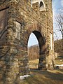 Gathland State Park Arch - panoramio.jpg 2,448 × 3,264; 4.19 MB
-
 Georgia Appalachian Trail Club marker Springer Mountain.jpg 1,536 × 2,049; 1.42 MB
-
 Grassy ridge trail - panoramio.jpg 4,480 × 1,840; 1.47 MB
-
 Great North Woods - New Hampshire.jpg 2,816 × 1,880; 5.42 MB
-
 Great Swamp - panoramio.jpg 4,352 × 3,264; 7.66 MB
-
 Green Mountains 182613785.jpg 1,536 × 2,048; 812 KB
-
 Heavy fog in the woods (Unsplash).jpg 5,184 × 3,456; 1.39 MB
-
 Highest point on the A.T. - panoramio.jpg 3,264 × 1,840; 2.53 MB
-
 James River Footbridge 1.jpg 4,032 × 3,024; 4.2 MB
-
 James River Footbridge 2.jpg 4,032 × 3,024; 3.67 MB
-
 James River Footbridge 3.jpg 4,032 × 3,024; 3.89 MB
-
 James River Footbridge 4.jpg 4,032 × 3,024; 2.3 MB
-
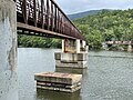 James River Footbridge 6.jpg 4,032 × 3,024; 3.19 MB
-
 James River Footbridge 7.jpg 4,032 × 3,024; 3.16 MB
-
 James River Footbridge 8.jpg 4,032 × 3,024; 4.74 MB
-
 James River Footbridge 9.jpg 4,032 × 3,024; 4.2 MB
-
 Lemon Squeezer - panoramio.jpg 4,352 × 3,264; 4.07 MB
-
 Lookout (9528343582).jpg 3,456 × 5,184; 10.42 MB
-
 Map of Triple Crown of Hiking Trail.png 280 × 183; 56 KB
-
 Marred (11040800216).jpg 3,456 × 5,184; 19.27 MB
-
 May-2010-LehighGapProject-FactSheet.pdf 1,275 × 1,650, 2 pages; 769 KB
-
 Moon Over Appalachian Trail by Brian S Woods.jpg 2,263 × 3,677; 2.84 MB
-
 Mount Rogers summit 2008.jpg 3,072 × 2,304; 4.61 MB
-
 Mt. Tammany Trail Map.webp 1,152 × 718; 95 KB
-
 Nelson Overlook (Revisited) (1) (8298918564).jpg 5,184 × 3,456; 10.5 MB
-
 Nelson Overlook (Revisited) (2) (8297871481).jpg 5,184 × 3,456; 11.11 MB
-
 Newfound Gap - panoramio (1).jpg 4,608 × 3,456; 3.72 MB
-
 NPS-ATC-MOU-2004.pdf 1,275 × 1,650, 7 pages; 123 KB
-
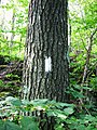
 Original 1930 ATC brass diamond tree marker.jpg 1,600 × 1,200; 603 KB
-
 Outcrop (11040949723).jpg 5,184 × 2,681; 9.51 MB
-
 Pitch Pine (8177521786).jpg 3,456 × 4,026; 11.87 MB
-
 Rocksylvania (11059547666).jpg 5,184 × 3,456; 24.72 MB
-
 Round bald - panoramio.jpg 6,256 × 1,808; 1.89 MB
-
 Scoutatmap.jpg 2,592 × 1,944; 2.07 MB
-
 Short Hike (1) (20435812532).jpg 5,184 × 3,114; 14.82 MB
-
 Short Hike (10) (20258015499) (17x22).jpg 2,421 × 3,134; 3.28 MB
-
 Short Hike (10) (20258015499).jpg 2,961 × 3,134; 3.4 MB
-
 Short Hike (11) (19822066404).jpg 3,456 × 3,859; 7.61 MB
-
 Short Hike (12) (20256694420).jpg 5,184 × 3,456; 20.46 MB
-
 Short Hike (2) (20435835912).jpg 5,044 × 3,206; 14.58 MB
-
 Short Hike (3) (20257893559).jpg 5,016 × 2,637; 12.42 MB
-
 Short Hike (3) (9707571300).jpg 5,184 × 2,823; 10.24 MB
-
 Short Hike (4) (20256557498).jpg 5,184 × 3,456; 13.22 MB
-
 Short Hike (4) (9704345703).jpg 3,456 × 5,184; 12.68 MB
-
 Short Hike (5) (9704327217).jpg 5,184 × 3,456; 12 MB
-
 Short Hike (6) (9704317677).jpg 3,456 × 4,937; 14.71 MB
-
 Short Hike (7) (9704390767).jpg 5,184 × 3,456; 19.36 MB
-
 Short Hike (9) (20258019969).jpg 2,775 × 2,744; 2.78 MB
-
 Smyth Co Recreation (20251247662).jpg 3,000 × 2,250; 2.55 MB
-
 Spreading Canopy (8484176924).jpg 3,456 × 5,184; 19.51 MB
-
 Squall Line (1) (8484169882).jpg 5,184 × 3,212; 12.03 MB
-
 Squall Line (2) (8483071743).jpg 5,184 × 3,456; 8.41 MB
-
 Squall Line (3) (8484161254).jpg 5,184 × 3,456; 10.46 MB
-
 Squall Line (4) (8484157000).jpg 5,044 × 3,397; 10.2 MB
-
 Summit (10369239743).jpg 3,456 × 4,438; 12.68 MB
-
 Sunfish-pond-nj-november2020.jpg 4,096 × 3,072; 1.91 MB
-
 TJWikiOldATDiamond.jpg 1,200 × 898; 766 KB
-
 Top of Challenge - panoramio.jpg 1,280 × 960; 161 KB
-

-
 Veterans Memorial Monument at High Point State Park in late spring sunset.jpg 2,579 × 1,720; 1.3 MB
-
 View from Appalachian Trail near Low Gap - Flickr - pellaea.jpg 10,438 × 2,553; 4.77 MB
-
 View from Dickey Ridge Visitors Center, Shenandoah NP, Virginia 1.jpg 4,032 × 3,024; 3.96 MB
-
 View from Dickey Ridge Visitors Center, Shenandoah NP, Virginia 2.jpg 4,032 × 2,268; 2.67 MB
-
 View from Dickey Ridge Visitors Center, Shenandoah NP, Virginia 3.jpg 4,032 × 2,268; 3 MB
-
 View from Dickey Ridge Visitors Center, Shenandoah NP, Virginia 4.jpg 4,032 × 3,024; 4.32 MB
-
 Vt14.jpg 800 × 593; 92 KB
-
 Walasi-Yi Interpretive Center from the shoe tree.jpg 5,548 × 3,699; 11.33 MB
-
 Waterfall - panoramio (10).jpg 4,320 × 3,240; 4.65 MB
-
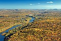
 Where the Potomac merges into the Shenandoah River at Harper's Ferry - panoramio.jpg 3,872 × 2,592; 3.08 MB
-
 Wild Geranium, Angels Rest Cluster.jpg 5,184 × 3,456; 6.27 MB
-
 Wildcat Mountain - panoramio.jpg 3,456 × 2,304; 4.83 MB
-
 Windswept trees on a slope (Unsplash).jpg 4,800 × 3,200; 2.86 MB


_(10355586453).jpg)
_(10355537623).jpg)
_(10355327996).jpg)
_(10355265295).jpg)
_(10355299666).jpg)
_(10355405723).jpg)
_(10355246136).jpg)
_(10355386973).jpg)
_(10355171246).jpg)
_(10355145306).jpg)
_(10355303223).jpg)
_(10355544225).jpg)
_(10355280153).jpg)
_(10355481004).jpg)
_(10355468906).jpg)
_(10355517116).jpg)
_(10355410375).jpg)
_(10355367934).jpg)
_(10355439495).jpg)
_(10355379496).jpg)


.jpg)
.jpg)
.jpg)
.jpg)
.jpg)
.jpg)
.jpg)


.jpg)


.jpg)

.jpg)


_(1)_(8298918564).jpg)
_(2)_(8297871481).jpg)
.jpg)

.jpg)
.jpg)
.jpg)

_(20435812532).jpg)
_(20258015499)_(17x22).jpg)
_(20258015499).jpg)
_(19822066404).jpg)
_(20256694420).jpg)
_(20435835912).jpg)
_(20257893559).jpg)
_(9707571300).jpg)
_(20256557498).jpg)
_(9704345703).jpg)
_(9704327217).jpg)
_(9704317677).jpg)
_(9704390767).jpg)
_(20258019969).jpg)
.jpg)
.jpg)
_(8484169882).jpg)
_(8483071743).jpg)
_(8484161254).jpg)
_(8484157000).jpg)
.jpg)


.jpg)


.jpg)