Category:Apartment buildings in the City of Manchester
Jump to navigation
Jump to search
Subcategories
This category has the following 13 subcategories, out of 13 total.
A
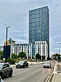
- Axis Tower, Manchester (18 F)
B
C
- Chips, Manchester (10 F)
D
- Deansgate Square (41 F)
E
- Elizabeth Tower, Manchester (6 F)
G
- Great Northern Tower (5 F)
- The Green Building (3 F)
H
- Hulme Crescents (14 F)
I
- Islington Wharf, Manchester (12 F)
J
M
- Milliner's Wharf, Manchester (3 F)
V
- Victoria Mills, Miles Platting (26 F)
Media in category "Apartment buildings in the City of Manchester"
The following 200 files are in this category, out of 272 total.
(previous page) (next page)-
 A studio room at The atrium, 75, Prince street, Manchester, UK.JPG 1,920 × 1,080; 1.05 MB
-
 All tied up - geograph.org.uk - 515808.jpg 640 × 425; 109 KB
-
 Ancoats Brownsfield Lock 83- 4548.JPG 3,488 × 2,616; 2.14 MB
-
 Ancoats Brownsfield Mill- 4518.JPG 3,488 × 2,616; 2.15 MB
-
 Ancoats Lane Lock -Lock 82 4512.JPG 3,488 × 2,616; 2.17 MB
-
 Ancoats Locks, Ashton Canal - geograph.org.uk - 2151.jpg 480 × 352; 33 KB
-
 Ancoats- 4527.JPG 3,488 × 2,616; 2.15 MB
-
 Ancoats- Ancoats- Rochdale Canal Dale St Picadilly Basin4536.JPG 3,488 × 2,616; 2.11 MB
-
 Ancoats- Ancoats- Rochdale Canal Ducie Street Bridge 4540.JPG 3,488 × 2,616; 2.22 MB
-
 Ancoats- Ancoats- Rochdale Canal Ducie Street Bridge 844539.JPG 3,488 × 2,616; 2.19 MB
-
 Angel Gardens (51151104313).jpg 2,736 × 3,648; 2.61 MB
-
 Angel Gardens 22 July.jpg 3,024 × 3,780; 1.98 MB
-
 Angel gardens 25 February 2018.jpg 3,024 × 3,780; 2.05 MB
-
 Angel Gardens 29 03 2019.jpg 1,870 × 3,195; 1.96 MB
-
 Angel Gardens site.jpg 3,024 × 3,780; 4.36 MB
-
 Angelgardens.jpg 2,834 × 3,778; 1.92 MB
-
 Aparthotel - geograph.org.uk - 5396361.jpg 640 × 426; 70 KB
-
 Apartment blocks and offices north of Victoria station in Manchester - panoramio.jpg 1,600 × 1,201; 265 KB
-
 Apartment blocks from Victoria station - geograph.org.uk - 2864374.jpg 480 × 640; 173 KB
-
 Apartments at Scotland Bridge - geograph.org.uk - 4298496.jpg 640 × 480; 297 KB
-
 Apartments overlooking the Bridgewater Canal - geograph.org.uk - 2050314.jpg 3,872 × 2,592; 1.55 MB
-
 Ashton Canal - Bridge 2 Piccadilly Village 5137.JPG 3,264 × 2,448; 2.88 MB
-
 Ashton Canal - geograph.org.uk - 1141499.jpg 640 × 480; 119 KB
-
 Ashton Canal - geograph.org.uk - 1569378.jpg 400 × 600; 138 KB
-
 Ashton Canal - geograph.org.uk - 1770057.jpg 640 × 480; 140 KB
-
 Ashton Canal -Piccadilly Village 5134.JPG 3,264 × 2,448; 3.25 MB
-
 Ashton Canal -Piccadilly Village 5135.JPG 3,264 × 2,448; 3.11 MB
-
 Ashton Canal 5139.JPG 3,264 × 2,448; 2.84 MB
-
 Ashton Canal Bridge 1 Jutland St 5122.JPG 3,264 × 2,448; 3.09 MB
-
 Ashton Canal Bridge 1 Jutland St 5126.JPG 3,264 × 2,448; 2.97 MB
-
 Ashton Canal Bridge 1 Jutland St 5129.JPG 3,264 × 2,448; 2.49 MB
-
 Ashton Canal Bridge 1 Jutland St vista 5123.JPG 3,264 × 2,448; 3.26 MB
-
 Ashton Canal Bridge 5 south-west vista 5176.JPG 3,264 × 2,448; 3.1 MB
-
 Ashton Canal Bridge Joe Mercer Way 5197.JPG 3,264 × 2,448; 3.95 MB
-
 Ashton Canal Lock 3 Milliners' Wharf 5159.JPG 3,203 × 2,403; 1.16 MB
-
 Ashton Canal Lock 4 5191.JPG 3,264 × 2,448; 3.26 MB
-
 Ashton Canal Lock 4 5192.JPG 3,264 × 2,448; 3.84 MB
-
 Ashton Canal Lock 5 5194.JPG 3,264 × 2,448; 3.69 MB
-
 Ashton Canal Phoenix Mill fields 5169.JPG 3,264 × 2,448; 3.5 MB
-
 Ashton Canal Piccadilly Village.jpg 3,264 × 1,836; 1.45 MB
-
 Ashton Canal Store Street aqueduct 5130.JPG 3,264 × 2,448; 3.07 MB
-
 Ashton Canal Store Street aqueduct 5132.JPG 3,264 × 2,448; 3.11 MB
-
 Ashton Canal- Sports City Lock 6 behind 5208.JPG 3,264 × 2,448; 4.26 MB
-
 Ashtoncanal10.jpg 2,918 × 2,191; 2.5 MB
-
 Ashtoncanal9.jpg 3,648 × 2,736; 2.76 MB
-
 Beautiful concrete jungle in Miles Platting, Manchester - panoramio.jpg 3,072 × 2,304; 1.83 MB
-
 Benkid77 Tower blocks, Manchester 1 250709.JPG 3,648 × 2,736; 3.65 MB
-
 Black ^ white pic of Collyhurst's tower blocks - panoramio.jpg 2,048 × 1,536; 614 KB
-
 Blackley.jpg 2,048 × 1,536; 1.63 MB
-

-
 Blocks of flats on Wilbraham Road - geograph.org.uk - 4518645.jpg 6,000 × 4,000; 3.78 MB
-
 Bloody bridge april 2008.jpg 4,652 × 1,884; 1.35 MB
-
 Brewer Street - geograph.org.uk - 4479650.jpg 2,810 × 4,695; 1.85 MB
-
 Bridge 89 over Rochdale Canal- geograph.org.uk - 1511686.jpg 626 × 640; 144 KB
-
 Bridgewater canal dale street bridge.jpg 1,617 × 1,842; 331 KB
-
 Bridgewater canal entering manchester.jpg 1,953 × 1,632; 386 KB
-
 Britton House, Manchester.jpg 1,785 × 2,413; 618 KB
-
 Bus in Poundswick Lane, Wythenshawe.jpg 2,048 × 1,536; 1.29 MB
-
 Cambridge Mill, Manchester (1).jpg 4,608 × 3,456; 5.28 MB
-
 Cambridge Street Block A, Manchester.jpg 3,456 × 4,952; 1.91 MB
-
 Canalside development - geograph.org.uk - 3528361.jpg 800 × 600; 104 KB
-
 Castlefield 4659.JPG 1,280 × 960; 468 KB
-
 Castlefield Bridgewater 4680.JPG 1,280 × 960; 473 KB
-
 Castlefield Bridgewater 4681.JPG 1,280 × 960; 464 KB
-
 Castlefield Bridgewater 4682.JPG 1,280 × 960; 471 KB
-
 Castlefield Bridgewater 4683.JPG 1,280 × 960; 475 KB
-
 Castlefield Bridgewater 4684.JPG 1,280 × 960; 454 KB
-
 Castlefield Bridgewater 4688.JPG 1,280 × 960; 470 KB
-
 Castlefield Bridgewater Deansgate end4646.JPG 960 × 1,280; 452 KB
-
 Castlefield Bridgewater Deansgate end4647.JPG 1,280 × 960; 472 KB
-
 Castlefield Bridgewater Deansgate end4648.JPG 1,280 × 960; 462 KB
-
 Castlefield Dawson St Bridge 12443.JPG 2,592 × 1,944; 1.17 MB
-
 Castlefield Dawson St Bridge 4685.JPG 1,280 × 960; 481 KB
-
 Castlefield Merchants 4665.JPG 1,280 × 960; 467 KB
-
 Castlefield Merchants 4691.JPG 1,280 × 960; 481 KB
-
 Castlefield Merchants 4699.JPG 1,280 × 960; 482 KB
-
 Castlefield Merchants 4702.JPG 1,280 × 960; 492 KB
-
 Castlefield Middle Basin 4661.JPG 1,280 × 960; 454 KB
-
 Castlefield Middle Basin 4662.JPG 1,280 × 960; 464 KB
-
 Castlefield Middle Basin 4663.JPG 960 × 1,280; 465 KB
-
 Castlefield Middle Basin 4664.JPG 1,280 × 960; 459 KB
-
 Castlefield Middle Basin 4666.JPG 1,280 × 960; 480 KB
-
 Castlefield New Elm Road 12396.JPG 2,592 × 1,944; 1.21 MB
-
 Castlefield New Elm Road 12401.JPG 2,592 × 1,944; 1.22 MB
-
 Castlefield Potato Wharf 12390.JPG 2,592 × 1,944; 1.16 MB
-
 Castlefield Potato Wharf 12402 cropped.jpg 1,984 × 1,223; 669 KB
-
 Castlefield Potato Wharf 12402.JPG 2,592 × 1,944; 1.26 MB
-
 Castlefield Rochdale 4698.JPG 1,280 × 960; 475 KB
-
 Castlefield Rochdale 4700.JPG 1,280 × 960; 481 KB
-
 Castlefield Rochdale4701.JPG 1,280 × 960; 474 KB
-
 Castlefield Staffordshire Arm 12327.JPG 2,592 × 1,944; 1.18 MB
-
 Castlefield Staffordshire Arm 12331.JPG 2,592 × 1,944; 1.23 MB
-
 Castlefield Staffordshire Arm 12334.JPG 2,592 × 1,944; 1.24 MB
-
 Castlefield, canal junction - geograph.org.uk - 1469940.jpg 640 × 480; 99 KB
-
 Castlefield20.jpg 1,024 × 768; 437 KB
-
 CastlefieldViaducts2321.JPG 2,592 × 1,944; 1.19 MB
-
 CastlefieldViaducts2322.JPG 2,592 × 1,944; 1.18 MB
-
 CastlefieldViaducts2323.JPG 2,592 × 1,944; 1.18 MB
-
 Chorlton Mill, Manchester (1).jpg 4,608 × 3,456; 6.2 MB
-
 Circular apartment block - geograph.org.uk - 3592973.jpg 1,280 × 825; 352 KB
-
 City Centre Living - geograph.org.uk - 568541.jpg 640 × 480; 73 KB
-
 City Gate - geograph.org.uk - 2651446.jpg 1,280 × 960; 635 KB
-
 City Gate, Manchester - geograph.org.uk - 2651325.jpg 640 × 853; 281 KB
-
 City living - geograph.org.uk - 5689385.jpg 4,800 × 3,194; 4.62 MB
-
 Civic flats ready for demolition - January 2007 - panoramio.jpg 2,048 × 1,536; 999 KB
-
 Civil Justice Centre viewed from Salford.JPG 5,184 × 3,456; 5.96 MB
-
 Clough House, Charlestown - panoramio.jpg 4,000 × 3,000; 5.08 MB
-
 Copper and brick cladding - geograph.org.uk - 4169231.jpg 484 × 640; 63 KB
-
 Cornbrook, canalside housing - geograph.org.uk - 1470016.jpg 640 × 480; 76 KB
-
 Cotton Field Wharf Apartments - geograph.org.uk - 5423792.jpg 1,000 × 750; 603 KB
-
 Crusader Mill - geograph.org.uk - 6126348.jpg 4,000 × 5,516; 2.02 MB
-

-
 Cypress Place Manchester April 2023.jpg 2,934 × 3,400; 2.67 MB
-
 Denison Court, Rusholme - geograph.org.uk - 661753.jpg 640 × 480; 89 KB
-
 Denison Road housing - geograph.org.uk - 661761.jpg 640 × 480; 83 KB
-
 Des Res - geograph.org.uk - 453473.jpg 425 × 640; 118 KB
-
 Developments by the railway line - geograph.org.uk - 3847154.jpg 640 × 430; 60 KB
-
 Duciestreetjunction.jpg 3,648 × 2,736; 5.22 MB
-
 Edwards Court - geograph.org.uk - 3110276.jpg 2,519 × 1,340; 390 KB
-
 Eider House under construction - geograph.org.uk - 6136354.jpg 1,280 × 1,707; 1.46 MB
-
 Flats - new and old - in Church Street.jpg 1,950 × 1,440; 537 KB
-
 Flats by a main road - geograph.org.uk - 1951491.jpg 640 × 451; 64 KB
-
 Flats by the Irwell - geograph.org.uk - 2031099.jpg 455 × 640; 85 KB
-
 Flats in Bowes Street, Moss Side, Manchester - panoramio.jpg 1,600 × 1,200; 280 KB
-
 Flats in Church Street.JPG 1,458 × 1,962; 422 KB
-
 Flats near Victoria Station - geograph.org.uk - 2224437.jpg 640 × 430; 126 KB
-
 Flats near Victoria Station - geograph.org.uk - 5375834.jpg 640 × 426; 57 KB
-
 Flats on Deansgate with cloud.jpg 1,875 × 1,503; 375 KB
-
 Flats on Moss Lane East in Moss Side, Manchester - panoramio.jpg 800 × 533; 245 KB
-

-

-

-

-

-
 Flats to let on Sherborne Street - geograph.org.uk - 2062039.jpg 3,872 × 2,592; 1.79 MB
-
 Flats to sky.jpg 2,304 × 1,728; 600 KB
-
 Flats under construction in Moss Side.jpg 950 × 534; 212 KB
-
 Flatsfromoxfrd.JPG 1,850 × 1,943; 710 KB
-
 Former Junction Works At Paradise Wharf.jpg 5,055 × 3,370; 2.69 MB
-
 Green Building by Terry Farrel and Partners 394640345.jpg 1,536 × 2,048; 929 KB
-
 Hacienda flats.jpg 1,536 × 2,048; 376 KB
-
 Haciendaapartments.jpg 2,048 × 1,536; 1,007 KB
-
 Hilton House - geograph.org.uk - 4479653.jpg 5,184 × 2,538; 1.87 MB
-
 Home Apartments - geograph.org.uk - 4479648.jpg 4,410 × 2,366; 1.82 MB
-
 Hornchurch Court, Hulme - panoramio.jpg 1,536 × 2,048; 366 KB
-
 Hulme Locks 2411.JPG 2,592 × 1,944; 1.21 MB
-
 Hulme Locks 2442.JPG 2,592 × 1,944; 1.2 MB
-
 India House - geograph.org.uk - 5957992.jpg 1,024 × 702; 266 KB
-
 Islington Wharf - geograph.org.uk - 3333569.jpg 2,592 × 3,888; 1.02 MB
-
 Jefferson Place, Manchester.jpg 4,320 × 3,240; 3.06 MB
-
 Kingsbridge Court, Harpurhey Road - geograph.org.uk - 1614205.jpg 640 × 540; 81 KB
-
 Leaning Towers - geograph.org.uk - 3543599.jpg 969 × 1,600; 256 KB
-
 Leftbank Apartments, Manchester.jpg 1,024 × 768; 456 KB
-
 Liberty Heights, Manchester - geograph.org.uk - 5724065.jpg 800 × 801; 84 KB
-
 Living beside the water - geograph.org.uk - 1380560.jpg 640 × 425; 83 KB
-
 Lock 89, Rochdale Canal, Manchester - geograph.org.uk - 1607804.jpg 640 × 433; 61 KB
-
 Lock keeper's cottage, Ashton Canal Manchester.jpg 3,072 × 2,304; 2.74 MB
-
-
 Lockton Court - geograph.org.uk - 4245493.jpg 640 × 434; 122 KB
-
 London Warehouse - geograph.org.uk - 2919749.jpg 640 × 430; 77 KB
-
 Manchester 2416.JPG 2,592 × 1,944; 1.2 MB
-
 Manchester 2420.JPG 2,592 × 1,944; 1.21 MB
-
 Manchester Apartments - geograph.org.uk - 4339848.jpg 640 × 428; 73 KB
-
 Manchester Bridgewater 2408.JPG 2,592 × 1,944; 1.17 MB
-
 Manchester Bridgewater 2409.JPG 2,592 × 1,944; 1.18 MB
-
 Manchester Bridgewater 2410.JPG 2,592 × 1,944; 1.18 MB
-
 Manchester Bridgewater 4672.JPG 1,280 × 960; 465 KB
-
 Manchester Bridgewater 4677.JPG 1,280 × 960; 475 KB
-
 Manchester Bridgewater Dawson St 4675.JPG 1,280 × 960; 482 KB
-
 Manchester Bridgewater Dawson St 4676.JPG 1,280 × 960; 462 KB
-
 Manchester Bridgewater Hulme Locks 4678.JPG 1,280 × 960; 481 KB
-
 Manchester Canals.jpg 754 × 579; 121 KB
-
 Manchester centre - panoramio - dzidek (33).jpg 3,264 × 2,448; 4.15 MB
-
 Manchester Rochdale Canal 88 4596.JPG 1,280 × 960; 474 KB
-
 Manchester Rochdale Canal 88 4598.JPG 960 × 1,280; 451 KB
-
 Manchester Rochdale Canal 884597.JPG 960 × 1,280; 453 KB
-
 Manchester Rochdale Canal 884634.JPG 1,280 × 960; 470 KB
-
 Manchester Rochdale Canal 89 4593.JPG 1,280 × 960; 470 KB
-
 Manchester Rochdale Canal 90 4591.JPG 1,280 × 960; 468 KB
-
 Manchester Rochdale Canal 90 4639.JPG 1,280 × 960; 471 KB
-
-
 Manchester, CWS Tobacco Factory - geograph.org.uk - 4293478.jpg 1,024 × 762; 126 KB
-
 Manchester, Rochdale Canal, head of Dale Street Lock No 84 - geograph.org.uk - 1700268.jpg 3,264 × 2,448; 2.39 MB
-
 Mansion House student flats, Manchester.jpg 4,608 × 3,456; 4.02 MB
-
 Mills at Ancoats - geograph.org.uk - 715425.jpg 427 × 640; 91 KB
-
 Modern development on Ancoats Street - geograph.org.uk - 2643222.jpg 480 × 640; 79 KB
-
 More apartments^ - geograph.org.uk - 539973.jpg 528 × 640; 132 KB
-
 More new flats - geograph.org.uk - 1078873.jpg 640 × 480; 65 KB
-
 Mural, Steele House - geograph.org.uk - 2031087.jpg 480 × 640; 117 KB
-
 New apartments by the railway line - geograph.org.uk - 3823524.jpg 640 × 384; 58 KB
-

-
 New Buildings Near Oxford Road Station - geograph.org.uk - 3701831.jpg 480 × 640; 264 KB
-
 New Development next to River Irwell - geograph.org.uk - 5100765.jpg 480 × 640; 480 KB
-

-
-
 New Islington Wharf - geograph.org.uk - 1868316.jpg 800 × 600; 134 KB
-
 Newton Heath Flats From Clayton Vale. - geograph.org.uk - 1835488.jpg 2,112 × 2,816; 1.49 MB
-
 Nick Everton House - geograph.org.uk - 1442632.jpg 640 × 615; 138 KB
-
 Nick Everton House - geograph.org.uk - 1993171.jpg 640 × 572; 136 KB
-


.jpg)


.jpg)


.jpg)


.jpg)


.jpg)


