Category:Antenna towers and masts in the City of Wakefield
Jump to navigation
Jump to search
Subcategories
This category has the following 2 subcategories, out of 2 total.
U
- Upton Communications Mast (2 F)
Media in category "Antenna towers and masts in the City of Wakefield"
The following 26 files are in this category, out of 26 total.
-
 BT Premises - Park Square - geograph.org.uk - 4249024.jpg 640 × 480; 61 KB
-
 Comms mast on Gallows Hill - geograph.org.uk - 3868793.jpg 800 × 566; 115 KB
-

-

-

-
 Newly erected communications mast - geograph.org.uk - 2694952.jpg 1,176 × 1,600; 266 KB
-
 No tipping - geograph.org.uk - 701327.jpg 640 × 480; 82 KB
-
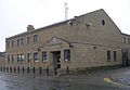 Ossett Police Station - Bank Street - geograph.org.uk - 679079.jpg 640 × 441; 186 KB
-
 Power station stockpile part 2 - geograph.org.uk - 2794991.jpg 2,435 × 2,803; 1,015 KB
-

-

-
 Telecommunications mast at Ossett - geograph.org.uk - 983756.jpg 480 × 640; 100 KB
-
 Telecoms mast adjacent the A1 - geograph.org.uk - 611899.jpg 640 × 480; 80 KB
-
 Telecoms mast near Woolley - geograph.org.uk - 617991.jpg 640 × 479; 157 KB
-
 Telecoms mast Upton - geograph.org.uk - 601916.jpg 427 × 640; 96 KB
-
 The Aire and Calder Navigation Canal at Ferrybridge - geograph.org.uk - 3739006.jpg 3,648 × 2,736; 3.73 MB
-
 The B6132 Gallows Hill - geograph.org.uk - 3110021.jpg 1,024 × 638; 96 KB
-
 The mast on Gallows Hill - geograph.org.uk - 2529168.jpg 777 × 570; 188 KB
-
 The river Aire at Ferrybridge - geograph.org.uk - 5652080.jpg 3,906 × 2,689; 1.8 MB
-
 The Transmitter Intake Lane - geograph.org.uk - 471850.jpg 480 × 640; 58 KB
-

-
 Transmitter mast on Gallows Hill - geograph.org.uk - 5912448.jpg 1,024 × 683; 127 KB
-
 Transmitter mast on Gallows Hill. - geograph.org.uk - 125543.jpg 640 × 480; 84 KB
-
 Upton communications mast. - geograph.org.uk - 534131.jpg 480 × 640; 106 KB
-
 Upton Rocket - geograph.org.uk - 55889.jpg 640 × 479; 105 KB
-
 Woolley Edge - geograph.org.uk - 80846.jpg 640 × 480; 124 KB


