Category:Ansty, Wiltshire
Jump to navigation
Jump to search
village and civil parish in southwest Wiltshire, England, UK  | |||||
| Upload media | |||||
| Instance of | |||||
|---|---|---|---|---|---|
| Location | Wiltshire, South West England, England | ||||
| official website | |||||
 | |||||
English: Ansty is a village and civil parish in Wiltshire, England, about seven miles east of Shaftesbury and adjacent to the A30 towards Salisbury. According to the 2001 census it had a population of 117.
Nederlands: Ansty is een dorp (village) en civil parish in de unitary authority Wiltshire, in het Engelse graafschap Wiltshire. De civil parish telt
Subcategories
This category has only the following subcategory.
S
Media in category "Ansty, Wiltshire"
The following 104 files are in this category, out of 104 total.
-
 A30 approaching Swallowcliffe garage - geograph.org.uk - 4046478.jpg 640 × 441; 68 KB
-

-
 A30 below White Sheet Hill - geograph.org.uk - 335779.jpg 640 × 430; 152 KB
-
 A30 between the two arms of Nower's Copse - geograph.org.uk - 3550824.jpg 1,024 × 768; 85 KB
-
 A30 going southwest - geograph.org.uk - 353426.jpg 640 × 430; 159 KB
-
 A30 heading west - geograph.org.uk - 5805517.jpg 1,024 × 684; 328 KB
-
 A30 heading west - geograph.org.uk - 5805521.jpg 1,024 × 684; 233 KB
-
 A30 heading west - geograph.org.uk - 5805527.jpg 1,024 × 684; 212 KB
-
 A30 junction for Alvediston - geograph.org.uk - 3550840.jpg 1,024 × 512; 68 KB
-
 Ansty Down - geograph.org.uk - 3076648.jpg 1,024 × 682; 130 KB
-
 Ansty Down - geograph.org.uk - 5261336.jpg 2,560 × 1,920; 2.89 MB
-
 Ansty Down Footpath - geograph.org.uk - 1341647.jpg 640 × 480; 105 KB
-
 Ansty Manor - geograph.org.uk - 516785.jpg 640 × 480; 102 KB
-
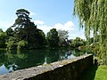 Ansty Pond - geograph.org.uk - 1341346.jpg 640 × 480; 99 KB
-
 Ansty Pond ca 1980 - geograph.org.uk - 3825544.jpg 640 × 424; 490 KB
-
 Ansty Pond ca 1980 - geograph.org.uk - 3825551.jpg 640 × 413; 392 KB
-
 Ansty, a fine view from the ridge - geograph.org.uk - 3501471.jpg 640 × 480; 98 KB
-
 Ansty, postbox № SP3 12 - geograph.org.uk - 3500052.jpg 640 × 480; 111 KB
-
 Ansty, the maypole - geograph.org.uk - 3500054.jpg 480 × 640; 61 KB
-
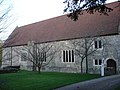
 Ansty, the old preceptory - geograph.org.uk - 3501461.jpg 640 × 480; 157 KB
-
 Ansty, the old preceptory from the road - geograph.org.uk - 3501463.jpg 640 × 480; 101 KB
-
 Ansty, the pond from the north - geograph.org.uk - 3501448.jpg 640 × 480; 112 KB
-
 Ansty, the pond from the south - geograph.org.uk - 3501450.jpg 640 × 480; 100 KB
-
 Arable Crop, Swallowcliffe Down - geograph.org.uk - 1825388.jpg 640 × 481; 147 KB
-
 Bench Mark, St James Church - geograph.org.uk - 1808850.jpg 480 × 640; 184 KB
-
 Bridleway, Ansty Hill - geograph.org.uk - 1159507.jpg 640 × 481; 166 KB
-
-
 Drive to Ark Farm - geograph.org.uk - 602259.jpg 640 × 480; 95 KB
-
 Footpath by Old Shaftesbury Drove - geograph.org.uk - 4244162.jpg 1,920 × 1,415; 816 KB
-
 Lane near Old Wardour Castle - geograph.org.uk - 384037.jpg 430 × 640; 146 KB
-
 Large hall in Ansty - geograph.org.uk - 289059.jpg 640 × 480; 112 KB
-
 Looking north from Middle Down towards Ansty - geograph.org.uk - 3076186.jpg 1,024 × 682; 102 KB
-
 Maize crop, Anstry Down - geograph.org.uk - 1978523.jpg 640 × 480; 148 KB
-
 Mallard on Ansty Pond - geograph.org.uk - 516791.jpg 640 × 480; 88 KB
-
 Maypole, Ansty - geograph.org.uk - 1973694.jpg 480 × 640; 109 KB
-
 Old Shaftesbury Drove - geograph.org.uk - 4244205.jpg 1,920 × 1,359; 778 KB
-
 Old Shaftesbury Drove - geograph.org.uk - 4244235.jpg 1,920 × 1,440; 710 KB
-
 Old Shaston Drove - geograph.org.uk - 849420.jpg 640 × 480; 109 KB
-
 Parting of the ways - geograph.org.uk - 384042.jpg 640 × 430; 176 KB
-
 Pond, Ansty - geograph.org.uk - 1997206.jpg 640 × 481; 168 KB
-

-
 Primroses, St James Churchyard - geograph.org.uk - 1808852.jpg 480 × 640; 217 KB
-
 Ride one, lead two - geograph.org.uk - 644965.jpg 640 × 480; 102 KB
-
 Rosebay Willow Herb, Ansty Down - geograph.org.uk - 1978517.jpg 640 × 480; 196 KB
-
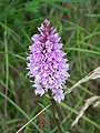
 Sainfoin (Onobrychis vicifolia) - geograph.org.uk - 849388.jpg 640 × 480; 48 KB
-
 Sawmill, Ansty - geograph.org.uk - 360828.jpg 640 × 480; 92 KB
-
 Sheep grazing by Old Shaftsbury Drove - geograph.org.uk - 382294.jpg 640 × 430; 97 KB
-

-
 Shelter belt on Ansty Down - geograph.org.uk - 4244214.jpg 1,920 × 2,427; 1.36 MB
-
 Stop me and buy one, Ansty - geograph.org.uk - 1997214.jpg 480 × 640; 138 KB
-
 Taking tea, Ansty - geograph.org.uk - 1997225.jpg 640 × 480; 118 KB
-
 Thatched Cottage and Maypole - geograph.org.uk - 314401.jpg 640 × 480; 124 KB
-
 The Old Commandery - geograph.org.uk - 2830741.jpg 2,048 × 1,536; 3.03 MB
-
 The smithsons, alison and peter smithson, ansty plum ramp, 1987 (5415398234).jpg 4,342 × 4,342; 12.85 MB
-
 Track towards Squalls Farm - geograph.org.uk - 384046.jpg 430 × 640; 153 KB
-
 Well stocked garden, Ansty - geograph.org.uk - 1997298.jpg 640 × 480; 192 KB
-
 Wheat field, Ansty Down - geograph.org.uk - 1978541.jpg 640 × 481; 176 KB
-
 Wiltshire Downland - geograph.org.uk - 5261329.jpg 2,560 × 1,920; 2.76 MB
-
 Wiltshire gate, Ansty Down - geograph.org.uk - 1978505.jpg 640 × 480; 138 KB
-
 Woodland at Ansty Farm Shop - geograph.org.uk - 3550837.jpg 1,024 × 1,021; 164 KB
-
 Woods next to Old Wardour Castle - geograph.org.uk - 288784.jpg 640 × 480; 164 KB
-
 Across bottom by Middle Down - geograph.org.uk - 382302.jpg 640 × 430; 97 KB
-
 Ansty Down - geograph.org.uk - 336021.jpg 640 × 430; 135 KB
-
 Ansty Fishpond - geograph.org.uk - 516776.jpg 640 × 480; 124 KB
-
 Ansty Pond - geograph.org.uk - 516799.jpg 640 × 480; 125 KB
-
 Ark Farm - geograph.org.uk - 383544.jpg 640 × 430; 95 KB
-
 Barn by A30 - geograph.org.uk - 353433.jpg 640 × 430; 127 KB
-
 Barns on Squalls Farm - geograph.org.uk - 384016.jpg 640 × 430; 90 KB
-
 Bottom by Middle Down - geograph.org.uk - 382299.jpg 640 × 430; 102 KB
-
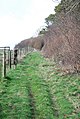 Bridleway to Old Shaftsbury Drove - geograph.org.uk - 337045.jpg 430 × 640; 129 KB
-

-

-
 Dilapidated sheds - feeding sheep - geograph.org.uk - 337051.jpg 640 × 430; 137 KB
-
 Downhill towards A30 - geograph.org.uk - 382289.jpg 640 × 430; 106 KB
-
 Downland north of Norrington Farm - geograph.org.uk - 336012.jpg 640 × 430; 127 KB
-
 Entrance to Horwood Farm from the A30 - geograph.org.uk - 360872.jpg 640 × 480; 121 KB
-
-
 Entrance to Squalls Farm, Ansty - geograph.org.uk - 360789.jpg 640 × 480; 111 KB
-
 Farmland by A30 - geograph.org.uk - 353427.jpg 640 × 430; 110 KB
-

-

-
 Footpath, Ansty - geograph.org.uk - 360862.jpg 640 × 480; 219 KB
-
 Gallows Hill - geograph.org.uk - 337971.jpg 640 × 430; 119 KB
-
 Hedged copse for pheasants - geograph.org.uk - 384031.jpg 640 × 430; 101 KB
-
 Horses on South Farm - geograph.org.uk - 353438.jpg 640 × 430; 131 KB
-
 Horwood Farm Dairy - geograph.org.uk - 335768.jpg 640 × 430; 129 KB
-
 Looking down on South Farm - geograph.org.uk - 382291.jpg 640 × 430; 117 KB
-

-
 New Barn - geograph.org.uk - 335755.jpg 640 × 430; 141 KB
-
 Old Shaftsbury Drove - geograph.org.uk - 336023.jpg 430 × 640; 109 KB
-
 Old Shaftsbury Drove - geograph.org.uk - 382292.jpg 430 × 640; 160 KB
-
 Old Shaston Drove, Ansty - geograph.org.uk - 698260.jpg 640 × 476; 79 KB
-
 Pheasants Copse - geograph.org.uk - 384025.jpg 640 × 430; 85 KB
-
 Pond by Squalls Lane, Ansty - geograph.org.uk - 360803.jpg 640 × 480; 169 KB
-
 Run off from Ansty Pond - geograph.org.uk - 516795.jpg 640 × 480; 126 KB
-
 Shave Lane - geograph.org.uk - 353432.jpg 430 × 640; 130 KB
-
 Stilted farm building - geograph.org.uk - 335761.jpg 640 × 430; 127 KB
-
 Stone barn by A30 - geograph.org.uk - 335765.jpg 640 × 430; 157 KB
-
 The steep and winding road - geograph.org.uk - 382284.jpg 640 × 430; 130 KB
-
 Trees atop of White Sheet Hill - geograph.org.uk - 353417.jpg 640 × 430; 106 KB
-
 View down Gallows Hill - geograph.org.uk - 337982.jpg 640 × 430; 143 KB
-
 White Sheet Hill - geograph.org.uk - 335778.jpg 640 × 430; 123 KB
-
 Woodland path near the Old Shaston Drove - geograph.org.uk - 698275.jpg 640 × 446; 112 KB
-
 Woods on Ansty Down - geograph.org.uk - 337970.jpg 640 × 430; 116 KB


_-_geograph.org.uk_-_849401.jpg)


_-_geograph.org.uk_-_849388.jpg)


.jpg)


