Category:Annesley
Jump to navigation
Jump to search
English: Annesley is a village and civil parish in the District of Ashfield in Nottinghamshire, England, located between Hucknall and Kirkby-in-Ashfield. According to the 2001 census the parish had a population of 1,096. Nearby to the west is Annesley Woodhouse.
village and civil parish in Nottinghamshire, UK  | |||||
| Upload media | |||||
| Instance of | |||||
|---|---|---|---|---|---|
| Location | Ashfield, Nottinghamshire, East Midlands, England | ||||
 | |||||
Subcategories
This category has the following 3 subcategories, out of 3 total.
A
- All Saints Church, Annesley (2 F)
- Annesley Hall, Nottinghamshire (30 F)
Media in category "Annesley"
The following 200 files are in this category, out of 262 total.
(previous page) (next page)-
 "Forever in our Hearts" - geograph.org.uk - 6036609.jpg 5,044 × 3,670; 5.37 MB
-
-
 63576 04 Annesley MPD '63 (2) (24442712528).jpg 2,592 × 1,728; 2.2 MB
-
 63711 Annesley MPD '63 (43564236201).jpg 2,592 × 1,728; 989 KB
-
 73045 Annesley MPD '63 - Copy (24306966928).jpg 2,592 × 1,728; 3.62 MB
-
 A608 lay-by near Junction 27 (M1) - geograph.org.uk - 3323492.jpg 3,440 × 2,143; 1.51 MB
-
 A608 towards Underwood - geograph.org.uk - 1830913.jpg 640 × 480; 63 KB
-
 A611, near Wighay Roundabout, Notts. - geograph.org.uk - 3339214.jpg 2,997 × 3,485; 1.64 MB
-
 Abandoned stable block, Annesley Hall estate - geograph.org.uk - 5950902.jpg 5,067 × 3,801; 5.82 MB
-
 Above Felley Mill - geograph.org.uk - 5975292.jpg 1,280 × 842; 358 KB
-
 All Saints Church at Annesley Hall - geograph.org.uk - 4960937.jpg 800 × 600; 168 KB
-
 All Saints' Church, Annesley - geograph.org.uk - 4961197.jpg 800 × 600; 122 KB
-
 Annesley - fields above Mosley Farm - geograph.org.uk - 2456528.jpg 1,600 × 1,200; 529 KB
-
 Annesley - houses on Derby Road - geograph.org.uk - 3253022.jpg 1,600 × 1,229; 560 KB
-
 Annesley - Robin Hood Hills.JPG 640 × 426; 223 KB
-
 Annesley Castle Bailey.jpg 4,357 × 3,081; 6.57 MB
-
 Annesley Castle Motte.jpg 4,299 × 3,040; 7.23 MB
-
 Annesley Cemetery - geograph.org.uk - 4961199.jpg 800 × 600; 156 KB
-
 Annesley Cemetery NG15, Notts. - geograph.org.uk - 3351298.jpg 3,141 × 2,727; 1.62 MB
-
 Annesley Cemetery to the left - geograph.org.uk - 5000239.jpg 3,072 × 1,728; 2.78 MB
-
 Annesley Chapel (8981032380).jpg 1,803 × 2,875; 3.16 MB
-
 Annesley Church NG15, Notts. - geograph.org.uk - 3351270.jpg 1,954 × 2,611; 832 KB
-
 Annesley Church NG15, Notts. - geograph.org.uk - 3351277.jpg 2,540 × 3,774; 1.98 MB
-
 Annesley Cutting NG15, Notts. - geograph.org.uk - 3351212.jpg 3,806 × 2,331; 1.59 MB
-
-
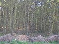
 Annesley Forest NG15, Notts. - geograph.org.uk - 3351879.jpg 3,190 × 1,987; 1.27 MB
-
 Annesley Forest NG15, Notts. - geograph.org.uk - 3351892.jpg 3,254 × 2,589; 1.59 MB
-
 Annesley Hall - geograph.org.uk - 1830926.jpg 640 × 480; 153 KB
-
 Annesley Hall - geograph.org.uk - 4682080.jpg 1,024 × 768; 240 KB
-
 Annesley Hall - geograph.org.uk - 4960945.jpg 800 × 600; 121 KB
-
 Annesley Hall, entrance facade - geograph.org.uk - 4682093.jpg 1,024 × 768; 185 KB
-
 Annesley Headframe - geograph.org.uk - 1589374.jpg 640 × 426; 79 KB
-
 Annesley Lodge, Notts (1).jpg 4,032 × 3,024; 3.62 MB
-
 Annesley Lodge, Notts (2).jpg 4,032 × 3,024; 2.28 MB
-
 Annesley NG15, Notts. - geograph.org.uk - 3351233.jpg 4,029 × 2,635; 1.94 MB
-
 Annesley NG15, Notts. - geograph.org.uk - 3351282.jpg 3,557 × 2,527; 1.79 MB
-
 Annesley NG15, Notts. - geograph.org.uk - 3351307.jpg 3,619 × 2,674; 1.81 MB
-
 Annesley NG15, Notts. - geograph.org.uk - 3351323.jpg 3,620 × 2,041; 1.55 MB
-
 Annesley Old Church - geograph.org.uk - 5950912.jpg 5,067 × 3,801; 6.53 MB
-
 Annesley Park - geograph.org.uk - 2417452.jpg 1,024 × 768; 183 KB
-
 Annesley Park Estate, Notts. - geograph.org.uk - 3339276.jpg 785 × 800; 152 KB
-
 Annesley Park in the snow - geograph.org.uk - 2417403.jpg 1,024 × 768; 206 KB
-
 Annesley Park, Notts. - geograph.org.uk - 3339254.jpg 3,498 × 1,867; 1.18 MB
-
 Annesley Village - geograph.org.uk - 1708329.jpg 640 × 480; 99 KB
-
 Annesley village artwork - 1 - geograph.org.uk - 1708452.jpg 640 × 480; 118 KB
-
 Annesley village artwork - 2 - geograph.org.uk - 1708496.jpg 640 × 480; 108 KB
-
 Approach to All Saints' Church, Annesley - geograph.org.uk - 4961202.jpg 600 × 800; 203 KB
-
 Approaching Annesley Village - geograph.org.uk - 2650530.jpg 640 × 480; 55 KB
-
 Arable land near Park Springs Wood - geograph.org.uk - 1574421.jpg 640 × 480; 116 KB
-

-

-
 Ashfield , M1 Motorway - geograph.org.uk - 5951671.jpg 6,000 × 4,000; 7.04 MB
-
 Ashfield , M1 Motorway - geograph.org.uk - 5951672.jpg 6,000 × 4,000; 7.32 MB
-
 Ashfield , M1 Motorway - geograph.org.uk - 5951673.jpg 6,000 × 4,000; 5.4 MB
-
 Ashfield , M1 Motorway - geograph.org.uk - 5951675.jpg 6,000 × 4,000; 6.73 MB
-
 Ashfield , M1 Motorway - geograph.org.uk - 5951676.jpg 6,000 × 4,000; 6.72 MB
-
 Ashfield , M1 Motorway - geograph.org.uk - 5976318.jpg 6,000 × 4,000; 6.8 MB
-
 Ashfield , M1 Motorway - geograph.org.uk - 5976319.jpg 6,000 × 4,000; 6.33 MB
-
 Ashfield , M1 Motorway - geograph.org.uk - 5976321.jpg 6,000 × 4,000; 6.96 MB
-
 Ashfield , M1 Motorway - geograph.org.uk - 5977345.jpg 6,000 × 4,000; 6.72 MB
-
 Ashfield , M1 Motorway - geograph.org.uk - 5977349.jpg 6,000 × 4,000; 6.73 MB
-
 Autumn beechwoods - geograph.org.uk - 5975277.jpg 961 × 1,280; 698 KB
-
 Autumn beechwoods - geograph.org.uk - 5975279.jpg 960 × 1,280; 669 KB
-

-
 Autumn in Beauvale woods - geograph.org.uk - 5975284.jpg 960 × 1,280; 666 KB
-
 Autumn near Felley Mill - geograph.org.uk - 5975294.jpg 1,280 × 960; 494 KB
-
 Bailey on Castle Hill - geograph.org.uk - 2810841.jpg 2,048 × 1,536; 740 KB
-
 Big Pond - geograph.org.uk - 5604336.jpg 2,212 × 1,659; 1.02 MB
-
 Blue Bells - geograph.org.uk - 2818755.jpg 1,568 × 1,168; 2.38 MB
-
 Boots warehouse at Sherwood Park - geograph.org.uk - 1559742.jpg 640 × 480; 77 KB
-
 Bridge over the M1 motorway - geograph.org.uk - 1830892.jpg 640 × 480; 70 KB
-
 Bridleway towards America Farm - geograph.org.uk - 1830886.jpg 640 × 480; 104 KB
-
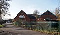
 Business units at Home Farm - geograph.org.uk - 4960931.jpg 800 × 600; 146 KB
-
 Byron Road, Annesley - geograph.org.uk - 1830180.jpg 640 × 480; 77 KB
-
 Byron Road, Annesley Village, looking north - geograph.org.uk - 5051662.jpg 2,024 × 1,450; 852 KB
-
 Can you not see the mast^ - geograph.org.uk - 5000210.jpg 3,072 × 1,728; 5.23 MB
-
 Castle Hill, Annesley Forest NG15, Notts. - geograph.org.uk - 3351832.jpg 2,875 × 1,708; 1.05 MB
-
 Castle Hill, Annesley Forest NG15, Notts. - geograph.org.uk - 3351852.jpg 3,016 × 4,032; 2.28 MB
-

-
 Clouds over Bagthorpe - geograph.org.uk - 3941481.jpg 1,920 × 1,182; 203 KB
-

-
 Countryside north of Morning Springs Plantation - geograph.org.uk - 6036608.jpg 4,814 × 3,544; 3.8 MB
-
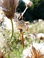 Crane Fly (7973005960).jpg 3,000 × 4,000; 2.9 MB
-
 Cycleway and footpath to Newstead - geograph.org.uk - 1705353.jpg 640 × 480; 122 KB
-
 Descending path towards Annesley Cutting - geograph.org.uk - 5000232.jpg 3,072 × 1,728; 4.62 MB
-
 Dog and Bear Lane - geograph.org.uk - 2810849.jpg 2,037 × 1,528; 667 KB
-
 East lake at Kodak Lakes in Sherwood Enterprise Park - geograph.org.uk - 3425692.jpg 3,648 × 2,736; 3.75 MB
-
 Exposed reinforcement - geograph.org.uk - 5390755.jpg 1,280 × 853; 181 KB
-
 Farm track enters Park Springs Wood - geograph.org.uk - 1574414.jpg 640 × 480; 116 KB
-

-
 Farm track near M1 motorway (footpath) - geograph.org.uk - 1833675.jpg 640 × 480; 110 KB
-
 Farm track near Park Springs Wood - geograph.org.uk - 1574434.jpg 640 × 480; 117 KB
-
 Farm track near Park Springs Wood - geograph.org.uk - 1574448.jpg 640 × 480; 115 KB
-
 Farmhouse on Kennel Lane - geograph.org.uk - 4960926.jpg 800 × 600; 154 KB
-

-
 Farmland near America Farm - geograph.org.uk - 1830881.jpg 640 × 480; 77 KB
-
 Farmland near Weaver's Lane - geograph.org.uk - 2416422.jpg 1,024 × 768; 234 KB
-
 Fast bread overhead - geograph.org.uk - 4996798.jpg 3,020 × 1,628; 4.12 MB
-
 Felley Mill Ford - geograph.org.uk - 6125940.jpg 3,662 × 2,744; 3.01 MB
-
 Felley Mill pond in Underwood - geograph.org.uk - 5627625.jpg 4,608 × 3,456; 3.51 MB
-
 Fields near Annesley - geograph.org.uk - 5051639.jpg 1,366 × 1,024; 337 KB
-
 Footbridge over the M1 - geograph.org.uk - 4667835.jpg 640 × 384; 23 KB
-
 Footpath in Kennel Wood - geograph.org.uk - 4960929.jpg 800 × 600; 172 KB
-
 Footpath Junction at Annesley Lane End - geograph.org.uk - 6020001.jpg 1,600 × 1,200; 556 KB
-
 Footpath subway in Park Forest - geograph.org.uk - 4958960.jpg 800 × 600; 171 KB
-
 Ford and footbridge at Felley Mill - geograph.org.uk - 5975298.jpg 1,280 × 960; 765 KB
-
 Forest track in Beauvale woods - geograph.org.uk - 5975282.jpg 1,280 × 816; 461 KB
-
 Former mill pond at Felley Mill - geograph.org.uk - 5975304.jpg 1,280 × 960; 762 KB
-
 Frank's Plantation - geograph.org.uk - 1830912.jpg 640 × 480; 85 KB
-
 Gantry and Annesley Lane Bridge, M1 - geograph.org.uk - 4667833.jpg 640 × 426; 31 KB
-
 Gatehouse and stable range, Annesley Hall - geograph.org.uk - 4682097.jpg 1,024 × 768; 258 KB
-
 Green space in the middle of Annesley Village - geograph.org.uk - 5051651.jpg 2,048 × 1,536; 838 KB
-
 Hedgerow oaks near Felley Mill - geograph.org.uk - 5975307.jpg 1,280 × 1,280; 484 KB
-
 Hereford Bull in the snow - geograph.org.uk - 2416473.jpg 1,024 × 754; 229 KB
-
 Hidden Valleys landscape - geograph.org.uk - 5975286.jpg 1,280 × 826; 298 KB
-
 Hidden Valleys landscape, autumn colours - geograph.org.uk - 5975288.jpg 1,280 × 808; 457 KB
-

-
 Holiday Inn hotel (formerly The Dakota) - geograph.org.uk - 2722736.jpg 1,024 × 768; 111 KB
-
 Home Farm - geograph.org.uk - 4997622.jpg 3,054 × 1,696; 4.59 MB
-
 If only^ - geograph.org.uk - 1121077.jpg 640 × 551; 49 KB
-
 In the woods by Park Springs - geograph.org.uk - 4996796.jpg 1,728 × 3,072; 5.01 MB
-
 Jacobs Sheep at Home Farm - geograph.org.uk - 2416412.jpg 1,024 × 767; 310 KB
-
 Kennel Lane - geograph.org.uk - 2417370.jpg 1,024 × 768; 477 KB
-
 Kennel Lane - geograph.org.uk - 2417411.jpg 1,024 × 768; 369 KB
-
 Kennel Lane heading south (footpath) - geograph.org.uk - 1830901.jpg 640 × 480; 98 KB
-
 Kennel Wood - geograph.org.uk - 1830905.jpg 640 × 480; 158 KB
-
 Lakeside Court - geograph.org.uk - 1559722.jpg 640 × 480; 89 KB
-
 Lay by on A608 Mansfield Road - geograph.org.uk - 2993873.jpg 2,000 × 1,500; 423 KB
-
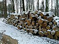 Log pile in Morning Springs forest - geograph.org.uk - 5627630.jpg 4,608 × 3,456; 3.04 MB
-

-
 M1 motorway southbound - geograph.org.uk - 1830898.jpg 640 × 480; 63 KB
-
 M1 Narrow lanes 4 more miles - geograph.org.uk - 1121083.jpg 640 × 413; 52 KB
-
 M1 north gridlock junction 27 to 28 - geograph.org.uk - 2476123.jpg 1,024 × 667; 88 KB
-
 M1 northbound at junction 27 - geograph.org.uk - 4340727.jpg 1,600 × 1,200; 860 KB
-
 M1 south of Junction 27 - geograph.org.uk - 2416499.jpg 1,024 × 781; 246 KB
-
 M1 southbound - geograph.org.uk - 1833683.jpg 640 × 480; 74 KB
-
 M1, Junction 27 - geograph.org.uk - 4667836.jpg 640 × 426; 23 KB
-
 Morning Springs forest road - geograph.org.uk - 5627635.jpg 4,608 × 3,456; 3.82 MB
-
 Moseley Farm - geograph.org.uk - 5051717.jpg 1,962 × 1,472; 746 KB
-
 Moss covered wall near Annesley church - geograph.org.uk - 1705120.jpg 640 × 480; 148 KB
-
 Motorway bridge at Park Springs Wood - geograph.org.uk - 1574392.jpg 640 × 480; 108 KB
-
 Motte and bailey on Castle Hill - geograph.org.uk - 2810822.jpg 2,048 × 1,536; 863 KB
-
 Nave and chancel of Old All Saints church - geograph.org.uk - 4682100.jpg 1,024 × 768; 211 KB
-
 New England colours in Old England - geograph.org.uk - 5975290.jpg 1,280 × 960; 424 KB
-
 New housing on the edge of Annesley - geograph.org.uk - 5051647.jpg 2,014 × 1,510; 689 KB
-
 Newstead Village Area NG15, Notts. - geograph.org.uk - 3351204.jpg 2,999 × 3,568; 1.73 MB
-
 Newstead Village NG15, Notts. - geograph.org.uk - 3351147.jpg 3,664 × 2,597; 1.65 MB
-
 Newstead Village NG15, Notts. - geograph.org.uk - 3351153.jpg 4,026 × 2,866; 2 MB
-
 Newstead Village NG15, Notts. - geograph.org.uk - 3351183.jpg 3,926 × 2,318; 1.79 MB
-
 Newstead Village Primary School - geograph.org.uk - 2650513.jpg 640 × 480; 60 KB
-

-
 No road^ - geograph.org.uk - 5051694.jpg 2,048 × 1,536; 945 KB
-
 Nottingham - NG15 (Annesley Hall Area) - geograph.org.uk - 2963628.jpg 600 × 800; 163 KB
-
 Notts - NG15 (Annesley Hall area) - geograph.org.uk - 2963004.jpg 800 × 600; 173 KB
-
 Notts - NG15 (Annesley Hall area) - geograph.org.uk - 2963010.jpg 800 × 600; 108 KB
-
 Notts - NG15 (Annesley Hall Area) - geograph.org.uk - 2963618.jpg 600 × 800; 139 KB
-
 Notts - NG15 (Annesley Hall Area) - geograph.org.uk - 2963650.jpg 800 × 600; 153 KB
-
 Notts - NG15 (Annesley Hall Area) - geograph.org.uk - 2963692.jpg 800 × 600; 148 KB
-
 Notts - NG15 (Annesley Hall Area) - geograph.org.uk - 2963717.jpg 800 × 600; 132 KB
-
 Notts - NG15 (Annesley Hall Area) - geograph.org.uk - 2964873.jpg 800 × 600; 113 KB
-
 Notts - NG15 (Annesley Hall) - geograph.org.uk - 2963062.jpg 800 × 600; 131 KB
-
 Notts - NG15 (Sherwood Park) - geograph.org.uk - 2964838.jpg 800 × 600; 122 KB
-
 Notts - NG15 - geograph.org.uk - 2963845.jpg 800 × 600; 114 KB
-
 Notts - NG16 (Annesley Hall Area) - geograph.org.uk - 2963741.jpg 800 × 600; 121 KB
-
 Notts - NG16 (Annesley Hall Area) - geograph.org.uk - 2963786.jpg 800 × 600; 128 KB
-
 Notts - NG16 (Annesley Hall Area) - geograph.org.uk - 2963816.jpg 800 × 600; 157 KB
-
 Notts - NG16 (Annesley Lane End) - geograph.org.uk - 2964818.jpg 800 × 600; 131 KB
-
 Notts NG16 - geograph.org.uk - 2963901.jpg 800 × 600; 128 KB
-
 Office block in Sherwood Enterprise Park - geograph.org.uk - 3425984.jpg 3,648 × 2,736; 1.79 MB
-
 Old All Saints church, west tower - geograph.org.uk - 4682104.jpg 1,024 × 768; 254 KB
-
 Old and new Annesley - geograph.org.uk - 5051675.jpg 2,045 × 1,534; 765 KB
-
 Old bridge - geograph.org.uk - 5051688.jpg 2,033 × 1,525; 835 KB
-
 Old bridge - geograph.org.uk - 5051709.jpg 2,047 × 1,535; 957 KB
-
 Old Post Office BandB, Newstead - geograph.org.uk - 895177.jpg 640 × 485; 80 KB
-
 On Kennel Lane - geograph.org.uk - 4996801.jpg 3,072 × 1,728; 1.49 MB
-
 On Kennel Lane approaching Kennel Wood - geograph.org.uk - 4996803.jpg 3,070 × 1,724; 3.94 MB
-
 Paddock at Annesley - geograph.org.uk - 3407563.jpg 3,186 × 2,489; 2.53 MB
-
 Part of former A608, near Junction 27 (M1) - geograph.org.uk - 3323502.jpg 3,749 × 2,619; 2.1 MB
-
 Part of former A608, near Junction 27 (M1) - geograph.org.uk - 3323601.jpg 2,798 × 1,781; 719 KB
-
 Path approaching Annesley Village - geograph.org.uk - 1708111.jpg 640 × 480; 113 KB
-
 Path beneath the M1 - geograph.org.uk - 5390744.jpg 1,280 × 1,280; 614 KB
-
 Path in Park Forest - geograph.org.uk - 4958956.jpg 800 × 600; 220 KB
-
 Path through Park Springs Wood - geograph.org.uk - 1574383.jpg 640 × 480; 137 KB
-

-

-
 Public footpath to Felley Mill - geograph.org.uk - 1574565.jpg 640 × 480; 128 KB
-
 Radio mast on part of former A608, near Junction 27 (M1) - geograph.org.uk - 3323579.jpg 2,438 × 3,250; 1.6 MB
-
 Radio masts on former A608, near Junction 27 (M1) - geograph.org.uk - 3323553.jpg 2,747 × 3,900; 1.94 MB
-
 RAF Stirling memorial stone, Annesley - geograph.org.uk - 895110.jpg 640 × 485; 116 KB
-
 RAF Stirling memorial, Annesley - geograph.org.uk - 895106.jpg 640 × 485; 88 KB
-
 Rear of now derelict Annesley Hall - geograph.org.uk - 5000199.jpg 3,072 × 1,728; 4.54 MB
-
 Road from Newstead to Annesley - geograph.org.uk - 4228479.jpg 640 × 343; 46 KB
-

-
 Ruins of Felley Mill - geograph.org.uk - 5975302.jpg 1,280 × 960; 681 KB
-
 Rural Scene - geograph.org.uk - 1716635.jpg 3,072 × 2,304; 3 MB
-

-
 Saplings in the snow near Home Farm - geograph.org.uk - 2416348.jpg 1,024 × 768; 236 KB
-
 School Hill, Annesley - geograph.org.uk - 1829503.jpg 640 × 480; 79 KB
-
 Sherwood Business Park - geograph.org.uk - 1563607.jpg 640 × 480; 87 KB
-
 Sherwood Way, Selston - geograph.org.uk - 1833670.jpg 640 × 480; 59 KB

_Highest_Point_in_Nottinghamshire_-_geograph.org.uk_-_87335.jpg)
_(24442712528).jpg)
.jpg)
.jpg)
_-_geograph.org.uk_-_3323492.jpg)


.jpg)


.jpg)
.jpg)


.jpg)


_-_geograph.org.uk_-_1833675.jpg)


_-_geograph.org.uk_-_2722736.jpg)


_-_geograph.org.uk_-_1830901.jpg)


_-_geograph.org.uk_-_2963628.jpg)
_-_geograph.org.uk_-_2963004.jpg)
_-_geograph.org.uk_-_2963010.jpg)
_-_geograph.org.uk_-_2963618.jpg)
_-_geograph.org.uk_-_2963650.jpg)
_-_geograph.org.uk_-_2963692.jpg)
_-_geograph.org.uk_-_2963717.jpg)
_-_geograph.org.uk_-_2964873.jpg)
_-_geograph.org.uk_-_2963062.jpg)
_-_geograph.org.uk_-_2964838.jpg)

_-_geograph.org.uk_-_2963741.jpg)
_-_geograph.org.uk_-_2963786.jpg)
_-_geograph.org.uk_-_2963816.jpg)
_-_geograph.org.uk_-_2964818.jpg)


_-_geograph.org.uk_-_3323502.jpg)
_-_geograph.org.uk_-_3323601.jpg)


_-_geograph.org.uk_-_3323579.jpg)
_-_geograph.org.uk_-_3323553.jpg)


