Category:Anna-rét
Jump to navigation
Jump to search
| Object location | | View all coordinates using: OpenStreetMap |
|---|
| Upload media | |||||
 | |||||
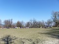
English: Anna-rét (Anna meadow/Anne meadow) Main sight is a chapel, but you'll find here playground for children, picnic fire places and Normafa sledging place (not part of the Normafa). Located 500 meter from Normafa ski house, between Normafa and Szaniszló-rét (Szaniszló meadow) in Svábhegy neighborhood, 12th district of Budapest Info (Hu)ː [1]
Subcategories
This category has only the following subcategory.
S
- Saint Anne chapel (Budapest) (5 F)
Media in category "Anna-rét"
The following 32 files are in this category, out of 32 total.
-
 Anna-rét (10).jpg 4,000 × 3,000; 4.43 MB
-
 Anna-rét (11).jpg 4,000 × 3,000; 4.84 MB
-
 Anna-rét (2).jpg 4,000 × 3,000; 4.48 MB
-
 Anna-rét (3).jpg 4,000 × 3,000; 4.7 MB
-
 Anna-rét (4).jpg 4,000 × 3,000; 4.81 MB
-
 Anna-rét (5).jpg 4,000 × 3,000; 4.53 MB
-
 Anna-rét (6).jpg 4,000 × 3,000; 4.8 MB
-
 Anna-rét (7).jpg 4,000 × 3,000; 4.62 MB
-
 Anna-rét (8).jpg 4,000 × 3,000; 4.73 MB
-
 Anna-rét (9).jpg 4,000 × 3,000; 4.57 MB
-
 Anna-rét playground.JPG 2,560 × 1,920; 3.19 MB
-
 Anna-rét.jpg 4,000 × 3,000; 4.83 MB
-
 Anna-Wiese Ost, Speck-Backplätze, 2022 Svábhegy.jpg 1,704 × 2,272; 1.07 MB
-
 Anna-Wiese, Drachenfliegen, 2022 Svábhegy.jpg 1,704 × 2,272; 1.3 MB
-
 Anna-Wiese, Jakobsweg Ungarn, Marienweg, 2022 Svábhegy.jpg 1,704 × 2,272; 1.43 MB
-
 Anna-Wiese, Kunstschnee, Rodelbahn, 2023 Svábhegy.jpg 2,272 × 1,704; 980 KB
-
 Anna-Wiese, Marienweg, 2022 Svábhegy.jpg 1,704 × 2,272; 1.54 MB
-
 Anna-Wiese, Rodelbahn, 2022 Svábhegy.jpg 2,272 × 1,704; 975 KB
-
 Anna-Wiese, Rodelbahn, Berggipfel Disznófő, 2022 Svábhegy.jpg 2,272 × 1,704; 997 KB
-
 Anna-Wiese, Rodelbahn, Skifahren verboten Schild, 2022 Svábhegy.jpg 1,704 × 2,272; 1.65 MB
-
 Anna-Wiese, Schneekanone, 2023 Svábhegy.jpg 1,704 × 2,272; 1.46 MB
-
 Anna-Wiese, SO, 2023 Svábhegy.jpg 2,272 × 1,704; 1.02 MB
-
 Anna-Wiese, Spielplatz, Rutsche, 2022 Svábhegy.jpg 2,272 × 1,704; 984 KB
-
 Anna-Wiese, Spielplatz, Seilrutsche, 2022 Svábhegy.jpg 2,272 × 1,704; 985 KB
-
 Anna-Wiese, Vogelhäusche, 2022 Svábhegy.jpg 1,704 × 2,272; 1.45 MB
-
 Anna-Wiese, Überwachungskameras, 2023 Svábhegy.jpg 1,704 × 2,272; 1.7 MB
-
 Anna rét. Monspart Sarolta tájfutó világbajnok. Fortepan 20802.jpg 3,303 × 2,047; 4.04 MB
-
 Budapest XII., Normafa, Anna rét, 1939. - Fortepan 92198.jpg 3,894 × 3,644; 10 MB
-
 Kreuz an der Kapelle St. Anna, 2023 Budapest.jpg 1,704 × 2,272; 1.42 MB
-
 Normafa Anna rét.jpg 2,560 × 1,920; 500 KB
-
 Paulinerweg, Station 1.5, 2023 Budapest.jpg 1,704 × 2,272; 1.31 MB
-
 Paulinerweg, Station 1.5, Wegweiser, 2023 Budapest.jpg 1,704 × 2,272; 1.39 MB
.jpg)
.jpg)
.jpg)
.jpg)
.jpg)
.jpg)
.jpg)
.jpg)
.jpg)
.jpg)


