Category:Altofts
Jump to navigation
Jump to search
village in United Kingdom  | |||||
| Upload media | |||||
| Instance of | |||||
|---|---|---|---|---|---|
| Location | Normanton, Wakefield, West Yorkshire, Yorkshire and the Humber, England | ||||
 | |||||
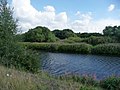
English: Altofts is a village near Normanton, West Yorkshire, England. The village is usually quiet, having a mixed population of young and old. There are four pubs, two Working Men's Clubs, a handful of small shops, one post office and a few farms. Lower Altofts is the area at the lower end of the village. It had the longest unbroken row of terraced houses in Europe, named Silkstone Row, until 1974, when it was demolished.
Subcategories
This category has the following 5 subcategories, out of 5 total.
Media in category "Altofts"
The following 34 files are in this category, out of 34 total.
-
 Aire and Calder towards Castleford - geograph.org.uk - 509906.jpg 640 × 318; 77 KB
-
 Allotments - Altofts Hall Road - geograph.org.uk - 1406311.jpg 640 × 480; 256 KB
-
 Allotments - Lee Brig - geograph.org.uk - 1405420.jpg 640 × 480; 254 KB
-

-

-
 Blot on the landscape - geograph.org.uk - 2790729.jpg 1,024 × 768; 565 KB
-
 Bridleway - Station Road - geograph.org.uk - 1405344.jpg 480 × 640; 221 KB
-

-
 Eastbound M62 Crossing River Calder - geograph.org.uk - 4768169.jpg 640 × 427; 293 KB
-
 Footpath - Ellentree Lane - geograph.org.uk - 1406301.jpg 480 × 640; 249 KB
-
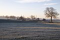 Frosty Morning - geograph.org.uk - 1121123.jpg 640 × 425; 75 KB
-
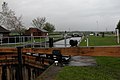 Kings Road Lock - geograph.org.uk - 5356.jpg 640 × 426; 72 KB
-

-

-
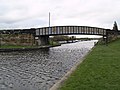
 Lee Brig - viewed from Patience Lane - geograph.org.uk - 1405415.jpg 640 × 480; 256 KB
-
 Let the power be with you. - geograph.org.uk - 561605.jpg 640 × 609; 112 KB
-
 Newland Park - geograph.org.uk - 190749.jpg 640 × 480; 47 KB
-
 Power lines west of Altofts - geograph.org.uk - 44187.jpg 640 × 480; 73 KB
-
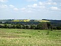 Rapeseed in flower - geograph.org.uk - 2402527.jpg 1,024 × 768; 710 KB
-
 River Calder - Foxholes - geograph.org.uk - 1941723.jpg 480 × 640; 317 KB
-
 River Calder - geograph.org.uk - 1832810.jpg 640 × 480; 286 KB
-
 River Calder - geograph.org.uk - 1832956.jpg 640 × 480; 305 KB
-
 Shoe factory, Bottomboat - geograph.org.uk - 1848482.jpg 640 × 480; 261 KB
-
 Steam clouds - geograph.org.uk - 2790721.jpg 1,024 × 768; 540 KB
-

-

-
-

-

-

-
 The footpath to Newland Park - geograph.org.uk - 2165744.jpg 1,024 × 768; 138 KB
-
 The River Calder - geograph.org.uk - 2015030.jpg 1,024 × 768; 154 KB
-
 The road to Altofts - geograph.org.uk - 44189.jpg 640 × 480; 85 KB
-


