Category:Alter Friedhof Durlach
Jump to navigation
Jump to search
| Object location | | View all coordinates using: OpenStreetMap |
|---|
cemetery in Durlach, Karlsruhe Government Region, Bade-Württemberg, Germany | |||||
| Upload media | |||||
| Instance of | |||||
|---|---|---|---|---|---|
| Location | Karlsruhe, Karlsruhe Government Region, Baden-Württemberg, Germany | ||||
| Heritage designation | |||||
 | |||||
This is the category of the Kulturdenkmal (cultural monument) of Karlsruhe with the ID 01346
|
Media in category "Alter Friedhof Durlach"
The following 7 files are in this category, out of 7 total.
-
 Alter Friedhof Karlsruhe-Durlach.JPG 3,456 × 5,184; 10.12 MB
-

-
 Durlach-Alter Friedhof.jpg 1,280 × 960; 787 KB
-
 Grabdenkmal II.JPG 1,920 × 2,560; 2.3 MB
-
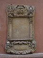 Grabplatte I.JPG 1,920 × 2,560; 2.16 MB
-
 Hahnenbrunnen.JPG 1,920 × 2,560; 2.22 MB
-
 Nikolauskapelle in Durlach.JPG 2,560 × 1,920; 2.21 MB

_-_geo.hlipp.de_-_19279.jpg)


