Category:Allensmore
Jump to navigation
Jump to search
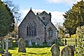
village in United Kingdom  Eglwys Sant Andreas, Allensmore | |||||
| Upload media | |||||
| Instance of | |||||
|---|---|---|---|---|---|
| Location | Herefordshire, West Midlands, England | ||||
 | |||||
Main Wikipedia article: Allensmore.
Subcategories
This category has the following 2 subcategories, out of 2 total.
A
Media in category "Allensmore"
The following 103 files are in this category, out of 103 total.
-
 A Clehonger orchard - geograph.org.uk - 3645667.jpg 800 × 600; 151 KB
-
 A465 at Goose Pool - geograph.org.uk - 2954523.jpg 640 × 480; 52 KB
-
 A465 at Webtree - geograph.org.uk - 3772328.jpg 800 × 450; 230 KB
-
 A465 east of Winnal - geograph.org.uk - 2954515.jpg 640 × 480; 49 KB
-
 A465 near Allensmore - geograph.org.uk - 2954518.jpg 640 × 481; 68 KB
-
 Allensmore Nurseries - geograph.org.uk - 315712.jpg 640 × 480; 69 KB
-
 Allensmore Nurseries in the distance - geograph.org.uk - 905220.jpg 640 × 480; 94 KB
-
 Arable land at Allensmore - geograph.org.uk - 3273881.jpg 1,024 × 680; 268 KB
-
 Black and white cottage - geograph.org.uk - 905238.jpg 640 × 480; 133 KB
-
 Bowley B^B, Clehonger - geograph.org.uk - 3645664.jpg 800 × 733; 109 KB
-
 Bridleway north - geograph.org.uk - 3095239.jpg 1,200 × 676; 422 KB
-
 Bridleway west - geograph.org.uk - 3095231.jpg 1,200 × 676; 438 KB
-

-
 Bus shelter and yellow Rover-MG - geograph.org.uk - 3772313.jpg 800 × 450; 218 KB
-
 Bus stop on the A465 - geograph.org.uk - 3114338.jpg 640 × 427; 48 KB
-
 Cattle chiropodist, Clehonger - geograph.org.uk - 3645659.jpg 800 × 573; 99 KB
-
 Church House, Allensmore - geograph.org.uk - 4824618.jpg 3,429 × 2,280; 2.76 MB
-
 Church House, Allensmore - geograph.org.uk - 4828370.jpg 2,280 × 3,429; 1.97 MB
-
 Coed More Lane - geograph.org.uk - 3113597.jpg 640 × 427; 65 KB
-
 Common Mallow, Malva sylvestris - geograph.org.uk - 905247.jpg 480 × 640; 93 KB
-
 Derelict cottage in Cobhall Common - geograph.org.uk - 3772310.jpg 800 × 450; 244 KB
-
 Dilapidated cottage in Cobhall Common - geograph.org.uk - 928239.jpg 640 × 418; 78 KB
-
-
 Farm buildings at Clehonger Court - geograph.org.uk - 149659.jpg 640 × 426; 104 KB
-
 Farmland near Clehonger - geograph.org.uk - 2080512.jpg 3,072 × 2,304; 1.9 MB
-
 Footpath sign, Thruston - geograph.org.uk - 2076017.jpg 2,304 × 3,072; 2.62 MB
-
 Footpath to Arkstone Common - geograph.org.uk - 2076012.jpg 3,072 × 2,304; 2.08 MB
-
 Footpath to Clehonger - geograph.org.uk - 4772008.jpg 1,600 × 901; 674 KB
-

-
 Green Farm, Allensmore - geograph.org.uk - 3103468.jpg 1,024 × 680; 212 KB
-
 Green Farm, Allensmore - geograph.org.uk - 369997.jpg 640 × 427; 205 KB
-
 Herefordshire arable land 1 - geograph.org.uk - 928172.jpg 640 × 480; 101 KB
-
 Herefordshire arable land 2013 - geograph.org.uk - 3772323.jpg 800 × 450; 237 KB
-

-
 Hungerstone Lane - geograph.org.uk - 4771945.jpg 1,600 × 901; 709 KB
-
 Hungerstone Rise - geograph.org.uk - 1521462.jpg 640 × 482; 87 KB
-
 Lane leading to Wallbrook Farm - geograph.org.uk - 1521410.jpg 640 × 482; 126 KB
-
 Lane near Thruxton corner - geograph.org.uk - 4771978.jpg 1,600 × 901; 734 KB
-
 Level crossing - geograph.org.uk - 958455.jpg 640 × 480; 78 KB
-
 Level crossing Allensmore, Hereford - geograph.org.uk - 1556192.jpg 640 × 481; 67 KB
-
 Level Crossing, Allensmore, Hereford - geograph.org.uk - 1535164.jpg 640 × 481; 83 KB
-
 Line heads north towards Hereford - geograph.org.uk - 578928.jpg 640 × 480; 101 KB
-
 Line heads south towards Abergavenny - geograph.org.uk - 578930.jpg 640 × 480; 134 KB
-
 Mawfield Lane - geograph.org.uk - 6167668.jpg 1,600 × 901; 977 KB
-
 Meer Pool - geograph.org.uk - 349027.jpg 640 × 480; 102 KB
-
 No through road near Allensmore - geograph.org.uk - 3273880.jpg 1,024 × 680; 194 KB
-
-
 Oak tree, Allensmore - geograph.org.uk - 834353.jpg 640 × 480; 93 KB
-
 Pasture land west of Cobhall Common - geograph.org.uk - 4495704.jpg 800 × 451; 189 KB
-
 Pill Box, Blakemore Hill - geograph.org.uk - 392590.jpg 640 × 427; 305 KB
-
 Poplar Road postbox, Clehonger - geograph.org.uk - 3645671.jpg 800 × 562; 99 KB
-
 Road to Hereford - geograph.org.uk - 6167672.jpg 1,600 × 901; 870 KB
-
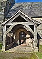
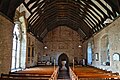
 St Andrew, Allensmore - geograph.org.uk - 4824586.jpg 2,133 × 1,721; 879 KB
-
 St Andrew, Allensmore - geograph.org.uk - 4824594.jpg 3,429 × 2,280; 2.58 MB
-
 St Andrew, Allensmore - geograph.org.uk - 4824602.jpg 3,489 × 2,320; 1.92 MB
-
 St Andrew, Allensmore - geograph.org.uk - 4828308.jpg 2,480 × 3,447; 2.36 MB
-
 St Andrew, Allensmore - geograph.org.uk - 4828412.jpg 2,308 × 3,473; 1.93 MB
-
 St Andrew, Allensmore - geograph.org.uk - 4828857.jpg 2,313 × 3,481; 2.92 MB
-
 St Andrew, Allensmore - geograph.org.uk - 4828865.jpg 2,280 × 3,429; 2.06 MB
-
 St Andrew, Allensmore - geograph.org.uk - 4831689.jpg 2,280 × 3,429; 1.94 MB
-
 St Andrew, Allensmore - geograph.org.uk - 4842947.jpg 3,368 × 2,240; 2.09 MB
-
 St Andrew, Allensmore - geograph.org.uk - 4843081.jpg 3,429 × 2,280; 1.67 MB
-
 St.Andrews Meade, Allensmore. - geograph.org.uk - 1535144.jpg 640 × 481; 150 KB
-
 Stile in a hole in a hedge - geograph.org.uk - 4495717.jpg 600 × 800; 314 KB
-
 Stubble field at Thruxton - geograph.org.uk - 2076022.jpg 3,072 × 2,304; 3.18 MB
-
 Telephone box and Postbox - geograph.org.uk - 3772316.jpg 800 × 450; 220 KB
-
 The Marches Line - geograph.org.uk - 1166701.jpg 640 × 481; 110 KB
-
 The Three Horse Shoes at Allensmore - geograph.org.uk - 4486848.jpg 3,648 × 2,736; 2.19 MB
-
 The Tram Inn - geograph.org.uk - 578921.jpg 640 × 480; 69 KB
-
 The Tram Inn Signal Box - geograph.org.uk - 578924.jpg 640 × 471; 135 KB
-
 The Tram Inn, Allensmore,Hereford - geograph.org.uk - 1535157.jpg 640 × 481; 69 KB
-
 Tram Inn - geograph.org.uk - 958448.jpg 640 × 480; 60 KB
-
 Tram Inn level crossing and pub - geograph.org.uk - 870486.jpg 640 × 363; 56 KB
-
 Tram inn signal box - geograph.org.uk - 958449.jpg 640 × 480; 116 KB
-
 Two trees - geograph.org.uk - 1166690.jpg 640 × 481; 216 KB
-

-
 Upright Hedge Parsley, Torilis japonica - geograph.org.uk - 4771988.jpg 1,600 × 901; 708 KB
-
 Western boundary of Clehonger - geograph.org.uk - 3643446.jpg 800 × 722; 165 KB
-
-
 Wheat west of Green Farm 1 - geograph.org.uk - 905240.jpg 640 × 480; 89 KB
-
 Wheat west of Green Farm 2 - geograph.org.uk - 905244.jpg 640 × 480; 100 KB
-

-
 Cobhall Farm - geograph.org.uk - 349022.jpg 640 × 480; 101 KB
-
 Cobhall Farm, Allensmore - geograph.org.uk - 149655.jpg 640 × 426; 105 KB
-
 Derelict Cottage, Coed More - geograph.org.uk - 403268 (cropped).jpg 330 × 330; 114 KB
-
 Derelict Cottage, Coed More - geograph.org.uk - 403268.jpg 640 × 427; 259 KB
-
 Entrance to the Vicarage, Allensmore - geograph.org.uk - 149587.jpg 640 × 426; 132 KB
-
 Farm at Mere Pool, Allensmore - geograph.org.uk - 149656.jpg 640 × 426; 156 KB
-
 Field to the east of Wallbrook Farm - geograph.org.uk - 149651.jpg 640 × 426; 140 KB
-
 Footpath near Mawfield Farm - geograph.org.uk - 149657.jpg 640 × 426; 124 KB
-
 Footpath to Clehonger - geograph.org.uk - 349028.jpg 640 × 480; 143 KB
-
 Haywood Lane - geograph.org.uk - 315707.jpg 640 × 480; 78 KB
-
 Haywood lane and Blakemore Hill - geograph.org.uk - 315709.jpg 640 × 480; 106 KB
-
 Hereford to Abergavenny railway line - geograph.org.uk - 349016.jpg 640 × 480; 119 KB
-
 Lane near Clehonger - geograph.org.uk - 349030.jpg 640 × 480; 132 KB
-
 Level Crossing by the Tram Inn - geograph.org.uk - 149245.jpg 640 × 426; 99 KB
-
 Merryhill Barn - geograph.org.uk - 150156.jpg 640 × 426; 107 KB
-
 Monkhall Farm - geograph.org.uk - 403158.jpg 640 × 427; 249 KB
-
 Old Perimeter Fence, Blakemoor Hill - geograph.org.uk - 403125.jpg 479 × 640; 314 KB
-
 Scots Pines by the lane to Coed More - geograph.org.uk - 349018.jpg 640 × 480; 92 KB
-
 Stile on footpath to Hungerstone - geograph.org.uk - 149609.jpg 426 × 640; 142 KB
-
 Sugar beet at Home Farm - geograph.org.uk - 349020.jpg 640 × 480; 86 KB
-
 Wood Street, Allensmore - geograph.org.uk - 369946.jpg 640 × 427; 266 KB


.jpg)


