Category:All Saints church, Dummer, Hampshire
Jump to navigation
Jump to search
| Object location | | View all coordinates using: OpenStreetMap |
|---|
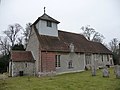
church in Dummer, Hampshire, United Kingdom    | |||||
| Upload media | |||||
| Instance of | |||||
|---|---|---|---|---|---|
| Dedicated to | |||||
| Location | Dummer, Basingstoke and Deane, Hampshire, South East England, England | ||||
| Diocese | |||||
| Heritage designation |
| ||||
| Inception |
| ||||
| Religion or worldview | |||||
 | |||||
This is a category about listed building number 1093019. |
Subcategories
This category has the following 3 subcategories, out of 3 total.
A
D
Media in category "All Saints church, Dummer, Hampshire"
The following 18 files are in this category, out of 18 total.
-
 All Saints church, Dummer, Hampshire (6307140295).jpg 1,536 × 2,048; 636 KB
-
 All Saints' church - geograph.org.uk - 1986417.jpg 640 × 426; 105 KB
-
 All Saints' church - geograph.org.uk - 1986419.jpg 426 × 640; 99 KB
-
 All Saints' church - geograph.org.uk - 4046520.jpg 1,024 × 683; 202 KB
-
 All Saints, Dummer - geograph.org.uk - 3312850.jpg 820 × 583; 492 KB
-
 Church at Dummer Hampshire UK South Side.jpg 4,128 × 3,096; 4.74 MB
-
 Crossroads and church at Dummer - geograph.org.uk - 3931061.jpg 800 × 600; 161 KB
-
 Dummer - All Saints Church - geograph.org.uk - 1216202.jpg 640 × 480; 60 KB
-
 Dummer - All Saints Church - geograph.org.uk - 1216236.jpg 640 × 480; 71 KB
-

-

-

-

-

-
 Dummer church.jpg 640 × 480; 89 KB
-
 Hampshire, All Saints Church, Dummer - geograph.org.uk - 2341539.jpg 2,816 × 2,112; 3.06 MB
-
 Hampshire, All Saints Church, Dummer - geograph.org.uk - 2341544.jpg 2,816 × 2,112; 3.15 MB
-
 We all take this view^ - geograph.org.uk - 2765791.jpg 640 × 480; 65 KB
.jpg)


_-_geograph.org.uk_-_2557071.jpg)


