Category:All Saints' Church, Down Ampney
Jump to navigation
Jump to search
| Object location | | View all coordinates using: OpenStreetMap |
|---|
Grade I listed church, Cotswold, United Kingdom _All_Saints_Church_-_geograph.org.uk_-_68217.jpg) | |||||
| Upload media | |||||
| Instance of | |||||
|---|---|---|---|---|---|
| Dedicated to | |||||
| Location | Down Ampney, Cotswold, Gloucestershire, South West England, England | ||||
| Diocese | |||||
| Heritage designation |
| ||||
| Inception |
| ||||
| Religion or worldview | |||||
 | |||||
Media in category "All Saints' Church, Down Ampney"
The following 64 files are in this category, out of 64 total.
-

-

-
 All Saints, Down Ampney, banner (i) - geograph.org.uk - 4098219.jpg 480 × 640; 51 KB
-
 All Saints, Down Ampney, banner (ii) - geograph.org.uk - 4098221.jpg 480 × 640; 41 KB
-

-
 All Saints, Down Ampney, churchyard (c) - geograph.org.uk - 4098103.jpg 640 × 480; 131 KB
-
 All Saints, Down Ampney, churchyard (d) - geograph.org.uk - 4098105.jpg 640 × 480; 108 KB
-
 All Saints, Down Ampney, churchyard (e) - geograph.org.uk - 4098106.jpg 640 × 480; 109 KB
-
 All Saints, Down Ampney, churchyard - geograph.org.uk - 4098099.jpg 640 × 480; 136 KB
-
 All Saints, Down Ampney, lych gate - geograph.org.uk - 4098095.jpg 480 × 640; 99 KB
-

-

-

-

-

-

-

-
 All Saints, Down Ampney, noticeboard - geograph.org.uk - 4098094.jpg 480 × 640; 83 KB
-

-

-

-

-

-

-

-

-
 All Saints, Down Ampney- churchyard (b) (geograph 4098101).jpg 640 × 480; 112 KB
-
 All Saints, Down Ampney- font (geograph 4098111).jpg 480 × 640; 56 KB
-
 All Saints, Down Ampney- porch (geograph 4098107).jpg 480 × 640; 101 KB
-
 Church of All Saints, Down Ampney (geograph 1964986).jpg 1,080 × 1,440; 1.11 MB
-
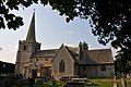
 Down Ampney (Glos) All Saints Church - geograph.org.uk - 68217.jpg 480 × 640; 104 KB
-
 Down Ampney church (geograph 2416071).jpg 1,024 × 680; 177 KB
-
 Down Ampney church (geograph 2417097).jpg 680 × 1,024; 145 KB
-
 Down Ampney church (geograph 5324159).jpg 640 × 480; 127 KB
-
 Down Ampney Church (geograph 6577929).jpg 1,200 × 803; 1.1 MB
-

-
 Entrance gates to Down Ampney House - geograph.org.uk - 2499772.jpg 640 × 480; 110 KB
-
 Inside All Saints, Down Ampney (I) - geograph.org.uk - 4098194.jpg 480 × 640; 54 KB
-
 Inside All Saints, Down Ampney (II) - geograph.org.uk - 4098196.jpg 470 × 640; 59 KB
-
 Inside All Saints, Down Ampney (III) - geograph.org.uk - 4098197.jpg 480 × 640; 39 KB
-
 Inside All Saints, Down Ampney (IV) - geograph.org.uk - 4098198.jpg 640 × 480; 85 KB
-
 Inside All Saints, Down Ampney (IX) - geograph.org.uk - 4098209.jpg 640 × 442; 59 KB
-
 Inside All Saints, Down Ampney (V) - geograph.org.uk - 4098200.jpg 480 × 640; 60 KB
-
 Inside All Saints, Down Ampney (VI) - geograph.org.uk - 4098203.jpg 480 × 640; 48 KB
-
 Inside All Saints, Down Ampney (VII) - geograph.org.uk - 4098205.jpg 640 × 480; 38 KB
-

-
 Inside All Saints, Down Ampney (X) - geograph.org.uk - 4098210.jpg 480 × 640; 72 KB
-
 Inside All Saints, Down Ampney (XI) - geograph.org.uk - 4098211.jpg 640 × 480; 68 KB
-
 Inside All Saints, Down Ampney (XI) - geograph.org.uk - 4098212.jpg 480 × 640; 74 KB
-
 Inside All Saints, Down Ampney (XII) - geograph.org.uk - 4098214.jpg 480 × 640; 74 KB
-

-
 Inside All Saints, Down Ampney (XIV) - geograph.org.uk - 4098217.jpg 480 × 640; 43 KB
-
 Inside All Saints, Down Ampney (XV) - geograph.org.uk - 4098218.jpg 640 × 480; 66 KB
-
 Interior of Down Ampney church (geograph 2416074).jpg 680 × 1,024; 138 KB
-
 Medieval effigies in Down Ampney church (geograph 2499777).jpg 640 × 480; 78 KB
-
 Memorial in Down Ampney church (geograph 2416078).jpg 680 × 1,024; 115 KB
-
 Pillar, All Saints Church, Down Ampney (geograph 3301563).jpg 4,000 × 3,000; 2.72 MB
-
 Porch to Down Ampney church (geograph 2417101).jpg 680 × 1,024; 216 KB
-
 Rood screen, All Saints Church, Down Ampney - geograph.org.uk - 3301584.jpg 3,000 × 4,000; 2.72 MB
-

-
 Stained glass Arnhem memorial window, All Saints Church, Down Ampney (geograph 3301249).jpg 3,000 × 4,000; 2.73 MB
-
 Weather cock, Down Ampney church (geograph 5343915).jpg 480 × 640; 62 KB
-
 Window in Down Ampney church (geograph 2417104).jpg 680 × 1,024; 225 KB
-
 Window in Down Ampney church (geograph 2417107).jpg 680 × 1,024; 226 KB
_-_geograph.org.uk_-_4098115.jpg)

_-_geograph.org.uk_-_4098219.jpg)
_-_geograph.org.uk_-_4098221.jpg)
_-_geograph.org.uk_-_4098100.jpg)
_-_geograph.org.uk_-_4098103.jpg)
_-_geograph.org.uk_-_4098105.jpg)
_-_geograph.org.uk_-_4098106.jpg)


_-_geograph.org.uk_-_4098109.jpg)
_-_geograph.org.uk_-_4098120.jpg)
_-_geograph.org.uk_-_4098122.jpg)
_-_geograph.org.uk_-_4098124.jpg)
_-_geograph.org.uk_-_4098126.jpg)
_-_geograph.org.uk_-_4098192.jpg)
_-_geograph.org.uk_-_4098190.jpg)

_-_geograph.org.uk_-_4098679.jpg)
_-_geograph.org.uk_-_4098681.jpg)
_-_geograph.org.uk_-_4098687.jpg)
_-_geograph.org.uk_-_4098688.jpg)
_-_geograph.org.uk_-_4098691.jpg)
_-_geograph.org.uk_-_4098692.jpg)
_-_geograph.org.uk_-_4098693.jpg)

_(geograph_4098101).jpg)
.jpg)
.jpg)
.jpg)
.jpg)
.jpg)
.jpg)
.jpg)
.jpg)

_-_geograph.org.uk_-_4098194.jpg)
_-_geograph.org.uk_-_4098196.jpg)
_-_geograph.org.uk_-_4098197.jpg)
_-_geograph.org.uk_-_4098198.jpg)
_-_geograph.org.uk_-_4098209.jpg)
_-_geograph.org.uk_-_4098200.jpg)
_-_geograph.org.uk_-_4098203.jpg)
_-_geograph.org.uk_-_4098205.jpg)
_-_geograph.org.uk_-_4098207.jpg)
_-_geograph.org.uk_-_4098210.jpg)
_-_geograph.org.uk_-_4098211.jpg)
_-_geograph.org.uk_-_4098212.jpg)
_-_geograph.org.uk_-_4098214.jpg)
_-_geograph.org.uk_-_4098216.jpg)
_-_geograph.org.uk_-_4098217.jpg)
_-_geograph.org.uk_-_4098218.jpg)
.jpg)
.jpg)
.jpg)
.jpg)
.jpg)


.jpg)
.jpg)
.jpg)
.jpg)