Category:Alford, Aberdeenshire (civil parish)
Jump to navigation
Jump to search
Scottish parish in Aberdeenshire, Scotland, UK | |||||
| Upload media | |||||
| Instance of | |||||
|---|---|---|---|---|---|
| Named after | |||||
| Location |
| ||||
| Population |
| ||||
| Area |
| ||||
 | |||||
Subcategories
This category has only the following subcategory.
A
Media in category "Alford, Aberdeenshire (civil parish)"
The following 200 files are in this category, out of 324 total.
(previous page) (next page)-

-
 A bad sign - geograph.org.uk - 3410765.jpg 640 × 360; 77 KB
-
 A bend in the River Don - geograph.org.uk - 3432981.jpg 1,024 × 697; 249 KB
-
 A hillside copse east of A980 near Droichs Bridge - geograph.org.uk - 5552225.jpg 4,896 × 3,672; 2.68 MB
-
 A manual 'Points Control' at Alford Station - geograph.org.uk - 5434613.jpg 4,896 × 3,672; 6.7 MB
-
 A plantation by the Swell Burn - geograph.org.uk - 5411272.jpg 4,896 × 3,672; 6.83 MB
-
 A view west from Gallowhill West - geograph.org.uk - 1223619.jpg 640 × 480; 108 KB
-

-
 A Wellhouse steading - geograph.org.uk - 1224207.jpg 640 × 437; 66 KB
-
 A980 approaching Bridge of Alford slip road - geograph.org.uk - 2882973.jpg 3,648 × 2,736; 1.39 MB
-
 A980 approaching Dorsell - geograph.org.uk - 5551538.jpg 4,896 × 3,672; 6.64 MB
-
 Access to Annfield Mill - geograph.org.uk - 1217618.jpg 640 × 434; 99 KB
-
 Access to Cedar Croft - geograph.org.uk - 1243846.jpg 640 × 480; 73 KB
-
 Access to Gallowhill House - geograph.org.uk - 1223595.jpg 640 × 429; 74 KB
-
 Access to Greystone Farm - geograph.org.uk - 1224275.jpg 640 × 410; 71 KB
-
 Access to Muir Farm - geograph.org.uk - 1217657.jpg 640 × 480; 153 KB
-
 Access to Muirfield - geograph.org.uk - 1224248.jpg 640 × 480; 104 KB
-
 Access to Oldtown of Carnaveron - geograph.org.uk - 880047.jpg 640 × 480; 63 KB
-
 Access to Tillychetly Farm - geograph.org.uk - 1243884.jpg 640 × 480; 66 KB
-
 Adam's Track - geograph.org.uk - 880043.jpg 640 × 480; 38 KB
-
 Aldersyde cottage - geograph.org.uk - 1224257.jpg 640 × 480; 76 KB
-
 Alford - geograph.org.uk - 3415652.jpg 640 × 360; 68 KB
-
 Alford Co-op - geograph.org.uk - 2980553.jpg 640 × 379; 208 KB
-
 Alford Golf Course - geograph.org.uk - 1362675.jpg 640 × 480; 135 KB
-
 Alford Heritage Centre - geograph.org.uk - 1240446.jpg 640 × 480; 65 KB
-
 Alford Heritage Museum - geograph.org.uk - 5524011.jpg 1,600 × 1,200; 513 KB
-
 Alford Millennium Sculpture Garden - geograph.org.uk - 5433473.jpg 4,896 × 3,672; 6.6 MB
-
 Alford post office and general store - geograph.org.uk - 5735249.jpg 5,015 × 3,872; 5.19 MB
-
 Alford Primary School - geograph.org.uk - 2971918.jpg 640 × 380; 207 KB
-
 Alford Station - geograph.org.uk - 2920310.jpg 2,520 × 1,680; 374 KB
-
 Alford Station - geograph.org.uk - 5636801.jpg 1,600 × 1,200; 514 KB
-
 Alford Transport Museum (3) - geograph.org.uk - 5436619.jpg 3,833 × 2,875; 1.99 MB
-
 Alford Transport Museum circuit (1) - geograph.org.uk - 5436583.jpg 640 × 442; 70 KB
-
 Alford Transport Museum circuit (2) - geograph.org.uk - 5436606.jpg 2,979 × 2,480; 1.23 MB
-
 Alford Valley Railway Museum - geograph.org.uk - 2920304.jpg 2,520 × 1,680; 357 KB
-
 Alford Valley Railway Museum - geograph.org.uk - 5433457.jpg 4,896 × 3,672; 7.05 MB
-
 Alford War Memorial - geograph.org.uk - 1243839.jpg 640 × 480; 101 KB
-
 Alford War Memorial - geograph.org.uk - 1243842.jpg 640 × 480; 103 KB
-
 Alford West Kirk and manse - geograph.org.uk - 4078634.jpg 4,608 × 3,456; 3.06 MB
-
 Alford, home of the Aberdeen Angus - geograph.org.uk - 2586256.jpg 800 × 534; 278 KB
-
 An anonymous inn (hotel^) on Alford Main Street - geograph.org.uk - 5434673.jpg 4,716 × 3,537; 3.38 MB
-
 An outbuilding by Swell Burn - geograph.org.uk - 1243969.jpg 640 × 480; 106 KB
-
 Ancient trees - geograph.org.uk - 1223380.jpg 640 × 480; 105 KB
-
 Antique shop - geograph.org.uk - 5637003.jpg 1,024 × 768; 232 KB
-
 Ants in his pants......... - geograph.org.uk - 3111188.jpg 532 × 800; 256 KB
-
 Approach to bridge over Leochel Burn - geograph.org.uk - 1223551.jpg 640 × 480; 81 KB
-
 Approach to Dorsell - geograph.org.uk - 1225083.jpg 640 × 452; 69 KB
-
 Approach to Drumnafunner - geograph.org.uk - 1223087.jpg 640 × 480; 92 KB
-
 Approach to Gallowhill West - geograph.org.uk - 1223567.jpg 640 × 480; 77 KB
-
 Approach to Red Gates - geograph.org.uk - 1224246.jpg 640 × 480; 95 KB
-
 Approach to road junction - geograph.org.uk - 1224217.jpg 640 × 388; 67 KB
-

-
 Approach to Upper Mill - geograph.org.uk - 1217738.jpg 640 × 449; 67 KB
-
 Archballoch farmhouse - geograph.org.uk - 1243863.jpg 640 × 480; 49 KB
-
 Bake Bare cottage - geograph.org.uk - 1224221.jpg 640 × 480; 87 KB
-
 Baldyvin - geograph.org.uk - 1032414.jpg 640 × 480; 79 KB
-
 Balfluig Castle - geograph.org.uk - 2063908.jpg 640 × 418; 242 KB
-
 Be careful, Sammy^ - geograph.org.uk - 3111142.jpg 800 × 534; 211 KB
-
 Behold Jeremy Eric of Bridgefoot - geograph.org.uk - 2586262.jpg 800 × 534; 213 KB
-
 Bend in road near Kingsford Lodge - geograph.org.uk - 1224215.jpg 640 × 388; 74 KB
-
 Bents Burn - geograph.org.uk - 5126025.jpg 1,024 × 683; 497 KB
-
 Birkhill - geograph.org.uk - 1032397.jpg 640 × 467; 105 KB
-
 Boisdale by Wellhouse - geograph.org.uk - 1224210.jpg 640 × 480; 120 KB
-
 Boisdale, Wellhouse Cottages - geograph.org.uk - 888098.jpg 640 × 471; 79 KB
-
 Borrowstone - geograph.org.uk - 1201641.jpg 640 × 480; 88 KB
-
 Borrowstone - geograph.org.uk - 5551530.jpg 4,896 × 3,672; 6.78 MB
-
 Breda Gardener's Cottage - geograph.org.uk - 1201609.jpg 640 × 480; 114 KB
-
 Breda Hill - geograph.org.uk - 1731148.jpg 640 × 427; 90 KB
-
 Breda Hill - geograph.org.uk - 978724.jpg 640 × 329; 44 KB
-
 Bridge abutment, Alford Valley Railway - geograph.org.uk - 5126023.jpg 1,024 × 683; 324 KB
-
 Bridge by Mill of Bandley - geograph.org.uk - 1032204.jpg 640 × 418; 85 KB
-
 Bridge carrying A980 over Leochel Burn - geograph.org.uk - 1201594.jpg 640 × 480; 112 KB
-
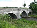 Bridge Of Alford in Bridge Of Alford - geograph.org.uk - 5461893.jpg 640 × 480; 101 KB
-
 Bridge over Strow Burn - geograph.org.uk - 1217674.jpg 640 × 402; 64 KB
-
 Bridge over the former Alford Railway - geograph.org.uk - 1032373.jpg 640 × 473; 130 KB
-
 Butchers' and Ambulance Station - geograph.org.uk - 2980590.jpg 640 × 372; 212 KB
-
 Cairnballoch - geograph.org.uk - 2063975.jpg 640 × 427; 243 KB
-
 Cairnfold - geograph.org.uk - 880039.jpg 640 × 480; 37 KB
-
 Car park, Alford - geograph.org.uk - 4630114.jpg 800 × 533; 330 KB
-
 Carnaveron Farm - geograph.org.uk - 4383026.jpg 2,358 × 1,563; 849 KB
-
 Carnaveron Hill - geograph.org.uk - 5411232.jpg 3,978 × 2,983; 2.8 MB
-
 Cedar Croft drive - geograph.org.uk - 1243851.jpg 640 × 640; 75 KB
-

-
 Children's Playground at Alford Valley Railway Museum - geograph.org.uk - 5433488.jpg 4,896 × 3,672; 6.83 MB
-
 Church by A980 - geograph.org.uk - 961197.jpg 640 × 480; 108 KB
-
 Clock in Main Street - geograph.org.uk - 5565192.jpg 819 × 1,024; 207 KB
-
 Co-op convenience store - geograph.org.uk - 5565233.jpg 1,024 × 683; 217 KB
-
 Coiliochbhar Hill - geograph.org.uk - 1441643.jpg 640 × 480; 74 KB
-
 Coiliochbhar Hill - geograph.org.uk - 3410761.jpg 640 × 360; 111 KB
-
 Communications mast - geograph.org.uk - 1243871.jpg 640 × 480; 74 KB
-
 Competing at Alford 2011 Convention - geograph.org.uk - 2586130.jpg 800 × 532; 283 KB
-

-
 Copse near North Nib - geograph.org.uk - 1225069.jpg 640 × 400; 62 KB
-
 Cottage by Baldyvin road - geograph.org.uk - 1032388.jpg 640 × 480; 96 KB
-
 Cottage in Parkside Wood - geograph.org.uk - 1032502.jpg 640 × 489; 114 KB
-
 Cottage north of old Alford Railway - geograph.org.uk - 1032384.jpg 640 × 544; 162 KB
-
 Deep snow at Kinstair - geograph.org.uk - 5656705.jpg 1,024 × 751; 142 KB
-
 Deep winter at Strone - geograph.org.uk - 5656700.jpg 1,024 × 751; 178 KB
-
 Deep winter at Strone - geograph.org.uk - 5656701.jpg 1,024 × 751; 142 KB
-
 Descent from Gallowhill to West Kirk - geograph.org.uk - 1223556.jpg 640 × 480; 97 KB
-
 Distant Coiliochbhar Hill - geograph.org.uk - 1570730.jpg 640 × 480; 54 KB
-
 Domestic wind turbine - geograph.org.uk - 1223105.jpg 640 × 480; 92 KB
-

-

-
 Downstream Leochel Burn - geograph.org.uk - 1201619.jpg 640 × 480; 94 KB
-
 Downstream River Don from Bridge of Alford - geograph.org.uk - 4502216.jpg 4,608 × 3,456; 3.21 MB
-
 Downstream Strow Burn - geograph.org.uk - 1223141.jpg 640 × 480; 72 KB
-
 Downstream Swell Burn - geograph.org.uk - 1243968.jpg 640 × 480; 93 KB
-
 Drain by garden wall - geograph.org.uk - 1223403.jpg 640 × 480; 146 KB
-
 Drain by road from Mid Mill - geograph.org.uk - 1201629.jpg 640 × 480; 98 KB
-
 Drain near Muir Farm - geograph.org.uk - 1223533.jpg 640 × 480; 72 KB
-
 Drainage ditches in the Don Valley - geograph.org.uk - 2882984.jpg 3,648 × 2,736; 1.2 MB
-
 Drumnafunner croft - geograph.org.uk - 1223097.jpg 640 × 480; 93 KB
-
 Drumnafunner lochan - geograph.org.uk - 1223138.jpg 640 × 485; 111 KB
-
 Dry Ski Slope in Alford - geograph.org.uk - 1224290.jpg 640 × 480; 95 KB
-
 Dwellings by A980 - geograph.org.uk - 1217600.jpg 640 × 480; 69 KB
-
 East flank of Carnaveron Hill - geograph.org.uk - 5411259.jpg 3,984 × 2,988; 2.55 MB
-
 East from Badens - geograph.org.uk - 1570670.jpg 640 × 480; 53 KB
-
 East Gallowhill (July) - geograph.org.uk - 888135.jpg 640 × 480; 92 KB
-
 East Gallowhill (March) - geograph.org.uk - 1224264.jpg 640 × 480; 116 KB
-
 Eastgate, birthplace of Charles Murray - geograph.org.uk - 4647581.jpg 1,390 × 978; 543 KB
-
 Enclosed grass track near to Balfluig - geograph.org.uk - 6303152.jpg 4,000 × 3,000; 4.17 MB
-
 Engine Shed - geograph.org.uk - 5636789.jpg 1,600 × 1,200; 690 KB
-
 Exhibits at the Grampian Transport Museum - geograph.org.uk - 5524001.jpg 1,600 × 1,200; 395 KB
-
 Farmland at Gallowhill - geograph.org.uk - 5235625.jpg 1,024 × 682; 150 KB
-
 Farmyard at Wellhouse - geograph.org.uk - 1224208.jpg 640 × 462; 74 KB
-
 Farquharson Fountain - geograph.org.uk - 2980533.jpg 640 × 427; 255 KB
-
 Field boundary up Damill - geograph.org.uk - 1223503.jpg 480 × 640; 131 KB
-
 Field gate by A980 - geograph.org.uk - 1223521.jpg 640 × 480; 70 KB
-
 Fields at North Strone - geograph.org.uk - 5647708.jpg 1,024 × 727; 157 KB
-
 Forest edge on east side of Coiliochbhar Hill - geograph.org.uk - 2672795.jpg 1,500 × 843; 1.42 MB
-
 Forest Track - geograph.org.uk - 1570652.jpg 640 × 480; 78 KB
-
 Former Gallowhill School (1) - geograph.org.uk - 4077967.jpg 4,608 × 3,456; 3.12 MB
-
 Former Gallowhill School (2) - geograph.org.uk - 4078627.jpg 4,608 × 3,456; 3.11 MB
-
 Former place of worship, Lynturk - geograph.org.uk - 1243970.jpg 640 × 480; 89 KB
-
 Gallow Hill wood - geograph.org.uk - 2882976.jpg 3,648 × 2,736; 1.38 MB
-
 Gallowhill House - geograph.org.uk - 888024.jpg 640 × 480; 73 KB
-
 Gallowhill Road - geograph.org.uk - 1019426.jpg 480 × 640; 110 KB
-
 Garden hedge by Montgarrie Road - geograph.org.uk - 1362714.jpg 640 × 480; 144 KB
-
 Gated entrance to Alford cemetery - geograph.org.uk - 1243340.jpg 640 × 480; 81 KB
-
 Gated entry to Drumnafunner - geograph.org.uk - 1223068.jpg 640 × 480; 96 KB
-
 Gated exit from West Parish Church - geograph.org.uk - 961383.jpg 640 × 480; 123 KB
-
 Glendronach Distillery Co. Ltd. - geograph.org.uk - 2927240.jpg 1,680 × 2,520; 490 KB
-
 Gnarled tree by Strow Burn - geograph.org.uk - 1222723.jpg 640 × 480; 108 KB
-
 Golf Course - geograph.org.uk - 5637040.jpg 1,600 × 1,200; 616 KB
-
 Gorse Covered Hillside - geograph.org.uk - 1570714.jpg 640 × 480; 56 KB
-
 Grampian Transport Museum - geograph.org.uk - 5524929.jpg 1,600 × 1,200; 510 KB
-
 Grampian Transport Museum, Alford - geograph.org.uk - 2927200.jpg 2,520 × 1,680; 403 KB
-
 Greystone - geograph.org.uk - 1224274.jpg 640 × 484; 78 KB
-
 Grim Determination - geograph.org.uk - 3112041.jpg 532 × 800; 233 KB
-
 Harvest time at Alford - geograph.org.uk - 1067474.jpg 640 × 480; 70 KB
-
 Haughton House - geograph.org.uk - 1014361.jpg 640 × 480; 59 KB
-
 Haughton Place, Alford - geograph.org.uk - 1362653.jpg 640 × 480; 175 KB
-
 Heritage Centre, Alford - geograph.org.uk - 5433450.jpg 4,896 × 3,672; 6.38 MB
-
 Houghton House - geograph.org.uk - 947728.jpg 640 × 480; 65 KB
-

-
 Howe of Alford - geograph.org.uk - 2063930.jpg 640 × 427; 265 KB
-
 Howe of Alford - geograph.org.uk - 2063936.jpg 640 × 296; 122 KB
-
 Howe of Alford - geograph.org.uk - 2063941.jpg 640 × 353; 165 KB
-
 Howe Trinity parish kirk, Alford - geograph.org.uk - 5734345.jpg 5,297 × 3,788; 4.99 MB
-

-
 In praise of a country pusuit^ - geograph.org.uk - 1224267.jpg 640 × 480; 53 KB
-
 Inscription on Charles Murray's memorial - geograph.org.uk - 1019413.jpg 640 × 559; 164 KB
-
 Keystone-arched bridge - geograph.org.uk - 1201632.jpg 640 × 480; 115 KB
-
 Kingsford from Archballoch - geograph.org.uk - 2063950.jpg 640 × 427; 229 KB
-
 Kingsford from Archballoch - geograph.org.uk - 5235620.jpg 1,024 × 674; 194 KB
-
 Kirkyard and former Manse - geograph.org.uk - 961206.jpg 640 × 480; 92 KB
-
 Kirkyard by A980 near Gallowhill - geograph.org.uk - 961192.jpg 480 × 640; 118 KB
-
 Lambing time at Muir of Alford - geograph.org.uk - 1223541.jpg 640 × 488; 125 KB
-
 Land out of production - geograph.org.uk - 3384660.jpg 640 × 360; 81 KB
-
 Landscaping at Aberdeen Road, Alford - geograph.org.uk - 5235648.jpg 1,024 × 682; 210 KB
-
 Langgadlie Hill - geograph.org.uk - 1441907.jpg 640 × 480; 79 KB
-
 Larch wood, Coiliochbhar Hill - geograph.org.uk - 3410767.jpg 640 × 360; 112 KB
-
 Larch wood, Coiliochbhar Hill - geograph.org.uk - 3410770.jpg 640 × 360; 93 KB
-
 Leader of the pack at Alford 2011 - geograph.org.uk - 2586151.jpg 800 × 535; 312 KB
-
 Leochel Burn weir - geograph.org.uk - 1201626.jpg 640 × 480; 92 KB
-

-
 Line of the old Alford railway - geograph.org.uk - 1032295.jpg 640 × 480; 110 KB
-
 Little Endovie farm - geograph.org.uk - 3847932.jpg 1,024 × 660; 118 KB
-
 Main Street - geograph.org.uk - 5565217.jpg 1,024 × 683; 176 KB
-
 Main Street, Alford - geograph.org.uk - 2980521.jpg 640 × 427; 257 KB
-
 Main Street, Alford - geograph.org.uk - 5735257.jpg 5,001 × 3,601; 3.84 MB
-
 Matti Griffin - stunt rider - geograph.org.uk - 3111160.jpg 533 × 800; 314 KB
-

-
 Metal bridge over the Don at Montgarrie - geograph.org.uk - 2274741.jpg 1,024 × 741; 270 KB
-
 Mid Mill - geograph.org.uk - 1201639.jpg 640 × 476; 108 KB
-
 Mill of Bandley - geograph.org.uk - 1032211.jpg 640 × 381; 71 KB
-
 Minor road approaching the A944 at Croft of Lonenwell - geograph.org.uk - 6303147.jpg 4,000 × 3,000; 3.34 MB
-
 Minor road at Park of Bandley - geograph.org.uk - 6303138.jpg 4,000 × 3,000; 3.55 MB
-
 Minor road beside Parkside Wood - geograph.org.uk - 6303144.jpg 4,000 × 3,000; 5.09 MB
-
 Minor road heading towards Mill of Bandley - geograph.org.uk - 6303123.jpg 4,000 × 3,000; 3.2 MB
-
 Minor road heading towards Roselea Cottage - geograph.org.uk - 6303111.jpg 4,000 × 3,000; 3.2 MB
-
 Modern Houses near Cairnballoch - geograph.org.uk - 2063986.jpg 640 × 427; 259 KB
-
 Montgarrie Bridge - geograph.org.uk - 4712784.jpg 640 × 427; 445 KB
-
 Montgarrie Bridge - geograph.org.uk - 4712786.jpg 640 × 427; 417 KB
-
 Montgarrie from the River Don - geograph.org.uk - 4712789.jpg 640 × 427; 466 KB
-
 Moorland, Coiliochbhar Hill - geograph.org.uk - 3385658.jpg 640 × 360; 73 KB
-
 Moorland, Coiliochbhar Hill - geograph.org.uk - 3410757.jpg 640 × 360; 85 KB
-
 Muir of Alford - geograph.org.uk - 1217649.jpg 640 × 480; 66 KB
-
 Muir of Alford farmhouse - geograph.org.uk - 1223538.jpg 640 × 498; 97 KB


_on_Alford_Main_Street_-_geograph.org.uk_-_5434673.jpg)


_-_geograph.org.uk_-_888135.jpg)
_-_geograph.org.uk_-_1224264.jpg)


_-_geograph.org.uk_-_4077967.jpg)
_-_geograph.org.uk_-_4078627.jpg)


&filefrom=Murray+Park+plaque%2C+Alford+-+geograph.org.uk+-+4646643.jpg#mw-category-media)
_-_geograph.org.uk_-_5436619.jpg)
_-_geograph.org.uk_-_5436583.jpg)
_-_geograph.org.uk_-_5436606.jpg)