Category:Albrighton, east Shropshire
Jump to navigation
Jump to search
Norsk bokmål: Albrighton er en stor landsby og et verdslig sogn i Shropshire, England. Den ligger rett nordvest for Wolverhampton, og har i praksis blitt en soveby denne byen. Jernbanestasjonen i landsbyen betjener tog på linjen mellom Shrewsbury og Wolverhampton, hvilket gjør det lett for pendlere å bo der.
village and civil parish in the east of Shropshire in the United Kingdom  | |||||
| Upload media | |||||
| Instance of | |||||
|---|---|---|---|---|---|
| Location | Shropshire, West Midlands, England | ||||
| Said to be the same as | Albrighton (Wikimedia duplicated page, civil parish) | ||||
 | |||||
Subcategories
This category has the following 4 subcategories, out of 4 total.
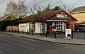
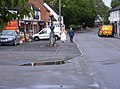
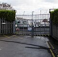
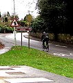
Media in category "Albrighton, east Shropshire"
The following 200 files are in this category, out of 294 total.
(previous page) (next page)-
 1857 emblem plaque on the pumping station - geograph.org.uk - 5222698.jpg 1,224 × 1,632; 558 KB
-
 1889 emblem plaque on the pumping station - geograph.org.uk - 5222707.jpg 1,224 × 1,632; 648 KB
-
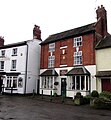
 62, 62A and 62B High Street, Albrighton - geograph.org.uk - 4754985.jpg 800 × 619; 107 KB
-
 70 High Street, Albrighton.jpg 796 × 800; 179 KB
-
 70, High Street, Albrighton - geograph.org.uk - 5818045.jpg 2,448 × 1,836; 1.51 MB
-
 71, High Street, Albrighton - geograph.org.uk - 5818042.jpg 2,081 × 2,774; 1.67 MB
-
 73 High Street, Albrighton - geograph.org.uk - 5815412.jpg 1,971 × 1,532; 1.12 MB
-
 73 High Street, Albrighton.jpg 800 × 629; 146 KB
-
 77, High Street, Albrighton - geograph.org.uk - 5815421.jpg 1,836 × 2,448; 1.45 MB
-
-
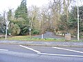
 A41 at Beamish Lane junction - geograph.org.uk - 2774217.jpg 640 × 480; 43 KB
-
-

-
 Albrighton - geograph.org.uk - 221453.jpg 640 × 480; 68 KB
-
 Albrighton Feeds - geograph.org.uk - 3689783.jpg 1,600 × 1,200; 299 KB
-
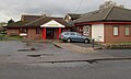
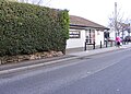
 Albrighton fire station - geograph.org.uk - 266812.jpg 640 × 427; 197 KB
-
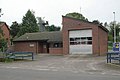
 Albrighton Fire Station - geograph.org.uk - 4757908.jpg 800 × 450; 95 KB
-
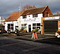 Albrighton Garage - geograph.org.uk - 4756803.jpg 800 × 720; 150 KB
-
 Albrighton Garage - geograph.org.uk - 4756815.jpg 800 × 543; 92 KB
-
 Albrighton Hall - geograph.org.uk - 1870929.jpg 691 × 518; 194 KB
-
 Albrighton Hardware - geograph.org.uk - 4755045.jpg 800 × 731; 144 KB
-

-
 Albrighton Medical Practice - geograph.org.uk - 4755676.jpg 800 × 478; 80 KB
-
 Albrighton News, Albrighton - geograph.org.uk - 4756818.jpg 800 × 681; 119 KB
-
 Albrighton old fire station site - geograph.org.uk - 1909332.jpg 640 × 427; 203 KB
-
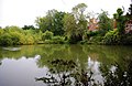
 Albrighton Pool from Rectory Road, Albrighton - geograph.org.uk - 4898708.jpg 1,200 × 799; 481 KB
-
 Albrighton Time - geograph.org.uk - 5859230.jpg 596 × 800; 141 KB
-
 Albrighton Tyre Bay - geograph.org.uk - 1394732.jpg 640 × 427; 209 KB
-
 Albrighton, The Shrewsbury Arms - geograph.org.uk - 5762976.jpg 3,118 × 2,081; 1.29 MB
-
 Along County Lane at Harriot's Hayes - geograph.org.uk - 1862086.jpg 717 × 538; 199 KB
-
 Ashfields, Albrighton - geograph.org.uk - 4759034.jpg 800 × 589; 107 KB
-
 Austin Rose Garden Green Man.jpg 603 × 452; 238 KB
-
 Balance in High Street, Albrighton - geograph.org.uk - 4756232.jpg 531 × 800; 130 KB
-
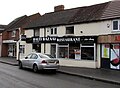 Balti Bazaar, Albrighton - geograph.org.uk - 4756819.jpg 800 × 589; 90 KB
-
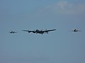 Battle of Britain Memorial Flight again - geograph.org.uk - 3507644.jpg 1,958 × 1,469; 328 KB
-
 BBMF Avro Lancaster - geograph.org.uk - 1355999.jpg 640 × 481; 40 KB
-
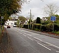
 Beamish Lane from A41 - geograph.org.uk - 4648241.jpg 640 × 426; 98 KB
-
 Beechurst, Albrighton.jpg 800 × 582; 89 KB
-

-
 Bowling Green Lane - geograph.org.uk - 3505192.jpg 640 × 480; 70 KB
-
-
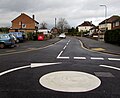
 Bowling Green Lane Island - geograph.org.uk - 5814929.jpg 800 × 600; 147 KB
-
 Bowling Green Lane near Albrighton - geograph.org.uk - 2763443.jpg 1,024 × 655; 188 KB
-
 Bowling Green Lane near Whiston Cross - geograph.org.uk - 2763419.jpg 1,024 × 670; 182 KB
-
 Bowling Green Lane, Albrighton - geograph.org.uk - 4757775.jpg 788 × 800; 192 KB
-
 Brian Richard, Albrighton - geograph.org.uk - 4756812.jpg 800 × 508; 107 KB
-
 Brides Walk - geograph.org.uk - 5859257.jpg 800 × 591; 126 KB
-
 Bridge 370 identifier, Albrighton - geograph.org.uk - 4758443.jpg 800 × 678; 142 KB
-
 Bridge 371 identifier, Albrighton - geograph.org.uk - 4758431.jpg 727 × 800; 170 KB
-
 BT phonebox, High Street, Albrighton - geograph.org.uk - 4756158.jpg 673 × 800; 196 KB
-
 Bushfield Road, Albrighton - geograph.org.uk - 4756796.jpg 800 × 519; 127 KB
-
-
 Carlini Scene - geograph.org.uk - 5677781.jpg 800 × 587; 75 KB
-

-
 Colourful Welcome to Albrighton sign - geograph.org.uk - 4755325.jpg 558 × 800; 122 KB
-

-
 Converted windmill near Albrighton - geograph.org.uk - 389128.jpg 480 × 640; 155 KB
-
 Cosford Bridge.jpg 1,632 × 1,224; 1.02 MB
-
 Crossroads at Harriot's Hayes - geograph.org.uk - 1862085.jpg 819 × 614; 188 KB
-
 Cycling into Albrighton - geograph.org.uk - 4757859.jpg 564 × 640; 109 KB
-
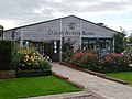 David Austin Roses - geograph.org.uk - 3689604.jpg 1,600 × 1,200; 399 KB
-
 David Austin Roses - geograph.org.uk - 5814899.jpg 800 × 600; 206 KB
-
 David Austin Roses - geograph.org.uk - 6168353.jpg 1,024 × 768; 276 KB
-
 David Austin Roses Near Albrighton - geograph.org.uk - 48054.jpg 640 × 365; 137 KB
-
 Detail on the chemist's shop - geograph.org.uk - 1408796.jpg 455 × 640; 112 KB
-
-
 Donington Pool, Donington - geograph.org.uk - 2766250.jpg 1,024 × 683; 183 KB
-
 Donington Pool, Donington - geograph.org.uk - 2766268.jpg 1,024 × 665; 188 KB
-
 Dried-up pond at Whiston Grange - geograph.org.uk - 1627047.jpg 640 × 480; 180 KB
-
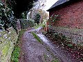
 Driveway into Harriot's Hayes Farm - geograph.org.uk - 3063582.jpg 640 × 425; 78 KB
-
 East along High Street, Albrighton - geograph.org.uk - 4756120.jpg 800 × 789; 134 KB
-
 East along the Albrighton Bypass - geograph.org.uk - 4755416.jpg 800 × 623; 120 KB
-
-
 Electricity paraphernalia at Beamish - geograph.org.uk - 1882056.jpg 819 × 614; 176 KB
-
-
 Entrance to Albrighton railway station - geograph.org.uk - 4758539.jpg 800 × 601; 103 KB
-
 Entrance to Aroma restaurant, Albrighton - geograph.org.uk - 4758674.jpg 800 × 769; 194 KB
-

-
 Entrance to the Red House, Albrighton - geograph.org.uk - 4759050.jpg 800 × 739; 133 KB
-
 Eurofighter Typhoon - geograph.org.uk - 3502381.jpg 1,632 × 1,224; 186 KB
-
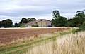
 Farmland near Albrighton - geograph.org.uk - 4398777.jpg 640 × 426; 42 KB
-
 Farmland, High House Farm - geograph.org.uk - 4398726.jpg 640 × 426; 52 KB
-
 Farmland, High House Farm - geograph.org.uk - 4398729.jpg 640 × 426; 44 KB
-
 Field by the railway line, Albrighton - geograph.org.uk - 5033956.jpg 1,600 × 783; 94 KB
-
-
 Fields and footpath near High House Farm - geograph.org.uk - 1870900.jpg 717 × 538; 211 KB
-
 Fields east of High House Farm - geograph.org.uk - 5033977.jpg 1,600 × 846; 167 KB
-
 Footbridge over a stream - geograph.org.uk - 1870925.jpg 640 × 480; 197 KB
-
 Footpath towards High House Farm - geograph.org.uk - 1870898.jpg 845 × 634; 190 KB
-
 Former Albrighton Acupuncture Clinic - geograph.org.uk - 4756602.jpg 800 × 578; 102 KB
-
 Former lodge, 54 High Street, Albrighton - geograph.org.uk - 4755912.jpg 800 × 532; 132 KB
-
 Former school in Albrighton - geograph.org.uk - 1414774.jpg 640 × 573; 89 KB
-

-
 Gillies' Pool - geograph.org.uk - 1861523.jpg 666 × 499; 210 KB
-

-

-
 Grange Park, Albrighton - geograph.org.uk - 4757515.jpg 800 × 554; 121 KB
-
 Grass triangle junction near Donington - geograph.org.uk - 4757752.jpg 800 × 640; 157 KB
-
 Graveyard Scene - geograph.org.uk - 5859294.jpg 800 × 600; 183 KB
-
 Hangar no. 7, RAF Cosford, near Albrighton - geograph.org.uk - 2763485.jpg 1,024 × 659; 186 KB
-
 Having a break on the A41 - geograph.org.uk - 2774220.jpg 640 × 480; 41 KB
-
 Health and Harmony Centre, Albrighton - geograph.org.uk - 4756143.jpg 737 × 800; 119 KB
-
 Henri's, Albrighton - geograph.org.uk - 4756787.jpg 800 × 800; 126 KB
-
 High House Farm - geograph.org.uk - 1870901.jpg 819 × 614; 186 KB
-
 High Street Bank - geograph.org.uk - 3689750.jpg 1,600 × 1,064; 386 KB
-
 High Street bench, Albrighton - geograph.org.uk - 4756118.jpg 800 × 763; 215 KB
-
 High Street Chemist in Albrighton - geograph.org.uk - 4756245.jpg 800 × 792; 121 KB
-

-

-
 High Street Scene - geograph.org.uk - 5677782.jpg 800 × 573; 152 KB
-
 High Street semis, Albrighton - geograph.org.uk - 4757020.jpg 800 × 599; 96 KB
-

-

-
-
 High Street View - geograph.org.uk - 5859215.jpg 800 × 592; 156 KB
-
 High Street, Albrighton - geograph.org.uk - 4898354.jpg 1,200 × 799; 413 KB
-
 Hog Roast Van - geograph.org.uk - 5859242.jpg 800 × 600; 159 KB
-
 Holles House, Albrighton - geograph.org.uk - 4756155.jpg 800 × 781; 116 KB
-
 Holyhead Road at Whiston Cross - geograph.org.uk - 3505186.jpg 640 × 480; 60 KB
-
 House and field off High House Lane, Albrighton - geograph.org.uk - 5033969.jpg 1,600 × 867; 125 KB
-
 Houses on Cross Road - geograph.org.uk - 3689707.jpg 1,600 × 1,064; 380 KB
-
 Houses on High House Lane - geograph.org.uk - 4398774.jpg 640 × 426; 51 KB
-
 Houses on High House Lane, Albrighton - geograph.org.uk - 5033965.jpg 1,600 × 936; 120 KB
-
 Hurricane and Spitfire flypast - geograph.org.uk - 3507635.jpg 1,958 × 1,469; 251 KB
-
 Indulgence in Albrighton - geograph.org.uk - 4758571.jpg 800 × 600; 127 KB
-
 Jane Eyre, Albrighton - geograph.org.uk - 4754869.jpg 800 × 615; 107 KB
-

-
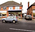
 Julie's High Street Stores, Albrighton - geograph.org.uk - 4754944.jpg 800 × 714; 145 KB
-

-
-

-
 Kennels at Whiston Cross - geograph.org.uk - 1585767.jpg 640 × 480; 226 KB
-
 Kennels of the Albrighton Hunt - geograph.org.uk - 1627052.jpg 640 × 480; 79 KB
-
 Kill Your Speed, Albrighton - geograph.org.uk - 4758747.jpg 800 × 616; 107 KB
-
-
 Kingswood Road - geograph.org.uk - 5677759.jpg 800 × 500; 123 KB
-
 Kingswood Road View - geograph.org.uk - 5677777.jpg 800 × 600; 155 KB
-
 Lancaster bomber display - Cosford Airshow June 2012 - geograph.org.uk - 3002379.jpg 1,795 × 1,346; 295 KB
-
 Lane junction for Ryton - geograph.org.uk - 3505185.jpg 640 × 480; 59 KB
-
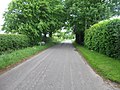
 Lane to Albrighton - geograph.org.uk - 748058.jpg 640 × 480; 99 KB
-
 Latte da, Albrighton - geograph.org.uk - 4754935.jpg 682 × 800; 136 KB
-
 Lloyds-TSB Bank in Albrighton - geograph.org.uk - 1408798.jpg 640 × 480; 109 KB
-

-
 Low-flying Tornado GR4 - geograph.org.uk - 2998139.jpg 1,142 × 857; 410 KB
-
 Lyncroft, Albrighton - geograph.org.uk - 4756810.jpg 800 × 712; 124 KB
-
 M54 entering Staffordshire - geograph.org.uk - 3107438.jpg 640 × 435; 47 KB
-
 M54, west of Big Wood - geograph.org.uk - 3107434.jpg 640 × 430; 47 KB
-
 Manor Cottage, High Street, Albrighton - geograph.org.uk - 4758689.jpg 800 × 713; 133 KB
-
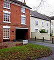
 Manor House, Albrighton.jpg 800 × 699; 120 KB
-
 Maywood Fold, Albrighton - geograph.org.uk - 4756789.jpg 800 × 664; 147 KB
-
 Meadow Road, Albrighton - geograph.org.uk - 4754837.jpg 800 × 654; 112 KB
-
 Meeson Close semis, Albrighton - geograph.org.uk - 4755905.jpg 800 × 656; 117 KB
-
 Meeson Close, Albrighton - geograph.org.uk - 4755904.jpg 800 × 565; 124 KB
-
 Meeson House, Albrighton.jpg 800 × 526; 105 KB
-
 Miller's Green, Albrighton.jpg 720 × 800; 193 KB
-
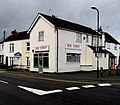 Mr Chef, Albrighton - geograph.org.uk - 4754828.jpg 800 × 698; 118 KB
-

-
-

-

-

-
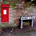
 North along Shaw Lane, Albrighton - geograph.org.uk - 4756007.jpg 800 × 600; 116 KB
-

-
 Northern end of Bowling Green Lane - geograph.org.uk - 3501479.jpg 640 × 480; 97 KB
-
 Notices by Donington Pool, Donington - geograph.org.uk - 2766288.jpg 668 × 1,024; 212 KB
-

-

-

-
 Open fields south of Harriot's Hayes - geograph.org.uk - 1882051.jpg 896 × 672; 207 KB
-
 Ordnance Survey Cut Mark - geograph.org.uk - 5143082.jpg 640 × 584; 143 KB
-

-

-
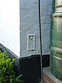
 OS benchmark - Whiston Cross - geograph.org.uk - 3999692.jpg 734 × 979; 472 KB
-
 OS Flush Bracket S094 - Whiston House - geograph.org.uk - 3571196.jpg 1,224 × 1,632; 665 KB
-
 Path through the park - geograph.org.uk - 748055.jpg 640 × 480; 95 KB
-
 Patshull Road near Albrighton - geograph.org.uk - 2405517.jpg 640 × 480; 104 KB
-
 Patshull Road near Albrighton - geograph.org.uk - 2405522.jpg 640 × 480; 91 KB
-
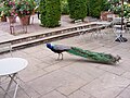 Peacock Walk - geograph.org.uk - 5814915.jpg 800 × 600; 146 KB
-
 Peckish in Albrighton - geograph.org.uk - 4758567.jpg 800 × 748; 134 KB
-
 Pizza Palace, Albrighton - geograph.org.uk - 4756608.jpg 800 × 633; 113 KB
-
 Potato field near Whiston Cross in Shropshire - geograph.org.uk - 6134680.jpg 1,600 × 900; 1.85 MB
-
 Potato field near Whiston Cross in Shropshire - geograph.org.uk - 6134689.jpg 1,440 × 960; 1.55 MB
-
 Public clock in the centre of Albrighton - geograph.org.uk - 4759038.jpg 800 × 743; 202 KB
-
-
 Public house lantern - geograph.org.uk - 4898256.jpg 799 × 1,200; 275 KB
-

-
 RAF Eurofighter Typhoon - Cosford Airshow June 2012 - geograph.org.uk - 3004853.jpg 1,795 × 1,346; 182 KB
-

-
 Rectory Road Junction - geograph.org.uk - 5677783.jpg 800 × 600; 159 KB
-
 Red Arrows close up - geograph.org.uk - 3507667.jpg 1,632 × 1,224; 235 KB
-
 Red Arrows display - Cosford Airshow June 2012 - geograph.org.uk - 2998124.jpg 857 × 1,142; 376 KB
-

-
 Riders at a lane junction - geograph.org.uk - 1036197.jpg 640 × 480; 87 KB
-
 Road to Whiston Cross in Shropshire - geograph.org.uk - 6134659.jpg 1,440 × 960; 1.64 MB
-
 Roads and Lea Hall south of Albrighton, Shropshire - geograph.org.uk - 6134902.jpg 1,600 × 800; 1.21 MB
-
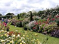
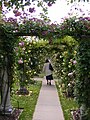 Rose Arches - geograph.org.uk - 5814902.jpg 600 × 800; 200 KB
-
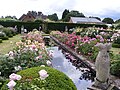 Rose Garden - geograph.org.uk - 5814906.jpg 800 × 600; 192 KB
-
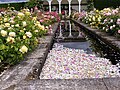 Rose Petals - geograph.org.uk - 5814894.jpg 800 × 597; 204 KB
-
 Rose Scene - geograph.org.uk - 5814913.jpg 800 × 600; 189 KB
-
 Roundabout at the top of Bowling Green Lane - geograph.org.uk - 3689622.jpg 1,600 × 1,064; 453 KB


_cabinet,_Newport_Road,_Albrighton_-_geograph.org.uk_-_4757848.jpg)


