Category:Aithsetter
Jump to navigation
Jump to search
| Object location | | View all coordinates using: OpenStreetMap |
|---|
village in the Shetland Islands, Scotland, UK .jpg) | |||||
| Upload media | |||||
| Instance of | |||||
|---|---|---|---|---|---|
| Location |
| ||||
 | |||||
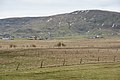
English: Aithsetter is a village on Mainland, Shetland. It is in the parish of Cunningsburgh, towards the north end of the village of the same name. It is nearly 10 miles from Lerwick.
Media in category "Aithsetter"
The following 14 files are in this category, out of 14 total.
-
 Aith Meadows, Cunningsburgh - geograph.org.uk - 1700700.jpg 800 × 534; 160 KB
-
 Aith Meadows, Cunningsburgh - geograph.org.uk - 1700702.jpg 800 × 534; 163 KB
-
 Aith Voe - geograph.org.uk - 3931111.jpg 1,280 × 851; 333 KB
-
 Aithsetter junction - geograph.org.uk - 888182.jpg 640 × 480; 53 KB
-
 Aithsetter, Cunningsburgh (geograph 1786901).jpg 800 × 600; 115 KB
-
 Aithsetter.jpg 640 × 480; 57 KB
-
 Beach at the head of Aith Voe - geograph.org.uk - 3586481.jpg 640 × 480; 264 KB
-
 Hay meadow, Aith - geograph.org.uk - 1329124.jpg 640 × 480; 144 KB
-
 Head of Aith Voe - geograph.org.uk - 2078368.jpg 2,560 × 1,920; 1.78 MB
-
 Ocraquoy from Aithsetter - geograph.org.uk - 1700621.jpg 640 × 427; 67 KB
-

-
 Towards Bressay - geograph.org.uk - 1058013.jpg 640 × 481; 144 KB
-
 Towards Ocraquoy - geograph.org.uk - 1058003.jpg 640 × 481; 123 KB
-
 Aith Meadows, Cunningsburgh - geograph.org.uk - 1180670.jpg 640 × 426; 101 KB


