Category:Aggermündung
Jump to navigation
Jump to search
| Object location | | View all coordinates using: OpenStreetMap |
|---|
Media in category "Aggermündung"
The following 3 files are in this category, out of 3 total.
-
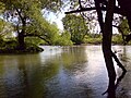
 Aggermuendung1.jpg 1,613 × 1,210; 613 KB
-
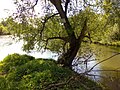
 Aggermuendung2.jpg 2,048 × 1,536; 1,014 KB
-
 Aggermuendung3.jpg 2,048 × 1,536; 1.21 MB


