Category:Aerial photographs of the Columbia River on the Washington-Oregon border
Jump to navigation
Jump to search
Media in category "Aerial photographs of the Columbia River on the Washington-Oregon border"
The following 52 files are in this category, out of 52 total.
-
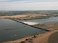
 15-438 Aerial View of Bonneville Dam Area by Brubaker (22488592692).jpg 2,965 × 1,834; 2.51 MB
-
 9358 Bridge of The Gods by Brubaker (22512994221).jpg 3,118 × 1,882; 2.8 MB
-
 A-4173 4cm5364.jpg 3,680 × 2,456; 2.14 MB
-
 A-4173 4cm5367.jpg 3,680 × 2,456; 2.16 MB
-
 A-4173 4cm5371.jpg 3,680 × 2,456; 2.31 MB
-
 Aerial - Lower Columbia River at dusk 01.jpg 4,288 × 2,848; 5.93 MB
-

-

-
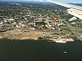
 Aerial view of Arlington, OR 01.jpg 4,288 × 2,848; 9.36 MB
-
 Aerial view of Burlington railroad bridge.jpg 4,032 × 3,024; 2.61 MB
-
 Aerial view of Vancouver in winter (32621292166).jpg 4,000 × 3,000; 2.34 MB
-
 Aerial view of Vancouver, WA.jpg 4,032 × 3,024; 3.15 MB
-
 Astoria and Tongue Point, Oregon - panoramio.jpg 2,560 × 1,920; 1.52 MB
-
-
 Bonneville Dam, Columbia River - panoramio.jpg 1,024 × 637; 250 KB
-
 Bridge of the Gods.jpg 2,400 × 1,600; 1.15 MB
-
 Camas, Washington aerial view.jpg 3,648 × 2,736; 1.61 MB
-
 Cascade Grain ethanol plant, Port Westward, Columbia River - panoramio.jpg 2,560 × 1,920; 1.49 MB
-
 Catwalks up Beacon Rock.jpg 948 × 621; 449 KB
-
 Columbia Gorge Regional Airport.jpg 2,695 × 1,685; 1.71 MB
-
 Columbia River 07787.JPG 2,412 × 1,809; 639 KB
-
 Columbia River 07788.JPG 2,560 × 1,920; 1.22 MB
-
 Columbia River 07789.JPG 2,560 × 1,920; 1.05 MB
-
 Columbia River at Washington-Oregon Border (1291216943).jpg 1,200 × 1,600; 204 KB
-
 Columbia River at Washington-Oregon Border (1291998560).jpg 1,600 × 1,200; 178 KB
-
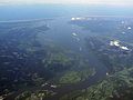
 COLUMBIA RIVER ESTUARY - NARA - 545114.jpg 2,011 × 3,000; 916 KB
-
 Columbia River from plane.jpg 4,272 × 2,848; 3.38 MB
-
 Fish wheel on the Columbia River (3226199775).jpg 4,320 × 2,712; 12.24 MB
-
 Glenn Jackson Bridge aerial.jpg 1,280 × 917; 246 KB
-
 Glenn L. Jackson Memorial Bridge aerial view from southeast 2015-10-20.jpg 3,000 × 2,000; 1.5 MB
-
 Hermiston area aerial (34522051522).jpg 3,264 × 2,448; 1.58 MB
-
 Hood River Bridge - panoramio.jpg 2,144 × 1,424; 747 KB
-
 Looking down to Columbia River.jpg 948 × 621; 327 KB
-
 McNary Dam, Umatilla, Oregon - panoramio.jpg 1,024 × 767; 276 KB
-
 Mill Pond Village, Astoria aerial - panoramio.jpg 2,128 × 1,414; 1.1 MB
-
 Pacific Northwest, Columbia River, Washington, Oregon, USA - March 17th, 2019 (46814338865).jpg 10,980 × 10,980; 95.78 MB
-
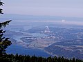
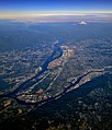 Portland, Vancouver, and Mount Hood.jpg 1,512 × 1,753; 1.29 MB
-
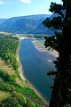
 Sandy River mouth - Oregon.jpg 2,390 × 1,790; 1.53 MB
-
 Stevenson, Washington on Columbia River (1292078764).jpg 1,200 × 1,600; 185 KB
-

-

-

-
 The Dalles aerial by Sam Beebe.jpg 3,264 × 2,448; 2.1 MB
-
 The Dalles Dam USGS.jpg 720 × 481; 208 KB
-
 The Dalles Oregon aerial.jpg 2,552 × 1,912; 2.39 MB
-
 The Dalles, Oregon (looking north to Googleville) - panoramio.jpg 2,552 × 1,912; 2.15 MB
-
 The Dalles, Oregon - panoramio.jpg 1,024 × 767; 421 KB
-
 The Dalles, Oregon from the air.jpg 4,032 × 3,024; 4.06 MB
-

-
 USACE Astoria-Megler Bridge.jpg 1,500 × 1,002; 274 KB
-
 Vancouver Lake.jpg 4,032 × 3,024; 2.15 MB
-
 Wapato Island from the air (14467733892).jpg 3,264 × 2,448; 1.95 MB
.jpg)
.jpg)


.jpg)
.jpg)


.jpg)


.jpg)
.jpg)


.jpg)


.jpg)


.jpg)


.jpg)


_-_panoramio.jpg)


.jpg)
_(mulDA0015c).jpg)