Category:Aerial photographs of islands of the United States
Jump to navigation
Jump to search
Subcategories
This category has the following 11 subcategories, out of 11 total.
Media in category "Aerial photographs of islands of the United States"
The following 54 files are in this category, out of 54 total.
-
 20170506-OC-PJK-0187 (34111882460).jpg 2,850 × 1,900; 1.85 MB
-
 Admiralty Islands.jpg 2,816 × 2,112; 2.05 MB
-
 Aerial View of Lois Island, Lewis and Clark National Wildlife Refuge.JPG 6,016 × 4,000; 7.75 MB
-
 Aerial view of Lummi Island.jpg 1,280 × 650; 71 KB
-
 Aerial view of SE Farallon Island..jpg 1,796 × 1,200; 1.67 MB
-
-
-
 Bering Strait - looking north - P1040612.JPG 2,048 × 1,536; 1.12 MB
-
 Bering Strait - looking north - P1040613.JPG 2,048 × 1,536; 1.06 MB
-
 Bering Strait - looking north - P1040614.JPG 2,048 × 1,536; 1.11 MB
-
 BogoslofIsland.jpg 1,024 × 654; 137 KB
-
 Curtis Island Camden October 2021 001.jpg 5,040 × 3,600; 6.69 MB
-
 Cuttyariel-291x225.jpg 291 × 225; 11 KB
-
 Deer Island, MA.JPG 1,600 × 1,200; 566 KB
-
 E-2B RVAW-110 DN-SC-85-06078.JPEG 3,000 × 2,391; 2.35 MB
-
 Fairway Rock 0489.jpg 568 × 450; 26 KB
-
 FairwayRock-Mil.jpg 567 × 450; 26 KB
-
 Fighting Island, LaSalle, Ontario (21079792884).jpg 3,720 × 2,790; 5.3 MB
-
 Fort Jefferson 4 wiki.jpg 750 × 512; 203 KB
-

-
 Gambell Alaska June 16 '06.jpg 1,644 × 869; 256 KB
-
 Gambell Alaska.jpg 2,048 × 1,536; 1.21 MB
-
 Gardiners island 2007.jpg 2,920 × 1,930; 3.81 MB
-
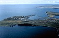
 Governors Island aerial.jpg 800 × 600; 151 KB
-
 GrassyIslandImage.png 375 × 179; 100 KB
-
 Green Island, Lake Erie, from the air.jpg 2,816 × 2,112; 1.7 MB
-
 Hazy Islet.jpg 1,050 × 694; 149 KB
-
 HiRes BlockIsland Aerial 7-23-2015.jpg 3,840 × 2,160; 981 KB
-
 Igitkin Island.jpg 4,288 × 2,848; 5.98 MB
-
 Joseph Kupke Estate Harsens Island photo by Harry Garland (1954).jpg 3,084 × 3,340; 3.29 MB
-
 Kanagaisland.jpg 432 × 206; 25 KB
-
 LONG KEY STATE PARK, MIDWAY BETWEEN KEY LARGO AND KEY WEST - NARA - 548630.jpg 3,000 × 2,016; 563 KB
-
 Lower Manhattan from Helicopter.jpg 1,718 × 1,438; 497 KB
-
 Mouse Island, Lake Erie.jpg 2,816 × 2,112; 2.14 MB
-
 North Farallon Islands.jpg 3,951 × 2,643; 979 KB
-
 Nushagak Peninsula.jpg 1,050 × 707; 182 KB
-
 Orcas Island aerial view EPA photo.jpg 1,600 × 1,064; 380 KB
-
 Pointe Mouillee.jpg 1,500 × 1,202; 548 KB
-
 Posey Island (32418201923).jpg 4,288 × 2,680; 4.13 MB
-
 Rainsford-island-by-doc-searls.jpg 3,504 × 1,996; 7.37 MB
-
 Saint Paul Island Alaska aerial view.jpg 1,500 × 981; 589 KB
-
 San Francisco-Oakland Bay Bridge, helicopter view 3.jpg 1,024 × 768; 210 KB
-
 SE Farallon Island.jpg 1,267 × 836; 151 KB
-
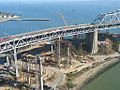
 SF-Oakland-Bay-Bridge-Construction.jpg 768 × 512; 74 KB
-
 Sfoair.jpg 800 × 442; 136 KB
-
 SFOBBESR-YBITS-Mid2012Progress.jpg 406 × 555; 110 KB
-
 Shemya Island-color.jpg 696 × 416; 40 KB
-
 South Semisopochnoi.jpg 432 × 173; 15 KB
-
 Spectacle Island USGS 2013-04-15.jpg 3,750 × 5,000; 31.49 MB
-
 St. Vincent Island.jpg 4,002 × 2,474; 5.37 MB
-
 TanagaVolcano.jpg 800 × 600; 65 KB
-
 Aerial of Three Mile Island - NARA - 540012.tif 2,700 × 2,700; 20.86 MB
-
 Unimak Island (12130013414).jpg 4,000 × 3,000; 3.99 MB
-
 USCGfarallonWithout.JPG 530 × 413; 71 KB
.jpg)


.jpg)


.jpg)


.jpg)


.jpg)
