Category:Aerial photographs of confluences
Jump to navigation
Jump to search
Media in category "Aerial photographs of confluences"
The following 22 files are in this category, out of 22 total.
-
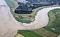
 2020-04-13-Siegmündung-0367.jpg 5,330 × 3,551; 14.48 MB
-
 Aerial image of the confluence of the Inn and Salzach (view from the west).jpg 5,300 × 3,100; 5.39 MB
-
 Aerial photograph Mündung Lühe Elbe 1.jpg 3,888 × 2,592; 3.35 MB
-
 Aerial photograph Mündung Lühe Elbe.jpg 3,888 × 2,592; 3.45 MB
-
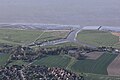
 Aerial photograph Mündung Medem Elbe 1.jpg 5,184 × 3,456; 3.47 MB
-
 Aerial photograph Mündung Medem Elbe.jpg 5,184 × 3,456; 3.86 MB
-
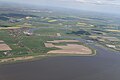
 Aerial photograph Mündung Schwinge Elbe.jpg 5,184 × 3,456; 3.99 MB
-
 Aerial photograph Mündung Stör Elbe.jpg 3,888 × 2,592; 1.47 MB
-
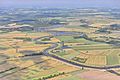
 Ahr, Mündung.jpg 3,648 × 2,052; 3.84 MB
-
 Buna-muendung.jpg 1,067 × 800; 394 KB
-
 Flug Westerstede nach Leer 2010 182.JPG 3,564 × 2,224; 5.65 MB
-
 Flug Westerstede nach Leer 2010 259.jpg 4,128 × 2,596; 7.46 MB
-
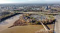 Forks of the Scioto.jpg 4,000 × 2,250; 1.9 MB
-
 Fröndenberg Kläranlage FFSW-0104.jpg 2,363 × 1,578; 5.93 MB
-
 Lausitz Luftsport- & Techniktage 2013-Rueckflug by-RaBoe 902.jpg 2,600 × 1,727; 641 KB
-
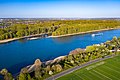
 Mainmuendung Luftbild.jpg 3,648 × 2,736; 1.69 MB
-
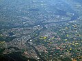
 Mainz aerial photograph.jpg 2,000 × 1,000; 1.76 MB
-
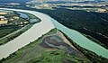
 Mura Drava Aerial.jpg 3,800 × 2,533; 2.07 MB
-
 Rienz - Gader, Mündung 001 - K.jpg 5,472 × 3,078; 9.55 MB
-
 Siegmündung.jpg 3,648 × 2,736; 5.33 MB
-
 Soutok Labe a Vltavy - panoramio.jpg 4,272 × 2,848; 1.48 MB
-
 Wied, Rheinmündung.jpg 4,032 × 2,268; 5.37 MB

.jpg)


