Category:Aerial photographs of cities in the United States
Jump to navigation
Jump to search
Subcategories
This category has the following 3 subcategories, out of 3 total.
A
W
Media in category "Aerial photographs of cities in the United States"
The following 69 files are in this category, out of 69 total.
-
 2004-01 Aerial View of Madison.JPG 1,656 × 1,242; 324 KB
-
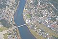
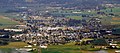
 Aerial - Libby, Montana 02 - white balanced (10322401176).jpg 4,288 × 2,848; 9.22 MB
-
 Aerial view of Addison, TX.png 4,928 × 2,772; 60.15 MB
-
 Aerial view of Ann Arbor, Michigan (2018).jpg 4,752 × 3,168; 5.42 MB
-
 Aerial view of Arlington, OR 01.jpg 4,288 × 2,848; 9.36 MB
-
 Aerial View of Gearhart, Oregon.JPG 6,016 × 4,000; 8.75 MB
-
 Aerial View of Hillsboro, Oregon.JPG 6,016 × 4,000; 9.66 MB
-
 Aerial view of I-5 at Kuebler (5035968597).jpg 640 × 428; 69 KB
-
 Aerial View of Pacific City, Oregon.JPG 6,016 × 4,000; 9.45 MB
-
 Aerial view of Pittsburgh area.jpg 4,318 × 3,083; 5.18 MB
-

-

-

-

-
 Aerial View of Tillamook, Oregon.JPG 4,536 × 1,992; 3.07 MB
-
 Aerial view of Willamette River at Corvallis, Oregon (6443607311).jpg 4,145 × 2,862; 1.43 MB
-
 Amity, Oregon aerial.jpg 4,078 × 2,708; 4.15 MB
-
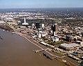 Baton Rouge Louisiana waterfront aerial view.jpg 1,500 × 1,200; 1.04 MB
-
 Beardstown, Illinois (7235193870).jpg 4,000 × 3,000; 2.21 MB
-
 Benton, Pennsylvania.PNG 401 × 285; 135 KB
-
 Billings MT and Yellowstone River.jpg 1,924 × 1,324; 1.29 MB
-
 Bloomsburg, Pennsylvania bird's eye view.PNG 400 × 287; 148 KB
-
 Boise aerial 2007.jpg 2,832 × 2,128; 1.18 MB
-
 Briar Creek, Pennsylvania.PNG 400 × 285; 138 KB
-
 BridgeportCT Aerial.jpg 2,400 × 1,600; 2.19 MB
-
 BUFFALO-LOOKING WEST TOWARD DOWNTOWN SECTON AND LAKE ERIE - NARA - 549480.jpg 3,000 × 2,030; 823 KB
-
 Cairo Illinois 1997 USGS.jpg 2,032 × 1,320; 353 KB
-

-
 Cincinnati aerial at night 2017.jpg 3,264 × 2,448; 2.16 MB
-
 Conejo Mountain in Thousand Oaks.jpg 4,000 × 2,250; 2.93 MB
-
 Des Moines Iowa.jpg 3,032 × 2,008; 2.09 MB
-
 DesMoinesIA Aerial.jpg 2,122 × 1,294; 967 KB
-
 Downtown cincinnati 2010 kdh.jpg 1,200 × 800; 677 KB
-
 Downtown Findlay from the air.jpg 2,272 × 1,704; 2.09 MB
-
 Downtown Millersburg, Ohio, from the air.jpg 2,816 × 2,112; 2.3 MB
-
 Durfee Mills Fall River 1968 LOC HABS 077843.jpg 4,448 × 3,472; 6.07 MB
-
 Eagle Point.jpg 2,576 × 1,932; 1.78 MB
-
 Fairfield CT aerial Pine Creek.jpg 3,504 × 2,336; 8.96 MB
-
 Florence OR aerial.jpg 4,120 × 2,736; 3.55 MB
-
 FlorenceAir.jpg 484 × 280; 60 KB
-
 GatlinburgAerial.jpg 4,028 × 2,213; 2.14 MB
-
 Grand Rapids April 2022.jpg 3,576 × 1,619; 1.77 MB
-
 Heppner Oregon aerial view.jpg 1,500 × 1,000; 537 KB
-
 Jefferson City.jpg 1,500 × 2,100; 325 KB
-
 Joliet, Illinois Aerial View.jpg 4,000 × 3,000; 2.69 MB
-
 Kaden-south-scott-ritcher.jpg 838 × 640; 192 KB
-
 LkHavasu.jpg 1,657 × 1,687; 3.83 MB
-
 Lorain, Ohio (7238168536).jpg 4,000 × 3,000; 2.17 MB
-
 Milwaukeedowntown.jpg 1,800 × 1,215; 1 MB
-
 Oak Brook (482227376).jpg 2,048 × 1,536; 995 KB
-
 Orlando downtown 2011.jpg 3,264 × 2,448; 3.45 MB
-
 Ottawa, Illinois (7981644021).jpg 4,000 × 3,000; 2.1 MB
-
 Peoria and Illinois River from Air 1974.jpg 1,250 × 729; 553 KB
-
 Peoria from the Air over Tazewell County 1977.jpg 1,200 × 667; 307 KB
-
 Photograph of Aerial View of Murry City, Ohio - NARA - 2128905.jpg 1,281 × 936; 870 KB
-
 PortlandOR-aerial.jpg 1,280 × 960; 814 KB
-
 Rochester Minnesota downtown aerial view.jpg 1,500 × 1,202; 1.15 MB
-
 Rumford, Maine Bird's-eye view.JPG 480 × 349; 39 KB
-
 SchenectadyAerial.jpeg 2,272 × 1,704; 2.12 MB
-
 Set intersection exemplified by road intersection.jpg 623 × 627; 84 KB
-
 Skyline Tulsa.jpg 4,000 × 3,000; 5.02 MB
-
 U.S. Geological Survey Skyline Center 2002.jpg 485 × 353; 39 KB
-
 University of Akron, Akron, Ohio (7994051476).jpg 4,000 × 3,000; 5.38 MB
-
 USACE Port Orford Oregon.jpg 1,500 × 1,500; 619 KB
-
 View of Rockland, Maine from a plane.jpg 1,000 × 1,504; 293 KB
-
 Washington D.C., United States of America.JPG 640 × 437; 122 KB
-
 WillimanticCT.jpg 1,714 × 964; 553 KB
-
 WilmingtonAerialViewCoastGuard.jpg 1,020 × 696; 98 KB
-
 Wyoming, Michigan aerial 2009.jpg 1,563 × 1,201; 1.62 MB

.jpg)

.jpg)


.jpg)


_IS_LOCATED._LARGE_SETTLING..._-_NARA_-_543738.jpg)
_IS_LOCATED._LARGE_MILL..._-_NARA_-_543734.jpg)


.jpg)


.jpg)


.jpg)

.jpg)

.jpg)


.jpg)


