Category:Aerial photographs of airports in Indiana
Jump to navigation
Jump to search
States of the United States: Alabama · Alaska · Arizona · Arkansas · California · Colorado · Connecticut · Delaware · Florida · Georgia · Hawaii · Idaho · Illinois · Indiana · Iowa · Kansas · Kentucky · Louisiana · Maine · Maryland · Massachusetts · Michigan · Minnesota · Mississippi · Missouri · Montana · Nebraska · Nevada · New Hampshire · New Jersey · New Mexico · New York · North Carolina · North Dakota · Ohio · Oklahoma · Oregon · Pennsylvania · Rhode Island · South Carolina · South Dakota · Tennessee · Texas · Utah · Vermont · Virginia · Washington · West Virginia · Wisconsin · Wyoming
Puerto Rico
Puerto Rico
English: Aerial photographs of airports in the state of Indiana, United States
Subcategories
This category has only the following subcategory.
Media in category "Aerial photographs of airports in Indiana"
The following 12 files are in this category, out of 12 total.
-
 Atterbury Army Airfield - IN - 25 November 1943.jpg 723 × 452; 65 KB
-
 Atterburyaaf-7aug1997.jpg 400 × 315; 32 KB
-
 Baer Army Air Base - IN - 24 November 1943.jpg 730 × 451; 93 KB
-
 Baeraaf-8apr1988.jpg 400 × 429; 55 KB
-
 Elkhart airport.jpg 1,280 × 819; 192 KB
-
 Fort Wayne International Airport - USGS 10 April 2002.jpg 2,000 × 2,000; 462 KB
-
 Freeman Municipal Airport-IN-27Mar1998-USGS.jpg 773 × 618; 124 KB
-
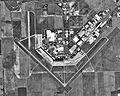
 Grissom AFB IN - 24 March 1998.jpg 502 × 676; 79 KB
-
 ISS-64 Elkhart Municipal Airport, Indiana.jpg 504 × 352; 56 KB
-
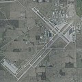
 KLAF.jpg 1,581 × 1,186; 483 KB
-
 Lake Village Airport and Lake Aero Estates looking south.jpg 2,304 × 1,728; 1.24 MB
-
 Smith Field KSMD - USGS 6 April 1998.jpg 1,200 × 900; 153 KB


