Category:Aerial photographs of Winthrop, Massachusetts
Jump to navigation
Jump to search
Media in category "Aerial photographs of Winthrop, Massachusetts"
The following 16 files are in this category, out of 16 total.
-
 A spit of land on Approach for 27 in Boston (2495091353).jpg 2,272 × 1,704; 4.21 MB
-
 Aerial photograph of part of Boston.jpg 3,264 × 2,448; 1.19 MB
-
 Aerial view of Beachmont and Winthrop Highlands, March 2023.jpg 2,791 × 2,100; 2.15 MB
-
 Aerial view of Belle Isle Inlet, March 2023.jpg 3,003 × 1,999; 1.62 MB
-
 Aerial view of Belle Isle Marsh and Short Creek, March 2023.jpg 3,024 × 2,266; 2.04 MB
-
 Aerial view of BRB&L bridge across Short Creek, March 2023.jpg 2,498 × 1,873; 2.11 MB
-
 Aerial view of Main Street, Winthrop, August 2017.jpg 3,600 × 2,400; 3.66 MB
-
 Aerial view of Winthrop at sunset.jpg 3,772 × 2,630; 1.22 MB
-
 Aerial view of Winthrop Beach and Crystal Cove, August 2017.jpg 3,600 × 2,400; 4.12 MB
-
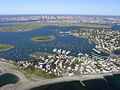
 Aerial view of Winthrop.jpg 3,309 × 2,037; 952 KB
-
 Approaching Runway 27 in Boston (2495912758).jpg 2,272 × 1,704; 4.1 MB
-
 BRB&L embankment in Winthrop.JPG 4,320 × 3,240; 2.44 MB
-
 Great Head Winthrop aerial.JPG 4,320 × 3,240; 2.61 MB
-
 N662JB, Take off from BOS (6959468337).jpg 3,264 × 2,448; 3.31 MB
-
 Winthrop ma.jpg 1,024 × 768; 274 KB
-
 Winthrop tilt-shift, November 2012.jpg 2,000 × 1,329; 270 KB
.jpg)


.jpg)


.jpg)

