Category:Aerial photographs of Victoria, Australia
Jump to navigation
Jump to search
States of Australia: New South Wales · Queensland · South Australia · Tasmania · Victoria · Western Australia
Internal territories of Australia: Australian Capital Territory · Northern Territory
External territories of Australia:
Internal territories of Australia: Australian Capital Territory · Northern Territory
External territories of Australia:
Subcategories
This category has the following 6 subcategories, out of 6 total.
M
W
Media in category "Aerial photographs of Victoria, Australia"
The following 186 files are in this category, out of 186 total.
-
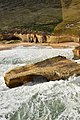
 12 Apostles, Victoria, Australia (Ank Kumar) 01.jpg 6,000 × 4,000; 6.27 MB
-
 12 Apostles, Victoria, Australia (Ank Kumar) 02.jpg 6,000 × 4,000; 7.71 MB
-
 12 Apostles, Victoria, Australia (Ank Kumar) 03.jpg 6,000 × 4,000; 7.61 MB
-
 12 Apostles, Victoria, Australia (Ank Kumar) 04.jpg 4,173 × 2,782; 2.44 MB
-
 12 Apostles, Victoria, Australia (Ank Kumar) 05.jpg 6,000 × 4,000; 6.95 MB
-
 12 Apostles, Victoria, Australia (Ank Kumar) 06.jpg 6,000 × 4,000; 6.2 MB
-
 12 Apostles, Victoria, Australia (Ank Kumar) 07.jpg 6,000 × 4,000; 7.65 MB
-
 12 Apostles, Victoria, Australia (Ank Kumar) 08.jpg 4,000 × 6,000; 7.97 MB
-
 12 Apostles, Victoria, Australia (Ank Kumar) 09.jpg 6,000 × 4,000; 5.81 MB
-
 12 Apostles, Victoria, Australia (Ank Kumar) 10.jpg 6,000 × 4,000; 6.39 MB
-
 12 Apostles, Victoria, Australia (Ank Kumar) 11.jpg 6,000 × 4,000; 5.91 MB
-
-

-
-
 Aerial - Bendigo 1.jpg 3,264 × 2,448; 2.19 MB
-
 Aerial - Bendigo 2.jpg 3,264 × 2,448; 2.49 MB
-
 Aerial - Melton from north.jpg 1,600 × 1,200; 531 KB
-
 Aerial panorama of Barwon Heads.jpg 5,000 × 2,349; 5.37 MB
-
 Aerial panorama of Blackburn, Victoria. Shot September 2018.jpg 9,733 × 2,569; 11.49 MB
-
 Aerial panorama of Blue Waters lake in Creswick.png 6,829 × 3,661; 43.12 MB
-
 Aerial panorama of Bundoora from above. Facing the Melbourne skyline. June 2023.jpg 8,192 × 3,308; 7.03 MB
-
 Aerial panorama of Candlebark Park alongside Fitzsimmons Reserve dog offleash area.jpg 8,192 × 3,306; 6.48 MB
-
 Aerial panorama of Deakin University facing north. July 2023.jpg 8,192 × 3,304; 5.67 MB
-
 Aerial panorama of Deakin University's Waurn Pond Campus.jpg 8,857 × 2,823; 12.09 MB
-
 Aerial panorama of Greendale, Victoria.jpg 8,790 × 2,844; 13.65 MB
-
 Aerial panorama of Lake Daylesford.jpg 6,165 × 3,422; 14.49 MB
-
 Aerial panorama of South Yarra facing the Melbourne skyline. September 2023.jpg 8,192 × 3,300; 5.04 MB
-
 Aerial panorama of the coastal township of Anglesea, Victoria.jpg 9,285 × 2,693; 10.75 MB
-
 Aerial panorama of Wombat Hill and Surrounds.jpg 4,111 × 1,830; 4.91 MB
-
 Aerial perspective of Bacchus Marsh IGA.jpg 6,305 × 3,965; 13.22 MB
-
 Aerial perspective of Bacchus Marsh.jpg 10,000 × 2,436; 13.82 MB
-
 Aerial perspective of Barwon Heads bridge.jpg 4,000 × 3,000; 5.06 MB
-
 Aerial perspective of Daylesford Boathouse.jpg 2,252 × 2,242; 4.4 MB
-
 Aerial perspective of Fishermans' Beach at Torquay. March 2019.jpg 4,000 × 2,250; 3.71 MB
-
 Aerial perspective of Kardinia Park Stadium with South Geelong station.jpg 1,384 × 1,356; 1.85 MB
-
 Aerial perspective of O'Brien's Crossing in Lerderderg State Park.jpg 4,000 × 3,000; 6.31 MB
-
 Aerial perspective of O'Brien's Crossing.jpg 8,923 × 2,802; 19.77 MB
-
 Aerial perspective of Point Lonsdale's lighthouses.jpg 9,040 × 2,764; 6.85 MB
-
 Aerial perspective of St Georges Lake in Creswick.jpg 7,498 × 3,334; 10.79 MB
-
 Aerial perspective of the Barwon river discharging into the Bass Strait.jpg 4,000 × 3,000; 5.89 MB
-
 Aerial perspective of the Costco roof at the Docklands. March 2019.jpg 4,000 × 2,250; 3.73 MB
-
 Aerial perspective of the District at the Docklands waterfront. March 2019.jpg 4,000 × 2,250; 3.93 MB
-
 Aerial perspective of the ramp going onto the M2. March 2019.jpg 4,000 × 2,250; 4.5 MB
-
 Aerial perspective of the Salty Dog Cafe at Torquay. March 2019.jpg 4,000 × 2,250; 4.47 MB
-
 Aerial perspective of the Sea Shepherd docked at the Docklands, Feb 2019.jpg 4,000 × 2,250; 3.52 MB
-

-
 Aerial perspective of Torquay Bowls . March 2019.jpg 4,000 × 2,250; 4.25 MB
-
 Aerial top-down perspective of Creswick's Blue Waters lake.jpg 4,000 × 3,000; 5.44 MB
-
 Aerial topdown of the sporting oval at Morton Park, Blackburn.jpg 4,000 × 3,000; 5.38 MB
-
 Aerial view of 12 Apostles, Victoria, Australia (Ank Kumar) 01.jpg 6,000 × 4,000; 7.78 MB
-
 Aerial view of 12 Apostles, Victoria, Australia (Ank Kumar) 02.jpg 6,000 × 4,000; 3.95 MB
-
 Aerial view of 12 Apostles, Victoria, Australia (Ank Kumar) 03.jpg 6,000 × 4,000; 6.88 MB
-
 Aerial view of 12 Apostles, Victoria, Australia (Ank Kumar) 04.jpg 4,798 × 3,199; 2.91 MB
-
 Aerial view of 12 Apostles, Victoria, Australia (Ank Kumar) 05.jpg 6,000 × 4,000; 4.06 MB
-
 Aerial view of 12 Apostles, Victoria, Australia (Ank Kumar) 06.jpg 6,000 × 4,000; 4.46 MB
-
 Aerial view of 12 Apostles, Victoria, Australia (Ank Kumar) 07.jpg 6,000 × 4,000; 8.66 MB
-
 Aerial view of 12 Apostles, Victoria, Australia (Ank Kumar) 08.jpg 5,323 × 3,548; 6.12 MB
-
 Aerial view of 12 Apostles, Victoria, Australia (Ank Kumar) 09.jpg 6,000 × 4,000; 7.4 MB
-
 Aerial view of 12 Apostles, Victoria, Australia (Ank Kumar) 10.jpg 6,000 × 4,000; 7.81 MB
-
 Aerial view of 12 Apostles, Victoria, Australia (Ank Kumar) 11.jpg 6,000 × 4,000; 8.57 MB
-
 Aerial view of 12 Apostles, Victoria, Australia (Ank Kumar) 12.jpg 5,026 × 3,351; 5.57 MB
-
 Aerial view of Bendigo, Victoria.jpg 3,858 × 2,752; 2.53 MB
-
 Aerial view of Riddells Creek May 2021.jpg 5,184 × 3,456; 5.84 MB
-
 Alexandra Victoria aerial.jpg 2,288 × 1,712; 3.31 MB
-
 Apex Park at Altona Beach - panoramio.jpg 7,000 × 1,816; 10.06 MB
-
 Ararat from One Tree Hill lookout.jpg 700 × 331; 65 KB
-
 Bacchus Marsh Airfield overview Vabre.jpg 1,024 × 685; 399 KB
-
 Barak Bushland reserve from above.jpg 8,192 × 3,312; 10.87 MB
-
 Beaconsfield Victoria aerial.jpg 2,288 × 1,712; 781 KB
-
 Benalla-aerial.jpg 2,425 × 1,531; 805 KB
-
 Beveridge Kalkello aerial.jpg 2,288 × 1,712; 3.23 MB
-
 Bonnie Doon and Lake Eildon.jpg 2,288 × 1,712; 2.74 MB
-
 Bundoora Farm and Cafe from above. June 2023.jpg 4,032 × 2,268; 3.09 MB
-
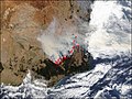 Bushfires Australia Jan 22 2003.jpg 540 × 405; 88 KB
-
 Calder Park aerial.jpg 1,659 × 979; 1.41 MB
-
 Cardinia Aerial.jpg 1,433 × 1,185; 671 KB
-
 Cardinia Reservoir aerial.jpg 2,288 × 1,712; 2.66 MB
-
 Castella Victoria aerial.jpg 2,288 × 1,712; 2.8 MB
-
 Central Victoria from the air.jpg 2,000 × 3,008; 1.65 MB
-
 Corryong aerial.jpg 2,288 × 1,712; 2.89 MB
-
 CSIRO ScienceImage 1705 Aerial view of Industrial Landscape.jpg 2,657 × 1,817; 4.04 MB
-
 CSIRO ScienceImage 1706 Aerial view of Industrial Landscape.jpg 1,835 × 2,657; 3.72 MB
-
 Cumulus clouds from the air.jpg 2,000 × 3,008; 2.15 MB
-
 Dartmouth aerial.jpg 2,288 × 1,712; 3.63 MB
-
 Diggers Rest aerial.jpg 1,810 × 1,368; 2.23 MB
-
 Diggers Rest Victoria SE.jpg 2,288 × 1,712; 2.79 MB
-
 Eden Park nth.jpg 2,288 × 1,712; 2.31 MB
-
 Eldorado Victoria aerial.jpg 2,285 × 1,282; 2.87 MB
-
 Eltham High School aerial panorama.jpg 8,192 × 3,280; 10.7 MB
-
 Eltham High School from above, facing west.jpg 4,032 × 2,268; 3.96 MB
-
 Eltham High School from above.jpg 4,032 × 2,268; 4.88 MB
-
 Gisborne South aerial.jpg 2,288 × 1,712; 2.65 MB
-
 Gisborne Victoria aerial.jpg 2,285 × 881; 1.55 MB
-
 Glenrowan-aerial.jpg 2,925 × 2,059; 3.1 MB
-
 Greater Geelong.png 697 × 1,024; 1.47 MB
-
 Greenvale reservoir 1.jpg 2,281 × 955; 1.69 MB
-
 Greenvale Reservoir 2.jpg 909 × 563; 438 KB
-
 Hamilton1927.jpg 4,391 × 3,472; 3.52 MB
-
 Harkaway-aerial.jpg 1,515 × 861; 1.28 MB
-
 Hume dam.jpg 2,400 × 1,602; 1.48 MB
-
 Humevale aerial.jpg 2,288 × 1,712; 2.82 MB
-
 Inverleigh aerial panorama. December 2022.jpg 8,192 × 3,318; 9.93 MB
-
 Inverloch Aerial.jpg 1,712 × 2,288; 784 KB
-
 Jamieson Victoria aerial.jpg 2,138 × 1,516; 2.55 MB
-
 Killaravic.png 1,792 × 828; 6.97 MB
-
 Kinglake aerial.jpg 2,288 × 1,712; 2.63 MB
-
 Kinglake West aerial.jpg 2,288 × 1,712; 2.35 MB
-
 Koo-wee-rup Aerial.jpg 1,712 × 2,288; 1.39 MB
-
 Lake Eildon National Park from above. March 2021.jpg 8,192 × 3,274; 9.42 MB
-
 Landing Shadow (32445589273).jpg 1,600 × 1,200; 903 KB
-
 Lang Lang Aerial.jpg 2,288 × 1,712; 905 KB
-
 Lawsons Park and Barwon River, Inverleigh from above.jpg 4,032 × 2,268; 4.81 MB
-
 Levantine Hill estate from above.jpg 4,000 × 2,250; 3.89 MB
-
 Lorne Pier from Teddys March 2019.jpg 2,404 × 1,354; 1.51 MB
-
 Maffra AerialView.jpg 600 × 519; 36 KB
-
 Mansfield Victoria aerial.jpg 2,288 × 1,712; 2.8 MB
-
 Marysville aerial.jpg 2,288 × 1,712; 2.97 MB
-
 Marysville-bal-PB120495.JPG 2,288 × 1,712; 2.58 MB
-
 Melbourne, Australia (Unsplash YIWBsKmrJh8).jpg 5,304 × 7,952; 6.75 MB
-
 Melton aerial 1.jpg 2,285 × 756; 1.27 MB
-
 Mickleham 1 aerial.jpg 2,283 × 1,055; 2.06 MB
-
 Mickleham 2 aerial.jpg 2,285 × 961; 1.97 MB
-
 Mickleham panorama facing eastwards to the Dandenong Ranges. April 2024.jpg 8,192 × 3,304; 5.12 MB
-
 Moonee ponds creek aerial north melbourne.jpg 800 × 600; 219 KB
-
 Mornington ca 1940.jpg 4,908 × 3,546; 4.35 MB
-
 Mount Beauty Tawonga South aerial.jpg 2,288 × 1,712; 3.06 MB
-
 Mount Buffalo Chalet.jpg 5,184 × 3,456; 14 MB
-
 Mount Buller aerial.jpg 2,288 × 1,712; 2.89 MB
-
 Mount Donna Buang from above.jpg 8,192 × 3,316; 5.9 MB
-
 Mount Donna Buang with its 21m high observation tower.jpg 8,192 × 3,326; 6.75 MB
-
 Mt Beauty Tawonga South aerial.jpg 2,288 × 1,712; 3.25 MB
-
 Mt Buller aerial zoom.jpg 2,288 × 1,712; 2.25 MB
-
 Mt Macedon as seen from the air 100m up on a misty spring afternoon.jpg 5,715 × 2,086; 8.95 MB
-
 Mullum Mullim Stadium from the air 1.jpg 4,000 × 2,250; 3.97 MB
-
 Mullum Mullim Stadium from the air 2.jpg 4,000 × 2,250; 4.14 MB
-
 Mullum Mullim Stadium from the air 3.jpg 4,000 × 2,250; 3.6 MB
-
 Murrindindi VIC 3717, Australia - panoramio.jpg 3,264 × 2,448; 2.49 MB
-
 Navarre Airfield overview Vabre.jpg 1,024 × 683; 452 KB
-
 Nyora Aerial..jpg 2,288 × 1,712; 1.27 MB
-
 Officer Aerial.jpg 1,299 × 931; 239 KB
-
 Pascoe Vale VIC 3044, Australia - panoramio.jpg 3,264 × 2,448; 2.77 MB
-
 Peterborough.jpg 520 × 738; 85 KB
-
 Pheasant Creek aerial.jpg 2,093 × 1,610; 2.56 MB
-
 Plenty Gorge from the Sky - panoramio.jpg 5,846 × 1,126; 4.38 MB
-
 Point Roadknight Back Beach Aerial Panorama.jpg 6,749 × 2,775; 14.58 MB
-
 Port Campbell.jpg 2,048 × 1,536; 1.98 MB
-
 Portarlington from the air.jpg 2,953 × 832; 1.85 MB
-
 QEO Renderland.jpg 3,992 × 2,242; 1.83 MB
-
 Queenscliffvic-airview-0508-2601-63.jpg 800 × 532; 376 KB
-
 Remnants of Steiglitz's mines - panoramio.jpg 7,660 × 2,622; 11.01 MB
-
 Ringwood Aerial panorama facing the Dandenong Ranges. January 2024.jpg 8,192 × 3,306; 5.6 MB
-

-
 Romsey-aerial-3.jpg 2,127 × 1,105; 562 KB
-
 Romsey.JPG 3,888 × 2,592; 7.08 MB
-
 Rushworth.JPG 3,888 × 2,592; 6.42 MB
-
 Rushworth2.jpg 3,888 × 2,592; 7.28 MB
-
 Seymour-aerial.jpg 2,784 × 1,766; 2.65 MB
-
 St Georges River along the Great Ocean Road March 2019.jpg 4,000 × 2,250; 3.78 MB
-
 Sunday Creek Reservoir aerial.jpg 1,651 × 1,623; 2 MB
-
 Templestowe Lower Sunset 020421.jpg 8,192 × 3,300; 16.67 MB
-
 The Anakies and Anakie Gorge from the sky - panoramio.jpg 5,846 × 1,184; 4.67 MB
-
 The Edge of Victoria (33213816666).jpg 1,586 × 1,180; 510 KB
-
 The ghost town of Steiglitz from the sky - panoramio.jpg 4,500 × 2,240; 5.9 MB
-
 The Yarra River Birrarung meandering past South Yarra. September 2023.jpg 8,192 × 3,314; 9.94 MB
-
 Tintaldra aerial.jpg 2,288 × 1,712; 2.82 MB
-
 Torquay Beach from the air. March 2019.jpg 4,000 × 2,250; 4.1 MB
-
 Truganina Park - panoramio.jpg 7,000 × 1,568; 9.15 MB
-
 Wangaratta-aerial.jpg 2,525 × 1,597; 1.47 MB
-
 Warburton Aerial Panorama 20 August 2022.jpg 8,192 × 3,324; 8.03 MB
-
 Warburton Water World from above.jpg 4,032 × 2,268; 3.19 MB
-
 Welaregang aerial.jpg 1,753 × 1,300; 1.88 MB
-
 Werribee's western periphery seen from the sky.jpg 2,000 × 967; 1.85 MB
-
 Whittlesea aerial.jpg 2,191 × 1,371; 2.49 MB
-
 Whittlesea Yan Yean Reservoir.jpg 2,288 × 1,712; 3.46 MB
-
 Wodonga-victoria-aerial.jpg 2,253 × 1,331; 636 KB
-
 Woodstock Merriang Rd.jpg 2,288 × 1,712; 2.78 MB
-
 Yan Yean Reservoir.jpg 1,516 × 754; 395 KB
-
 Yarra Valley wine region panorama. Facing east.jpg 7,911 × 3,160; 8.48 MB
-
 Yea River Conservation Reserve Jan 2020.jpg 11,028 × 2,123; 10.99 MB
-
 Yea Swimming Pool from the air. Jan 2020.jpg 4,000 × 2,250; 4.06 MB
-
 Yea Township from the air.jpg 4,000 × 2,250; 4.3 MB
-
 Yea Township Panorama from the air.jpg 10,205 × 2,194; 12.24 MB
-
 Yea township vertical panorama. Jan 2020.jpg 4,192 × 8,336; 24.09 MB
-
 Yea-bal-PB120592.JPG 1,589 × 1,103; 1.61 MB
-
 Yerram Yaluk Bun and Inverleigh Hotel from above.jpg 4,032 × 2,268; 4.74 MB
-
 Zone 7 860 C3 Drouin C3.jpg 386 × 284; 53 KB
_01.jpg)
_02.jpg)
_03.jpg)
_04.jpg)
_05.jpg)
_06.jpg)
_07.jpg)
_08.jpg)
_09.jpg)
_10.jpg)
_11.jpg)


_01.jpg)
_02.jpg)
_03.jpg)
_04.jpg)
_05.jpg)
_06.jpg)
_07.jpg)
_08.jpg)
_09.jpg)
_10.jpg)
_11.jpg)
_12.jpg)


.jpg)


.jpg)


.jpg)


