Category:Aerial photographs of South-Central Alaska
Jump to navigation
Jump to search
Subcategories
This category has the following 4 subcategories, out of 4 total.
A
C
V
Media in category "Aerial photographs of South-Central Alaska"
The following 95 files are in this category, out of 95 total.
-
 210714 Coast Guard Base Kodiak.jpg 4,567 × 2,725; 1.49 MB
-
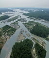 3 Rivers Joining at Talkeetna, Alaska.jpg 1,079 × 1,280; 480 KB
-

-
 Above (6778613344).jpg 1,868 × 2,613; 1.4 MB
-
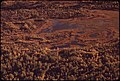
 Aerial photography of national reserve lakes.jpg 2,100 × 1,398; 123 KB
-
 Aerial view of glacier in wrangell mountains.jpg 2,100 × 1,414; 1.18 MB
-
 Aerial View of Homer Spit.jpg 2,048 × 1,461; 235 KB
-
 Aerial view of lowland lakes in the Kenai refuge.jpg 2,100 × 1,330; 173 KB
-
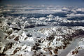
 Alaska range aerial view.jpg 1,050 × 715; 127 KB
-
 Alaska Range from Air (7065264169).jpg 5,034 × 3,356; 10.03 MB
-
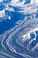 Alaska Range Glacier.jpg 1,365 × 2,048; 653 KB
-
 Alaska Range Mountain Peaks.jpg 1,050 × 702; 840 KB
-
 Alaskan landscape on the way to Maui (8034611647).jpg 2,000 × 1,500; 2.81 MB
-
 AlaskaQuake-Seward.jpg 1,000 × 666; 149 KB
-
 Alsek Lake aerial.jpg 800 × 419; 322 KB
-
 Approach to Quartz Creek on Kenai Lake - panoramio.jpg 1,024 × 768; 167 KB
-
 Augustine Volcano.jpg 1,050 × 707; 152 KB
-
 Big River Lakes - panoramio.jpg 1,280 × 960; 251 KB
-
 Black Bear in Russian River.jpg 700 × 490; 513 KB
-
 Black bear in russian river.jpg 700 × 490; 102 KB
-
 Blockade Glacier - panoramio - palm ak.jpg 1,280 × 960; 543 KB
-
 Blueberry Hill, Valdez, Alaska.jpg 1,228 × 780; 742 KB
-
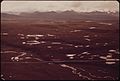
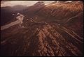
 Braided River Outwash Plain.jpg 1,050 × 699; 147 KB
-
 Cape Hinchinbrook, Alaska, Lightstation - NARA - 298198.tif 3,000 × 2,615; 7.48 MB
-
 Cape Hinchinbrook, Alaska, Lightstation, 1948 - NARA - 298198.jpg 3,000 × 2,615; 2.09 MB
-
 Chenega, Alaska Aerial 1.jpg 1,348 × 870; 904 KB
-
 Chenega, Alaska Aerial 2.jpg 1,358 × 888; 778 KB
-
-
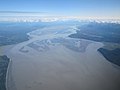
 Copper River Delta - panoramio.jpg 2,552 × 1,912; 1.72 MB
-
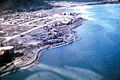
 Cordova Alaska aerial view.jpg 1,500 × 1,417; 821 KB
-
 Cordova Alaska aerial.jpg 4,085 × 2,414; 6 MB
-
 Double Glacier and Mt. Redoubt - panoramio.jpg 1,024 × 768; 66 KB
-
 Eagle River, Alaska Aerial.jpg 1,024 × 768; 148 KB
-
 Earthquake, GlennPalmer Interchange 11.20.2018 2.jpg 2,736 × 1,824; 2.07 MB
-
 ENA-b.jpg 845 × 634; 64 KB
-
 Fire Island Alaska from airliner.jpg 2,781 × 2,732; 2.2 MB
-
 GKN-e.jpg 695 × 470; 40 KB
-

-
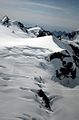
 Harding Ice Field 2.jpg 1,050 × 704; 127 KB
-
 Harding Ice Field above Skilak Glacier.jpg 1,050 × 720; 92 KB
-
 Harding Ice Field.jpg 693 × 1,050; 98 KB
-
 Homer Spit aerial.jpg 3,008 × 2,000; 741 KB
-
-
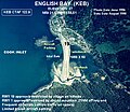 KEB-c.jpg 563 × 489; 102 KB
-
 Kenai Airport - panoramio.jpg 1,280 × 960; 551 KB
-
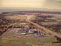 Kenai Central high School.jpg 1,280 × 960; 265 KB
-
 Kenai lief hansen memorial park.jpg 1,280 × 960; 273 KB
-
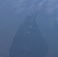
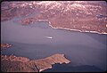
 Kenai Peninsula Borough, AK, USA - panoramio.jpg 1,024 × 1,365; 184 KB
-
 Kenai Refuge Lakes (8426057383).jpg 1,050 × 695; 91 KB
-
 Kenai Refuge Lowland Lakes.jpg 1,050 × 665; 156 KB
-
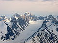 Kichatna Peaks.jpg 1,600 × 1,200; 1.08 MB
-
 King County Creek Fire 2005.jpg 1,050 × 788; 138 KB
-
 Knik River.jpg 1,024 × 768; 75 KB
-
 Lake Clark Wikivoyage Banner.jpg 3,008 × 430; 1.55 MB
-
-
 Line5073 - Flickr - NOAA Photo Library.jpg 3,008 × 2,000; 1.39 MB
-

-
 Matanuska Glacier From The Air.JPG 3,648 × 2,736; 2.54 MB
-
 McArthur River - panoramio - palm ak (1).jpg 1,280 × 960; 302 KB
-
 Merge, grind, flow!.jpg 4,320 × 3,240; 4.26 MB
-
 Mount Iliamna.jpg 3,008 × 2,000; 5.29 MB
-
 No caption (26275964112).jpg 4,013 × 3,272; 8.14 MB
-

-

-
 Plane crash debris, near Anchorage.JPG 1,280 × 960; 296 KB
-
 Portage Glacier 8341.JPG 4,272 × 2,848; 3.72 MB
-
 Portage Glacier 8342.JPG 4,272 × 2,848; 3.72 MB
-
-

-
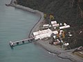
 Sawmill Bay Hatchery, Evans Island, Alaska.jpg 1,264 × 886; 848 KB
-
 Seabulk Pride aground.jpg 1,596 × 1,061; 508 KB
-
 Seward Alaska aerial view.jpg 1,500 × 1,011; 533 KB
-
 Seward before quake damage aeq00054.jpg 3,606 × 2,400; 2.83 MB
-
 Sheridan River - panoramio.jpg 2,446 × 1,832; 1.42 MB
-
 Snug Harbor Cannery - panoramio.jpg 1,280 × 960; 240 KB
-
 Snug Harbor Cannery on Chisik Island - panoramio.jpg 1,024 × 1,365; 221 KB
-
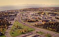
 Soldotna, Alaska Aerial.jpg 1,073 × 360; 466 KB
-
 Taken somewhere south of Anchorage on the way to Maui (8034600449).jpg 2,000 × 1,047; 1.93 MB
-

-
-
 Tustumena Glacier - panoramio.jpg 2,560 × 1,920; 1.51 MB
-
 Tyonek, Alaska.jpg 640 × 413; 93 KB
-

-
 USACE Homer Spit Alaska.jpg 1,500 × 1,124; 501 KB
-
 Valdez (3873215708).jpg 3,776 × 2,520; 1.23 MB
-
 Valdez aerial.jpg 3,371 × 2,197; 4.66 MB
-
 Valdez, Alaska Aerial 1989.jpg 1,310 × 803; 914 KB
-

-

-

-

-

-

-
 Vine Road after repairs.jpg 2,510 × 1,562; 2.14 MB
-
 Wally Noerenberg Hatchery.jpg 1,176 × 514; 112 KB


.jpg)


.jpg)


.jpg)


,_Lone_Mountain_(middle)_and_Nelson_Mountain_(center_background)._(39319233234).jpg)


.jpg)


.jpg)


.jpg)


.jpg)


.jpg)


_ACROSS_PORT_VALDEZ_TO_THE_CITY_OF_VALDEZ._SAW_ISLAND..._-_NARA_-_555690.jpg)


