Category:Aerial photographs of Salzatal
Jump to navigation
Jump to search
Deutsch: Luftbilder der Einheitsgemeinde Salzatal im Saalekreis (Sachsen-Anhalt) einschließlich ihrer Ortsteile
English: Aerial photographs of Salzatal (Saalekreis, Saxony-Anhalt, Germany), including incorporated villages.
Media in category "Aerial photographs of Salzatal"
The following 7 files are in this category, out of 7 total.
-
 A 143 Auffahrt B 80.jpg 3,357 × 2,238; 6.54 MB
-
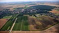 Beesenstedt 001.jpg 6,016 × 3,384; 8.26 MB
-
 Beesenstedt 002, Schwittersdorf.jpg 6,016 × 3,384; 8.2 MB
-
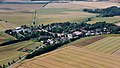
 Höhnstedt luft.jpg 4,000 × 3,000; 2.07 MB
-
 Höhnstedt.jpg 4,000 × 3,000; 4.7 MB
-
 Luftbild Schloss Schochwitz 2016.jpg 3,872 × 2,592; 8.31 MB
-
 St. Lucia und Ottilie Höhnstedt.jpg 4,000 × 3,000; 2.02 MB


