Category:Aerial photographs of Northern Alaska
Jump to navigation
Jump to search
Media in category "Aerial photographs of Northern Alaska"
The following 110 files are in this category, out of 110 total.
-
 2010-06-25-CPX-8566a.jpg 800 × 500; 149 KB
-

-

-
 Aerial view of BELA (7536751430).jpg 900 × 600; 58 KB
-
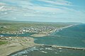
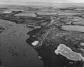
 Aerial view of Nome (9511349455).jpg 2,204 × 1,653; 2.9 MB
-
 Aerial View of Sand Dunes (8490155804).jpg 2,816 × 2,112; 506 KB
-
 Aerial view of Selawik National Wildlife Refuge wetlands burn area.jpg 2,100 × 1,398; 160 KB
-
 Aerial view of Serpentine Valley (9922716004).jpg 2,848 × 4,288; 6.2 MB
-
 Aerial winter view of the village of ambler Alaska.jpg 2,100 × 1,672; 213 KB
-
 AKP D.Khalsa (51) (27430891572).jpg 1,920 × 1,281; 2.11 MB
-
 Anaktuvuk Pass, Alaska from the air.jpg 4,288 × 2,848; 4.44 MB
-
 Anaktuvuk Pass, Alaska.jpg 3,575 × 2,202; 2.69 MB
-
 Arrigetch Peaks.jpg 1,050 × 704; 107 KB
-
 Barrier Islands and Lagoons at Cape Espenberg - Kotzebue Sound.jpg 1,050 × 701; 567 KB
-
 Barrow AK.jpg 1,600 × 800; 560 KB
-
 Barrow-Alaska-skyview.jpg 1,624 × 1,218; 420 KB
-
 Beach Ridges (20692973940).jpg 3,692 × 2,472; 1.69 MB
-
 BELA Kuzitrin River sand bars (35353611610).jpg 4,187 × 2,591; 7.15 MB
-
 Bering Land Bridge Coastline (9510919499).jpg 3,072 × 2,304; 4.57 MB
-
 Bering Strait - looking north - P1040612.JPG 2,048 × 1,536; 1.12 MB
-
 Bering Strait - looking north - P1040613.JPG 2,048 × 1,536; 1.06 MB
-
 Bering Strait - looking north - P1040614.JPG 2,048 × 1,536; 1.11 MB
-
 Brevig Mission Alaska - Drone 2018.jpg 4,000 × 2,250; 1.56 MB
-
 Brooks Range (39) from aeroplane.jpg 2,520 × 1,680; 3.81 MB
-
 Brooks Range Mountains ANWR.jpg 1,156 × 806; 212 KB
-
 BRW-g.jpg 761 × 512; 47 KB
-
 BTI-a.jpg 768 × 512; 39 KB
-
 Buckland Alaska aerial view.jpg 1,500 × 1,125; 251 KB
-
 CapeKrusensternNM.jpg 363 × 244; 19 KB
-
 Chandalar River in summer.jpg 1,050 × 705; 153 KB
-
 Cool Green Summer Tundra (4748865125).jpg 1,024 × 681; 341 KB
-
 Cottonwood Cabin (16374520662).jpg 2,048 × 1,536; 838 KB
-
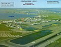
 Deadhorse Alaska aerial view.jpg 1,866 × 1,122; 400 KB
-
 Devil Mountain Lakes from a Small Plane (4884042722).jpg 3,675 × 2,387; 1.9 MB
-

-
 Fairhaven Ditch (16349435886).jpg 1,591 × 1,193; 1.84 MB
-
 Fairway Rock 0489.jpg 568 × 450; 26 KB
-
 FairwayRock-Mil.jpg 567 × 450; 26 KB
-
 Fall Colors (9514069794).jpg 3,391 × 2,261; 6.37 MB
-
 Flight to Cottonwood (9510958313).jpg 3,456 × 2,304; 6.21 MB
-
 Flying over the Preserve (9514172180).jpg 3,552 × 2,368; 4.9 MB
-
 Gambell Alaska - Drone.jpg 822 × 485; 432 KB
-
 Gambell Alaska June 16 '06.jpg 1,644 × 869; 256 KB
-
 Gambell Alaska.jpg 2,048 × 1,536; 1.21 MB
-
 Gravel extraction Noatak village FWS.jpg 1,050 × 703; 124 KB
-

-

-
 GRAYLING CREEK, VIEW NORTH - NARA - 550531.jpg 2,018 × 3,000; 668 KB
-
 Herd of Muskox (4116427941).jpg 1,800 × 1,200; 2.27 MB
-
 June 2010 BELA muskox calves (4709268095).jpg 800 × 533; 191 KB
-
 Kiana 20070516.jpg 2,288 × 1,712; 729 KB
-
 King Island, Alaska - P1040608.JPG 2,048 × 1,536; 1.05 MB
-
 King Island, Alaska - P1040609.JPG 2,048 × 1,536; 1.03 MB
-
 King Island, Alaska - P1040610.JPG 2,048 × 1,536; 1,019 KB
-
 King Island, Alaska - P1040611.JPG 2,048 × 1,536; 1.15 MB
-
 King Island, Alaska and mainland - P1040607.JPG 2,048 × 1,536; 1.13 MB
-
 Kivalina Alaska aerial view.jpg 1,500 × 1,125; 208 KB
-
 Kotzebue 1950 FWS.jpg 1,050 × 724; 425 KB
-
 Kotzebue 2013.webp 999 × 665; 210 KB
-
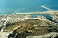
 Kotzebue Alaska aerial view.jpg 1,500 × 1,125; 372 KB
-
 Kotzebue surround from air 01(js).jpg 5,612 × 3,182; 7.47 MB
-
 Kotzebue surround from air 02(js).jpg 5,588 × 2,978; 8.46 MB
-
 Kotzebue surround from air 03(js).jpg 5,612 × 2,888; 9.33 MB
-
 Kotzebue surround from air 04(js).jpg 5,612 × 3,638; 9.23 MB
-
 Kotzebue surround from air 05(js).jpg 5,612 × 3,638; 10.96 MB
-
 Kotzebue surround from air 06(js).jpg 5,426 × 3,044; 9.53 MB
-
 Kotzebue surround from air 07(js).jpg 5,592 × 3,638; 10.28 MB
-
 Kotzebue surround from air 08(js).jpg 5,632 × 3,647; 9.38 MB
-
 Kotzebue, Alaska.jpg 2,100 × 1,370; 168 KB
-
 Kova-19 (8029772807).jpg 2,048 × 1,363; 2.67 MB
-
 Koyuk Alaska - Drone.jpg 4,000 × 2,250; 4.02 MB
-
 Little Diomede Island 2018 Drone Photo.jpg 4,000 × 2,250; 2.49 MB
-
 Moose in the Kobuk River (20774752518).jpg 2,600 × 1,729; 1.96 MB
-
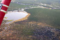
 NOAT Anisak Fire3 (4689112937).jpg 3,072 × 2,304; 1.13 MB
-
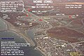
 Nome Alaska aerial 2006.jpg 2,256 × 1,496; 705 KB
-
 Nome Alaska aerial view.jpg 1,500 × 993; 644 KB
-
 Noorvik, AK.jpg 800 × 491; 107 KB
-
 OME-d.jpg 768 × 512; 47 KB
-
 Patterned Ground (9903655363).jpg 1,600 × 1,067; 729 KB
-

-

-
 Pingo- aerial tundra edit (16087773137).jpg 5,616 × 3,744; 16.28 MB
-
 Prudhoe Bay 1968 FWS.jpg 1,050 × 723; 104 KB
-
 Prudhoe Bay aerial FWS.jpg 504 × 331; 49 KB
-
 Prudhoe Bay oil fields 1971 FWS.jpg 1,050 × 837; 553 KB
-
 Purcell Mountains.jpg 1,050 × 707; 182 KB
-
 River basin east of Nome - aerial - P1040600.JPG 2,048 × 1,536; 1.32 MB
-
 SCC-b.jpg 600 × 472; 36 KB
-
 SCC-b.JPG 396 × 312; 33 KB
-
 Selawik Refuge Wetlands.jpg 1,050 × 699; 230 KB
-
 Serpentine (7644886134).jpg 3,744 × 5,616; 24.11 MB
-
 Serpentine River- Katie Cullen 133 edit resize (15651084754).jpg 2,400 × 3,199; 5.7 MB
-
 Seward Peninsula coast between Nome and Port Clarence - P1040601.JPG 2,048 × 1,536; 1.2 MB
-
 Seward Peninsula coast between Nome and Port Clarence - P1040602.JPG 640 × 480; 67 KB
-
 Seward Peninsula coast between Nome and Port Clarence - P1040603.JPG 640 × 480; 66 KB
-
 Seward Peninsula coast between Nome and Port Clarence - P1040604.JPG 2,048 × 1,536; 1.23 MB
-
 Seward Peninsula coast between Nome and Port Clarence - P1040605.JPG 2,048 × 1,536; 1.25 MB
-
 Shaktoolik Alaska - Drone.jpg 4,000 × 2,250; 2.72 MB
-
 Shishmaref- Erin (53) edit (15653586503).jpg 3,460 × 2,592; 6.73 MB
-

-
 Teller Alaska - Drone.jpg 4,000 × 2,250; 1.29 MB
-

-
 The Southern Edge of the Dunes (8489055507).jpg 3,008 × 2,000; 515 KB
-
 Town of Barrow, Alaska.jpg 2,816 × 1,584; 648 KB
-
 Ukivok aerial.jpg 1,772 × 1,176; 1.2 MB
-
 Unalakleet aerial 2010 (cropped).jpg 5,184 × 2,823; 1.28 MB
-
 Unalakleet aerial 2010.jpg 5,184 × 3,456; 1.4 MB
-
 Wetlands near cape Espenberg.jpg 2,100 × 1,402; 100 KB
-
 Wild and Crazy Tundra (9903532656).jpg 1,600 × 1,067; 711 KB
-
 York Mountains (9511439605).jpg 3,456 × 2,592; 7 MB

.jpg)
_TO_165_(UPPER..._-_NARA_-_550509.jpg)
.jpg)
.jpg)
.jpg)

.jpg)

_(27430891572).jpg)


.jpg)
.jpg)
.jpg)


_from_aeroplane.jpg)


.jpg)
.jpg)

.jpg)

.jpg)


.jpg)
.jpg)
.jpg)


._VIEW_EAST._ROUTE_RUNS_ALONG_EAST_(TOP)_SIDE_OF_CREEK_-_NARA_-_550527.jpg)
_SIDE_OF_VALLEY,_PARALLELING_AN..._-_NARA_-_550528.jpg)

.jpg)
.jpg)


.jpg)
.jpg)
.jpg)
.jpg)
.jpg)
.jpg)
.jpg)
.jpg)

.jpg)


.jpg)
.jpg)


.jpg)


.jpg)


.jpg)
.jpg)


_edit_(15653586503).jpg)


.jpg)


.jpg)


.jpg)
.jpg)