Category:Aerial photographs of Mohave County, Arizona
Jump to navigation
Jump to search
Subcategories
This category has only the following subcategory.
H
- Aerial photographs of Hoover Dam (111 F)
Media in category "Aerial photographs of Mohave County, Arizona"
The following 12 files are in this category, out of 12 total.
-

-
 Black Mountains, Arizona (6780622011).jpg 4,000 × 3,000; 5.25 MB
-
 Bonelli Bay, Lake Mead National Recreation Area, East of Las Vegas, Nevada (15830857829).jpg 4,000 × 3,000; 3.03 MB
-
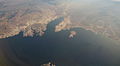 Bonelli Bay, Lake Mead National Recreation Area, East of Las Vegas, Nevada (16014931741).jpg 4,000 × 2,190; 1.37 MB
-
 Bonelli Bay, Near Eastern Terminus of Lake Mead, Arizona (6780622383).jpg 3,960 × 2,855; 5.34 MB
-
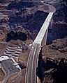
 Hoover Dam Bypass Bridge construction 2010-10-12 A.jpg 2,500 × 2,000; 637 KB
-
 Hoover Dam Bypass Bridge construction 2010-10-12 B.jpg 2,000 × 2,500; 785 KB
-
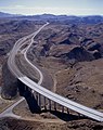 Hoover Dam Bypass under construction, Arizona side 2010-10-12.jpg 1,986 × 2,500; 743 KB
-
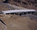 Hoover Dam Bypass under construction, bridge over old US 93, Arizona side 2010-10-12.jpg 2,500 × 2,000; 720 KB
-
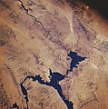
 Lake Mead National Recreation Area, Nevada-Arizona (90024897).jpg 1,280 × 960; 95 KB
-
 Lake mead.jpg 634 × 639; 160 KB
-
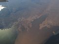
 Pearce Ferry & upper Lake Mead.jpg 4,368 × 2,456; 8.23 MB
.jpg)
.jpg)
.jpg)
.jpg)


.jpg)

