Category:Aerial photographs of Landkreis Stendal
Jump to navigation
Jump to search
Districts of Saxony-Anhalt:
Urban districts (cities):
Media in category "Aerial photographs of Landkreis Stendal"
The following 22 files are in this category, out of 22 total.
-
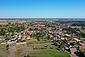
 15-02-27-Flug-Berlin-Düsseldorf-RalfR-DSCF2475-09.jpg 1,959 × 1,041; 739 KB
-
 Aerial image of the Klietz-Scharlibbe airfield.jpg 4,500 × 2,900; 4.69 MB
-
 Aerial image of the Stendal-Borstel airfield.jpg 4,500 × 3,000; 5.04 MB
-
 Arneburg Aerial alt1.jpg 5,472 × 3,648; 15.76 MB
-
 Arneburg Aerial alt2.jpg 5,472 × 3,648; 15.9 MB
-
 Arneburg Aerial Pan180.jpg 17,444 × 4,583; 56.96 MB
-
 Arneburg Aerial.jpg 5,472 × 3,648; 15.03 MB
-
 Arneburg, Industrie- und Gewerbepark Altmark.jpg 3,024 × 1,701; 2.69 MB
-
 Arneburg.jpg 3,648 × 2,736; 5.3 MB
-
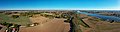
 Elbe near Schönhausen Aerial.jpg 5,472 × 3,648; 16.2 MB
-
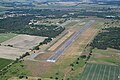
 Flugplatz Stendal.jpg 3,648 × 2,736; 5.17 MB
-
 Havelberg, Luftaufnahme 2014.JPG 4,032 × 2,268; 4.68 MB
-
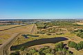
 Hochwasser Elbe 2013-06-10.jpg 500 × 333; 33 KB
-
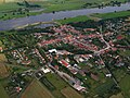
 Luftbild Tangermünde.jpg 4,000 × 3,000; 3.98 MB
-
 Schönhausen Elbe Aerial Pan.jpg 17,532 × 4,776; 54.37 MB
-
 Schönhausen Elbe Aerial.jpg 5,472 × 3,648; 14.81 MB
-
 Stendal Aerial Pan180.jpg 17,612 × 4,620; 56.95 MB
-
 Stendal Aerial.jpg 5,472 × 3,648; 16.18 MB
-
 Tangermünde Aerial alt.jpg 5,472 × 3,648; 15.35 MB
-
 Tangermünde Aerial Pan alt.jpg 17,487 × 4,790; 54.63 MB
-
 Tangermünde Aerial Pan.jpg 17,496 × 4,444; 58.36 MB
-
 Tangermünde Aerial.jpg 5,472 × 3,648; 16.04 MB


