Category:Aerial photographs of Dorsten
Jump to navigation
Jump to search
| Object location | | View all coordinates using: OpenStreetMap |
|---|
Subcategories
This category has only the following subcategory.
A
Media in category "Aerial photographs of Dorsten"
The following 17 files are in this category, out of 17 total.
-
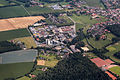
 Dorsten, Kaltenbach -- 2014 -- 1992.jpg 5,472 × 3,648; 13.53 MB
-
 Dorsten, Kaltenbach -- 2014 -- 1993.jpg 5,472 × 3,648; 12.96 MB
-
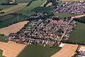
 Dorsten, Lembeck -- 2014 -- 1956.jpg 5,472 × 3,648; 14.67 MB
-
 Dorsten, Lembeck -- 2014 -- 1966.jpg 5,472 × 3,648; 13.37 MB
-
 Dorsten, Lembeck, Autobahn 31 -- 2014 -- 1991.jpg 5,472 × 3,648; 15.15 MB
-
 Dorsten, Lembeck, Don-Bosco-Kindergarten -- 2014 -- 1973.jpg 5,472 × 3,648; 14.36 MB
-
 Dorsten, Lembeck, Gestüt -- 2014 -- 1974.jpg 5,472 × 3,648; 12.09 MB
-
 Dorsten, Lembeck, Rasthof an der Autobahn 31 -- 2014 -- 1990.jpg 5,472 × 3,648; 11.97 MB
-
 Dorsten, Lembeck, Rasthof an der Autobahn 31 -- 2014 -- 1994.jpg 5,472 × 3,648; 12.42 MB
-
 Dorsten, Lembeck, Rasthof an der Autobahn 31 -- 2014 -- 1995.jpg 5,472 × 3,648; 12.25 MB
-
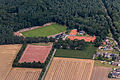
 Dorsten, Lembeck, Sportplatz -- 2014 -- 1958.jpg 5,472 × 3,648; 14.01 MB
-
 Dorsten, Lembeck, Sportplatz -- 2014 -- 1975.jpg 5,472 × 3,648; 13.13 MB
-
 Dorsten, Mastbetrieb -- 2014 -- 1954.jpg 5,472 × 3,648; 12.69 MB
-
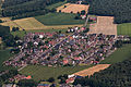
 Dorsten, Rhade -- 2014 -- 1997.jpg 5,472 × 3,648; 13.68 MB
-
 Dorsten, Rhade -- 2014 -- 1998.jpg 5,472 × 3,648; 10.84 MB
-
 Dorsten, Rhade, Umland -- 2014 -- 2000.jpg 5,472 × 3,648; 11.38 MB
-
 Dorsten, Umland -- 2014 -- 1955.jpg 5,472 × 3,648; 14.01 MB


