Category:Aerial photographs of Argentina
Jump to navigation
Jump to search
Countries of South America: Argentina · Bolivia · Brazil · Chile · Colombia · Ecuador · Paraguay · Peru · Suriname · Trinidad and Tobago‡ · Uruguay · Venezuela
Other territories: Aruba · Curaçao · Falkland Islands · French Guiana
‡: partly located in South America
Other territories: Aruba · Curaçao · Falkland Islands · French Guiana
‡: partly located in South America
Aerial photographs of Argentina.
Subcategories
This category has the following 13 subcategories, out of 13 total.
Media in category "Aerial photographs of Argentina"
The following 119 files are in this category, out of 119 total.
-
 -i---i- (32205260234).jpg 4,032 × 3,024; 1.83 MB
-
 01 Laguna Setúbal de Santa Fe y la bajante histórica del río Paraná 2021.jpg 6,909 × 3,876; 23.22 MB
-
 02 Laguna Setúbal de Santa Fe y la bajante histórica del Paraná 2021.jpg 6,324 × 3,873; 22.39 MB
-
 02 Río Paraná Bajante Histórica 2021.jpg 7,000 × 3,914; 25.59 MB
-
 03 Laguna Setúbal de Santa Fe y la bajante histórica del Paraná 2021.jpg 5,136 × 3,210; 15.13 MB
-

-
-
 05 Rectorado de la Universidad Nacional del Litoral.jpg 2,000 × 1,500; 3.71 MB
-

-
 07 Laguna Setúbal de Santa Fe y la bajante histórica del Paraná 2021.jpg 3,992 × 2,242; 7.93 MB
-

-
 09 Laguna Setúbal de Santa Fe y la bajante histórica del Paraná 2021.jpg 4,591 × 3,061; 8.45 MB
-
 10 Laguna Setúbal de Santa Fe y la bajante histórica del Paraná 2021.jpg 6,118 × 4,079; 12.02 MB
-
 11 Laguna Setúbal de Santa Fe - Bajante histórica del río Paraná - 2021.jpg 6,646 × 4,431; 13.17 MB
-

-
 Aconcagua (aerial).jpg 2,288 × 1,712; 1.26 MB
-
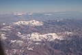
 Aconcagua 2019.jpg 4,272 × 2,848; 3.71 MB
-
 Aconcagua july 2011.JPG 2,736 × 3,648; 2.77 MB
-
 Aerea Formosa.jpg 1,781 × 851; 527 KB
-
 Aereamonteros.JPG 1,065 × 763; 160 KB
-
 Aerial photo Neuquén (1920).jpg 1,309 × 964; 1.23 MB
-
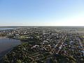
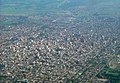
 Aerial view of Formosa city.jpg 1,873 × 885; 520 KB
-
 Aerial view of General Roca.jpg 2,592 × 1,944; 2.26 MB
-
 Aerial view of the Lower Paraná Delta, 2009-03-25.jpg 3,643 × 2,739; 10.57 MB
-
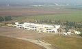
 Aeropuerto de Tartagal desde el aire.jpg 1,580 × 1,316; 322 KB
-
 Aeropuerto Ezeiza.jpg 415 × 332; 44 KB
-
 ARG-2016-Aerial-Tierra del Fuego (Ushuaia)–Ojo del Albino Glacier 01.jpg 3,201 × 4,260; 8.34 MB
-
 ARG-2016-Aerial-Tierra del Fuego (Ushuaia)–Ojo del Albino Glacier 02.jpg 4,760 × 6,335; 18.76 MB
-
 ARG-2016-Aerial-Tierra del Fuego (Ushuaia)–Ojo del Albino Glacier 03.jpg 6,773 × 5,089; 13.33 MB
-
 ARG-2016-Aerial-Tierra del Fuego (Ushuaia)–Ojo del Albino Glacier 04.jpg 3,760 × 5,004; 12.27 MB
-
 ARG-2016-Aerial-Tierra del Fuego (Ushuaia)–Ojo del Albino Glacier 05.jpg 6,280 × 4,186; 13.79 MB
-
 Argentine F9F Panther in 1963.jpg 476 × 273; 41 KB
-
 Argentinian Pampas, 27th. Dec. 2010 - Flickr - PhillipC.jpg 4,288 × 2,848; 2.43 MB
-
 ArialViewIquazuFallsTurbidRiver.JPG 3,456 × 2,592; 3.5 MB
-
 Barreal (Calingasta) 2021.jpg 2,578 × 2,432; 1.65 MB
-
 Campo de Hielo Patagónico Sur 1.jpg 2,794 × 3,690; 9.12 MB
-
 Campo de Hielo Patagónico Sur 4.jpg 2,848 × 4,288; 13.3 MB
-
 Campo de Hielo Patagónico Sur 5.jpg 2,848 × 4,061; 8.77 MB
-
 Catamarca Andalgala.JPG 1,024 × 809; 147 KB
-
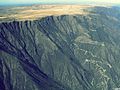
 Cañón del Chicamocha (7978223255).jpg 1,024 × 683; 1.01 MB
-
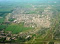
 Ceres (Argentina) 2019.jpg 898 × 598; 272 KB
-
 City of Formosa, Argentina.jpg 579 × 414; 124 KB
-
 Ciudad de Ramallo.jpg 4,096 × 2,304; 3.02 MB
-
 Costa del Portezuelo - San Fernando del Valle de Catamarca, Argentina.jpg 2,048 × 1,536; 1,023 KB
-
 CPCpanoramica2.JPG 2,304 × 1,728; 876 KB
-
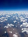 Cumulus humilis viewed from the air.jpg 3,024 × 4,032; 2.24 MB
-
 Estacion del Ferrocarril Cordoba y Noroeste. Foto aerea, 1927.png 414 × 296; 104 KB
-
 Ezeiza, Greater Buenos Aires (44139374304).jpg 5,760 × 3,840; 5.31 MB
-
 Federación desde el aire I.JPG 4,608 × 3,456; 3.06 MB
-
 Federación desde el aire II.JPG 4,608 × 3,456; 2.94 MB
-
 Federación desde el aire III.jpg 4,608 × 3,456; 3.02 MB
-
 Federación desde el aire IV.jpg 4,608 × 3,456; 2.96 MB
-
 Federación desde el aire V.jpg 4,608 × 3,456; 3.05 MB
-
 Federación desde el aire VI.jpg 4,608 × 3,456; 3.01 MB
-
 Federación desde el aire. (33246857110).jpg 4,608 × 3,456; 3.02 MB
-
 Flight from EZE to SCL, KL701, PH-BVR, 2019 (01).jpg 4,272 × 2,848; 3.11 MB
-
 Flight from EZE to SCL, KL701, PH-BVR, 2019 (03).jpg 4,272 × 2,848; 3.04 MB
-
 Flight from EZE to SCL, KL701, PH-BVR, 2019 (04).jpg 4,272 × 2,848; 3.69 MB
-
 Flight from EZE to SCL, KL701, PH-BVR, 2019 (05).jpg 4,272 × 2,848; 3.58 MB
-
 Flight from EZE to SCL, KL701, PH-BVR, 2019 (06).jpg 4,272 × 2,848; 3.75 MB
-
 Flight from EZE to SCL, KL701, PH-BVR, 2019 (07).jpg 4,272 × 2,848; 3.63 MB
-
 Flight from PMC to PUQ, H2001, CC-ABW, 2019 (06).jpg 4,272 × 2,848; 3.01 MB
-
 Foto aérea de Santa Rosa de Calamuchita.jpg 2,000 × 1,124; 2.51 MB
-
 Fábrica Arcor en Arroyito, Córdoba.jpg 3,992 × 2,242; 8.8 MB
-
 General Roca RN.jpg 1,024 × 576; 205 KB
-
 Hotel Garden Tower desde el aire.jpg 720 × 1,600; 216 KB
-
 ISS015-E-23132 - View of Earth.jpg 3,032 × 2,008; 1.38 MB
-
 Jovitga Vista aérea 1 p.jpg 320 × 213; 58 KB
-
 La Falda desde un drone.jpg 800 × 451; 98 KB
-
 Lago Argentino, aérea.jpg 4,288 × 2,776; 13.72 MB
-
 Lago Argentino, aéreas 1994 01.jpg 1,068 × 704; 953 KB
-
 Lago Argentino, aéreas 1994 02.jpg 1,068 × 704; 804 KB
-
 Lago Argentino, aéreas 1994 03.jpg 1,057 × 704; 561 KB
-
 Lago Argentino, aéreas 1994 04.jpg 705 × 1,067; 926 KB
-
 Las Cuevas desde el Camino al Cristo Redentor.jpg 2,592 × 1,944; 2.05 MB
-
 LasCuevasAerial.jpg 640 × 427; 339 KB
-
 Los Andes 1994 01.jpg 708 × 1,068; 650 KB
-
 LV FVO above the Beagle Channel.jpg 3,456 × 4,608; 3.98 MB
-
 Nwowk realico1.jpg 2,048 × 1,536; 798 KB
-
 Obispo Trejo (Argentina) 2019.jpg 1,929 × 1,285; 1.17 MB
-
 Parque acuatico y termas de Federación vistas desde el aire.jpg 4,608 × 3,456; 3.34 MB
-
 PAVE Campaign - View of Argentina (4312200100).jpg 2,400 × 1,800; 221 KB
-
 Pilares Fundamentales - Joaquín Jesús Mántaras 1 (cropped).jpg 3,203 × 1,387; 1.93 MB
-
 Pilares Fundamentales - Joaquín Jesús Mántaras 1.jpg 3,884 × 2,911; 3.53 MB
-
 Pirané Formosa Argentina.jpg 960 × 720; 345 KB
-
 Plaza 25 de Mayo Rafaela.jpg 900 × 585; 205 KB
-
 Plaza de Mayo, aerial view.jpg 1,280 × 960; 256 KB
-
 Posadas y Encarnación.png 787 × 612; 1,000 KB
-
 Posadas-Vista-Aerea-Mayo-2013.JPG 4,320 × 3,240; 6.31 MB
-
 Puerto Quequén, vista aérea (1930).jpg 768 × 575; 200 KB
-
 Reloj de la plaza.jpg 4,384 × 2,466; 2.88 MB
-
 Rio Plata delta Air view 1.JPG 3,200 × 2,400; 1.78 MB
-
 Rio Plata delta Air view 2.JPG 3,200 × 2,400; 1.67 MB
-
 Salta, aérea 1994 01.jpg 712 × 1,068; 901 KB
-
 Saltadesdeelespacio.jpg 990 × 609; 87 KB
-
 Salí River near San Miguel de Tucumán.jpg 2,048 × 1,536; 367 KB
-
 San Lorenzo-North Terminals.JPG 1,600 × 1,200; 367 KB
-
 San Martín de los Andes Village.jpg 2,304 × 1,728; 1.24 MB
-

-
 SanMiguelDeTucumanAereo.jpg 700 × 525; 121 KB
-
 Santa Cruz (provincia) 1994 15.jpg 1,065 × 698; 699 KB
-
 Santa Cruz (provincia) 1994 16.jpg 1,065 × 704; 732 KB
-
 Termas y parque acuatico de Federación desde el aire.jpg 4,608 × 3,456; 3.35 MB
-
 Tucuman International Airport.JPG 783 × 469; 50 KB
-
 Tucuman 1853d.JPG 1,111 × 773; 164 KB
-
 Tucuman BRS Vista Aérea.JPG 1,164 × 849; 207 KB
-
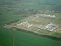 Tucuman El Bracho.JPG 1,473 × 1,112; 712 KB
-
 Tucuman Famailla Aerea.JPG 1,224 × 972; 432 KB
-
 Tucuman Parque 9 de Julio aerea.JPG 953 × 735; 131 KB
-
 Tucuman Quinta Agronomica UNT.JPG 800 × 600; 614 KB
-
 Tucuman sugar mill.JPG 1,280 × 960; 185 KB
-
 TurderaVistaAerea.jpg 1,600 × 900; 333 KB
-
 Ucacha aerial image.jpg 800 × 600; 347 KB
-
 Ushuaia zoom.JPG 3,828 × 2,871; 4.22 MB
-
 Venado Tuerto Panoramica 1.jpg 1,800 × 1,200; 1.47 MB
-
 VenadoTuerto Panoramica 2.jpg 1,800 × 1,200; 1.51 MB
-
 Vista aérea de El Mollar, Argentina.jpg 2,048 × 1,536; 491 KB
-
 Vista aérea de San Fernando del Valle de Catamarca, Argentina.jpg 972 × 670; 197 KB
-
 Vistaaereadeposadas.jpg 960 × 487; 77 KB
.jpg)


_y_la_bajante_hist%C3%B3rica_del_Paran%C3%A1_2021.jpg)
_y_la_bajante_hist%C3%B3rica_del_Paran%C3%A1_2021.jpg)

_y_la_bajante_hist%C3%B3rica_del_Paran%C3%A1_2021.jpg)

_y_la_bajante_hist%C3%B3rica_del_r%C3%ADo_Paran%C3%A1_-_2021.jpg)


_le.Mart%C3%ADn_Garc%C3%ADa_Island,AR,ri.Timoteo_Dom%C3%ADnguez_Island,UY_fri29nov2019-0651h(UTC-3).jpg)
.jpg)


.jpg)


%E2%80%93Ojo_del_Albino_Glacier_01.jpg)
%E2%80%93Ojo_del_Albino_Glacier_02.jpg)
%E2%80%93Ojo_del_Albino_Glacier_03.jpg)
%E2%80%93Ojo_del_Albino_Glacier_04.jpg)
%E2%80%93Ojo_del_Albino_Glacier_05.jpg)


_2021.jpg)


.jpg)
_2019.jpg)


.jpg)


.jpg)
.jpg)
.jpg)
.jpg)
.jpg)
.jpg)
.jpg)
.jpg)


_2019.jpg)

.jpg)
.jpg)


.jpg)


_1994_15.jpg)
_1994_16.jpg)


